Date: June 15, 2013
Time: 3:30 - 7:30PM MDT
Place: Limon, Hugo, McClave, CO
Distance: 920 mi (422 positioning, 130 chasing, 368 to home)
Camera: T3i, GoPro, Lumix
Warnings: SVR
Rating: S3
Forecast and Set Up
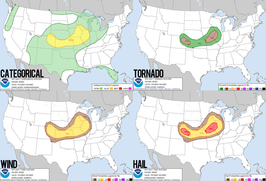
June storm chasing in eastern Colorado is always something I've wanted to try. Besides the beautiful landscapes, you can get interesting storm behavior thanks to some unique geography. For example, the Palmer Divide is a raised ridge that runs west to east off the Rocky Mountains just north of Colorado Springs. This feature can generate unique orthographic lift that helps focus storm development. So given CAPE values in the 1500-2000 J/kg range and some upper level wind support, I was definitely excited to see what would develop.
We left I-25 in Trinidad, Colorado and headed northeast with a target of Limon, CO. The drive along Hwy 350 was extremely beautiful and desolate. It rivals the roads west of Springer, NM as some of the loneliest I have ever driven. Cell reception was also really poor in this area as well, thanks to the fact that Sprint recently sold their 3G cell towers in eastern Colorado and western Kansas.
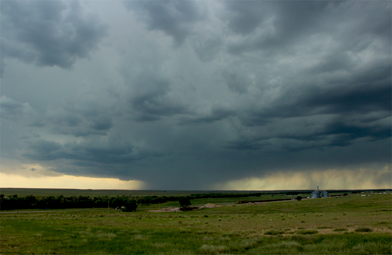
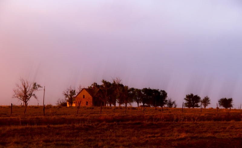
Around mid-afternoon, we arrived in Limon and pulled onto a dead end road on the west side of town with a great overlook to the west. Sure enough, a storm was already popping off the Palmer divide and heading our way!
The Chase
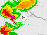
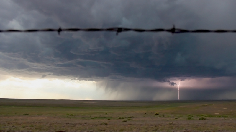
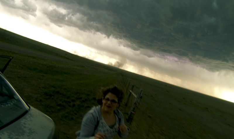
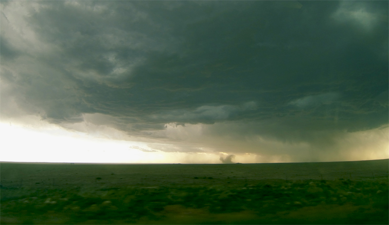
We held our ground for quite some time in Limon, letting the storm rumble its way toward us. As usual, I was obsessing over camera gear and getting various motion timelapse shots. On radar, the cell indicated a very robust hail core and a weak mesocyclone. So even though shear wasn't all that strong, I still held out hope for a magical Colorado landspout.
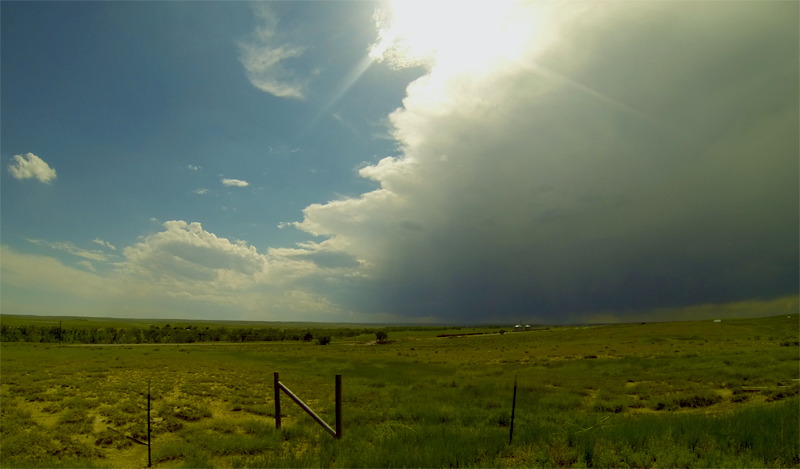
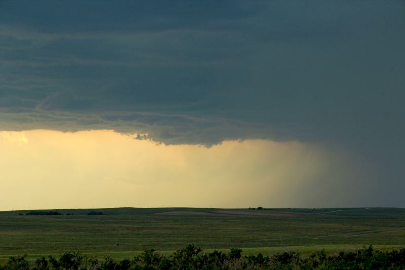
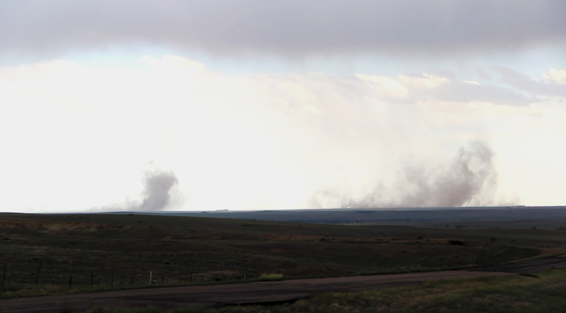
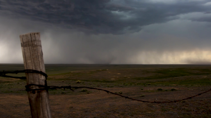
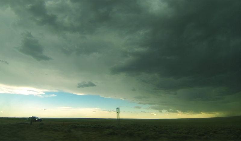
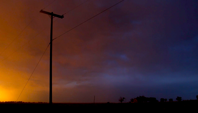
After about 45 minutes, it was clear we need to drop south, as the storm had sent out an outflow boundary that was sparking new cells right on top of us. Suddenly I was less hopeful for a tornado. We followed Hwy 287 southeast out of town and eventually made our way south of Hugo on some bumpy gravel roads. Now several miles downstream from the storm, but directly in its path, we had another great opportunity to get some timelapse. The beautiful, flowing base exhibited some really interesting structure and motion. While we were watching, a state trooper pulled up beside us and asked what we thought about the storm. I told him my thoughts were pretty pessimistic on tornadoes, but pointed out the greenish tint within the clouds that probably indicated some decent-sized hail. He was very friendly, and answered some questions about the local road network, since he knew the area. As we were chatting, several microbursts began kicking up dust to our south as new cells began dropping rain-cooled air. It was neat to have such a visible marker of new storm development.
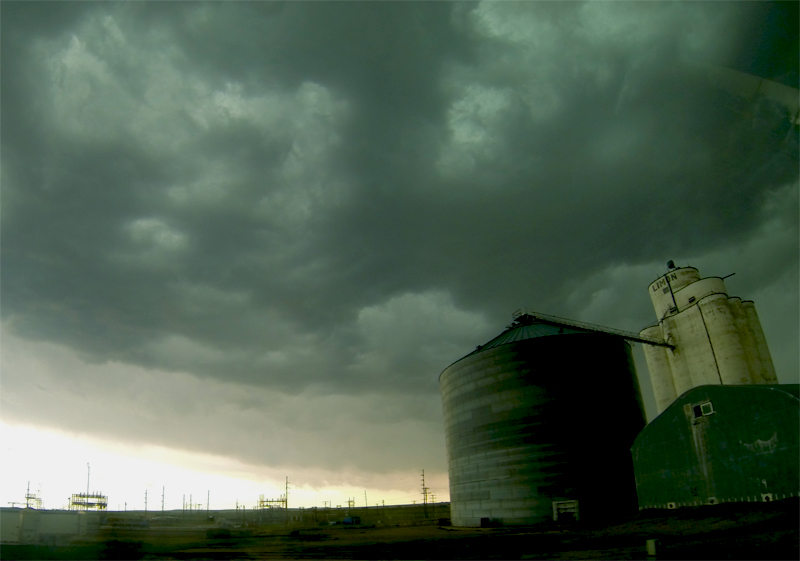
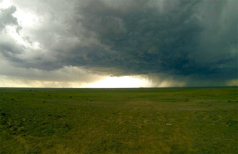
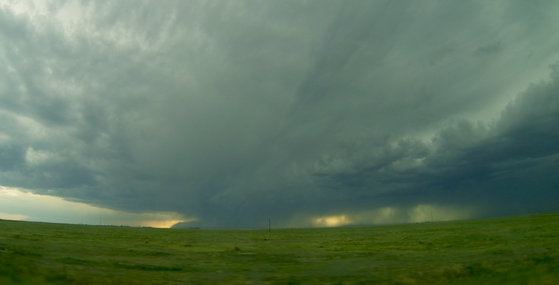
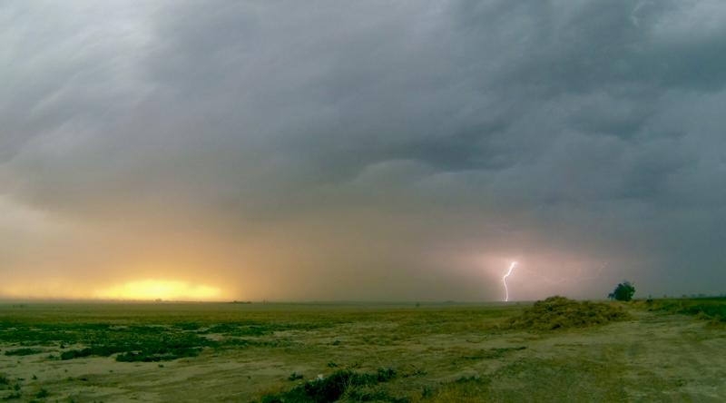
Before long, we needed to reposition again to avoid being overrun by rain and hail. By this point, both the sky and radar were indicating that this storm was on its last legs. There was a decent new cell to the south, and since there was plenty of daylight left we decided to attempt an intercept. Taking the state trooper's advice, we avoided the most direct path towards the new storm on some questionable roads. Unfortunately this meant we had to take a circuitous route far to the east, then south, and then back west towards the cell. By the time we had navigated this course, it was clear that our second storm was also in the process of fizzling out. We sat through a nice barrage of dust from and outflow boundary near McClave, CO before calling it a day and heading to a hotel in La Junta.
Recap, Filmmaking Notes, and Lessons Learned
- Eastern Colorado lived up to its great reputation as beautiful chase country, even if the storms were not all that impressive today.
- This is pretty basic, but when preparing a timelapse shot, you need to think about the changing ambient light as the storm approaches and makes the environment darker. If we are directly in the path of a storm, I tend to start 1.5 stops over exposed. By the time the storm is near, I'm usually underexposed by the same amount.
- The GoPro3 Black does a good job with consistent exposure from shot to shot even if the settings are on automatic. This adds to its point-it-and-forget-it charm.
- Some motion slider shots are more appealing if the close foreground elements are in focus, leaving the background storm clouds slightly bokeh-ed. This was counterintuitively to me at first, since I always tended to put the background in focus and blur the foreground (storms are what I wanted to film, after all). But this techniques still allows cloud motions to be evident while composing a more natural feeling shot. That said, this is not a hard and fast rule.