Date: May 19, 2013
Time: 2:30 - 8:00 PM CDT
Place: Viola, Udall, Arkansas City, KS, and Tonkawa, OK
Distance: 886 mi (127 positioning, 124 chasing, 635 to home)
Camera: T3i, GoPro, and Lumix
Warnings: SVR, TOR
Rating: S5
Forecast and Set Up
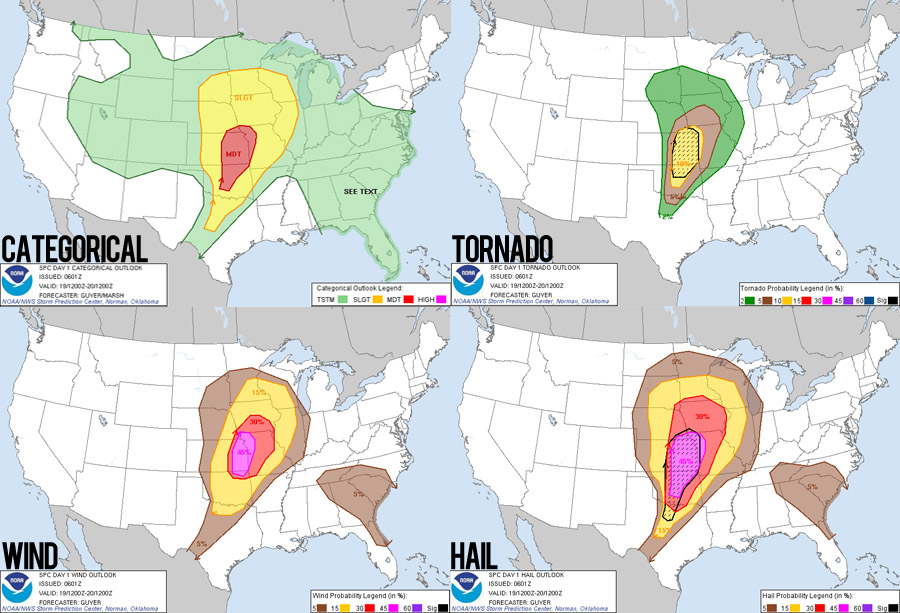
While we were out having the best chase of our lives yesterday, the Storm Prediction Center was already busy thinking about storm chances today and issued a "Day 2" moderate risk (fairly rare) for western Kansas and Oklahoma. With the jet stream directly overhead, great instability, and outflow boundaries left over from nighttime storms, all signs pointed to a very active day with most parameters even better than yesterday. The only issue that made me a little concerned was the somewhat "straight-line" hodographs (wind increasing with height, but not turning with height), which could signal that storms would quickly congeal into lines.
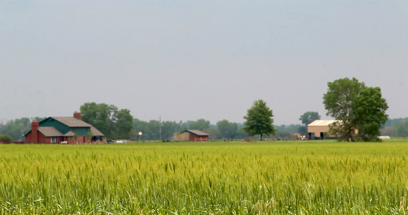
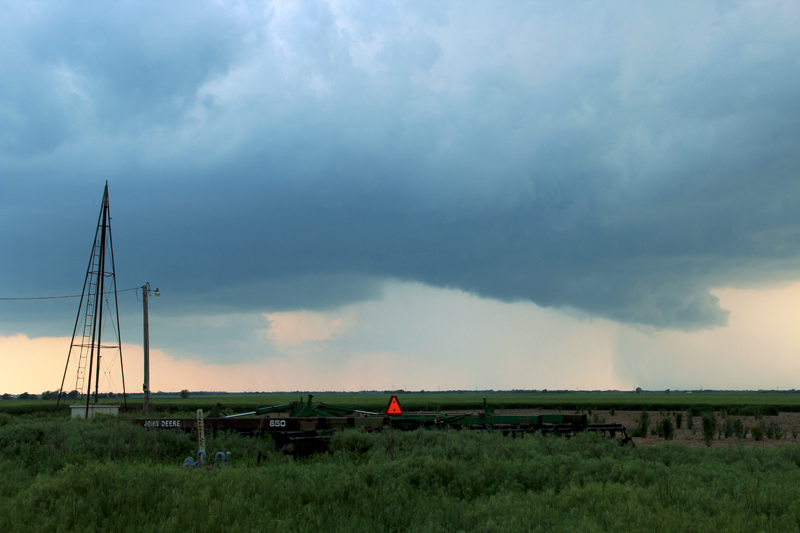
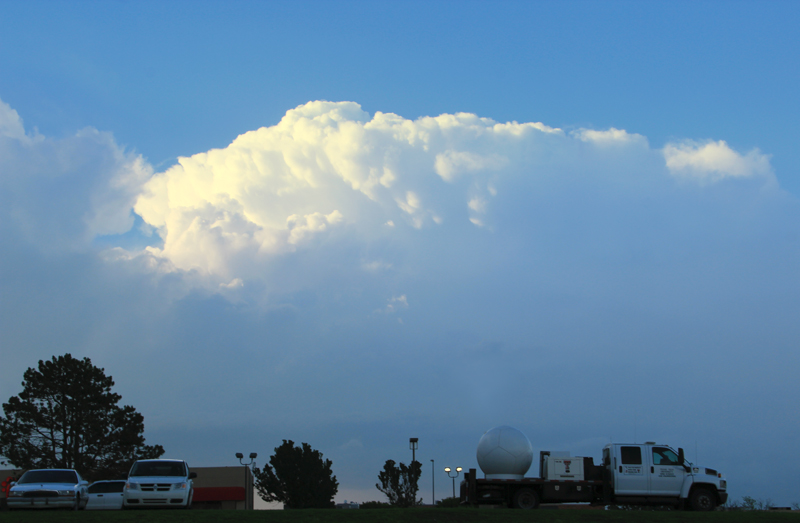
This morning I awoke to one of the best feelings a storm chaser can imagine. There's nothing better than waking up in a hotel surrounded by charging batteries and camera gear, knowing that storms and adventure are just hours away. Today we only needed to drive about 120 miles to our chase target (west of Wichita), so we got a lazy start out of Larned, KS. The late morning atmosphere was a little soupier than I'd like, but it indicated more than enough moisture was in place. We were hardly even hungry for lunch upon arrival in Hutchinson, KS, but we figured it'd be good to eat while we could with a weak cap it looked like storms would initiate fairly early in the afternoon. (FYI: it's nearly impossible to get a quick lunch in Hutchinson, since you have to drive so far into the center of town to find any restaurants.)
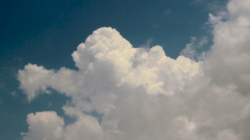
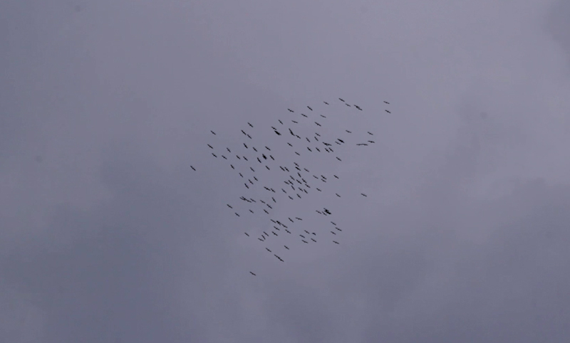
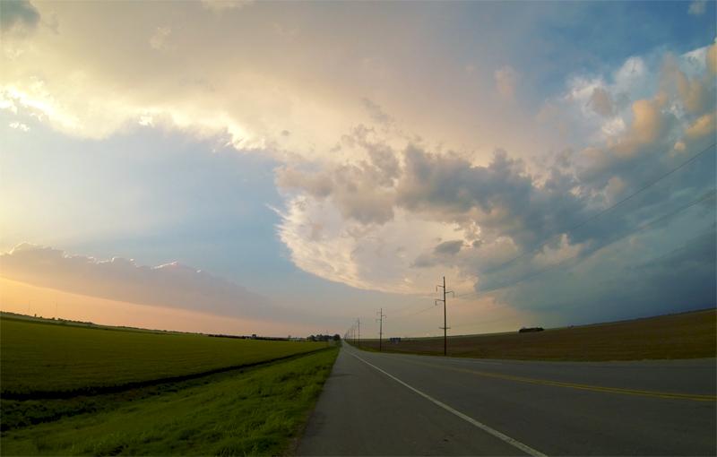
During lunch I poured over the latest observations (great for conversation with Toni) and decided that the target west of Wichita was looking better and better as a confluence of boundaries was coming together there. Leaving Hutchinson and heading south, we passed Pretty Prairie and I honestly felt nostalgic thinking about our first tiny tornado there back on April 14, 2012. By 1:45PM we had arrived at our target and pulled off Hwy 54 north of Cheney to await initiation. Cumulus clouds were already quite agitated as updrafts were beginning to pierce the cap. We even saw a flock of birds circling and rising on thermals before continuing their flight north. Then at 2:11PM the first green splotches began to appear on radar and storms were underway.
The Chase
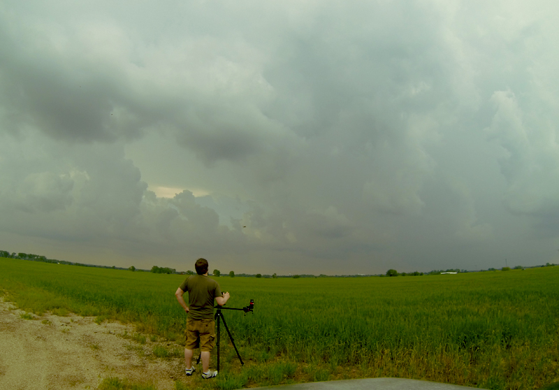
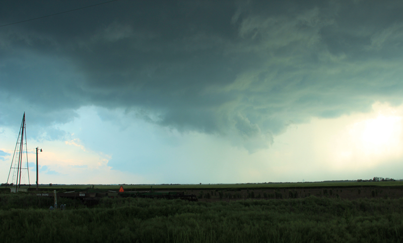
We were pretty lucky with our target selection as a single storm exploded to our southwest near Harper, KS and headed straight towards us. Even with the storm about 20 miles away, we began to hear a constant thunder-rumble, which was an incredibly creepy ambiance given the calmness around us. We decided to hold our location and let the storm get a little closer before intercepting. This meant we could get nice long timelapse shots as the storm approached. Unfortunately, looking south into the forward flank of a storm is pretty boring from a structure perspective.
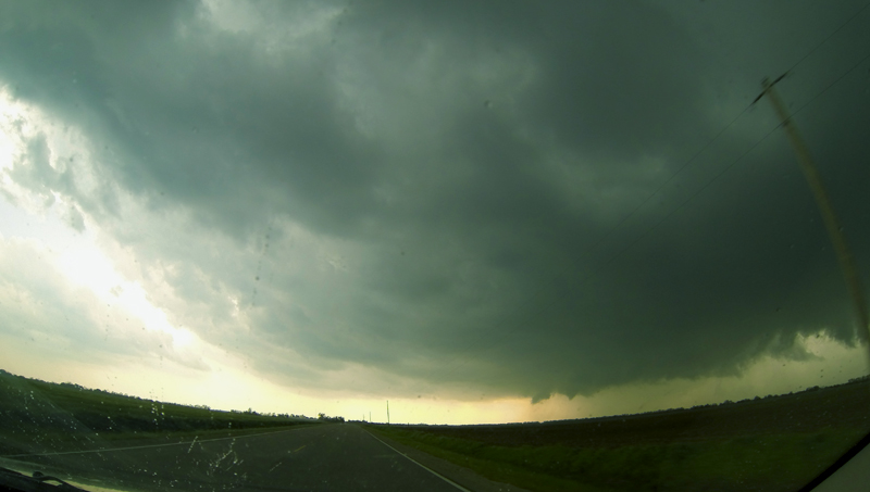
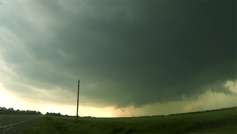
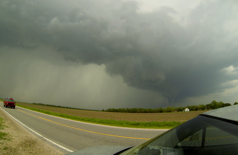
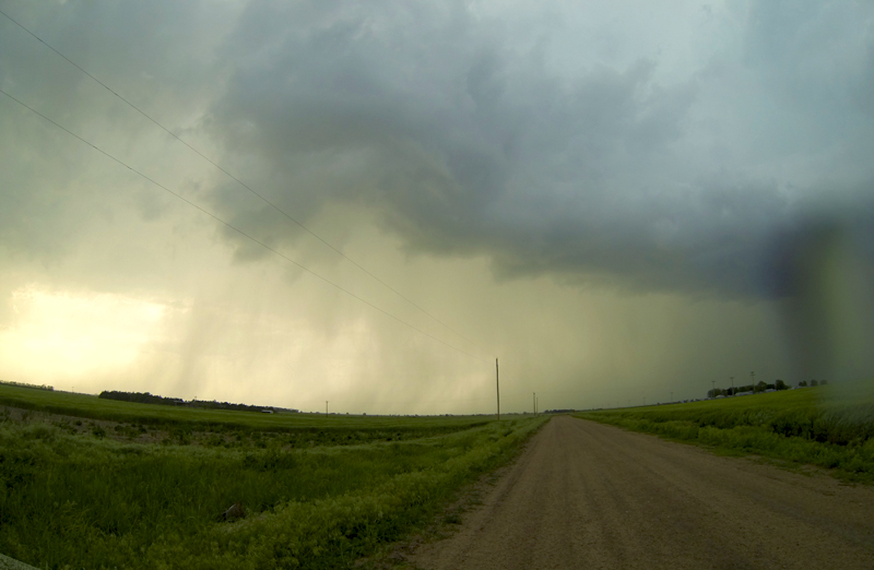
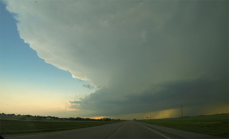
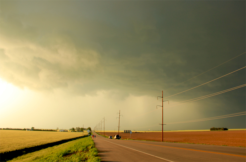
Roughly thirty minutes later, the first few rain drops began falling on us from the anvil overhead. The supercell had really exploded in intensity and organization, and it was time for us to get into position. Since the storm exhibited a very stable northeast path, we only needed to jog a few miles east, and then cut south to get a view of the updraft core. At 3:05PM as we were dropping south on a small country road towards Viola, KS, the storm went tornado warned ratcheting up the tension in the car. While we weren't core punching (only moderate rain was falling), this was the most aggressively we had ever cut across a storm path and we still didn't have visibility on the storm structure, so I was definitely nervous.
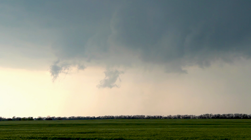
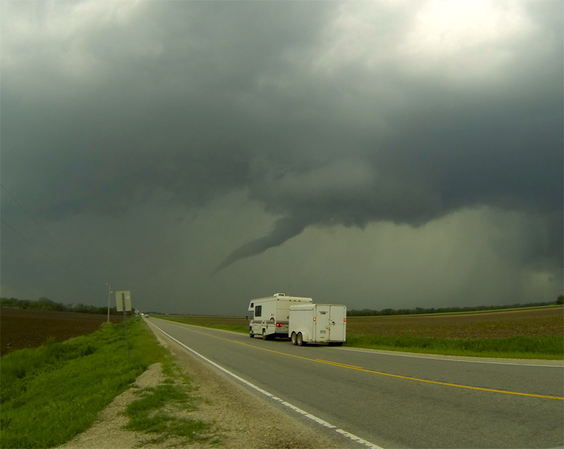
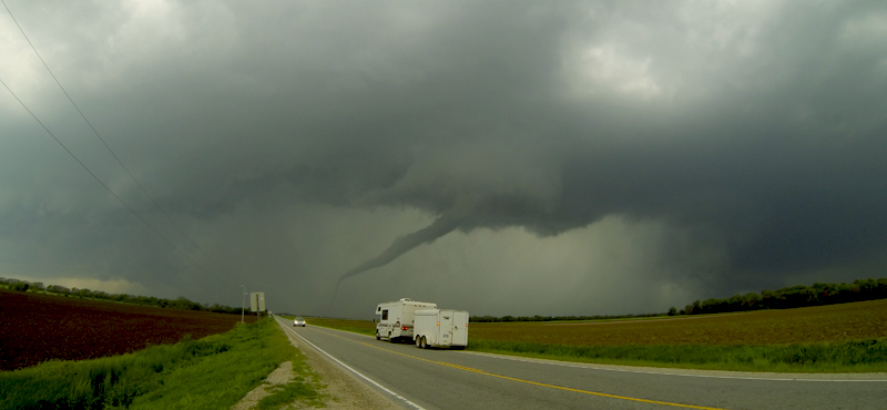
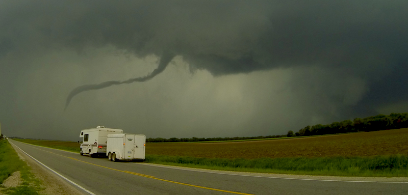
Several minutes later as we continue south, the precipitation cleared and we started getting glimpses of a robust wall cloud to our southwest. Then suddenly just a couple miles north of Viola, the terrain cleared and presented a jolting sight. Just 2 miles to our south-southwest, a well defined cone funnel was hanging beneath a turbulent wall cloud and kicking up dust off the ground. The storm was less than 1 hour old and it was already producing a tornado! We pulled to the side of the road and filmed for a couple minutes, hearing the distant wail of Viola's tornado sirens. The uncondensed tornado didn't last more than 45 seconds. However, my anxiousness increased when it became apparent that the wall cloud was moving from right to left, meaning that the tornado producing region of the storm would pass to our south. We still needed to get further south to avoid getting cut off by the precipitation core, and the wall cloud was already beginning to pass over our north-south road.
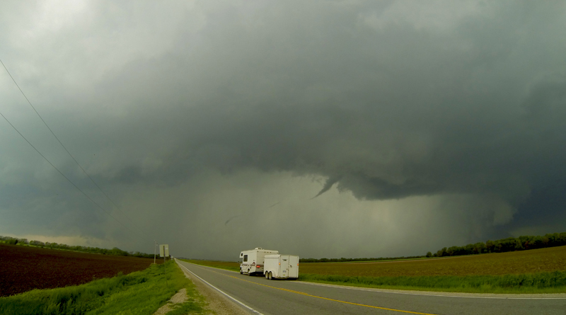
We decided to drive just a little further south to get a good east road option. This brought almost directly under the wall cloud. It was with great relief that we arrived at the intersection of K-19 and West 111 St S, noting that just off in a field to our south dust was getting kicked up from what appeared to be another weak tornado (I haven't seen video to confirm this however). We bolted east for a mile or so trying to put some distance between us and the wall cloud. At one point we pulled off the road behind a storm chase tour. I got out of the car intending to film, looked at the violent rotation that was still too close for comfort, and "noped" right back into the car to get a little further away. The feeling of being pursued was very palpable.
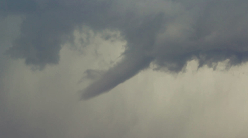
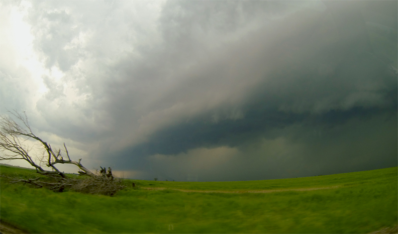
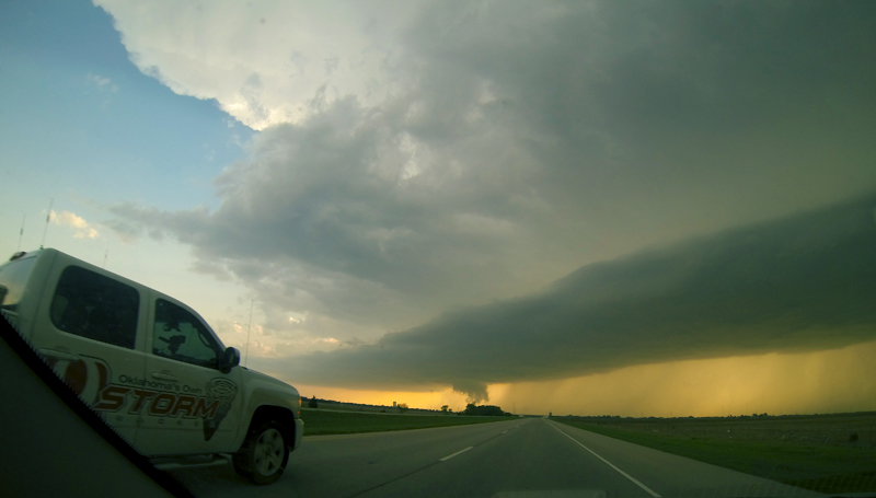
A couple miles further east, when we were just outside Clearwater, KS, we again pulled off the road - now with a little more breathing room between us and the very intimidating wall cloud. Within seconds of stepping out of the car, a tube funnel began poking out of the southern end of the wall cloud at a nearly horizontal angle. Within another 30 seconds it had condensed all the way to the ground as a gorgeous elephant trunk. I could hardly believe our luck photogenic tornadoes two days in a row! The elephant trunk began to elongate as the parent wall cloud moved northeast while the point of ground contact remained nearly stationary. We had just mounted my T3i to the tripod by the time the tornado had fully roped out. But between my handheld shots and the GoPro on the back of the car, we had again captured a complete tornado lifecycle on timelapse!
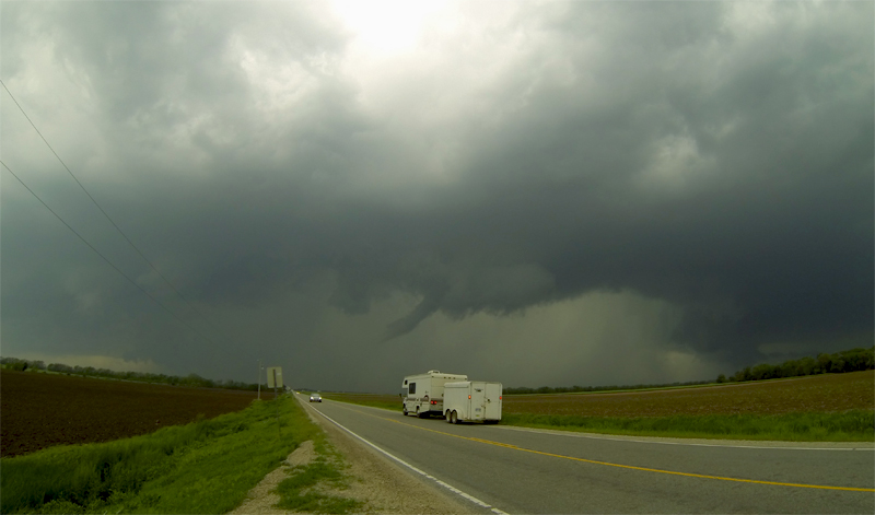
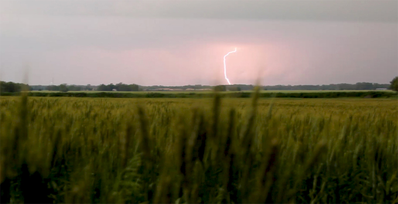
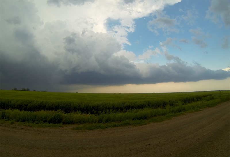
Fearing the traffic and traffic lights if we continued to pursue this storm northeast, we decided to bail south and catch some new storms that were moving out of Oklahoma. Our initial storm was fanning an enormous outflow boundary on its southern end that was erupting in to a linear mess of storms. We crossed under the precipitation from this congealing line, finally relaxing a little as we were not in imminent tornado paths. Heading east of I-35 and then south out of Udall, KS, we again found ourselves in front of a very intimidating line of storms. Setting up near a well defined inflow notch, we sat beside a wheat field and listened to the deep booming thunder of the approaching storms. They had an incredibly dark and menacing appearance, and I didn't want to get caught in a huge rain/hail core, so we again bailed south of the inflow notch before seeing any structure or tornado.
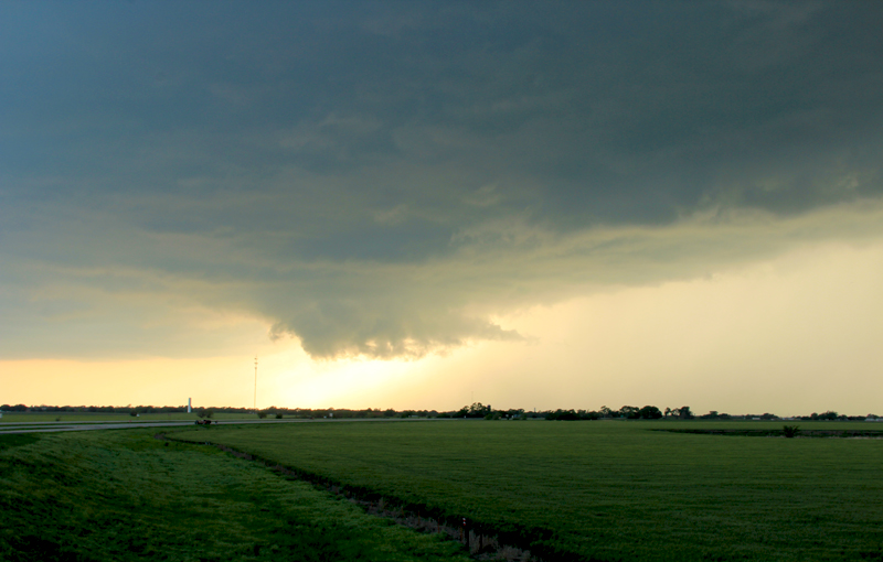
South of Arkansas City, KS, we sat outside an emu farm (for real) and waited for the tail-end storm on the now-fully-congealed line to mature. There was a pretty pitiful wall cloud north of a decent RFD horseshoe, but for some reason this storm just didn't have the necessary ingredients to really get going. I noted a brief comma of rotation in the wall cloud as it passed overhead, but that was about all the storm offered. Stair stepping south and west, we again encountered a new tail-end storm (the line was still congealing to our northeast) near Tonkawa, OK. I loved our vantage point on the embankment of a Hwy 77 overpass right at sunset. However, this storm had an even scruffier wallcloud than the previous. We still got some neat time lapse footage out of both these storms, though. Since the sun was setting, I had work the next day, and we were 635 miles from home, we started the long trek to Amarillo, where we spent the night before getting an early start the next day to finish the trip.
Recap, Filmmaking Notes, and Lessons Learned
- All in all, this did turn out to be a very active day across Kansas and Oklahoma. Further south near OKC, several very strong tornadoes occurred with supercells that developed along the dryline and stayed more discrete.
- We attacked the initial supercell pretty aggressively to get into position and see the Viola tornado. This worked out really well, but on looking back we should have played things a little differently. First, as we approached from the north we probably should have given the storm a little more space in case it took a substantial right turn. Second, we should have anticipated the very quick storm organization and repositioned earlier instead of waiting for the storm to come to us.
- I'm a little disappointed I didn't get any slider shots of the Viola tornado, but when you're being chased by the storm it's not a good idea to unpack all your gear.