Date: June 13, 2017
Time: 3:30 - 9:30 PM CDT
Place: Dunning to York, NE
Distance: 1194 mi (151 to target, 243 chasing, 800 to home)
Camera: T3i, GoPro3, GoPro5, Sony RX100ii
Warnings: SVR
Rating: S4
Pre-Chase
10:00 AM - 3:30 PM CDT: The glamour of storm chasing: waking up alone in an Ogallala, Nebraska Quality Inn, walking over to the Country Breakfast attached to the motel, and wondering how long the block of motel rooms next to yours has been abandoned (looked like a hurricane tore through them). Still, there's something oddly giddy about having no responsibilities for the day other than driving around trying to see storms. Today that feeling was mixed with the independence of being solo once again.
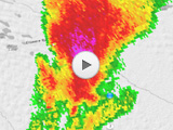
After yesterday's volatile setup in Wyoming, today's ingredients don't overlap quite as nicely but still suggest a decent chase day. The upper low over Montana ejects in earnest, bringing a negatively-tilted, 40kt flow at 500mb from Nebraska up to North Dakota. Deep moisture promises excellent instability up to 4000 J/kg MLCAPE. Directional shear will be best in South Dakota at the nose of the 500mb flow, but storms will initiate along the (non-crashing) cold front in central Nebraska and I'm hoping to get lucky with a tail-end-Charlie play. I just can't justify a drive all the way to SD. Main issues with my target: lack of low-level shear (only about 100 0-1km SRH) and storm motion parallel to the cold front and dry line.
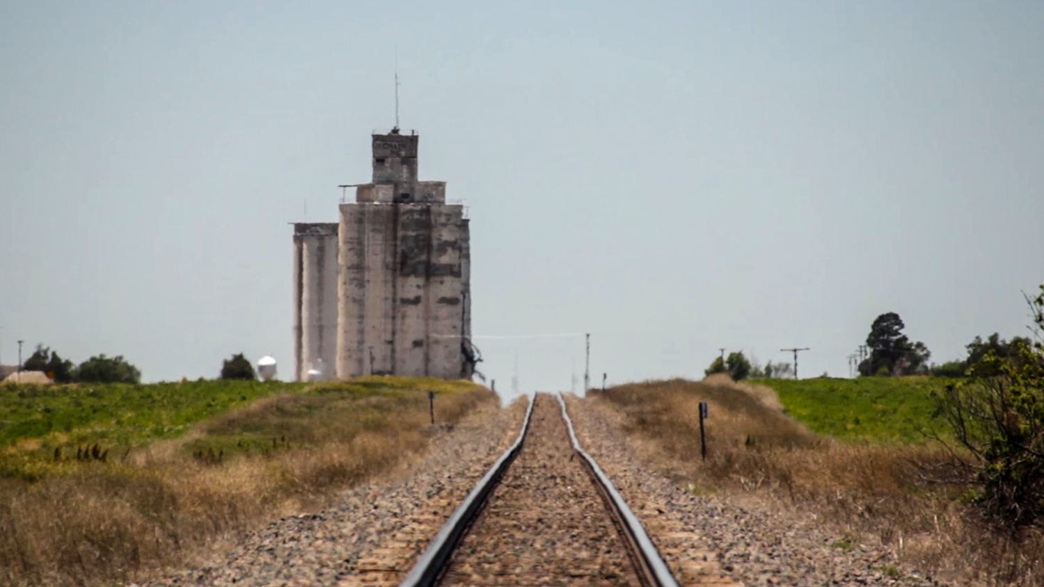
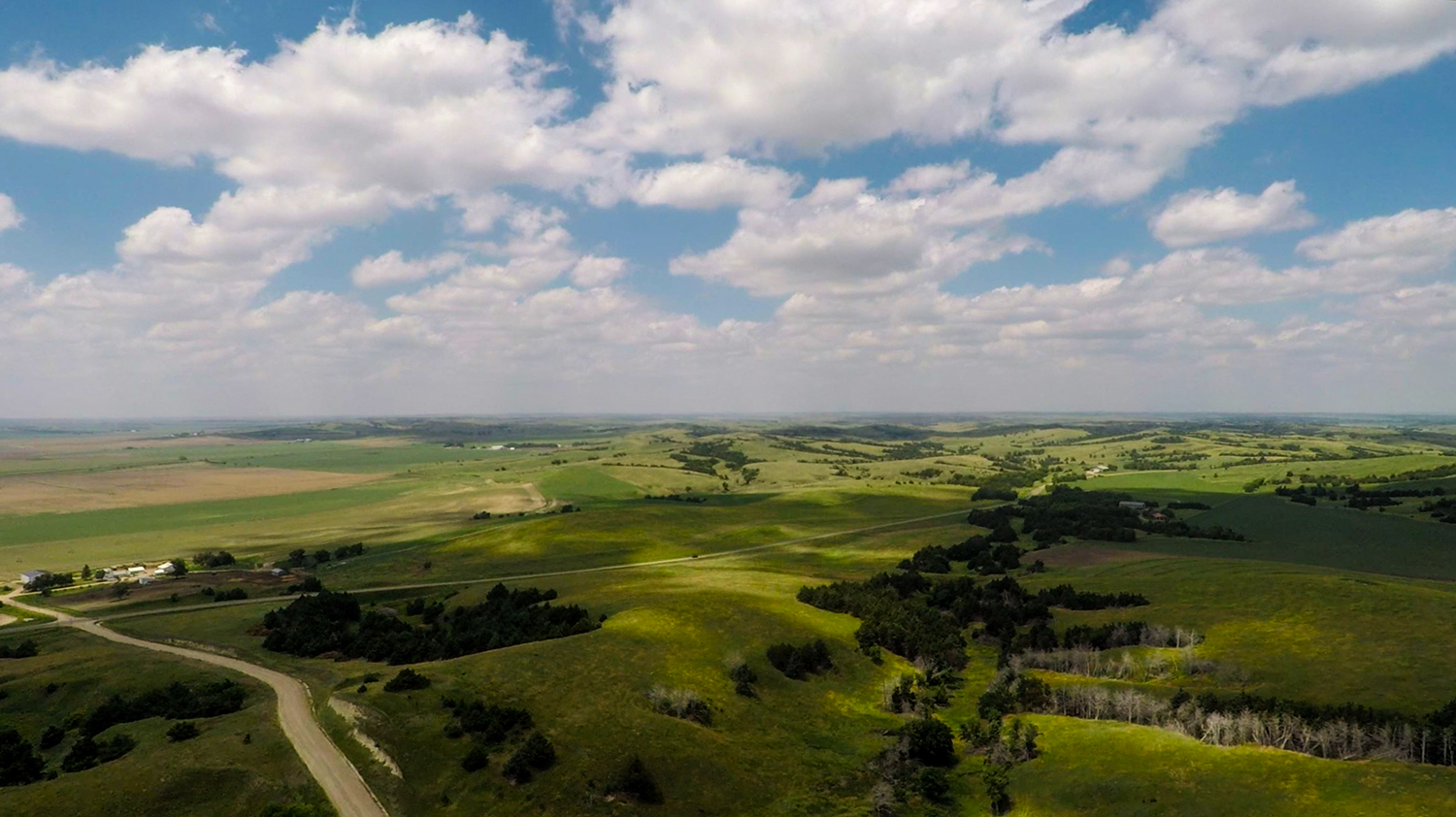
I checked out of the hotel at 11am and struck out east on I-80 to North Platte then northeast towards my nominal target of Dunning. Highways 83 and 92 trace the southern fringe of the Nebraska Sandhills where instead of the smoothly undulating terrain (literally, sand dunes with a layer of grass), the topography features 10-mile plateaus, followed by 10-mile valleys, rinse and repeat. I spent most of the early afternoon exploring these neat little canyonlands at the boundary between the plateaus and valleys (consuming an hour flying my drone on the plateau vista overlooking Merna).
By 2:15, agitated cumulus was obvious near Dunning, so I crept up to the stationary cold front to watch the towers mature. At 2:30, the SPC issued an MCD for the area, followed by a TOR watch box at 3:15. At 3:27 the first streaks of rain started falling underneath a nice tower north of Dunning. Initiation was underway...
The Chase
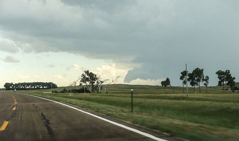
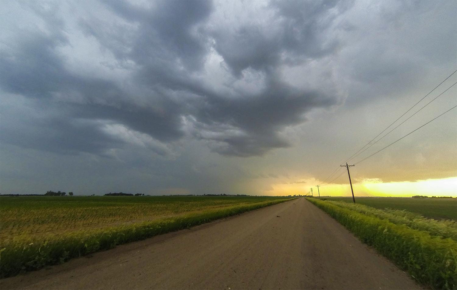
3:30 - 4:05 PM: Driving north out of Dunning, you are well and truly in the Nebraska Sandhills, and that means two things: limited roads and limited cell service. But at the moment, there was really only one initiating storm; visibility was fine and chasing the old fashioned way was no issue. The bright green rolling hills, bright blue background sky, and bright white Cu towers were a beautiful treat. Cutting north out of Brewster, I guessed my target cell would cross Hwy 7 about 15 miles north of town.
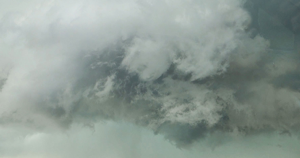
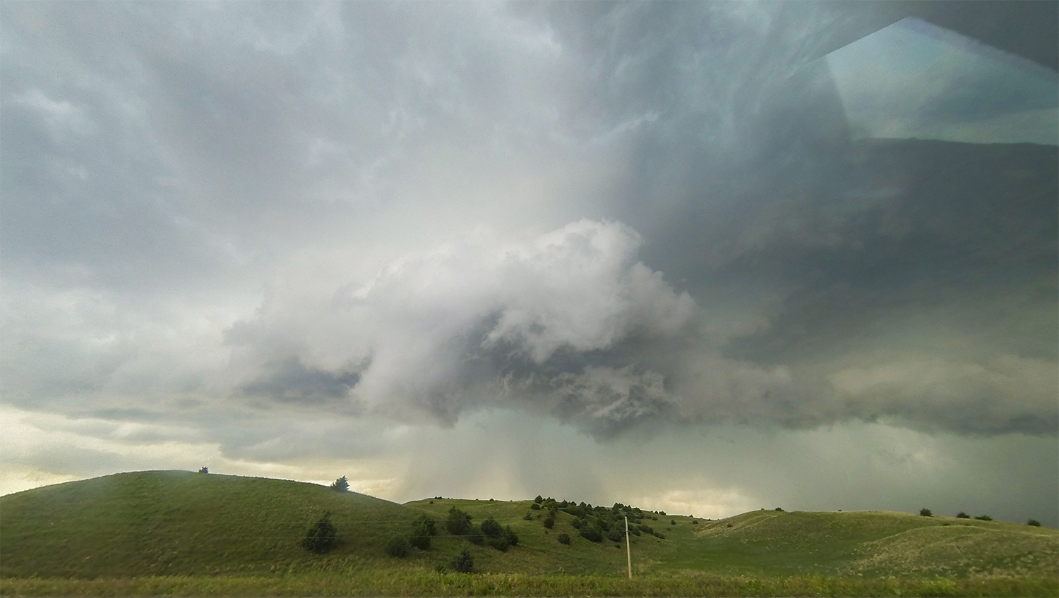
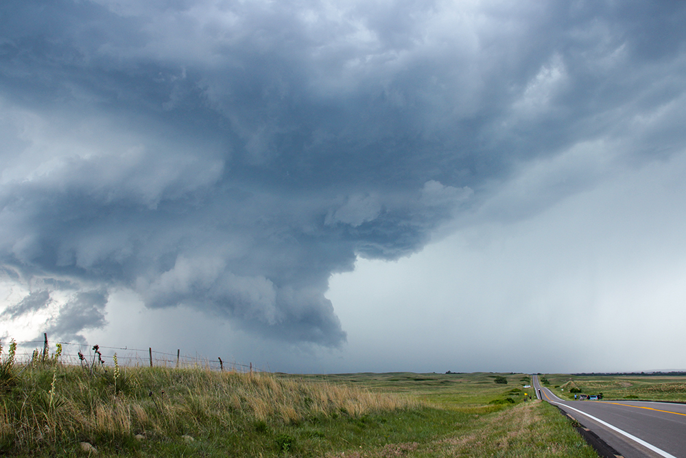
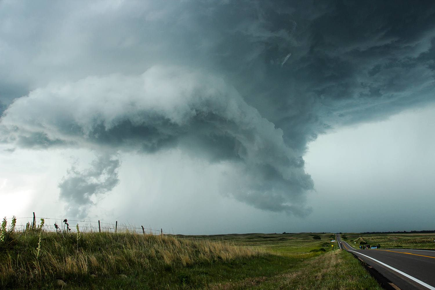
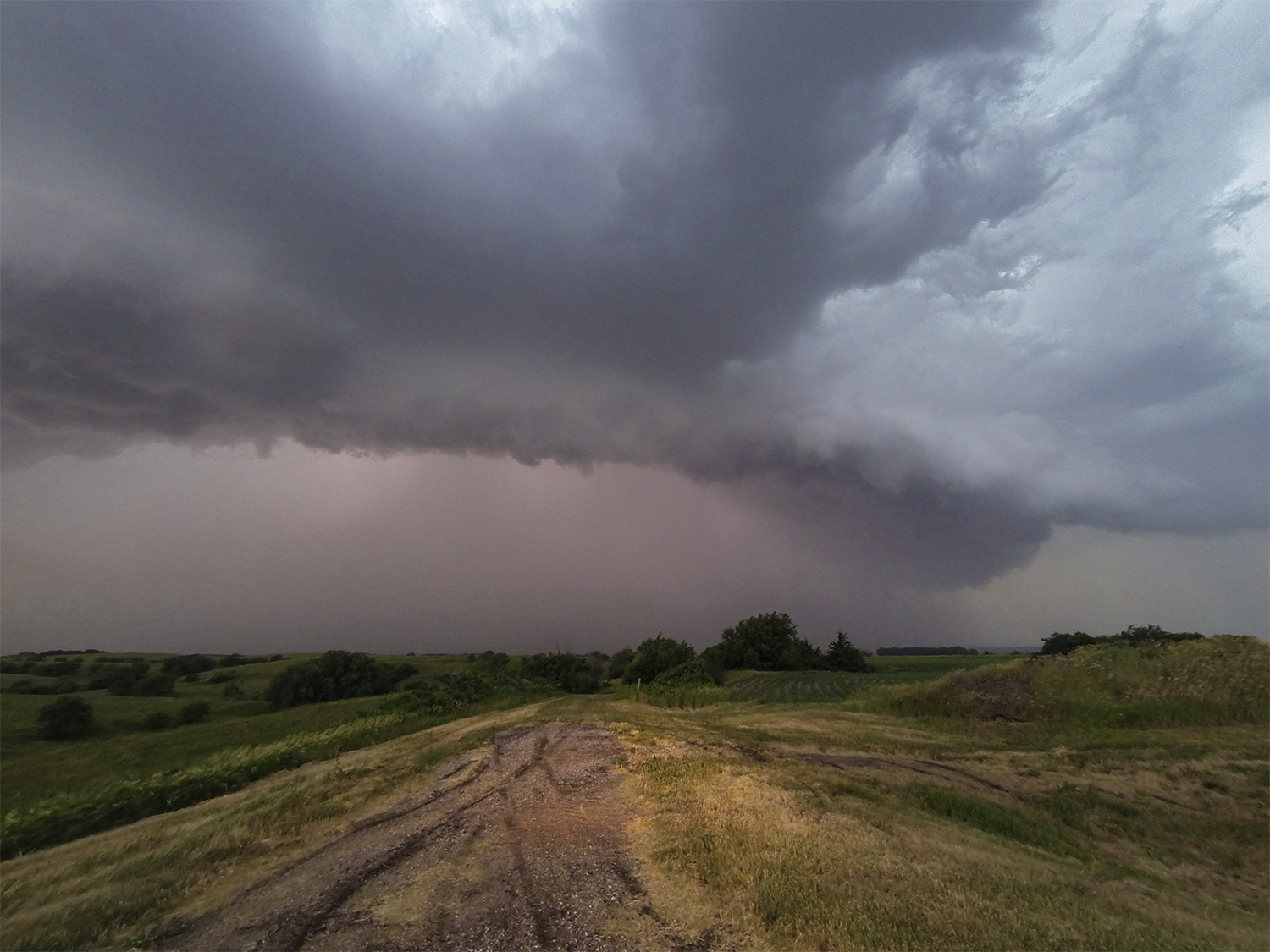
Now on a collision course, the storm's base continued to darken ominously just a few miles to my west - with glimpses of a scuddy wall cloud / shelf cloud hybrid peaking above the low hills as I raced north. Radar-blind, it was time to pick the right stopping point: too far north and I'd fall into the precip, too far south and I might miss the action if a wet RFD wrapped in. Creeping a mile further north than my gut suggested, I finally pulled to the side of the highway at 3:42, just as the wall / shelf hybrid closed in. To my delight, the lowering punched forward and wrapped up with a cool little cyclonic nub funnel - almost directly overhead! I suspect this was likely a little meso-vortex on the gust front, rather than part of a deeper mesocyclone, but it was a great way to start the chase - only 30 minutes in!
4:05 - 5:00 PM: After watching the wall / shelf hybrid shrivel up to my northeast, I briefly attempted to follow northwards. But after a couple miles, rain enshrouded my location and cut off all visibility. Rather than continuing north without radar, I stuck with the tail-end-charlie decision and dropped back south to see what was developing towards Brewster. Sure enough, another suspicious base emerged on the southern horizon and a radar update suggested my best intercept option was 7 miles east of Brewster on Hwy 91.
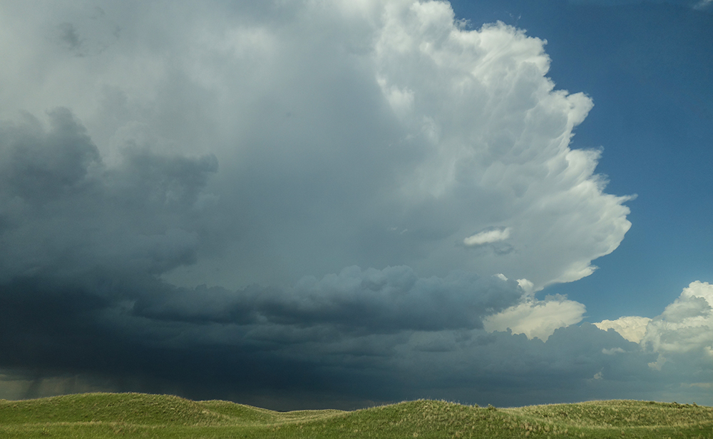
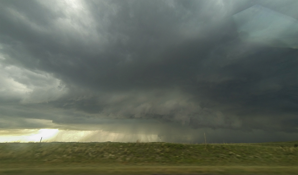
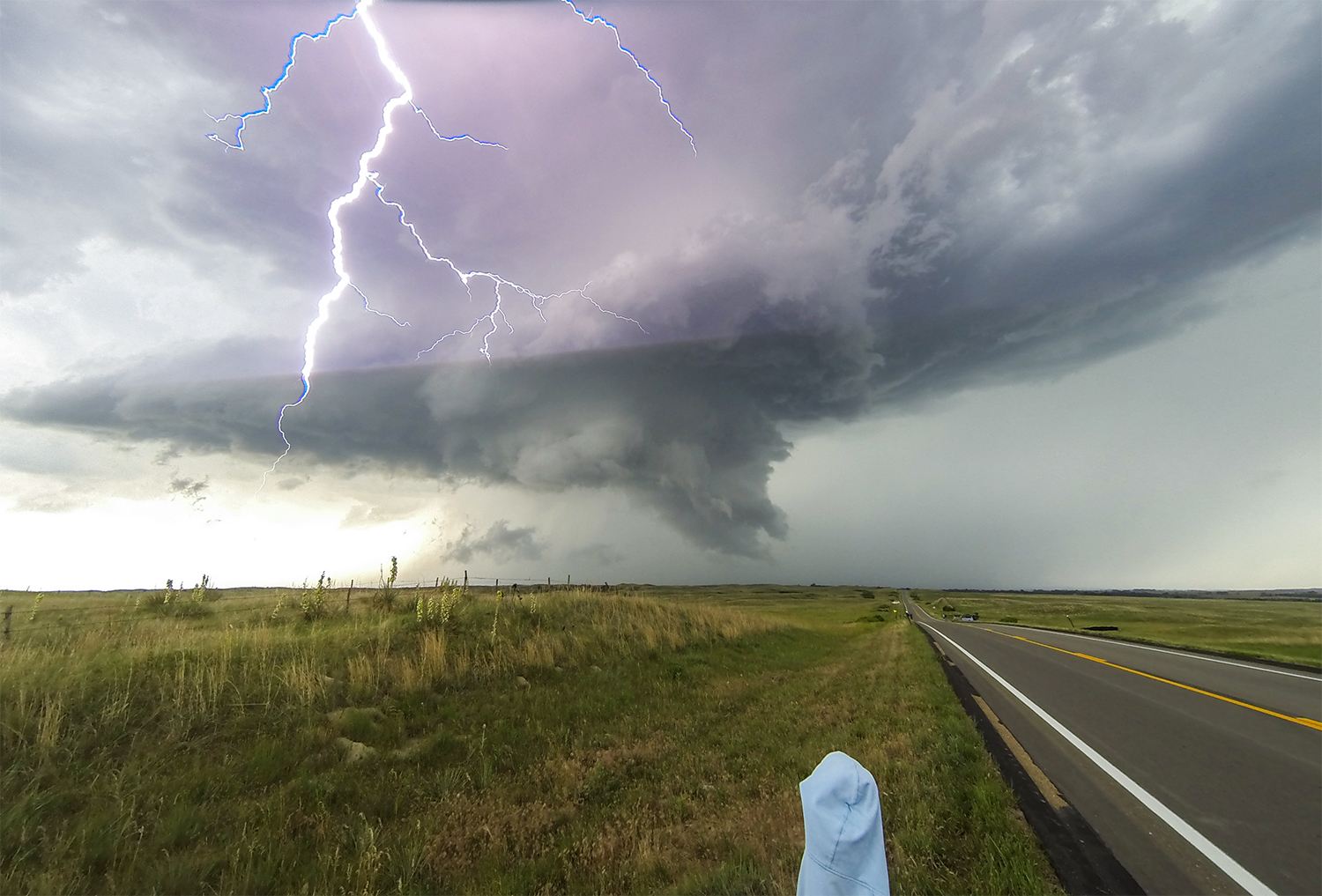
A few other chasers were scattered nearby as I parked on a highway hillcrest - greeted by a gnarled, multi-tiered shelf cloud bulging in my direction. Storm #2 of the day was a gorgeous, outflow-dominant cell with lots of jagged lightning dropping in the clear air out in front of it. After quickly setting up the timelapse cameras, I spent much of the time huddled in the Crosstrek trunk with my feet off the ground - safe from the random bolts striking all around. Even though this storm had zero tornado potential, these little moments are what make chasing so much fun.
When rain and hail curtains were just a couple hundred feet down the road, I dodged east into the town of Taylor and gassed up next to Brandon Ivey's storm chase tour group. Pulling a little "Jonas" move, I dilly-dallied for a couple minutes to see which way they would go. Despite their decision to pursue north, I just didn't have the heart to chase what looked like a collapsing storm.
6:45 - 9:00 PM: Models had consistently shown a secondary axis of storm development later in the day near Grand Island, albeit a more linear mode with lower tornado potential. But it was June in Nebraska; I was more than happy to take that chance. By 6:45, I'd driven all the way to Genoa, Nebraska just north of the Platte River. And as it turned out, the models were right 😀! But also, the models were right 😒.
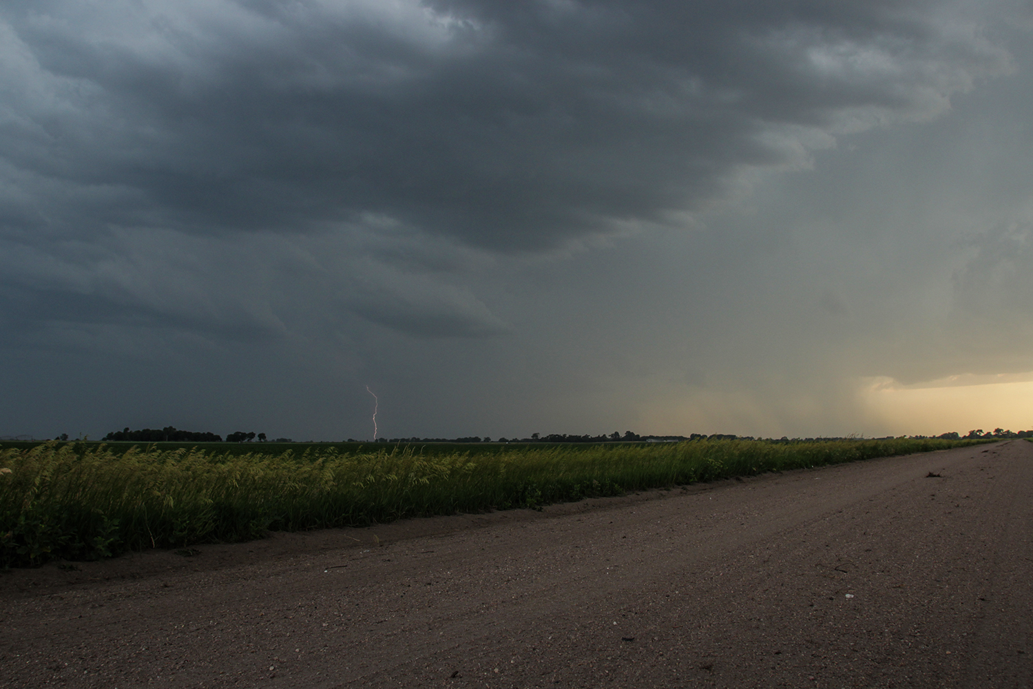
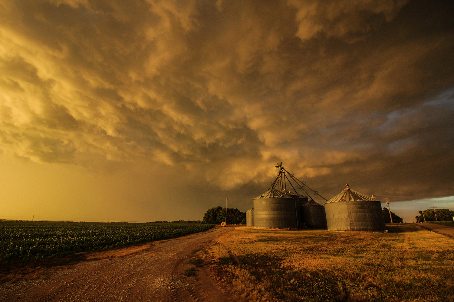
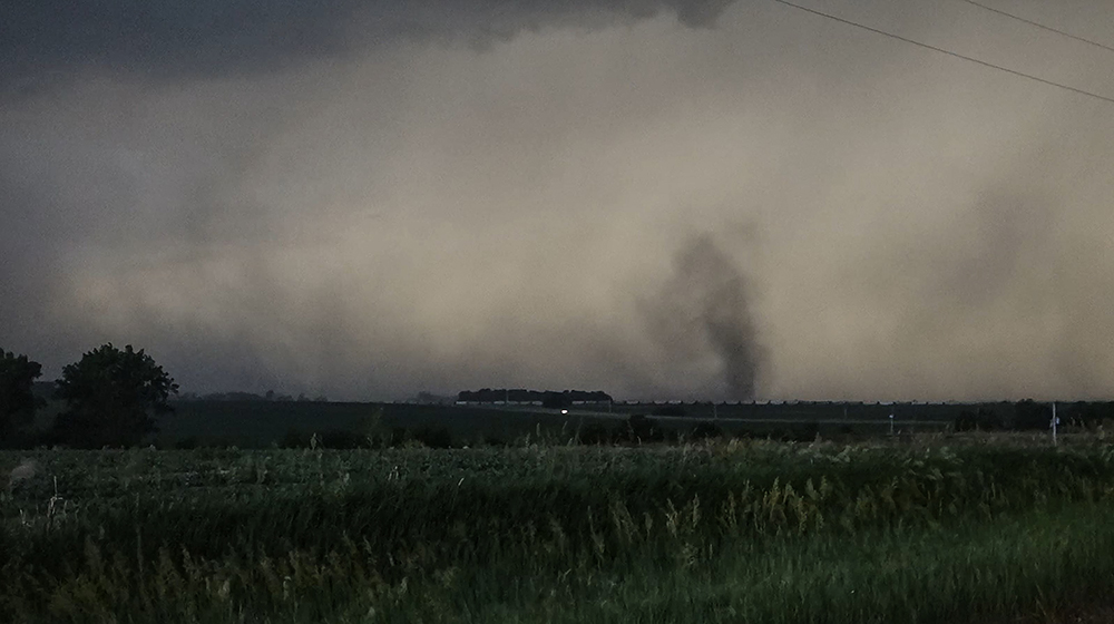
As predicted, new storms blew up along the NE/SW dryline and began moving NE. But this meant that cells almost instantly began to congeal and fight with each other - no room for a discrete storm to pull off any surprises. More disappointingly, the first few cells in line were high-based and not very interesting visually. By 7:20, however, a SVR-warned embedded supercell was developing an impressive pocket of wind velocities. I dropped a few miles south of Silver City and let the RFD gust front pass over. Not the most intimidating shelf cloud ever, but there were some large gustnades on the apex of the outflow followed by 60-70 MPH straight line winds (a few severe reports in the area mentioned 80 MPH gusts).
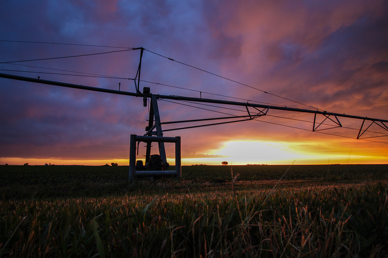
Thanks to the orientation of the dryline, I could drive a few miles south and easily be out in front of the next storm in the line. I played this game a few times between Stromsburg and York - each time collecting a few more gustnadoes and wind gusts. The final storm in York passed over just as the sun was setting, creating a wonderful yellow-orange backlight shining through the falling rain. By now it was getting close to 9PM, so I got some final timelapse shots in the deepening twilight before heading to Kearney for the night.
Recap, Filmmaking Notes, and Lessons Learned
- South Dakota did turn out to be the tornado play of the day, with a good number of weak tornado reports. Only hail and wind were reported in Nebraska.
- Holy cow, it's been a few years since we last stayed in Kearney (back in June 2014). Crazy how much the hotels have built up since then. The Hampton Inn seems like a fancy conference center.
- Finished the Seveneves audiobook on the drive to ABQ the next day. ★★★★☆