Date: June 3, 2014
Time: 3:30 - 10:00 PM CDT
Place: Ord, Fullerton, Palmer, Grand Island, Nebraska
Distance: 429 mi (227 positioning, 191 chasing, 11 to hotel)
Camera: GoPro3 Silver, T3i, Lumix
Warnings: SVR, TOR
Rating: S5
Forecast and Set Up
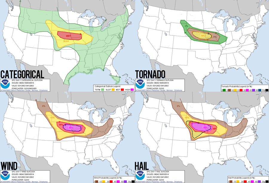
Yesterday we took a leisurely drive from Hays, Kansas up to Kearney, Nebraska stopping all along the way to see new sights and generally enjoying the freedom and desolation of a central plains road trip. Today, however, was all business. Not since the April 14, 2012 high-risk event have I been so nervous about a storm chase. For several days, models were showing a monster warm front setup in central Nebraska. Good moisture and instability were creeping north, an intense jetstreak was digging in rapidly and deepening a surface low in western Nebraska, and most importantly wind shear was absolutely insane along the warm front with some of the scariest hodographs Ive seen (one of the Area Forecast Discussions called them obscene). All elements were in place for a dangerous outbreak of tornadoes on our first ever Nebraska chase.
Amping up my nervousness, I awoke to morning HRRR runs that were consistently showing a threatening outbreak of discrete supercells over central Nebraska by late afternoon. Adding to the palpably ominous atmosphere, our hotel lobby was plastered with warning signs showing where and where not to shelter from a tornado. For big chase days like this, the morning and early afternoon waiting game is definitely difficult; I get really edgy and antsy (I nearly drove off from a Kearney gas station with the gas nozzle still in the Crosstrek).
Leaving Kearney midmorning, we traveled north and west towards the SigTor (Significant Tornado Parameter) bullseye over Broken Bow. The Prairie Grounds coffee shop was our base while we awaited initiation, and despite my nervousness we had a delightful time chatting with the owner and locals for several hours. During this time, a couple outflow boundaries (OFBs) began approaching our position: one to our south was left over from overnight convection and was lifting back north to reinforce the warm front while another to our north was crashing south from a monster elevated supercell that started late in the morning in South Dakota. I was a little worried that these roughly parallel boundaries were squeezing the prime tornadic atmosphere into a very narrow corridor meaning there might only be one dominant supercell with concentrated chaser hoards.
By 3:15, the consolidated warm front was just a few miles to our north, while the cold crashing OFB was another 20 miles further north. Agitated cumulus fields along the northern OFB indicated imminent initiation, while back to our southwest in the warm sector closer to North Platte, another area of slightly less agitated cumulus signaled possible initiation there as well. At 3:30 I could wait no longer. Storms directly to our north were just beginning to grow explosively. This wasnt ideal, since they were still about 20 miles north of the warm front implying potentially elevated storms. But I wanted to get into position quickly on these in case they were able to tug the warm front north and tap the rich surface air. Plus, I figured we could close distance quickly if storms to our southwest started to mature. After what seemed like ages, the chase was on!
The Chase
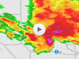
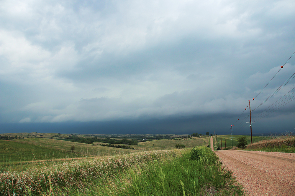
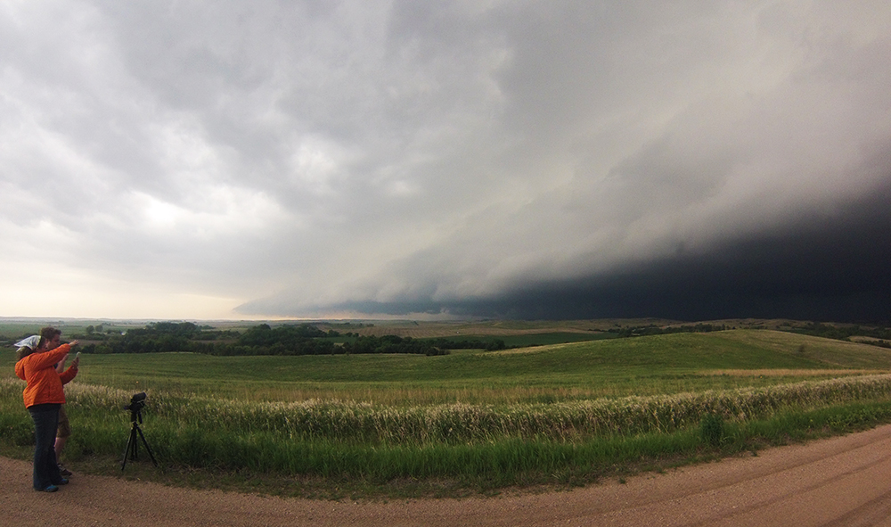
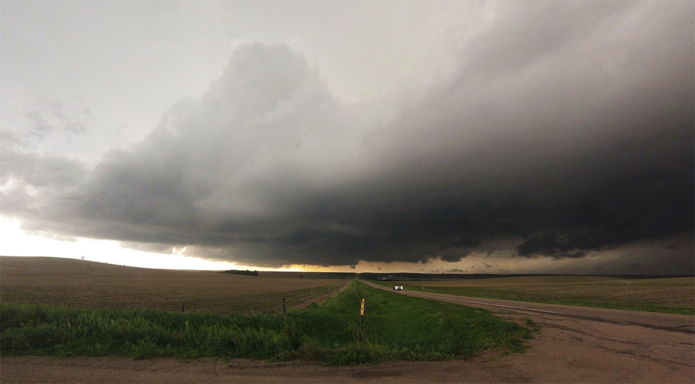
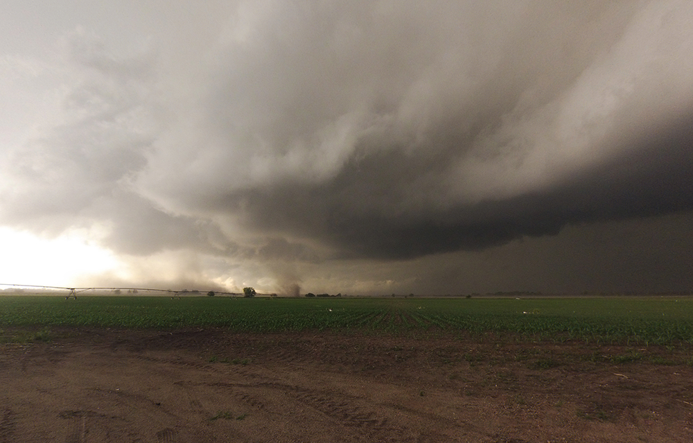
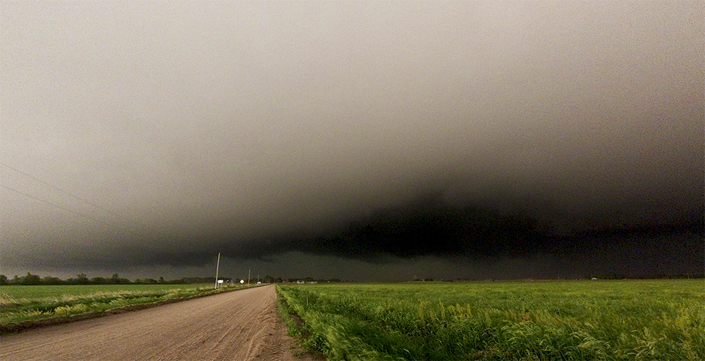
I drove east on Hwy 70 out of Broken Bow while Toni monitored radar and satellite. Over the next 40 minutes, the southwest cumulus field fizzled out while a dominant supercell began to take shape to our north. Just outside of Ord, we parked on a beautiful hilltop with a sweeping view to our northwest at the approaching supercell. Initially, visibility was poor as the atmosphere was very soupy, but after 10 minutes an enormous dark base began to emerge. About this time, a tornado warning was issued on our storm and we were in perfect position!
As the supercell approached, we realized two things: 1) it had already become HP because the inky darkness underneath the base was not clearing up to reveal any detail, and 2) the storm was moving much faster than forecast (45-50MPH instead of 25-30MPH). Taking a lesson from El Reno, we left our position earlier than I usually would - just as the first cold RFD gusts hit. Instead of retreating southeast from Ord, we escaped directly south along Hwy 70 and then east along Hwy 22 staying just along the fringes of the massive RFD outflow.
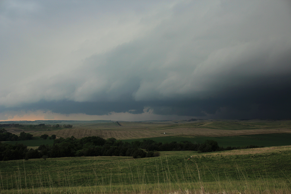
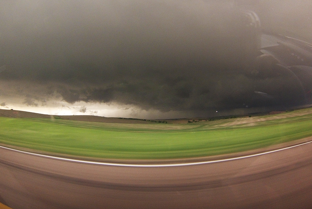
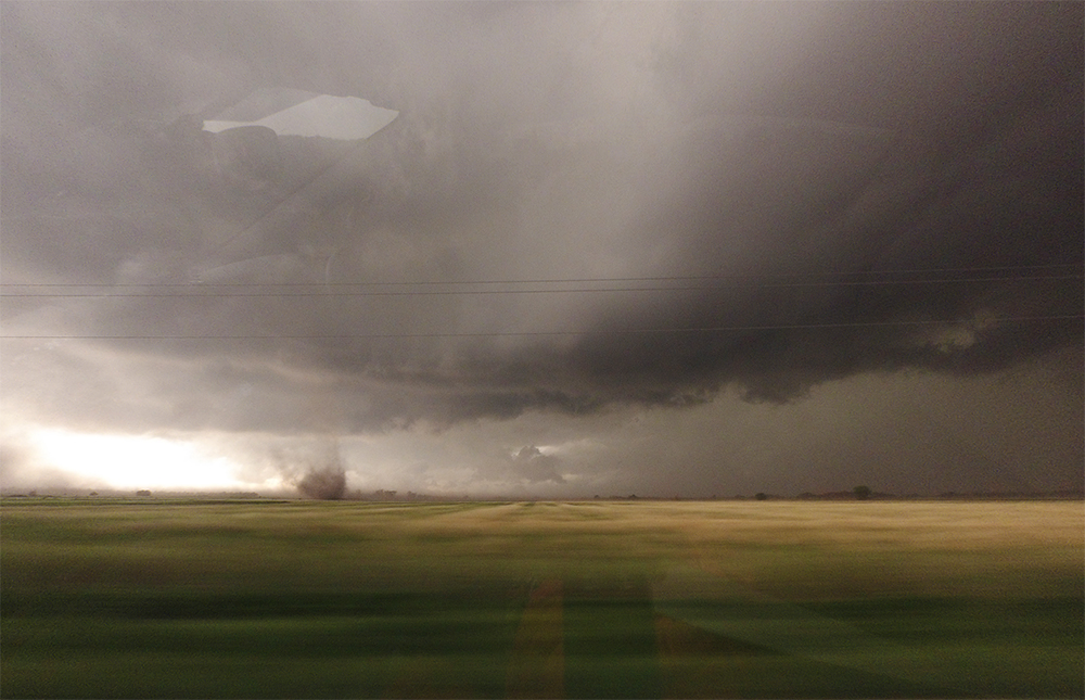
Due to the supercells fast southeast motion, we spent the next hour just barely outpacing the storm and photo opportunities were rare and brief. The drive became more and more white-knuckled as chaser crowds began to thicken this being the only dominant storm in the area. I did have the GoPro facing the storm for the entire drive and was able to capture some very interesting fine-scale features in the leading edge of the RFD. At many points during the drive, a small section of inflow winds would punch into the RFD - creating micro-scale notches that would begin to rotate cyclonically. Often under these micro-notches, very large gustnadoes would develop. Even though the ground and cloud circulations were connected, I dont count these as full tornadoes as I really doubt they were attached to the mesocyclone. But it was still an amazing process to see this play out multiple times.
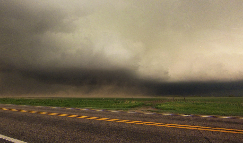
In the town of Fullerton, the train of chaser vehicles separated into the brave (turning north for a shot at the primary inflow notch) and the scared (i.e. us escaping south). A couple miles south of town, we were able to stop for the longest picture opportunity yet (5 whole minutes!) and saw some very impressive gustnadoes and RFD-driven dust. At one point as we continued driving south, gustnadoes were dancing all around the car kicking up mud and debris from the surrounding fields and pelting the car. It was intense, but I was confident we were safely out of harm's way. Shortly thereafter, we also drove through an incredibly dense fetch of dust that brought visibility down to 5 feet for a couple minutes.
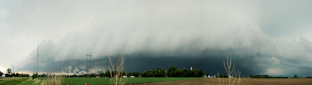
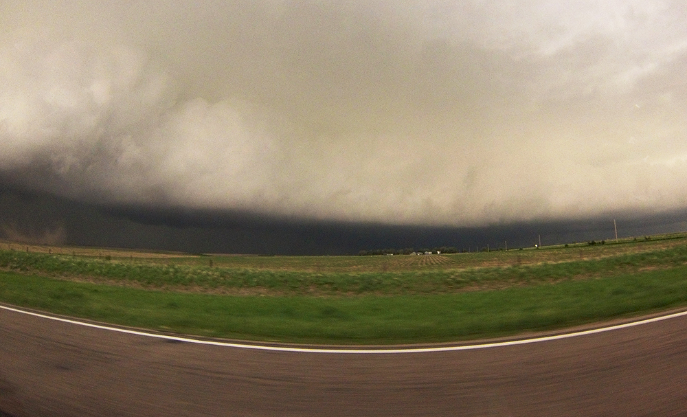
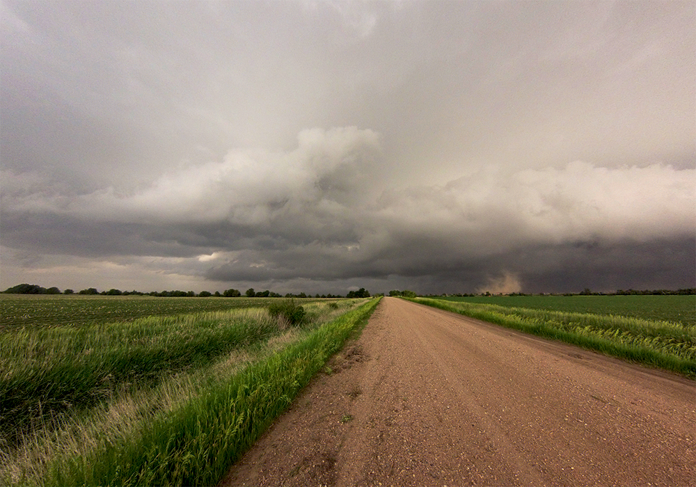
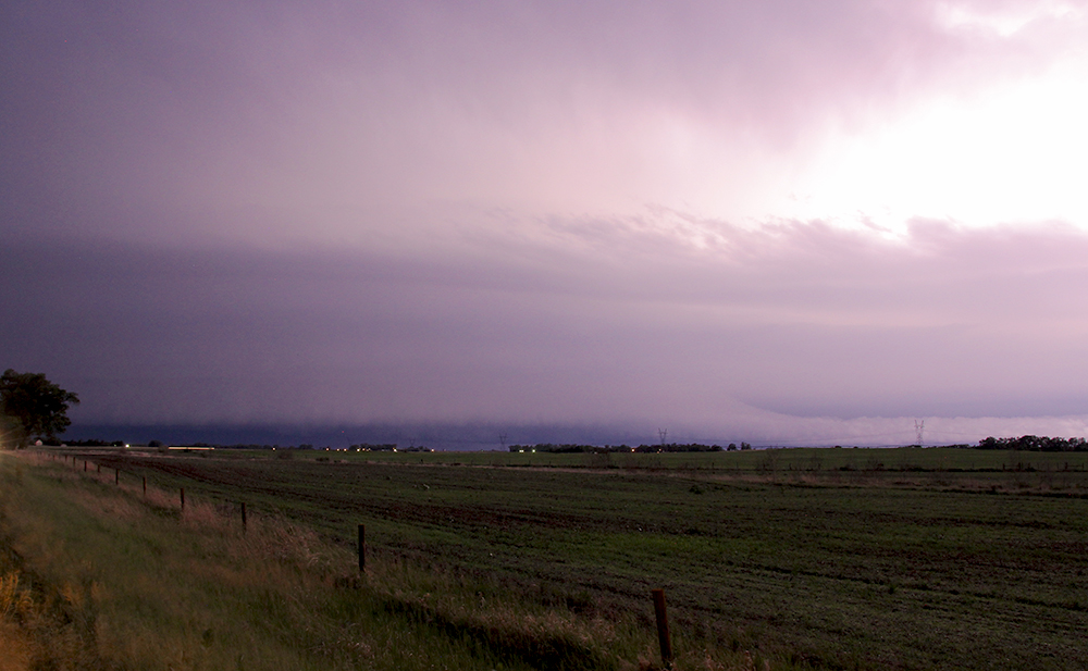
After that experience, we needed to catch our breath and relax a little. Being in non-stop, fast-paced chase mode for nearly 2 hours is stressful, plus the road network stopped cooperating at this point and we fell hopelessly behind the supercell. Thus, we pulled onto a lonely dirt road south of Central City to reevaluate our options. A new line was quickly congealing back to our northwest, and there didnt appear to be any other chaseable storms in the immediate area. So after gassing up in Central City, we headed west on Hwy 92, quickly closing the gap between us and the surging line of storms. Ducking a few miles south of Palmer to avoid a direct hit from an inflow notch along the line, we sat beside a creepy stop sign with shoes nailed to it and awaited the squall line. I set up various motion timelapse shots as the storm closed in. The inky blackness as the shelf cloud passed over was literally the darkest I have ever witnessed. All in all though, it was a pretty standard squall line and nothing as intense as the HP supercell earlier in the day.
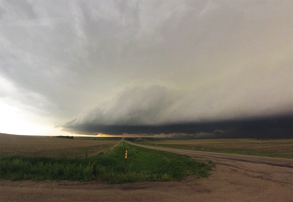
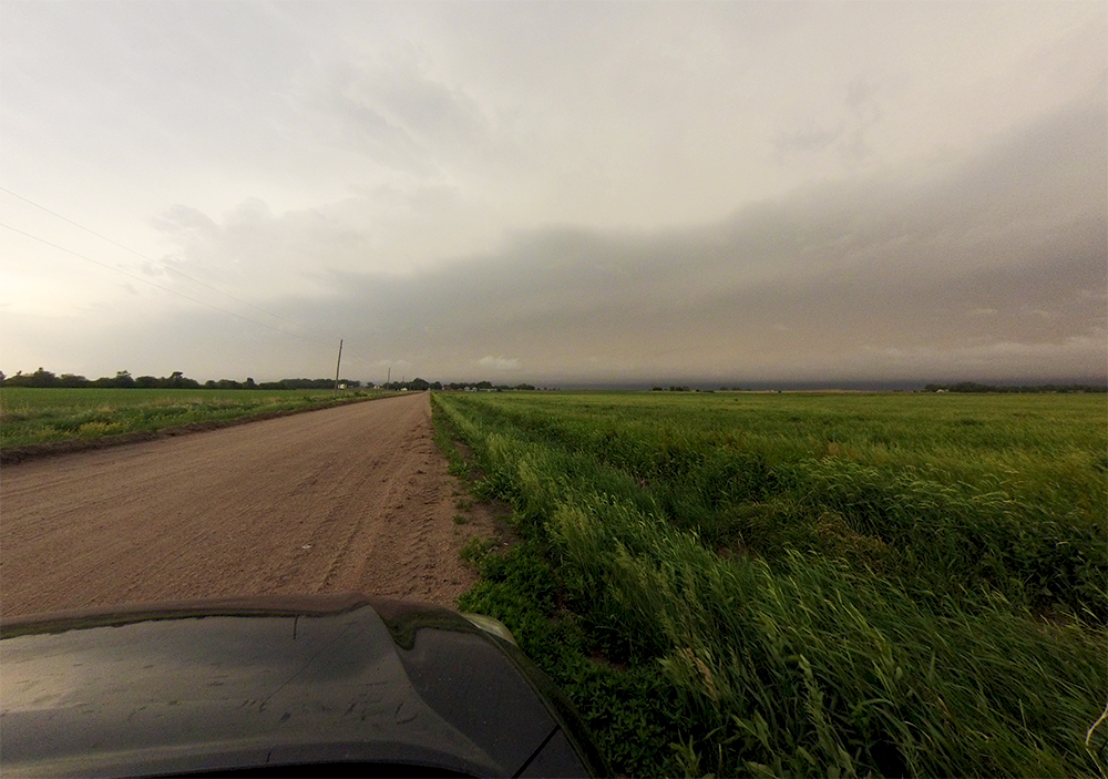
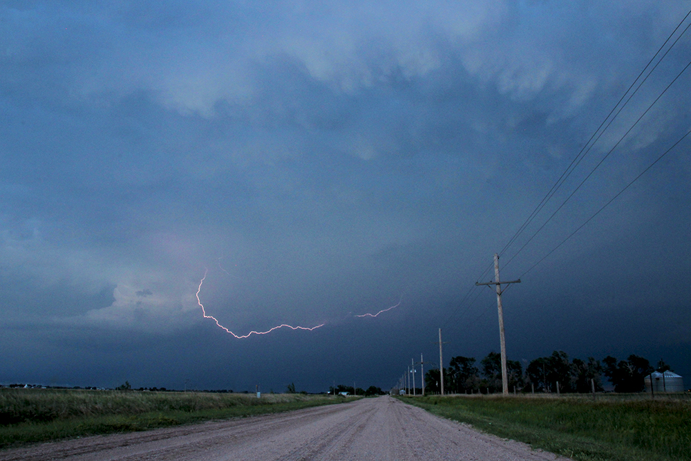
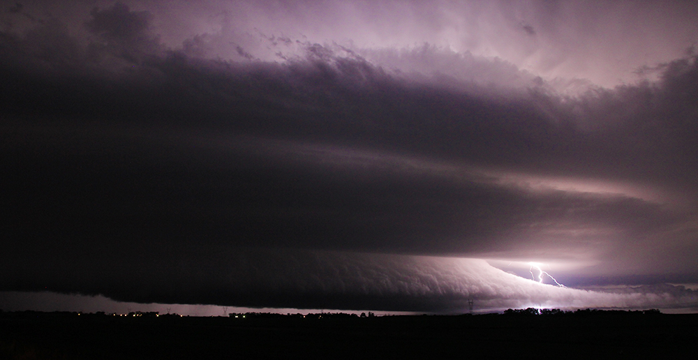
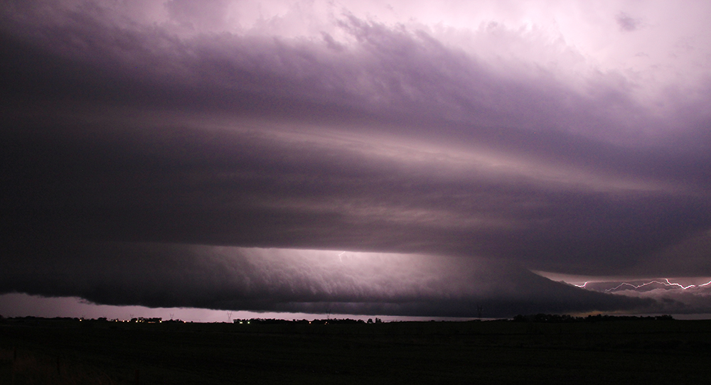
As evening began to close in, we again reevaluated our options just outside Grand Island. Perhaps feeling a little let down by the storms so far, I was determined to stay out just a little bit longer before calling it quits. I got a few lightning shots from a very anemic storm that passed north of town. Then, just as we were about to head for a hotel, a new storm to our west-northwest got a tornado warning. We only had to maneuver a few miles north to be in perfect position! As twilight deepened, we began seeing the first flashes of lightning on the horizon. It wasnt long before we were treated to a beautiful pancake-stacked supercell illuminated by frequent C-G and C-C lightning. The crispness of the inflow tail and RFD front was especially impressive and ended up being the best structure we saw all day.
As the storm closed in, we escaped south to avoid any unintentional nighttime tornado intercept and called it a day. Booking a hotel in Grand Island, I was more excited than I should have been upon seeing a Buffalo Wild Wings right across the parking lot. While eating wings and then going to sleep back in the hotel, a training line of storms brought continual lightning and thunder that gave the day a perfect conclusion.
Recap, Filmmaking Notes, and Lessons Learned
- The primary supercell of the day put down at least 3 weak tornadoes along its path, one of which occurred while we first watched the storm approach Ord, but it was hidden in the rain. I'm sad nothing photogenic ever developed, given the setup, but I'm also relieved we didn't miss anything.
- The faster than expected motion was probably due to the slightly elevated storm mode (not suprising given the first supercell started north of the warm front). Hence the storms weren't slowed via rooting down into the backed surface layer winds - they skipped across this layer kinda like a rock across a stream.
- Hectic chases like this make it nearly impossible to capture the more deliberate, cinematic storm shots I'm really interested in. The Konova slider got one deployment, and the quadcopter didn't see any action. I still have lots of room for improvement in efficient gear deployment. Integrating Toni more tightly into the process is probably a good place to start.
- Never underestimate how quickly RFD can sneak ahead of your planned route.
- While pursuing post-twilight storms is still not something I'm really interested in, the old wait-for-it-to-approach method can definitely yield some neat nighttime timelapse opportunities.