Date: May 17, 2019
Time: 3:30 - 9:00 PM CDT
Place: McCook, Stockville, Farnam, NE
Distance: 853 mi (557 positioning, 237 chasing, 59 to hotel)
Camera: T3i, GoPros5 & 7, Note5, Note9
Warnings: SVR, TOR
Rating: S5
Pre-Chase
May 16, 6:50 PM MDT - May 17, 1:30 AM CDT: Even after all these years, there's still a magical feeling about an evening drive in anticipation of storms the next day; doubly so with the prospects of multiple chase days. Tonight, we exited the comfy confines of the ABQ elevated mixed layer (EML) and headed east -- down into the deep, rich moisture of the central plains. Nowadays, this is the closest I get to the feeling of summer vacation, the sudden switch from work to play. This was especially mirrored tonight by our choice of new audiobook: Summer of Night by Dan Simmons. As we cruised along the dark, lonely Hwy54 towards Liberal, KS, the occasional coyote or deer eyes flashing in our headlights, the audiobook launched into a tale of kids just starting their own summer vacation, but with an elusive, sinister force haunting the fringes of their small town. You couldn't help but feel the parallels to our own trip -- adventure and tragedy always the dual possibilities of a storm chase.
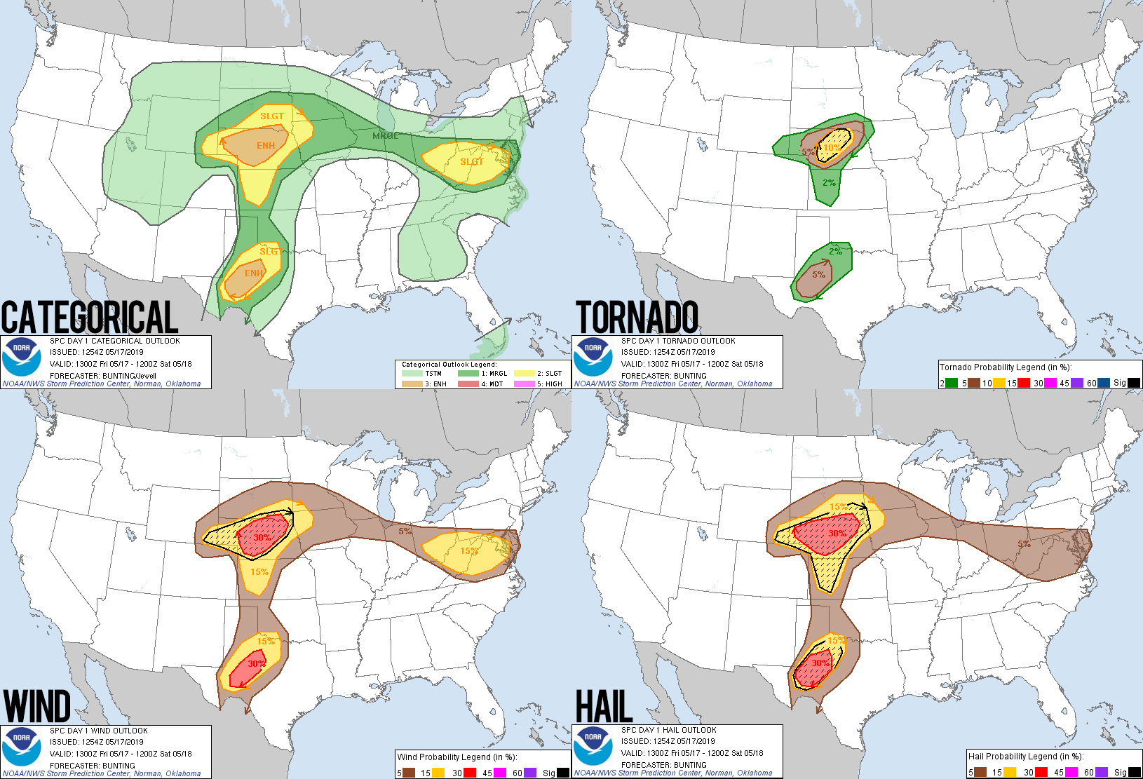
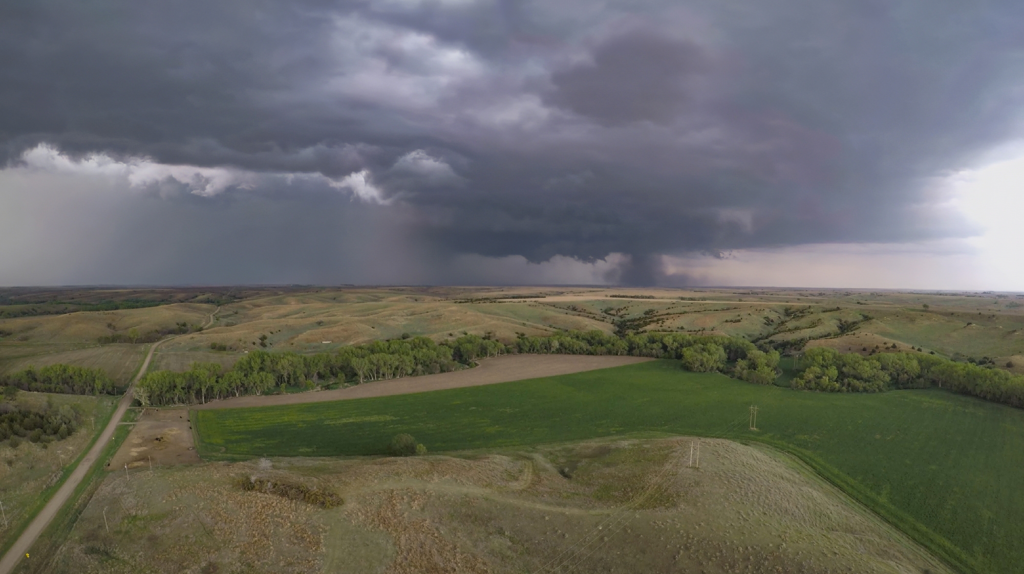
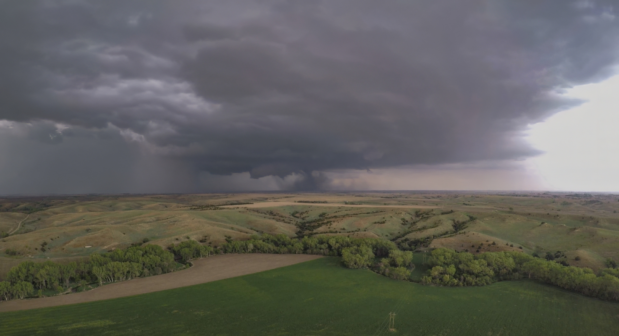
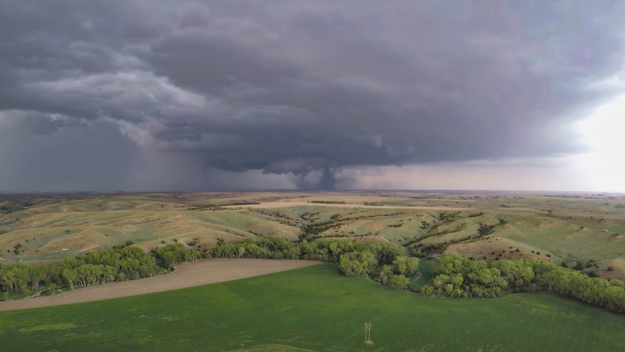
10:15 AM - 3:35 PM CDT: After eyeing this system for the last 6 days, it was finally go-time. Today starts the textbook late may "synoptically evident" severe weather period. And this setup couldn't be more classic, with a deep upper trough over a dryline that stretches from Nebraska to the Mexican border. Despite the great look, the day still started with a tricky choice: stick around SW KS where capping made storm chances more uncertain or head north to Nebraska for higher initiation probs. In the end, fear of the blue-sky-bust won out -- we were Nebraska bound.
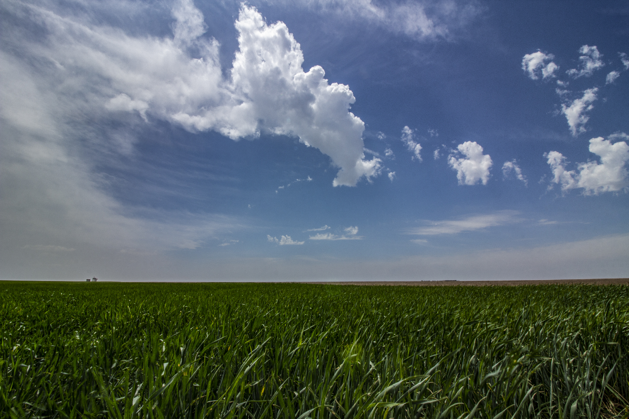
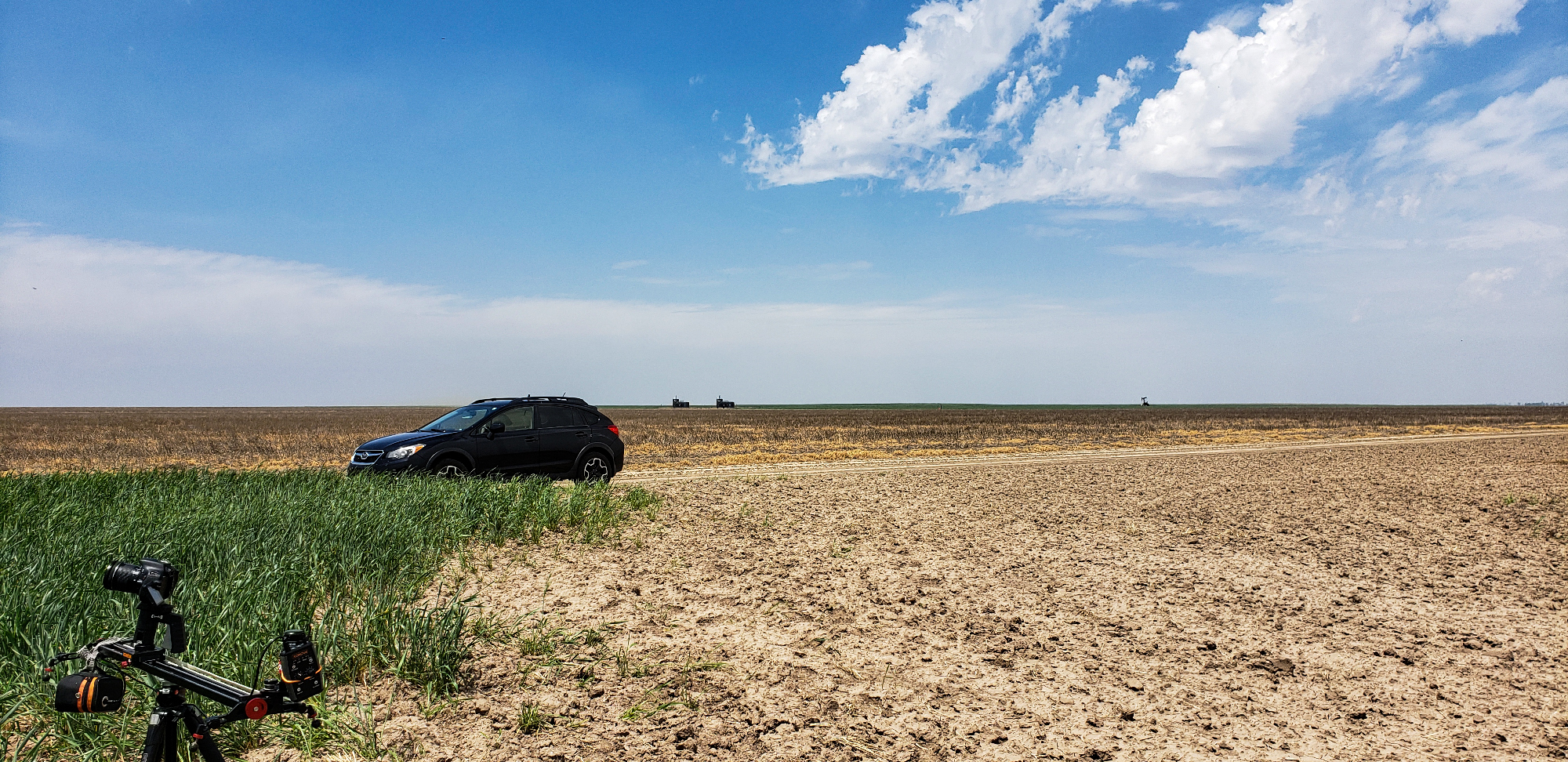
It might seem weird that chasers often sing the praises of morning fog. But it's true; many outstanding tornado days have started with dense early fog. This low cloud layer has a tendency to prevent temperatures from getting too hot, thus forestalling T/Td spread from getting too wide, thus keeping storm bases from growing too high, thus making tornadoes more likely to form. Obvious right? Well, I was certainly enthusiastic as we crossed north of Scott City and into some tasty, moist fog. Muggy air streamed NNW towards our target as we stopped occasionally between Scott City and Oakley to exercise some B-roll drone flights and slide rail lapses.
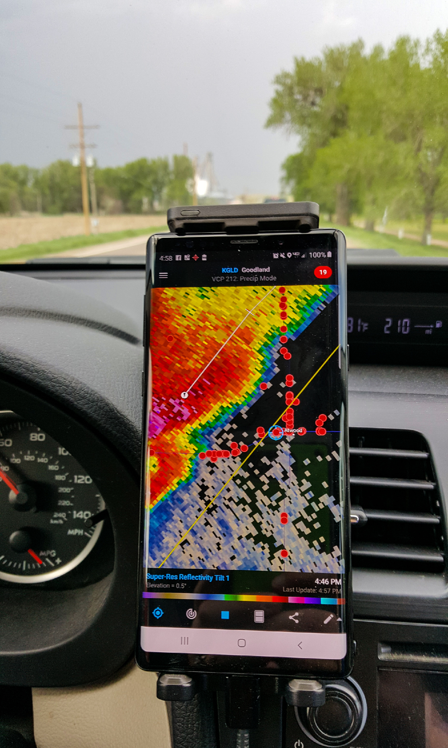
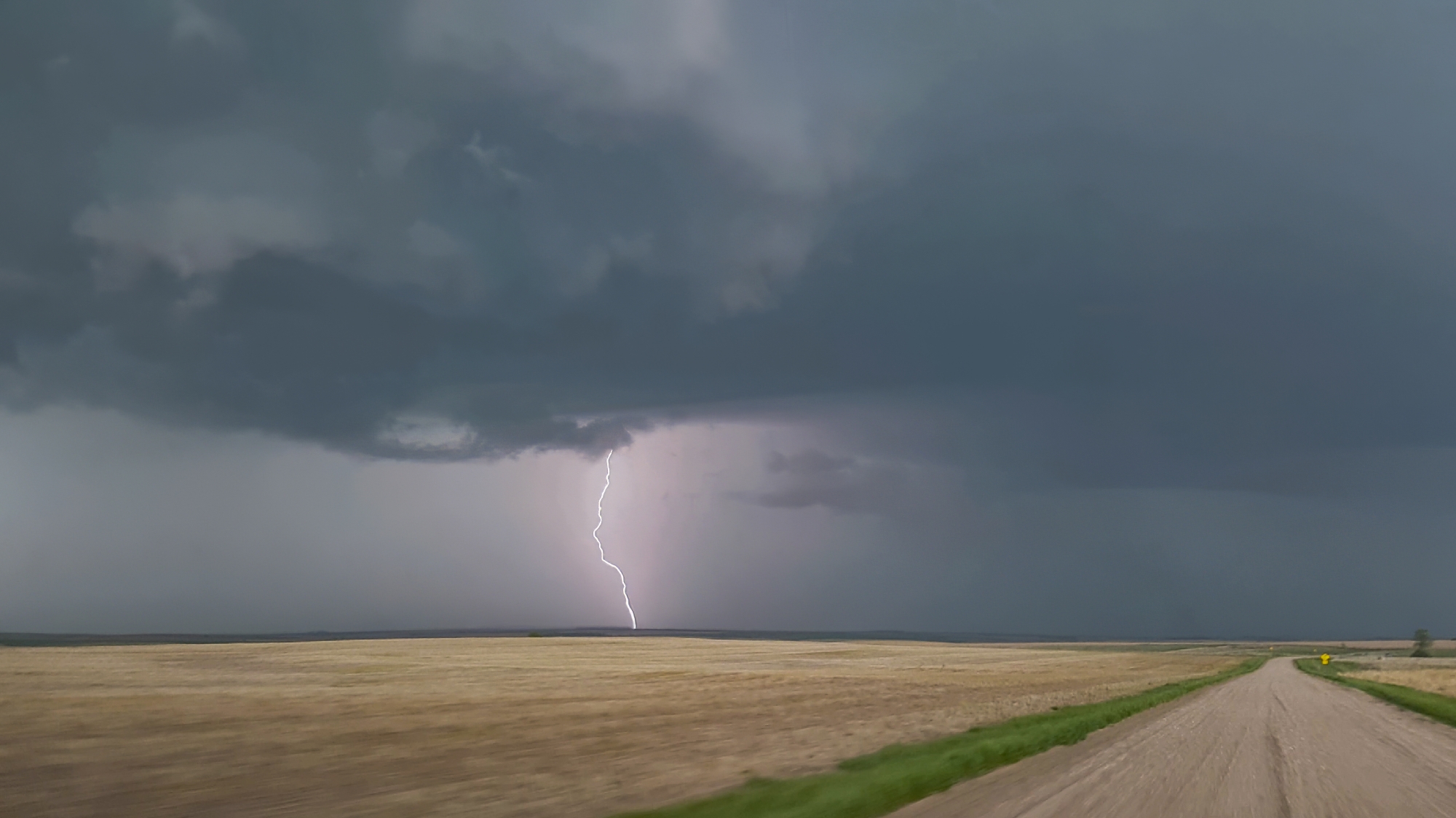
I was growing particularly antsy (very normal for me) by 2:45 when we pulled into the Colby Arby's for a quick lunch. An MCD had been out for over an hour -- taunting with a relatively meager discussion on tornadoes. Satellite showed bubbling Cu on the dryline just a few miles to our west, and by 3:16 the first radar blips emerged on KGLD. A mere 13 minutes later, the blips went SVR WARNED! Throwing strategy to the wind, we tore out of town west on I70 directly towards the new cell 20 miles away. Chase on!!
The Chase
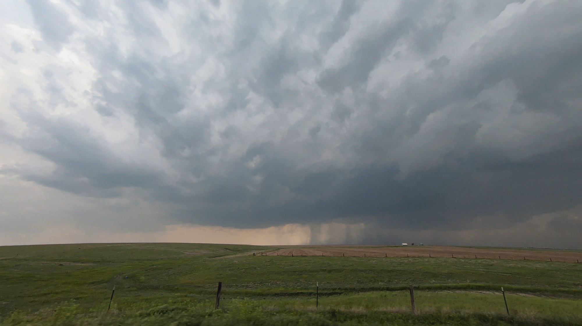
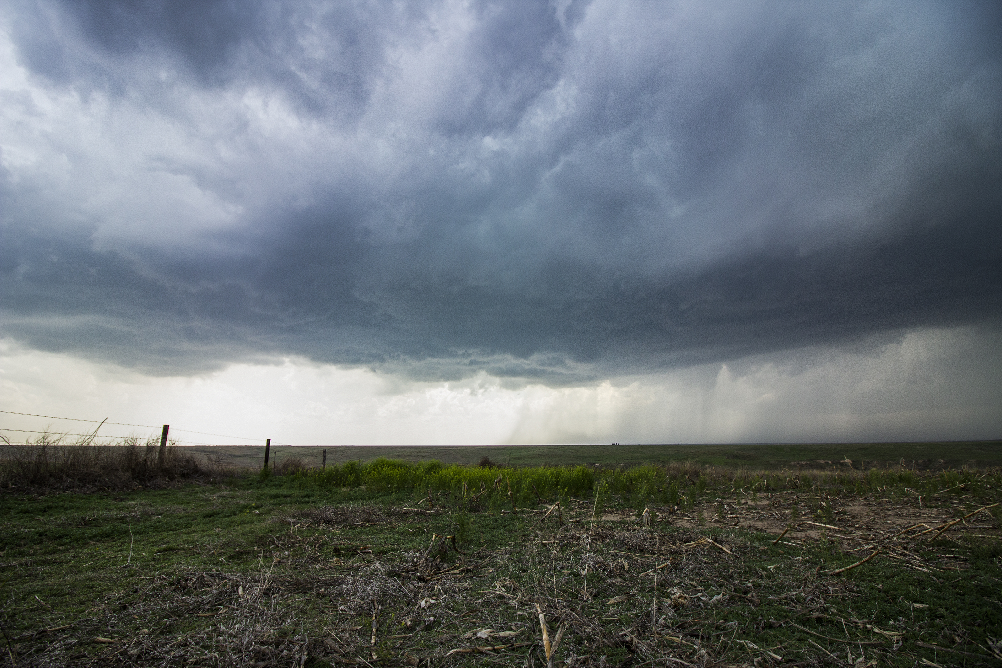
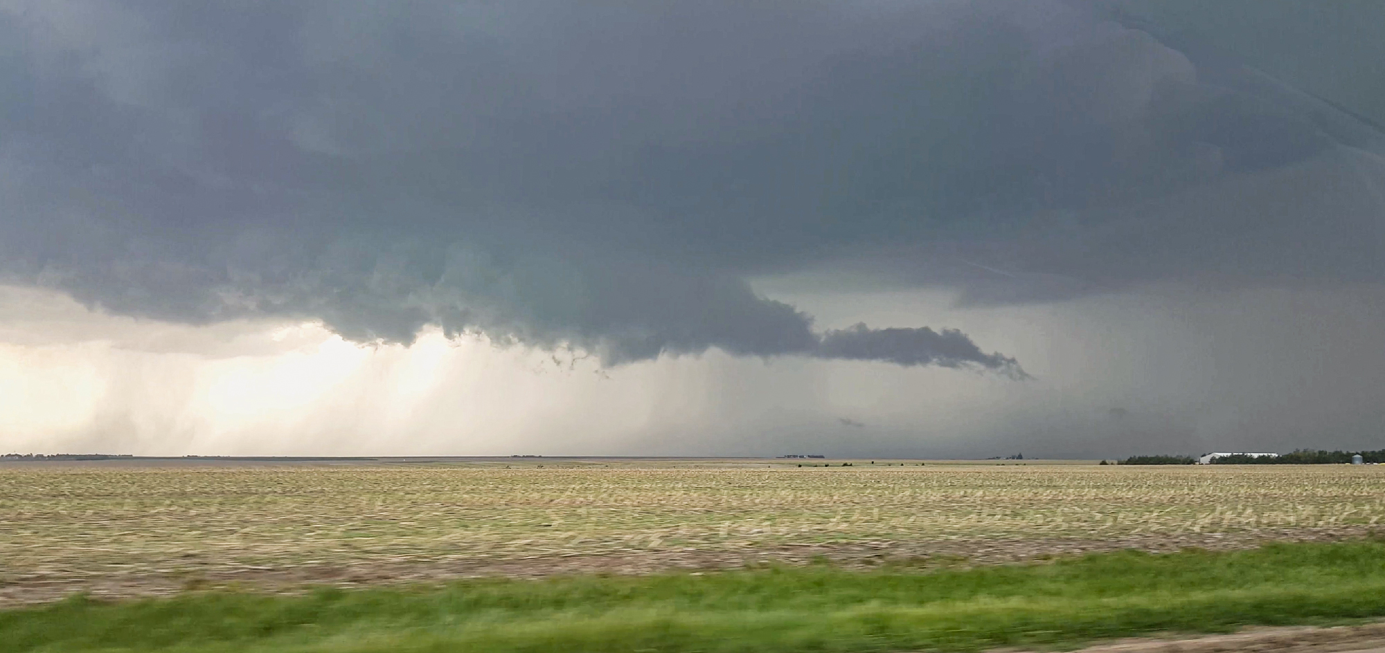
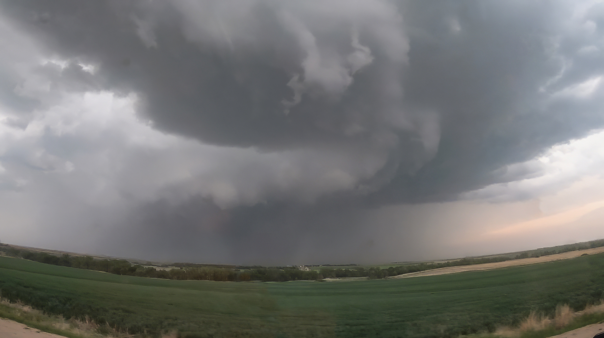
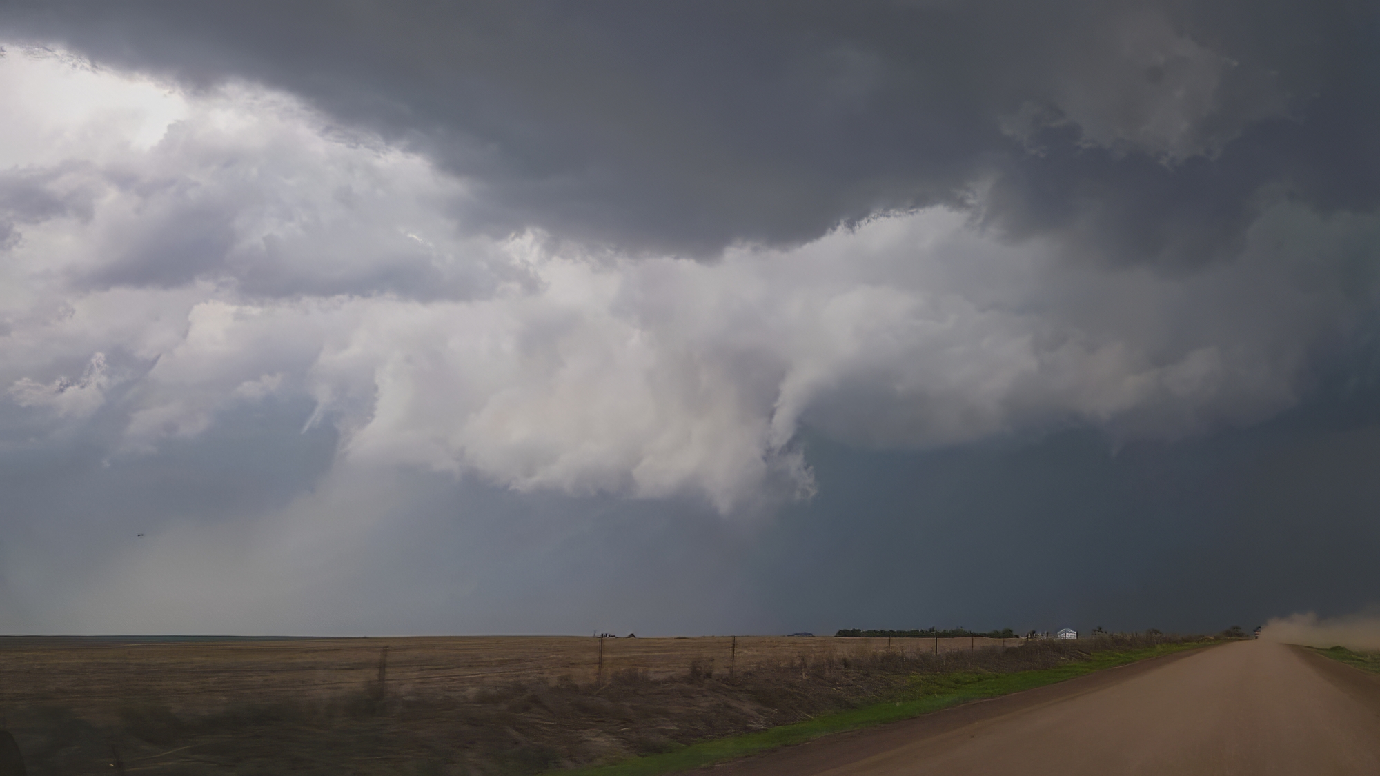
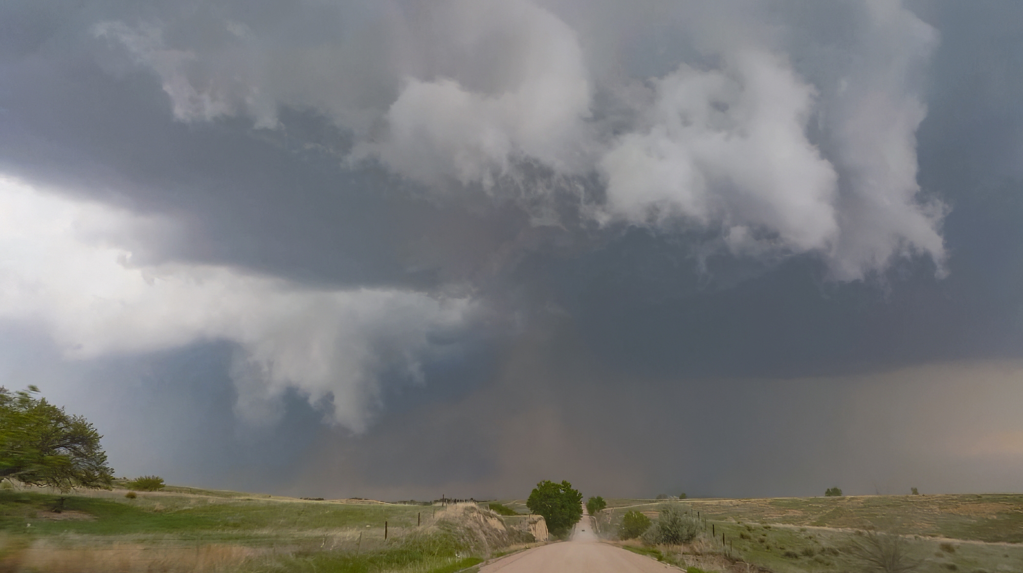
3:35 - 5:15 PM CDT: As often lamented on this blog, early storm appearance is rarely anything to write home about. But today actually held a pleasant surprise: pressing north out of Brewster, KS and getting our first look at the young severe storm, I was charmingly delighted to see a dark rain-free base and even a proto-vault in the forward flank. Stopping for the first storm lapse of the day, a couple curious horses crept up wondering what we found so interesting. And interest was indeed rising, as by 4:20 PM the first signs of a baby RFD began carving a small arc into the back of the base. Even some tentative rising scud indicated a first failed attempt at tornadogenesis. At this rate, surely we'd be seeing tornadoes within the hour, right?
Around 4:30, our aggressive chase strategy was threatening to undo our good fortunes. Typical for me, I waited until the last minute to halt our slider timelapse, and by that point the strengthening supercell was already crossing the dirt road to our north. Slowed by the mud and small hail, we risked falling behind early and being out of position for the remainder of the chase. But thank goodness for Hwy36, whose beautiful E/W pavement allowed a crisp hook slice into Atwood, KS to get downstream.
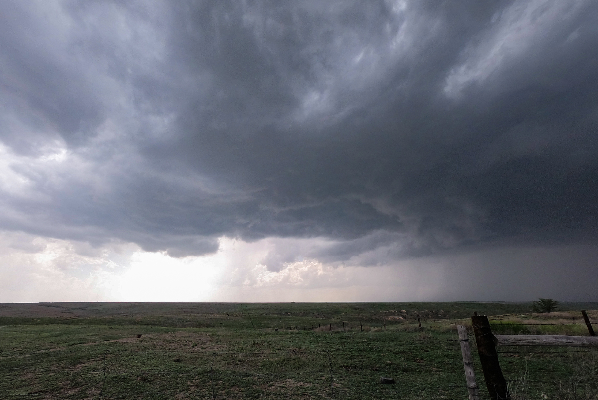
After having our early vantage point all to ourselves, it was jarring to suddenly enter the chaser hoard as we cruised north out of Atwood. All manner of decal-covered and hail-guarded vehicle watched to the west as our storm gathered a more ominous inflow tail and scuddy wallcloud. Despite the maturing structure, there was still more surging than wrapping motion, thus I felt safe getting a little further north well into the notch. We paused for only a couple minutes as ground-scraping scud closed on our position. But still no obvious focal point for rotation was apparent. By 510, the storm was once again crossing our highway. Time to venture out on the grid.
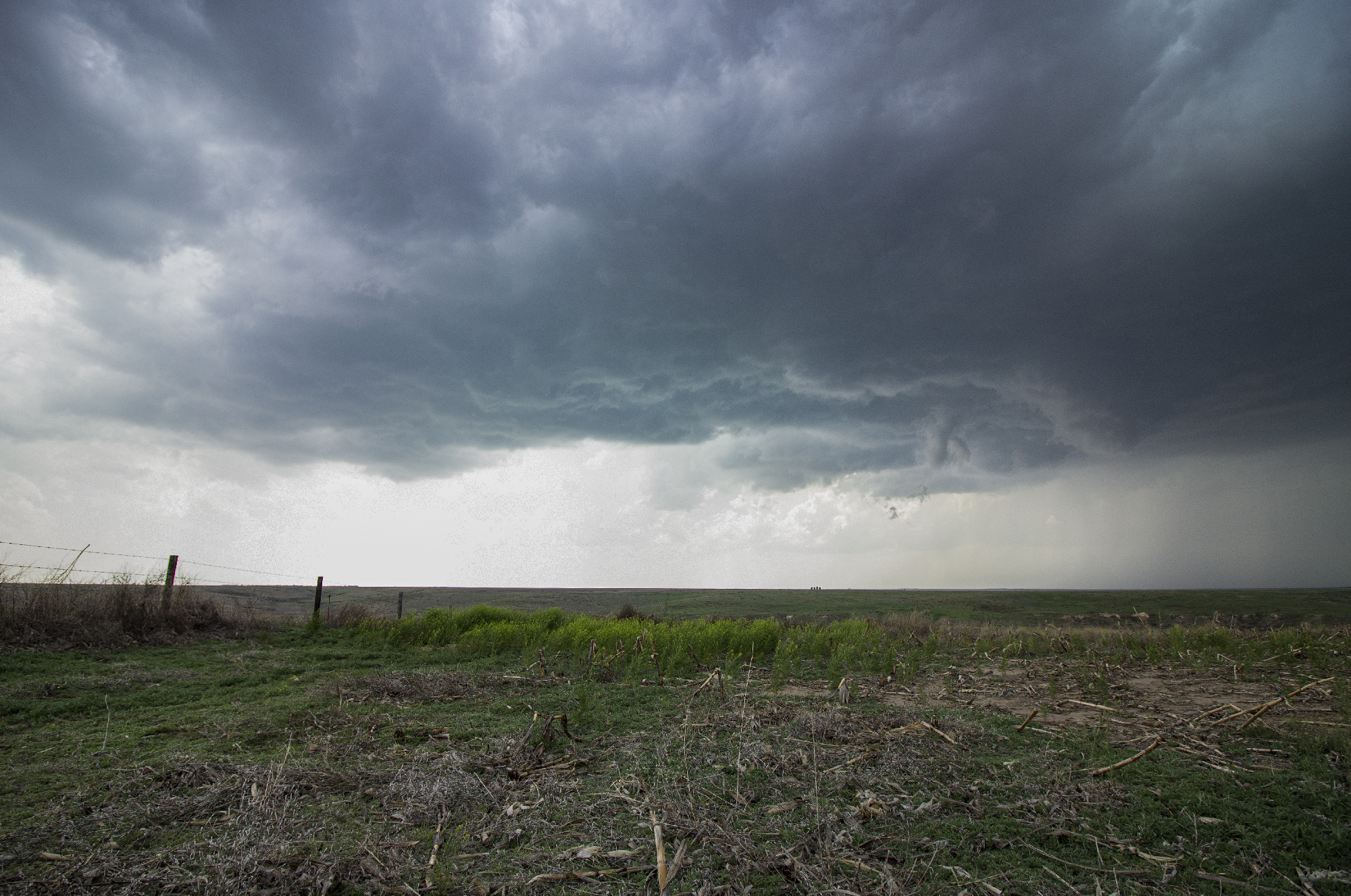
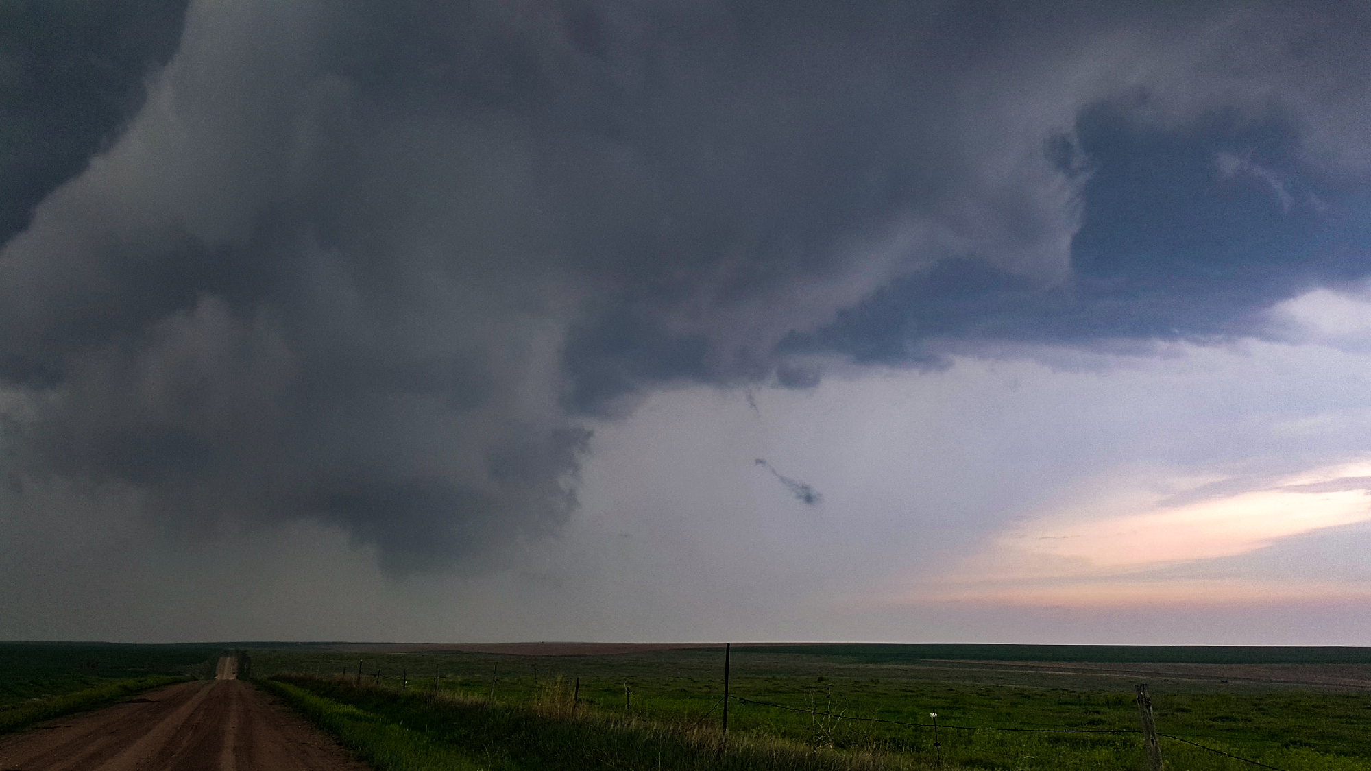
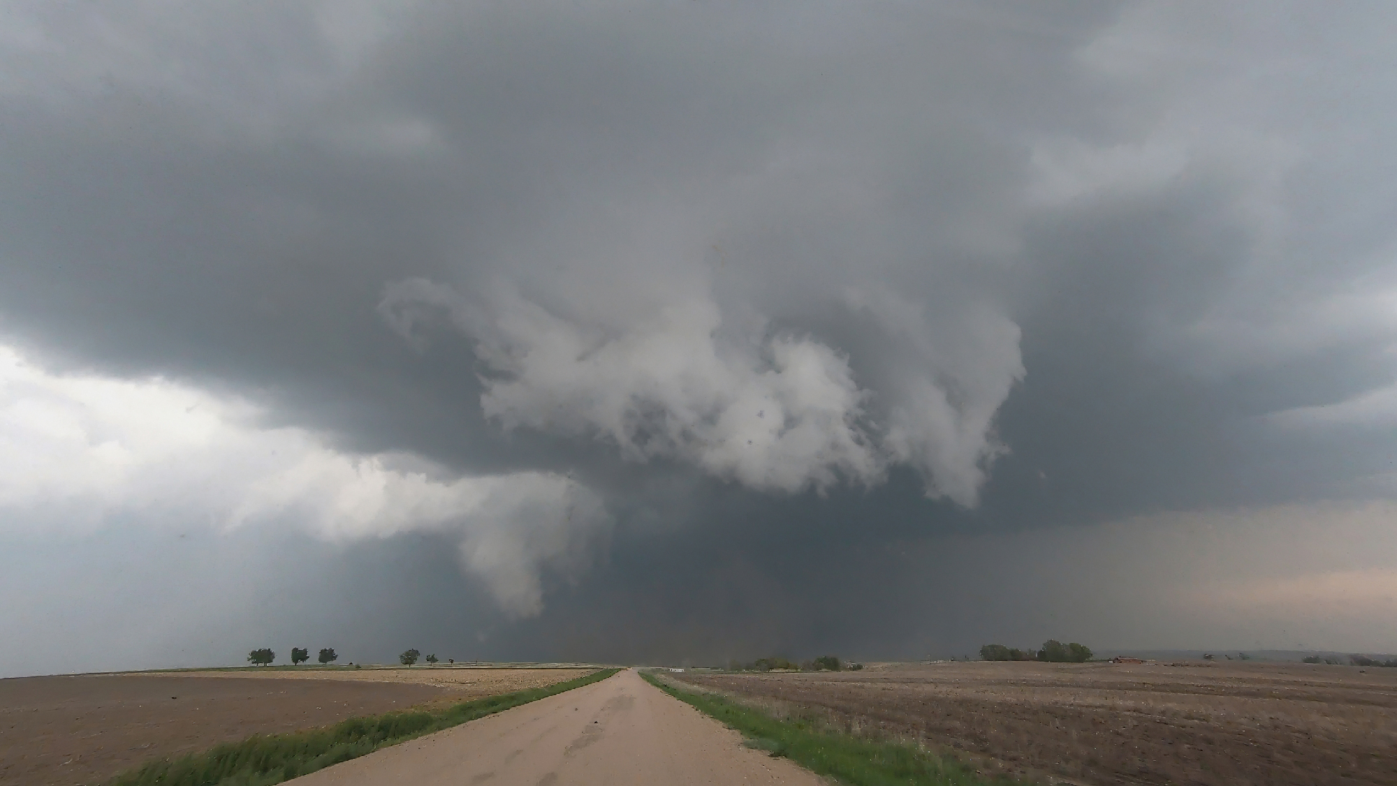
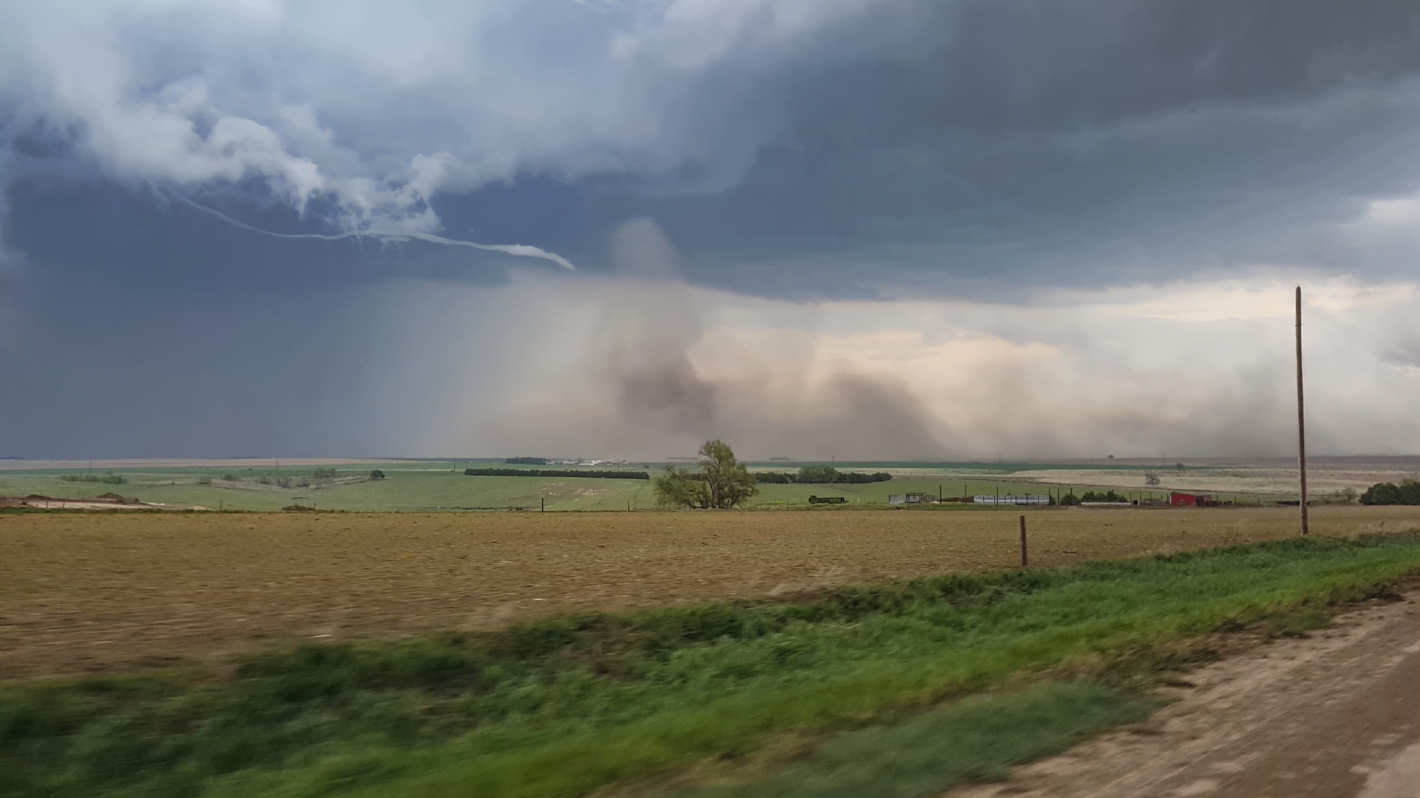
5:15 - 6:08 PM CDT: Almost the instant our wheels hit dirt, the all too familiar squeal of a tornado warning bellowed simultaneously from our phones -- and we were directly beneath the meso. Fortunately, roads were solid and the RFD was not too wet as we zig-zagged north and east in pursuit -- just barely keeping pace with the storm. By 5:25, a more concentrated lowering developed, and as we zigged north a number of tight, small funnels caroselled around the broader wallcloud right out our windshield. The scale was absolutely mesmerizing.
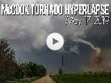
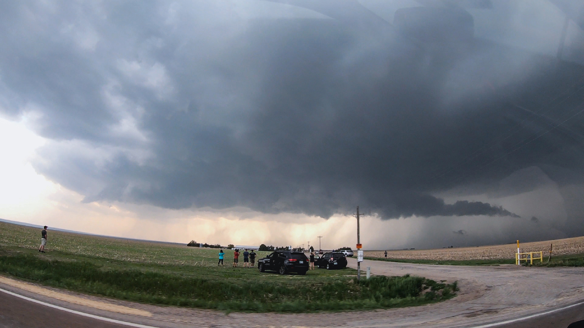
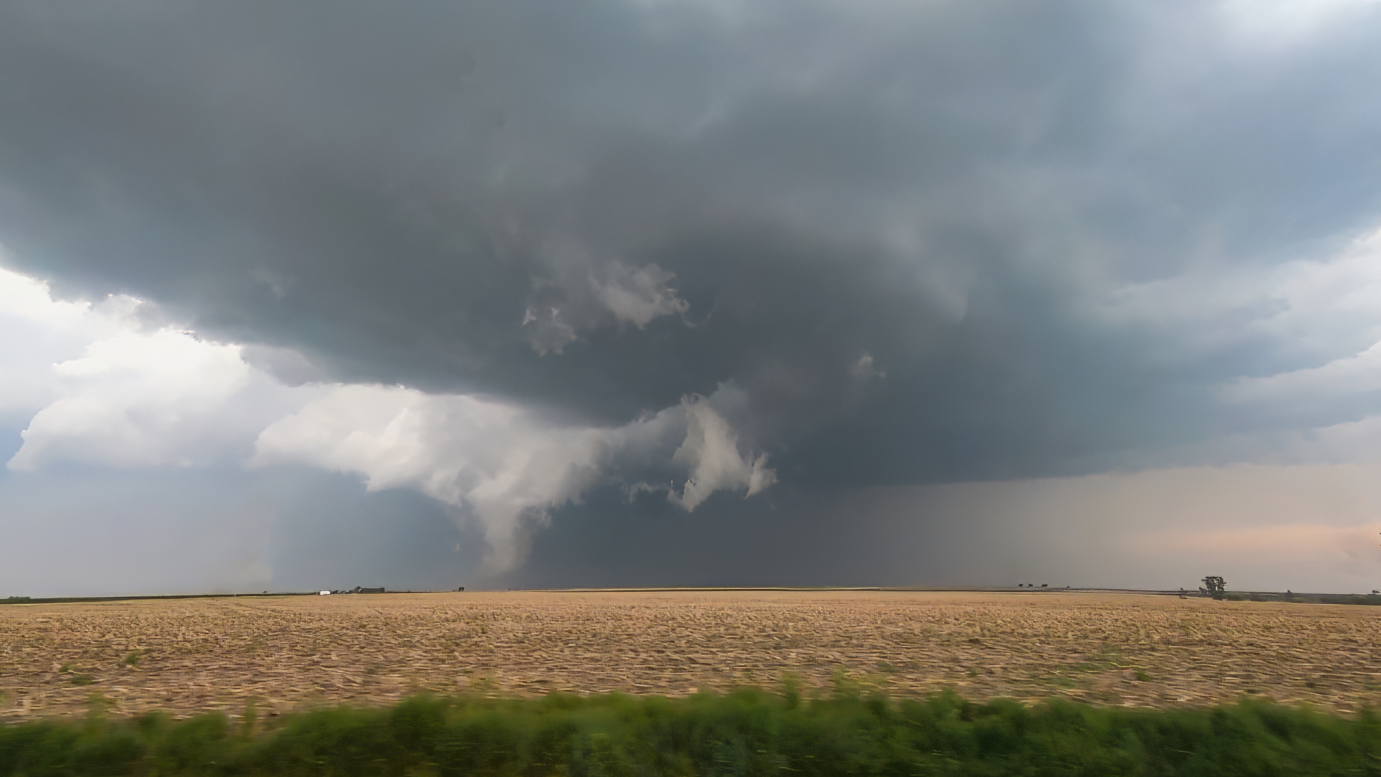
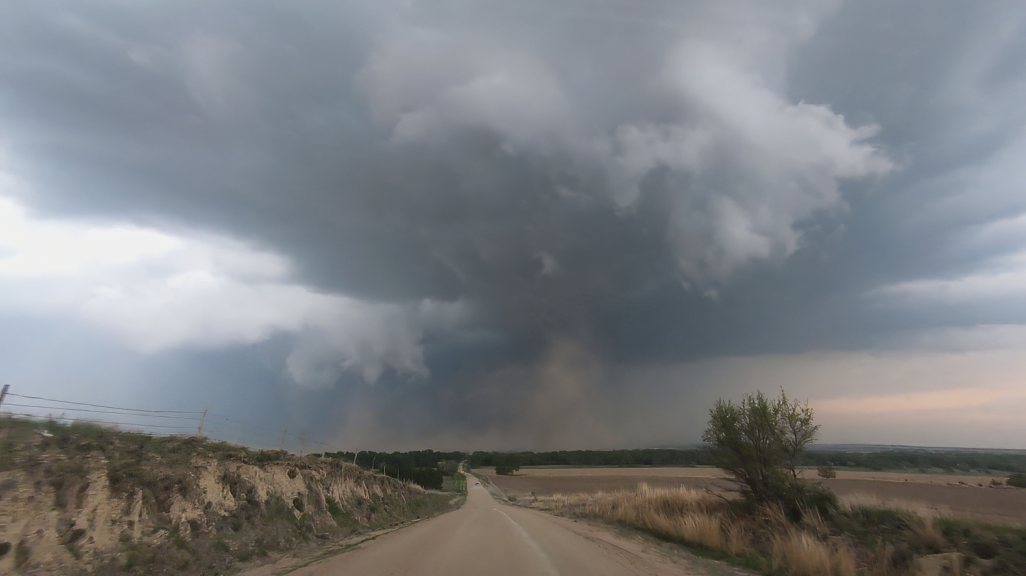
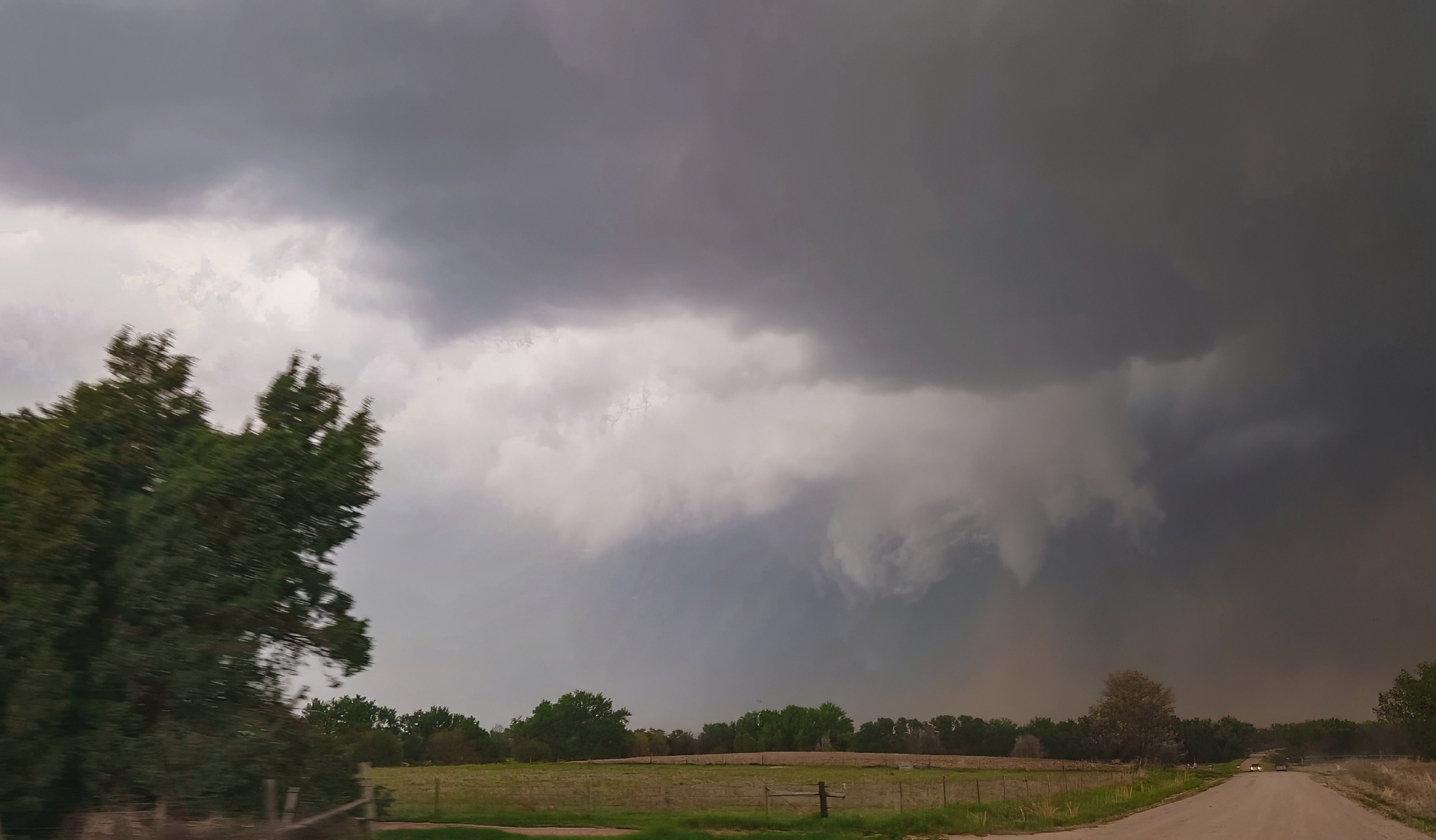
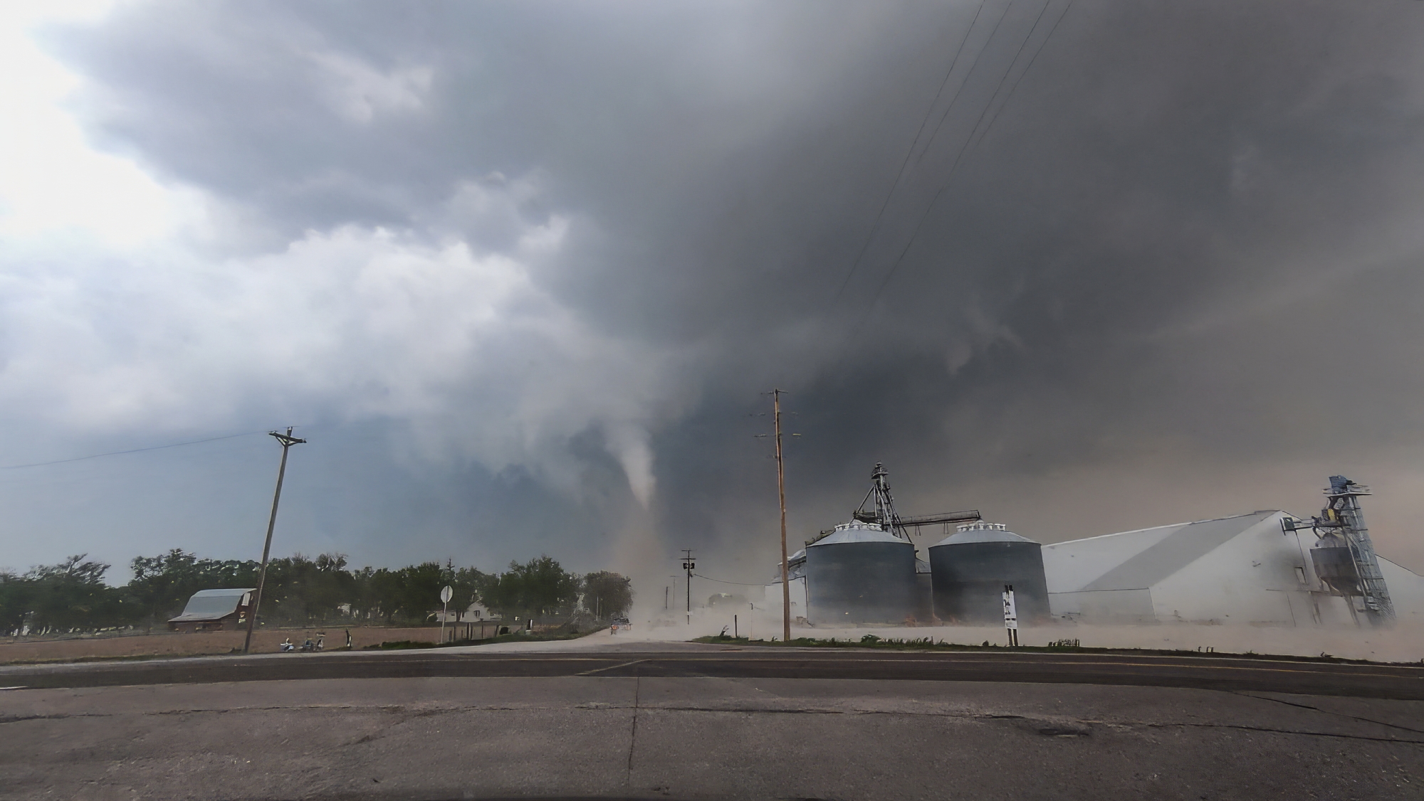
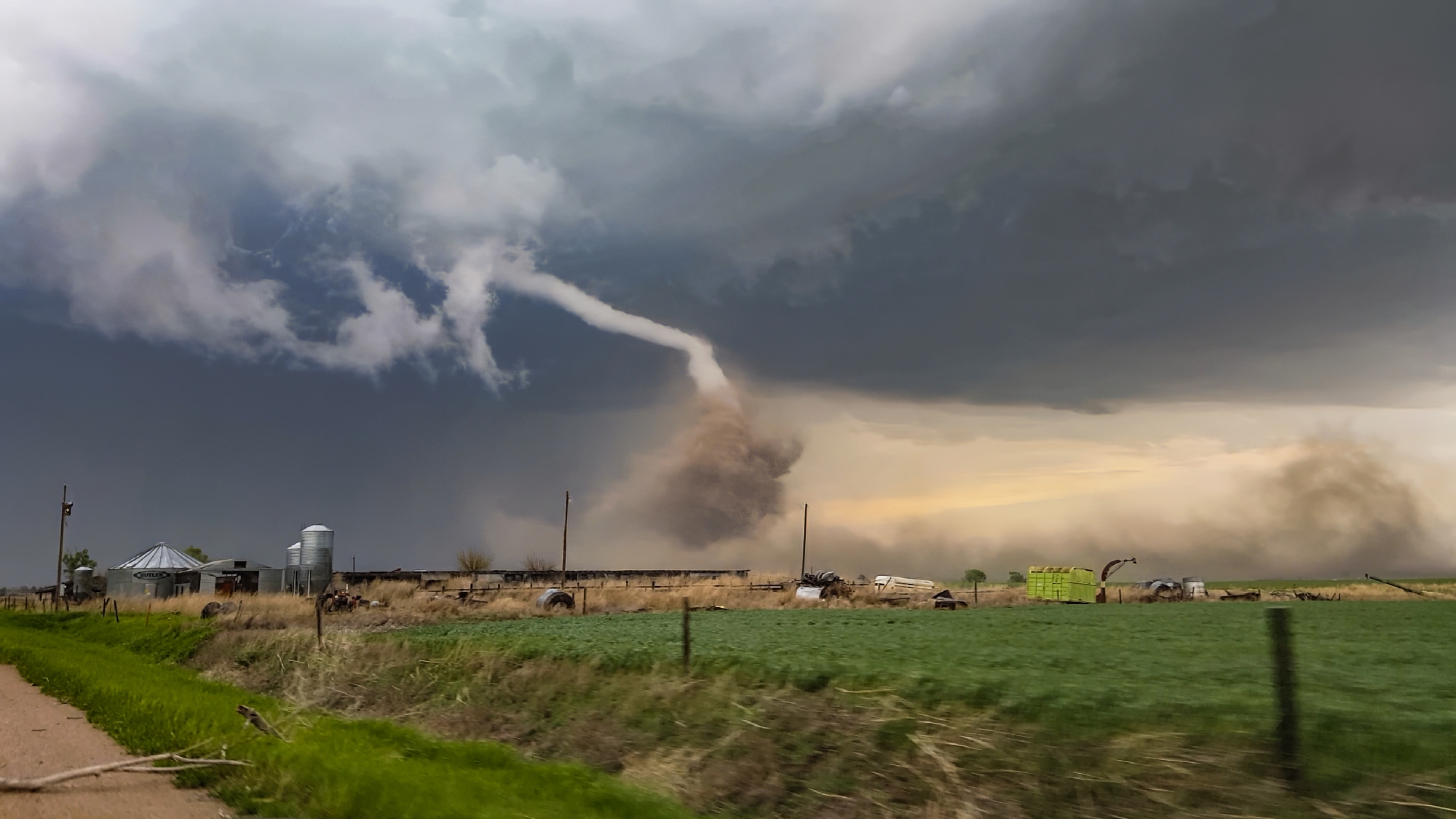
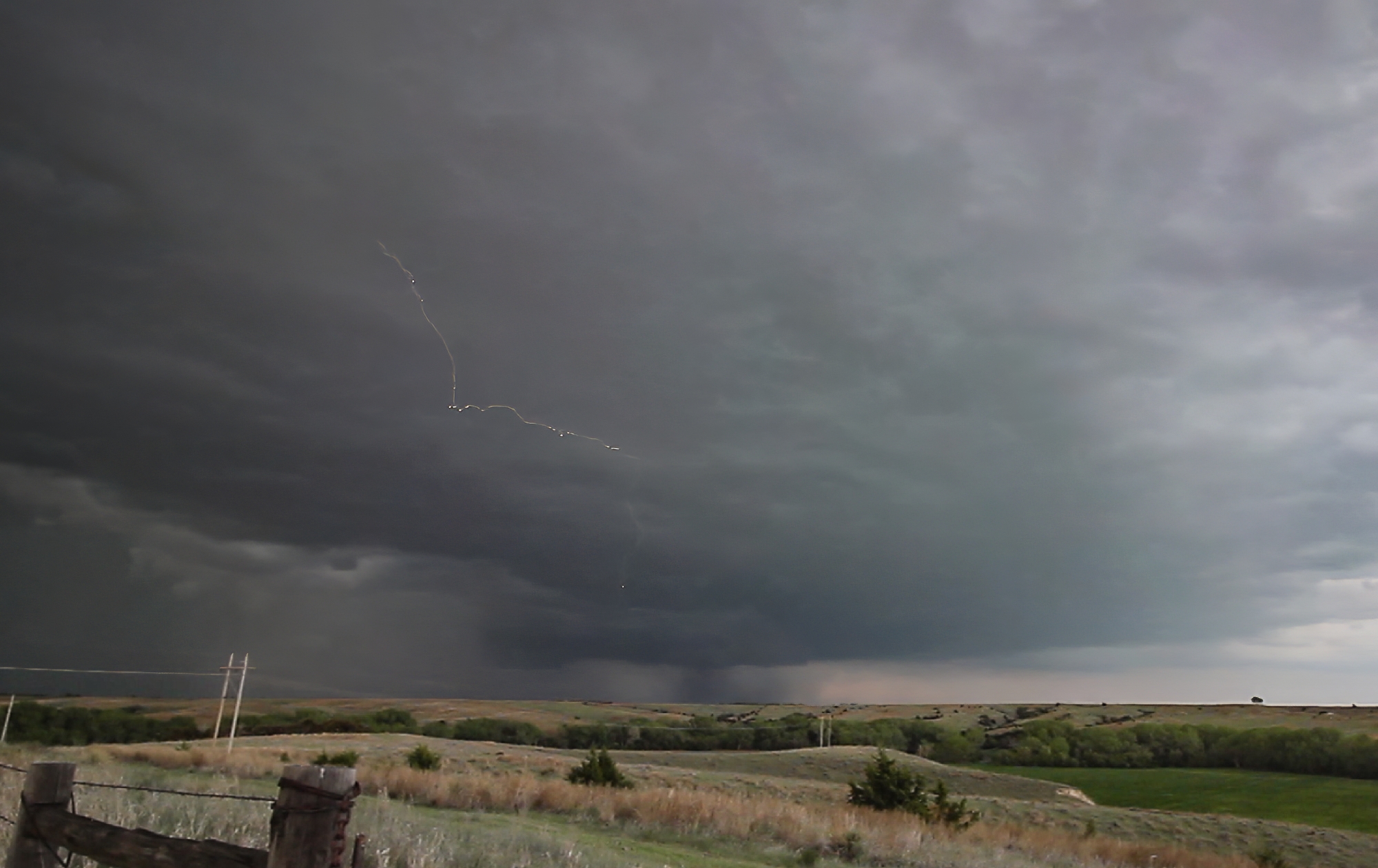
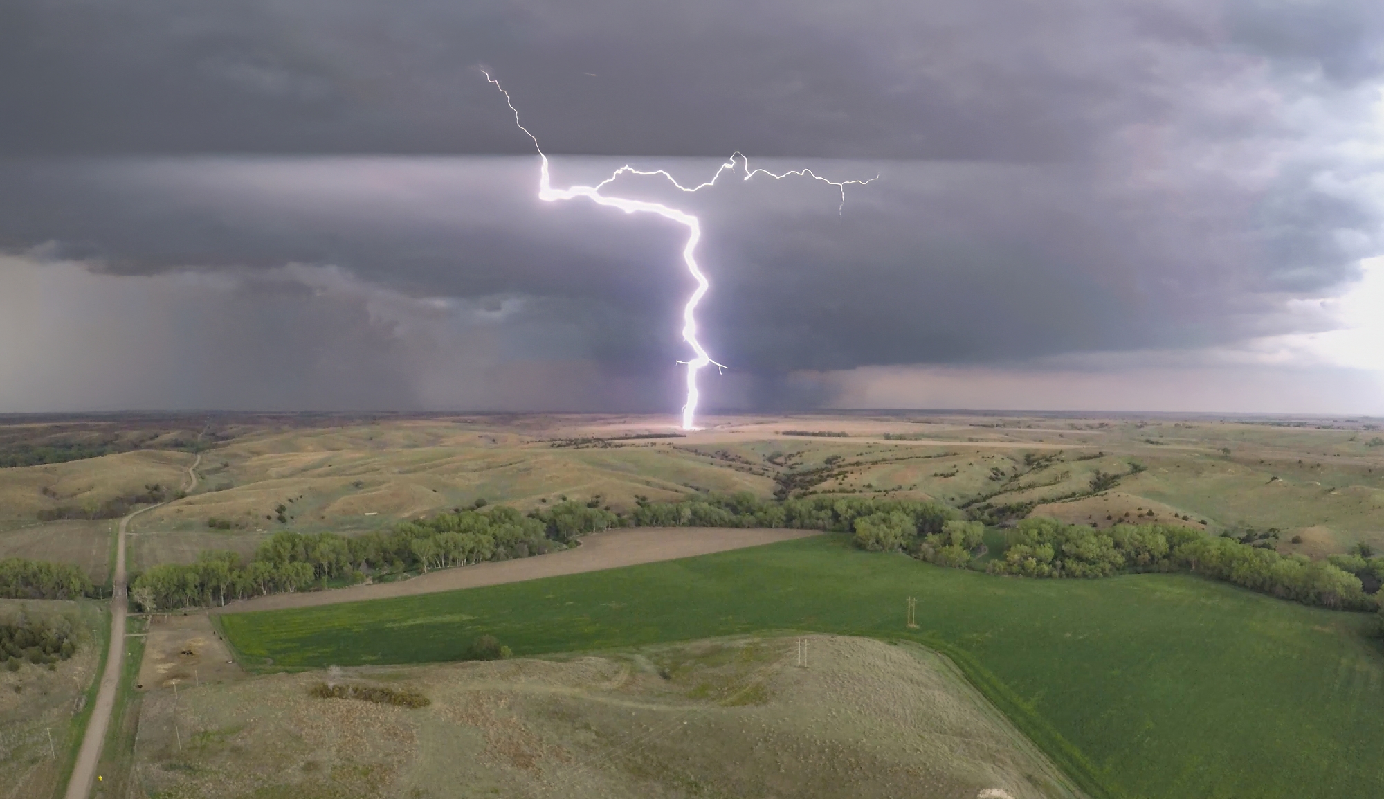
The baby funnels only fueled our appetite for something bigger, but the current cycle soon fell apart as we started losing the battle to out-flank with the storm. Yet once again, a clutch Hwy17 (not an intentional Half Life 2 reference I swear) helped us play catchup. By 5:45, we were trailing just a couple miles behind the storm as a vigorous new RFD cut began to arc into the base. This new surge formed a massive horseshoe with a huge cloud of dust fanning out underneath. Transient lowerings looked suspicious, but the show had not quite started yet. At precisely 5:56 we took a final jog north on Rd380. In a blur, we passed a weather balloon sounding launch as we pushed under the RFD arc. Then, just as we topped the final hill south of the Republican River, a sweeping view north into the jaws of the meso, there she was. A dust column under a small laminar cone standing out amongst the more ragged RFD scud tags. WE HAD TORNADOGENESIS.
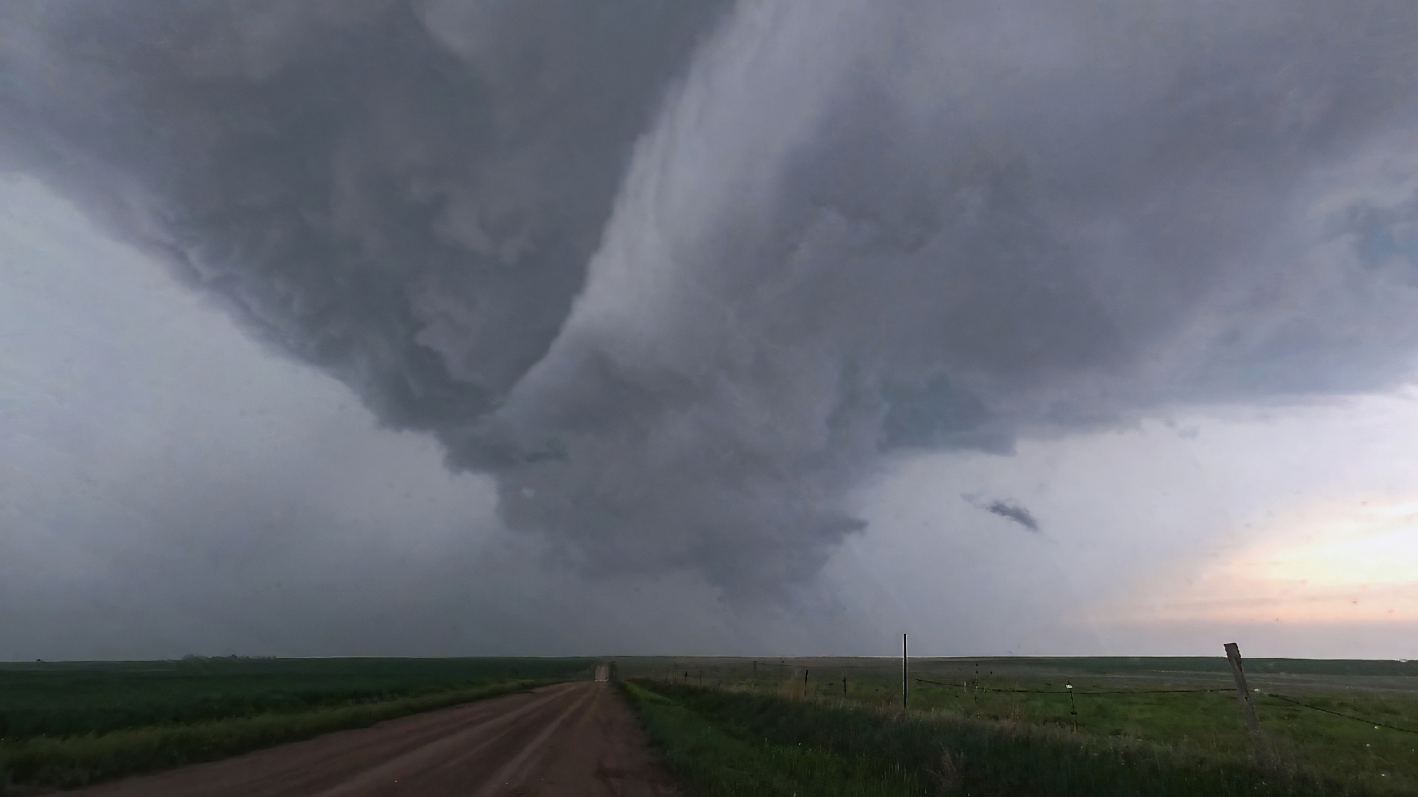
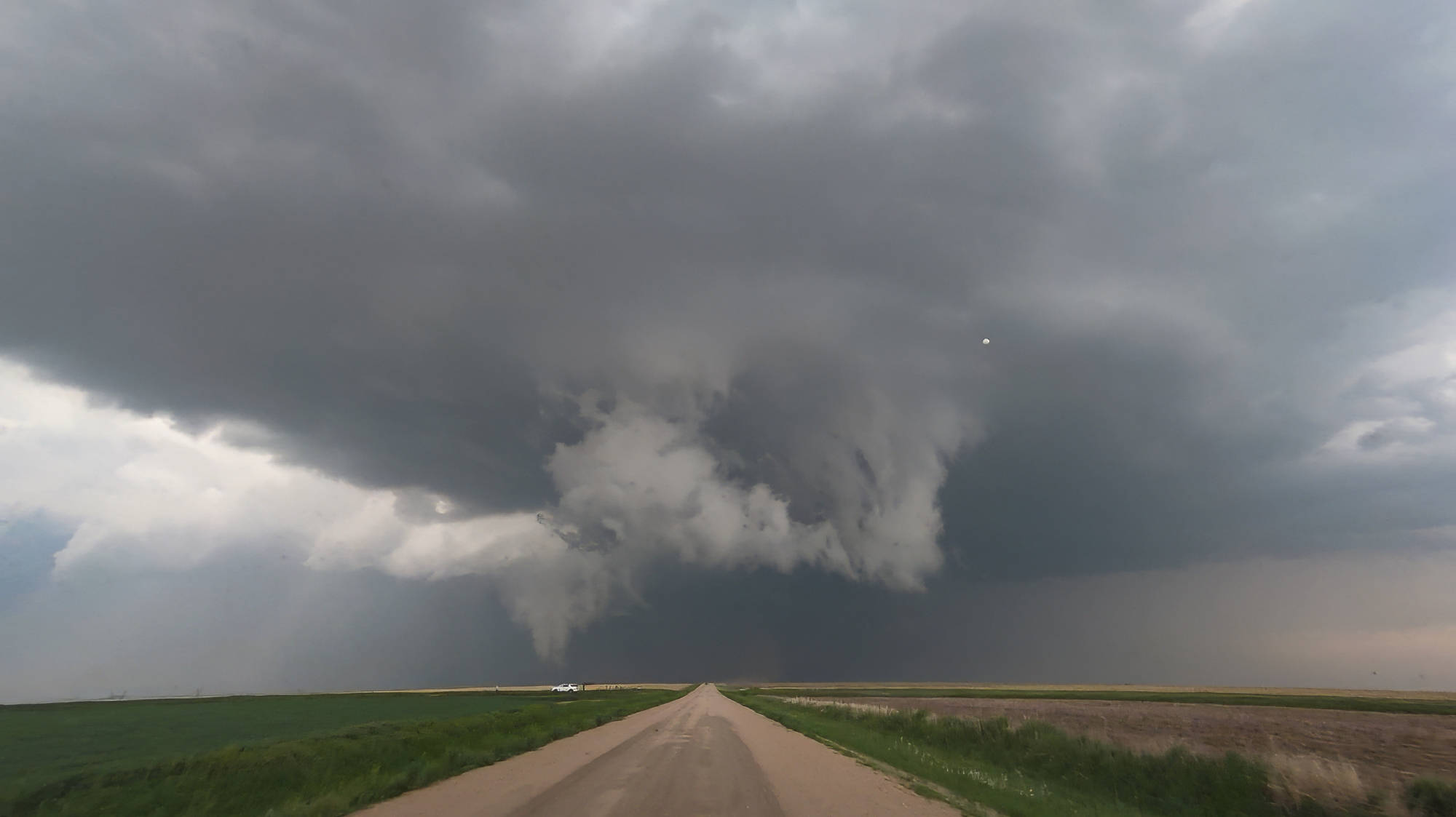
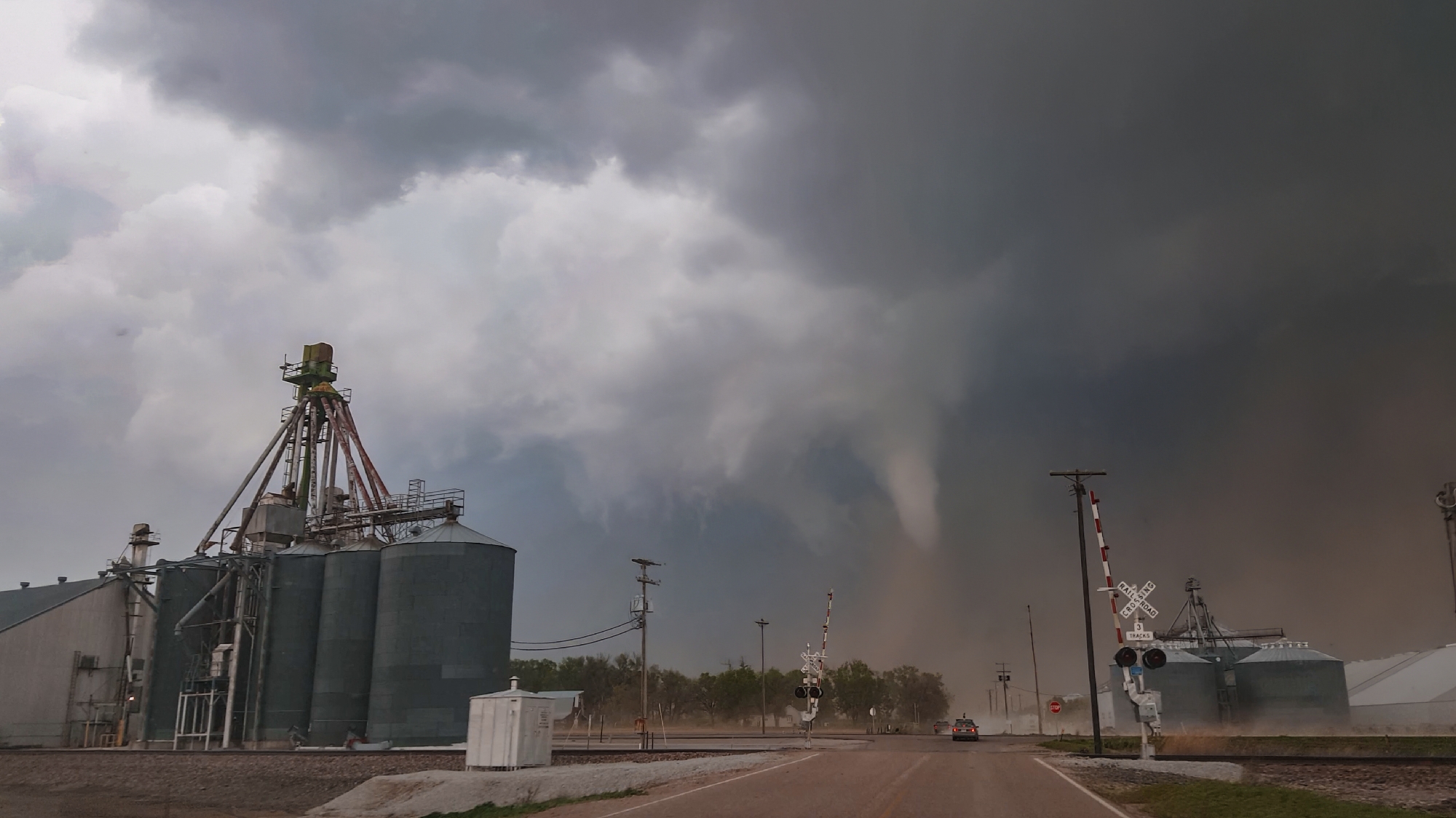
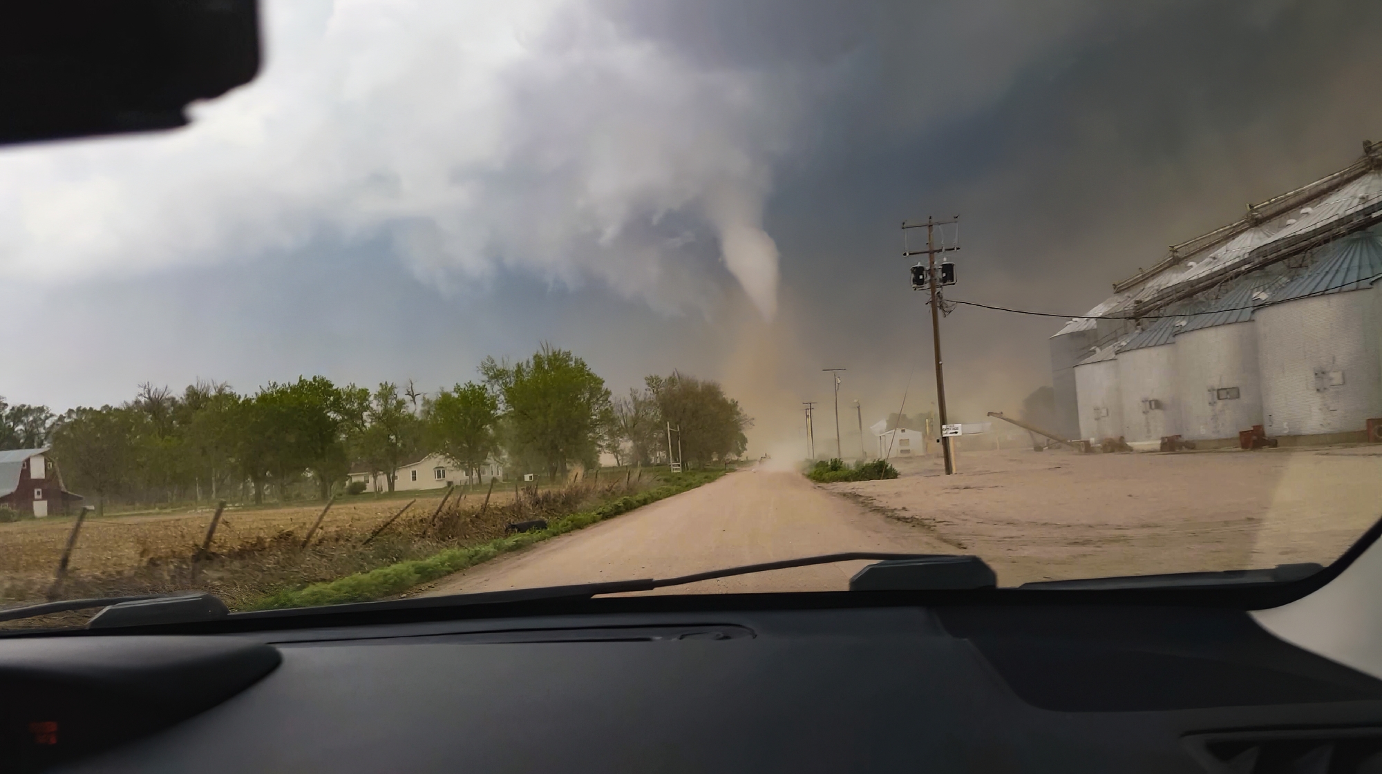
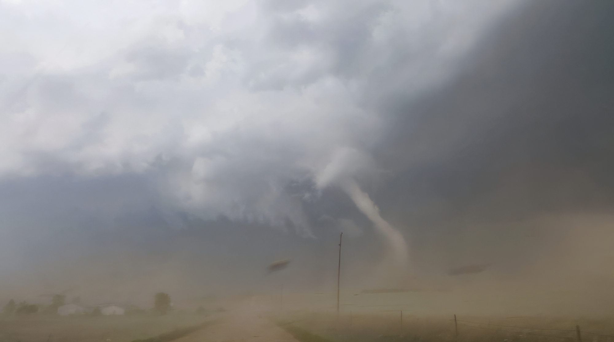
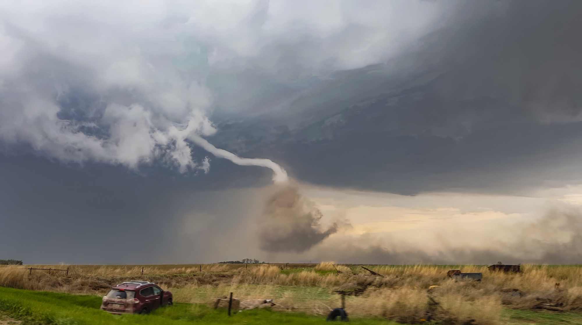
Now the task was to get as close as safely possible. At the Rd380 / US34 intersection, we bounced across the roughest railroad crossing ever. "Did we break our car??" Toni asked. But no, the pursuit was still on. RFD broadsided the Crosstrek we continued north, the elongating cone dead ahead. In all the blowing dust, scale became tricky to judge. Was the tornado only 100 yards ahead or was it still a mile up the road?? Finally, we simultaneously climbed a small hill and broke into a slightly calmer zone closer to the tornado, and it was at that moment Toni captured the picture of the day -- the fully-condensed, kinked rope with a dramatic, churning dust cloud at its base. It's one of the top views we've ever had, and in that instant, I might have shed a single tear (but it was probably from all the dust we'd just driven through).
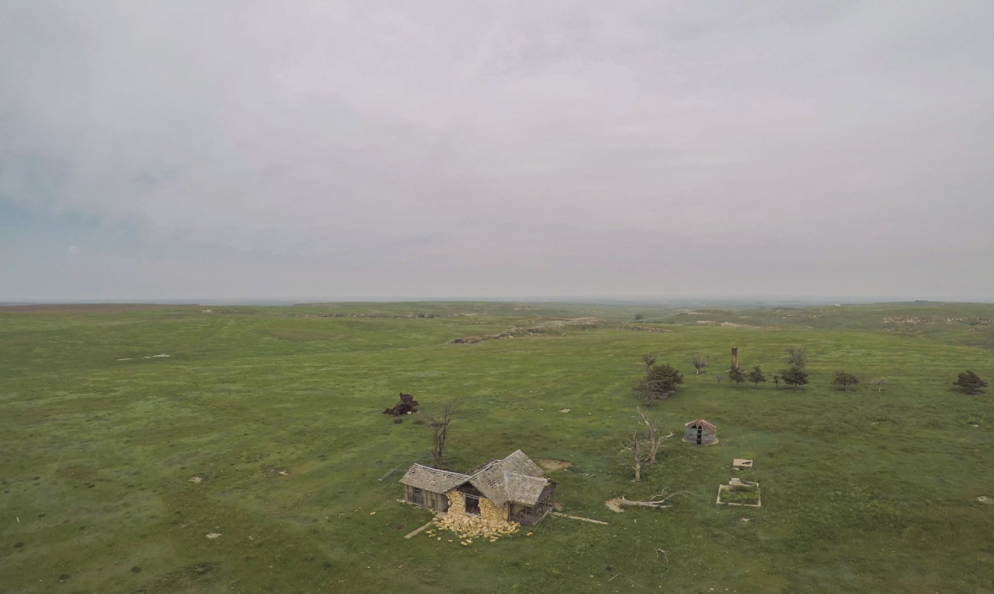
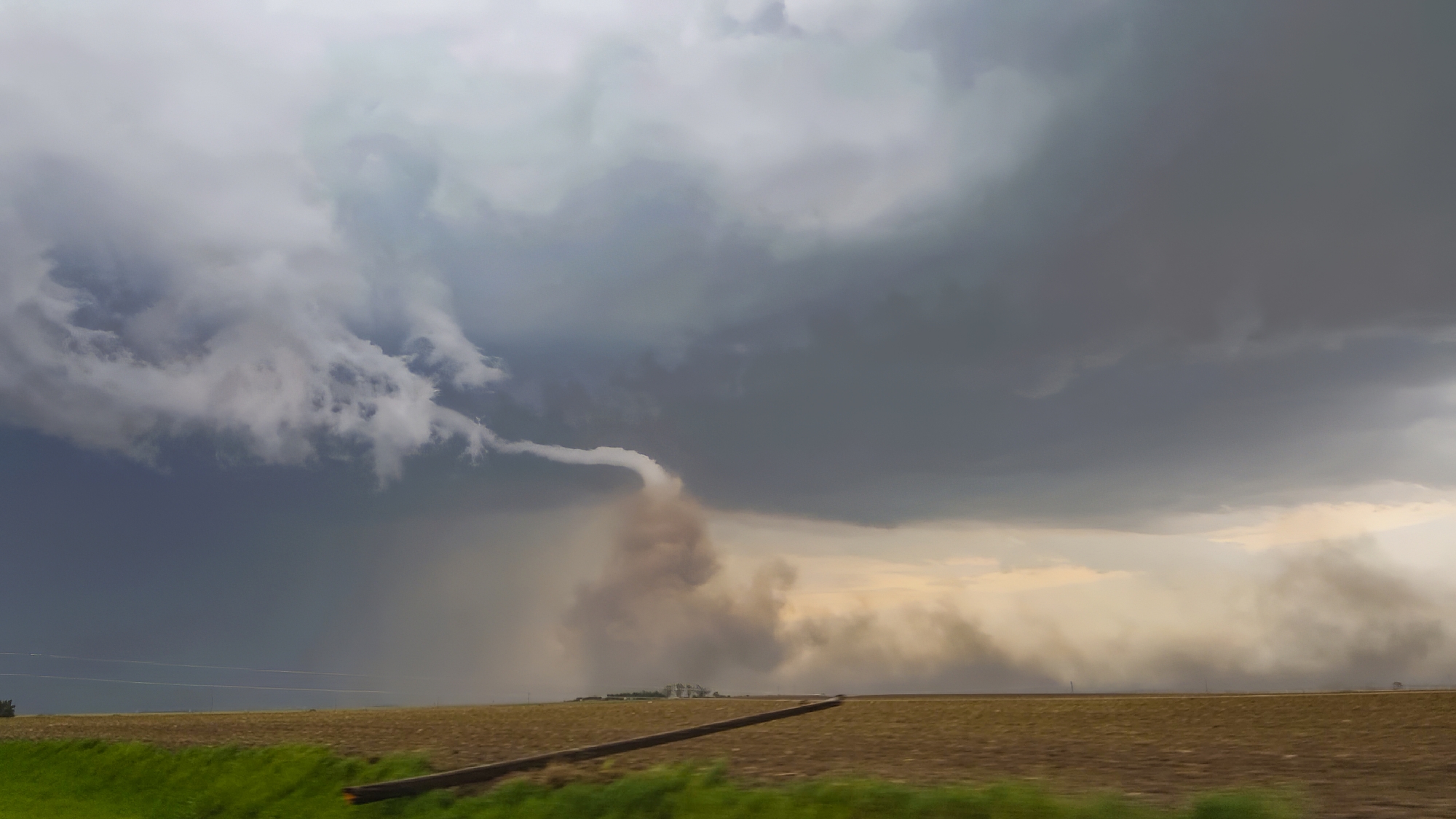
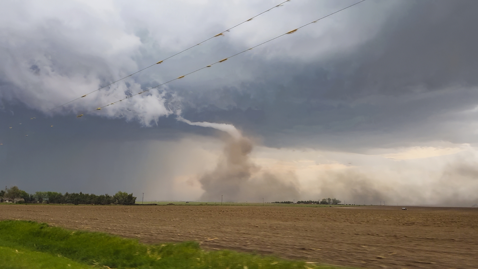
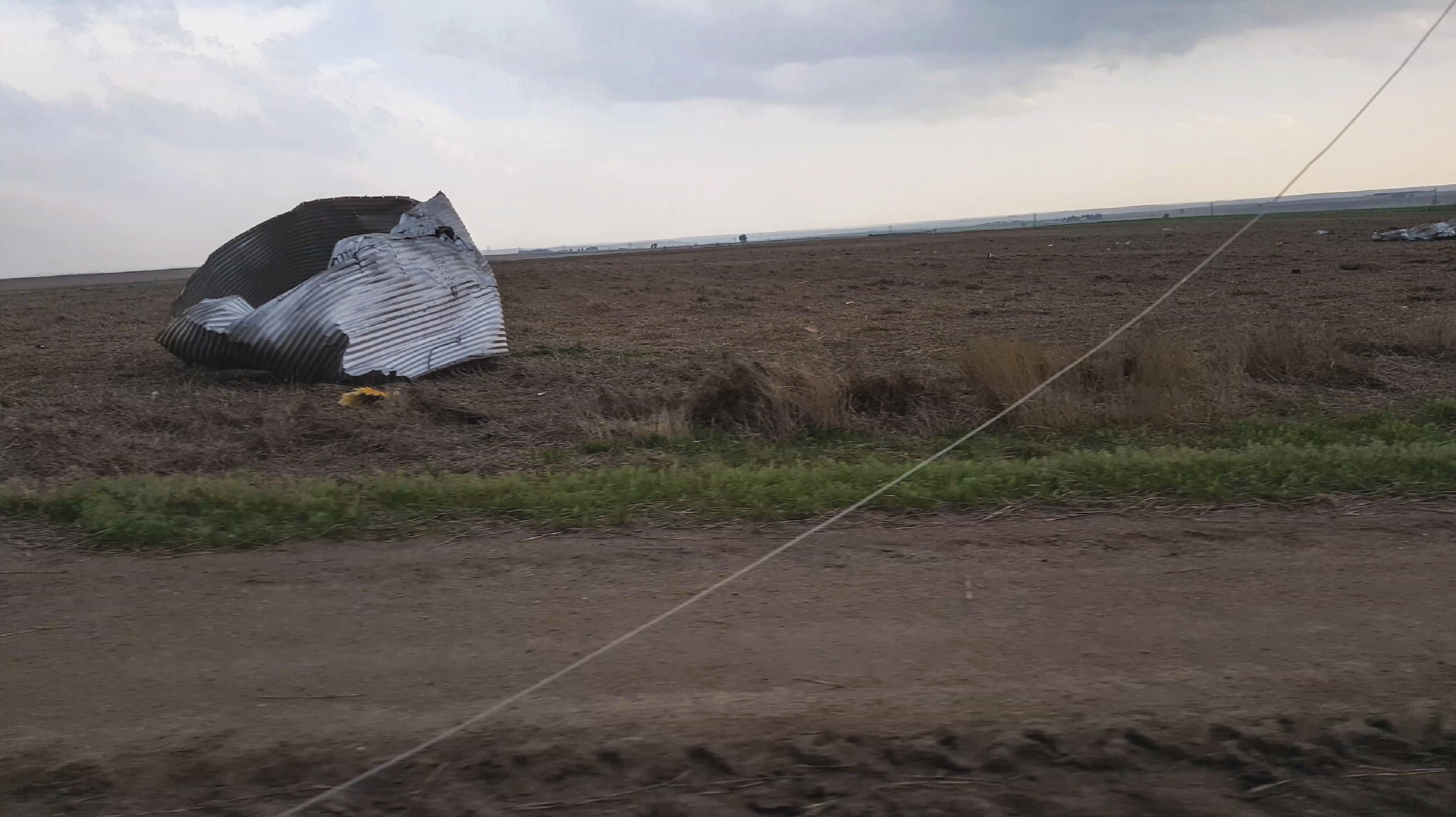
The rope continued to stretch and elongate as the parent storm outpaced the ground circulation. We passed through the damage path twice in pursuit. Fortunately, only some power poles and sheet metal were the only damage visible (we did completely miss a house tucked behind some trees that ended up taking significant damage, but the residents were ok). By 6:08 the tornado had fully roped, having traveled 6 miles over its 10-minute life (later receiving an EF2 rating for the house damage). Thanks to our early, aggressive strategy, we spent the entire duration in chase -- not a single frame shot from a static location. Nevertheless, it felt amazing to be on the board for the year, especially with one of the most dynamic and beautiful tors we've ever caught.
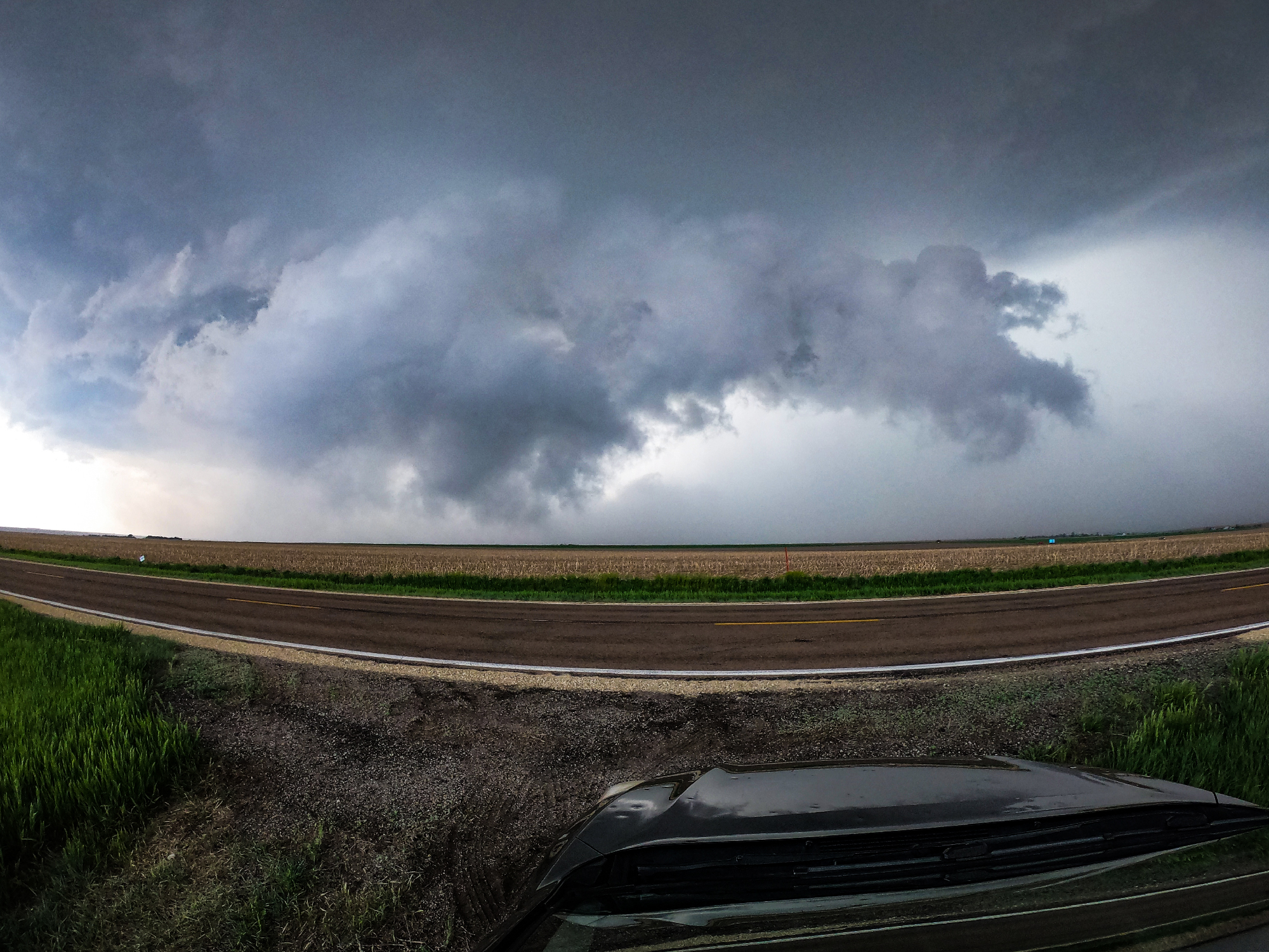
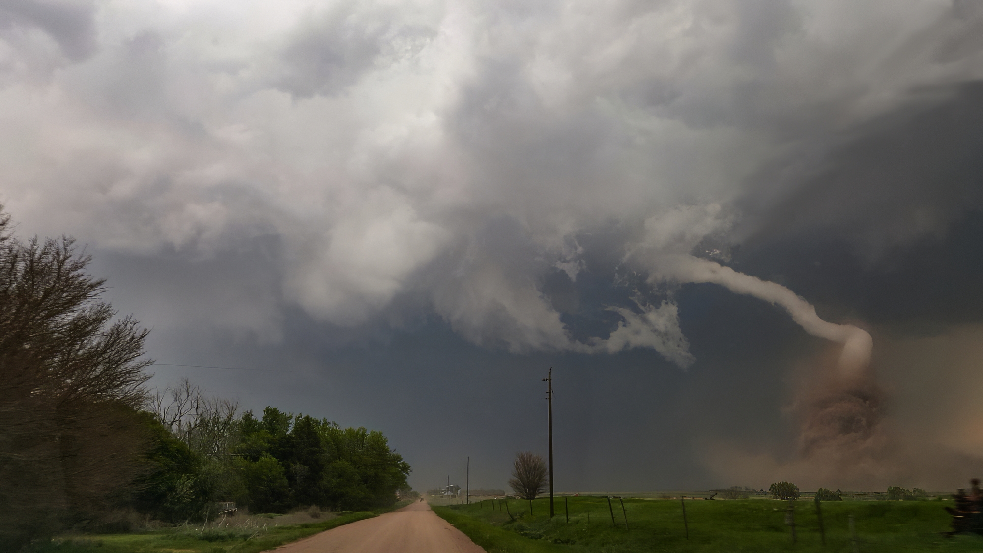
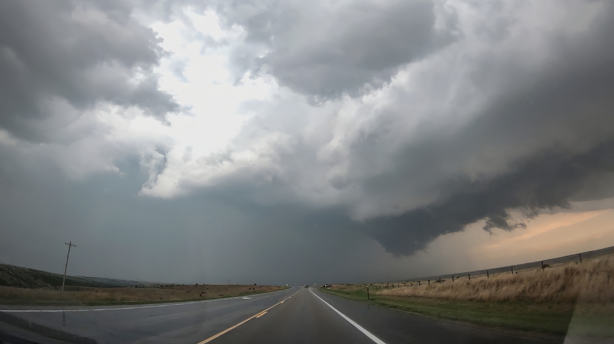
6:08 - 7:10 PM CDT: The supercell began a new cycle almost immediately, and at 6:15 we noted a new lowering to our northeast from our vantage on Hwy83. Likely if we'd hung back, we might have seen the brief tornado on this cycle, but I closed in too tight and we lost visibility in the RFD precip and hills. From there it was another 20-mile grid hop northeast as we again played keep-up with the storm. Even though we were approaching the 7-o-clock magic hour (classic for the ramping low level jet that enhances hodographs and maximizes tornado chances), our storm took on an elevated, featureless base with little promise of an imminent tor.
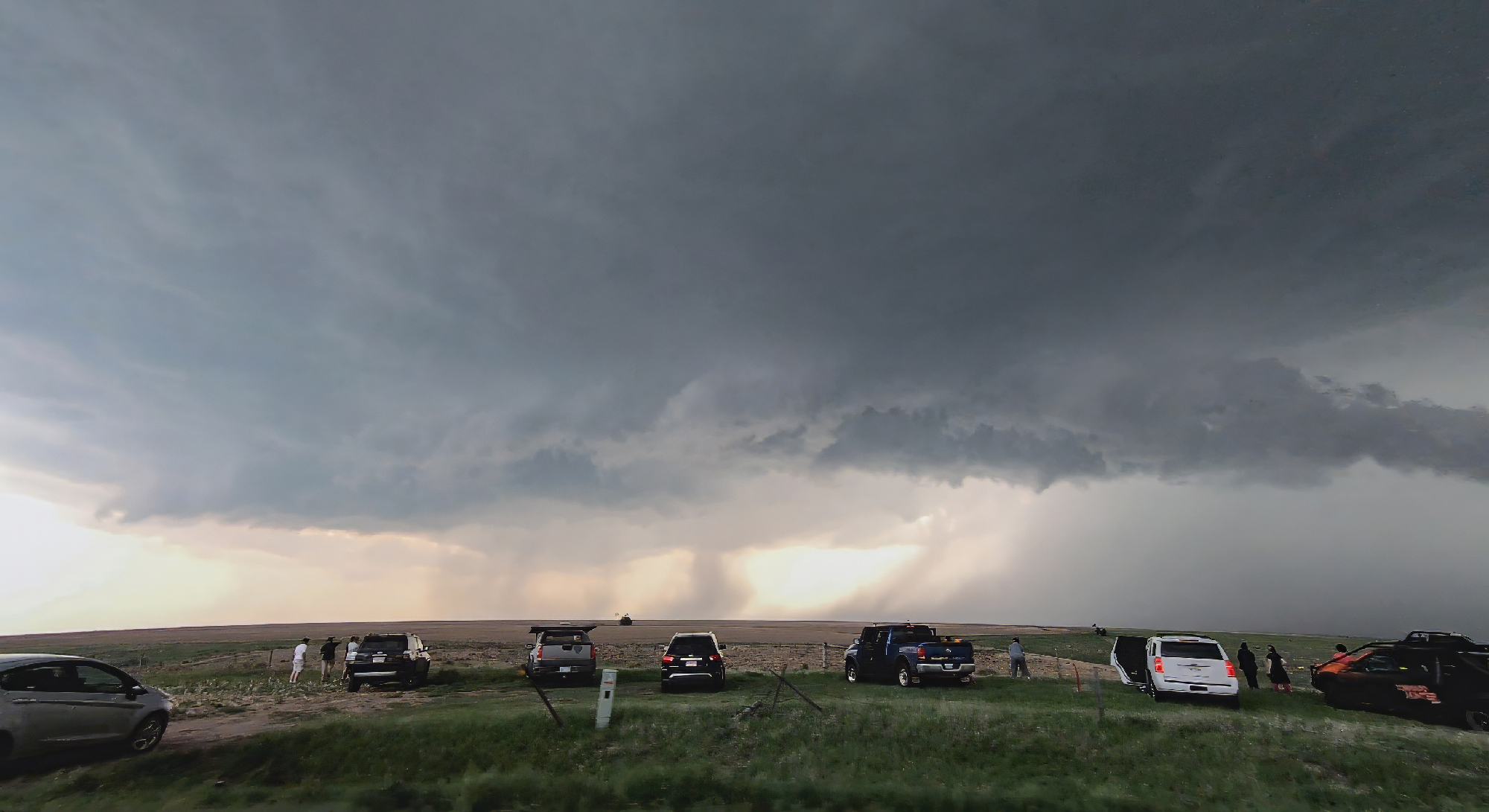
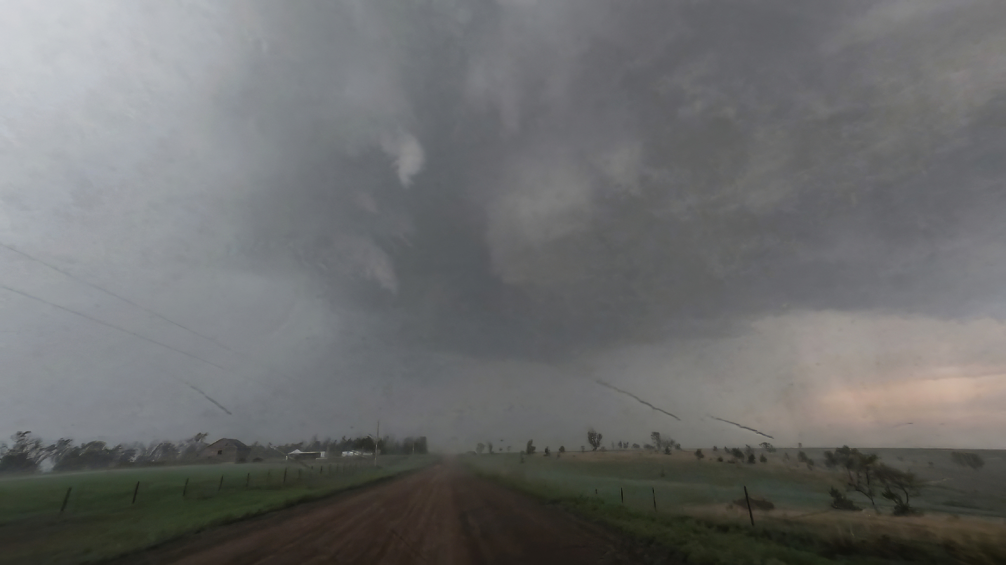
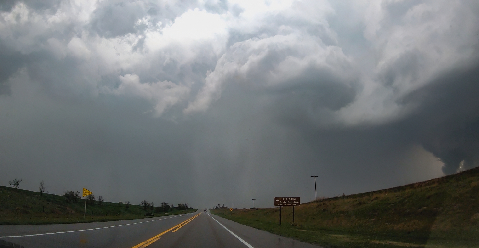
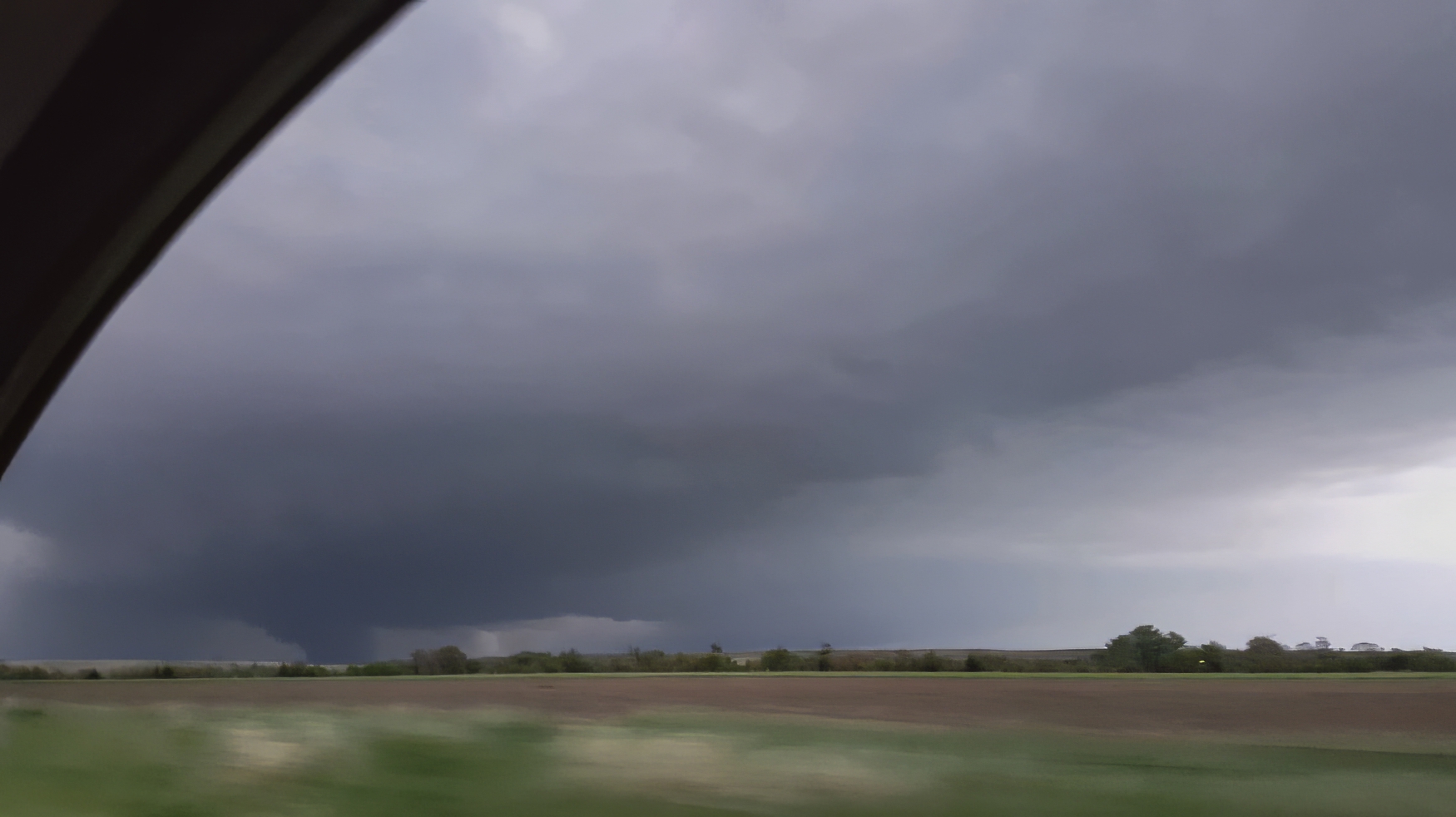
Pulling into Stockville at 6:47, our arrival was greeted by the song of our people -- a blaring tornado siren. Enjoying the ambiance for a few minutes and assessing radar, we soon ventured north of town on some very sketchy roads. I could feel the Crosstrek just begging to slide off either side of the sloping mud road. After only a mile, I chickened out; we slowly reversed course retreating from the punishing hook precip. Then suddenly, I glanced east and noticed a tornado already on the ground -- a wispy funnel with tight rising dust. I never even got a photo of this spinup before it was gone. We slowly negotiated the incredibly slick roads back towards Stockville when, after rising another hill, low and behold ANOTHER tornado was already on the ground!
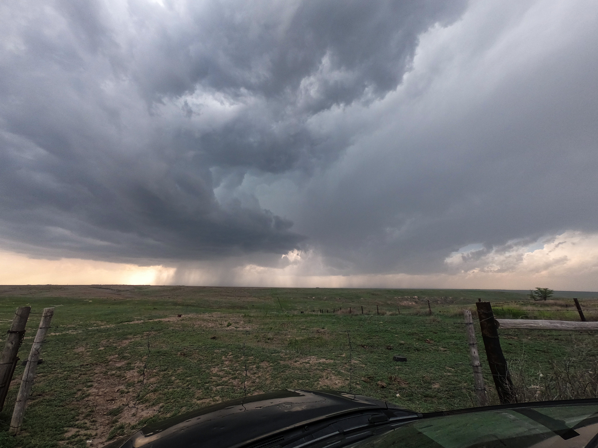
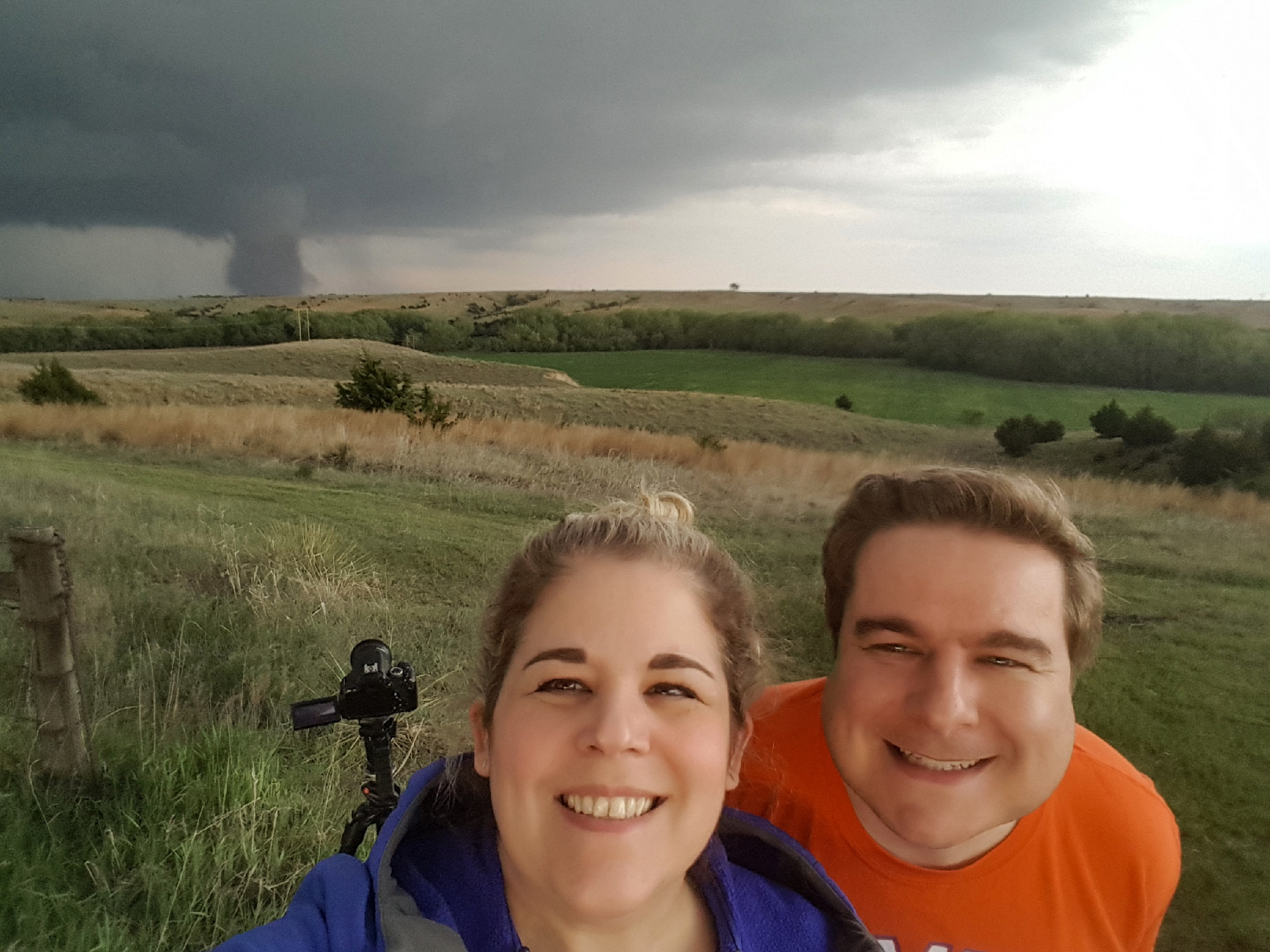
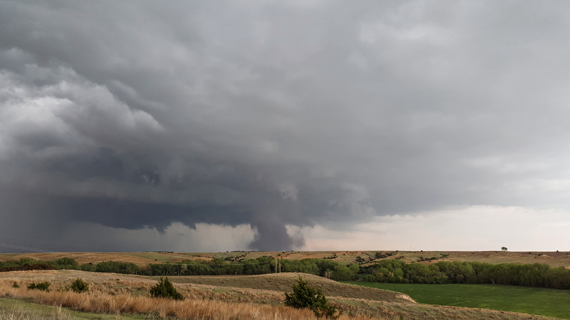
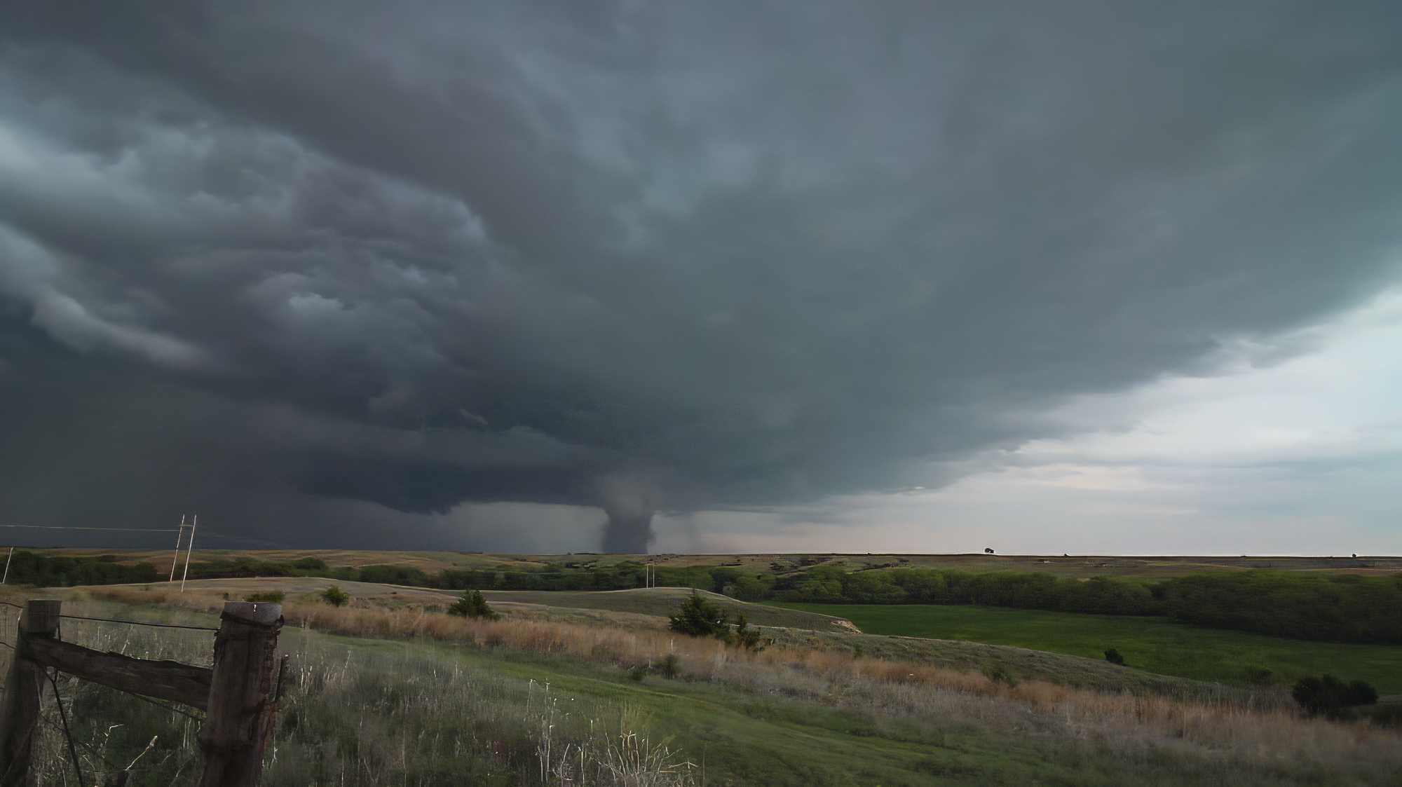
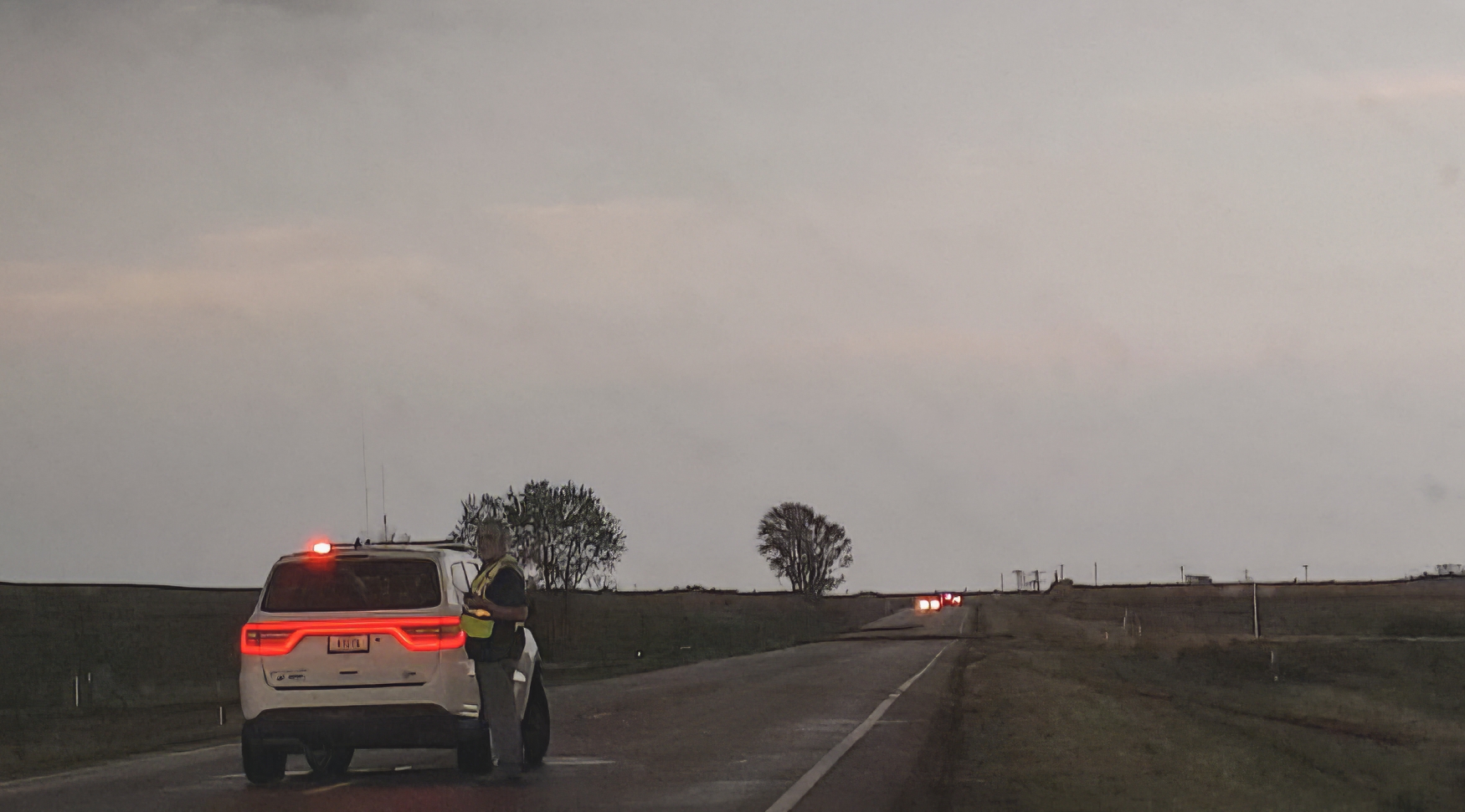
This new tornado, now officially called the Stockville EF3, dropped at exactly 7PM -- the magic hour worked its witchcraft after all. I knew we were hopelessly far behind with the road conditions, so it was an easy decision to stop and capture our first stable, tripod shots of the day -- selfies included. From our vantage about 7 miles behind the ground circulation, the dark dust created a very menacing appearance. Definitely the strongest of today's tornadoes. Another chaser pulled up beside us, but per usual we made introductions and then I promptly forgot his name. But I didn't forget to get the drone out for a flight, and was rewarded with a nice long aerial timelapse of the departing twister with parent structure. It was a nice change of pace from the hectic McCook intercept. On final inspection, the Stockville EF3 tore a path 2.1 miles long, 400 yards wide, and with peak winds around 157 MPH.
7:10 - 9:02 PM CDT: After the Stockville tor lifted, we were feeling pretty triumphant. What more was left to capture? Nevertheless, a trailing supercell was closing in and looking better by the minute. But with the more relaxed, no-pressure atmosphere, I'll admit I made the mistake of letting my guard down. And that's when things started happening quickly.
We made our way north on another dirt road into Farnam, NE -- along the way monitoring the trailing supercell just to our west. We pulled into Farnam just minutes ahead of the hook, but I didn't feel too threatened by the impending precip because we had a good escape route east on Hwy23. At least, I THOUGHT we had a safe escape. Only seconds after turning east, we met a traffic jam ahead. Apparently, the lead supercell dropped another tor just after Stockville, blocking our path with downed powerlines. Suddenly we were trapped between the onrushing hook and a closed road. Seeking a quick alternate route, I jogged north onto the grid looking for a way east. But the first grid road was also blocked. By this point the hook was overtaking us, and while I didn't see a big tornado on the ground, we were not in control of the situation. Then suddenly, as we were slowing working along a 3rd grid option, a small vortex appeared in the road 20 feet in front of us. And before we even knew what was happening, the small vortex rushed directly west towards us and impacted the vehicle. Now granted, this thing only had about 50-60 MPH winds, so it barely rocked the car. But it was at that moment Toni and I both realized how carelessly we'd treated the situation.
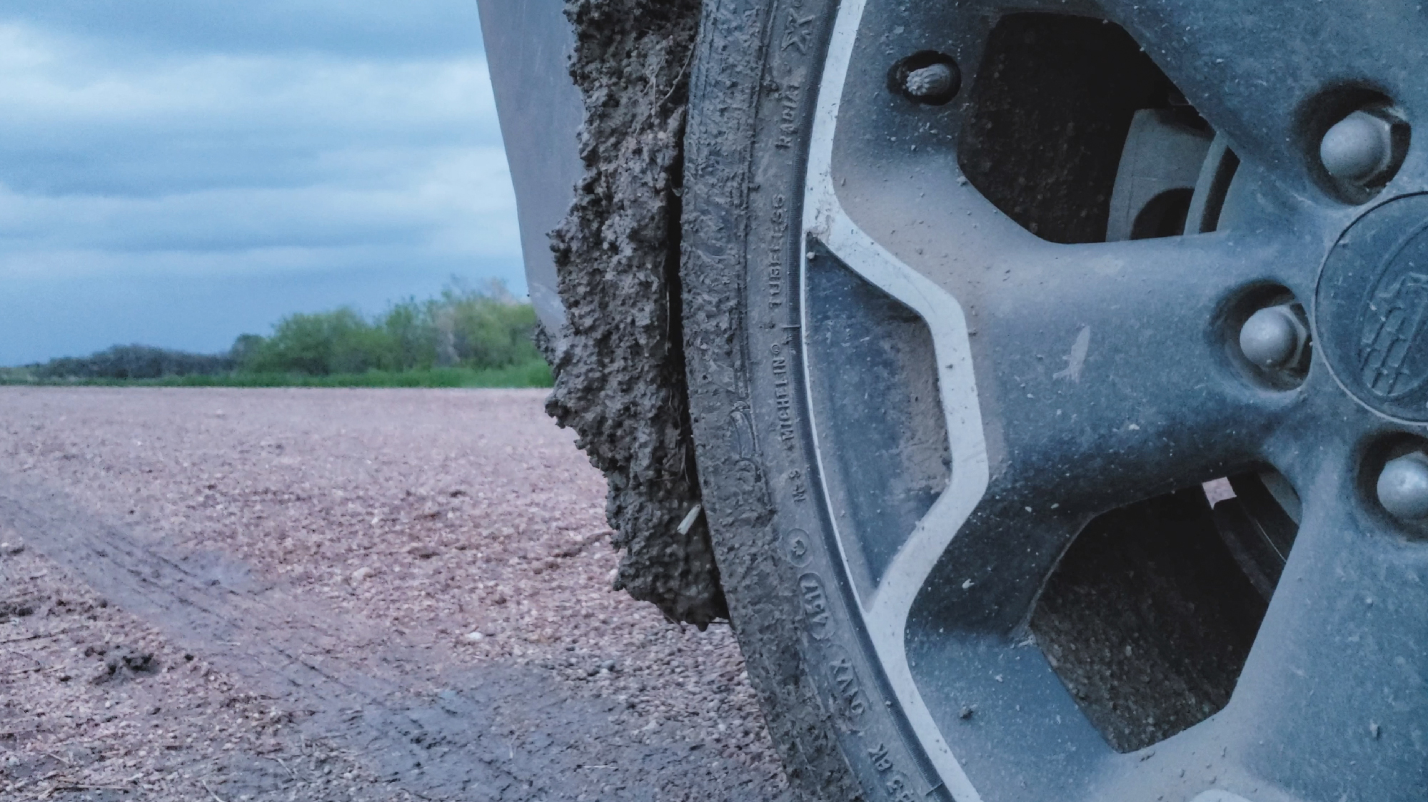
Now fully transitioned from triumphant to humbled, and now also fully behind the trailing supercell, we took a much more cautious approach to the remainder of the chase. In the remaining light, there was the possibility the we could take Hwy47 north then I80 east and use the faster highways to make up lost ground. And our planned seemed to be working as we passed just behind yet another tornado path in Cozad at 8:28. In the growing darkness, we could catch fleeting glimpses of the lowering to our northeast, but never anything definitive. Finally, as we took a grid road north of Lexington and into the Sandhills, I realized the chase was done. Once again, the Crosstrek threatened to veer off into the ditch. But this time the sandy mud caked the inner wheel wells so thickly it threatened to cut our mobility completely. And so at 9:02 PM in the deepening twilight, I enjoyed one last view of the strobing supercell escaping to the northeast. Truly this was a top tier chase.
Post-Chase
9:02 - 11:05 PM I don't know why, but I've always liked the town of Kearney. Maybe it's the weird pronunciation? Maybe it's because it was our first venture into Nebraska way back on June 3, 2014. Whatever the case, Kearney became our home base for the night. Limping along the interstate due to the mud-encrusted wheels, we finally pulled into town just before 11 PM. And just like our very first visit, we again chose the Old Chicago Pizza for dinner (very sadly now closed as of 2022). Despite the late hour, we were surrounded by other chase teams all recounting their exploits for the day. It seemed like no one busted today, and you couldn't help but feel the group comradery after a chase that was very sorely needed by all.
Recap, Filmmaking Notes, and Lessons Learned
- Tornado Archive tracks 13 Nebraska tornadoes today between McCook and Eddyville. We definitely saw the three main twisters, but missed the other 10 (with the possible exception of the very first pre-McCook tor). I've definitely noticed that on the most prolific supercells, it can be hard to discriminate between the start and ends of different cycles/tornadoes.
- All three targets performed well today. In SW KS, the high-based Minneola tornado was an amazing catch. The beautiful Ft Stockton, TX tornado rounded out a successful chase day for the southern target. After 2018, I think all chasers needed this.
- One of the more viral moments of this day was when Reed intercepted the beginning of the McCook tornado on foot. We were actually seated next to his group that night at dinner and heard him discover all the dust and debris that was still in his pocket.
- As a timelapser who loves to shoot until the last possible moment, days like today highlight the need to keep a good downstream distance until the storm is really ready to produce. I have a tendency to capture footage at any intercept opportunity, rather than aborting a shot early to stay ahead of the storm. This will always be a tension in my chase style, but all the "from behind" footage today really highlights the need to be tactical about when you let the storm get close.