Date: June 12, 2017
Time: 2:45 - 8:15 PM MDT
Place: Cheyenne, WY to Bridgeport, NE
Distance: 855 mi (582 to target, 179 chasing, 94 to hotel)
Camera: T3i, GoPro3, Sony RX100ii
Warnings: TOR, SVR
Rating: S5
Pre-Chase
June 11th, 3:00 - 11:15 PM MDT: For the first time in 6 years and 45 storm chases, today I'm heading out all by myself. Toni has a doctor's appointment tomorrow that she just can't miss. After scrubbing models all day, I decided that I too have my own unmissable appointment in SE Wyoming.
Over the past few years, I've started paying more attention to local NWS Area Forecast Discussions when examining a setup. Each AFD has a distinct personality, with detailed understanding of the geography, recent conditions, and climatology of its own little corner of the US. In other words, they're typically dry, hype-free sanity checks on my own forecasts. But this afternoon, the Cheyenne NWS issued one of the tastiest AFDs I've ever read. Quoted below to set the stage:
Our attention then shifts to what very well could be one of the most significant severe weather episodes we have seen in recent years for southeast WY and the western NE Panhandle...Steep mid-level lapse rates, coupled with strong surface heating is expected to yield a moderately to strongly unstable air mass characterized by MLCAPE over 2000 J/kg. Impressive forecast soundings remain with 0-6 km shear over 50 knots across all of our high plains zones. Very large, curved, and even a few sickle-like hodographs are common along/n of the warm front between 00z-03z as the low-level jet rapidly strengthens with 50 knot flow at 850 mb and resulting 0-1 km/effective SRH over 400 m2/s2. This will support intense supercells with low-level mesocyclones, likely being capable of all facets of severe weather including tornadoes, extremely large and damaging hail, flash flooding, and destructive winds. Any storms which can become rooted in the boundary layer by evening will almost certainly have the potential to produce a strong/violent, long-track tornado.
Needless to say, Cheyenne NWS was hyped and so was I. To help get me through the long, lonely drive north on I-25, I started the new Seveneves audiobook (Toni not being a Neal Stephenson fan, it seemed like an opportune time). Stopping a couple times to take in the crystal clear Colorado sunset, the atmosphere had a palpable "calm before the storm" feel. I FB chatted with Bill Giles as we watched a tiny thundershower try to roll off the foothills near Castle Rock in the fading light. Then before I knew it, I'd arrived at the Loveland Best Western. From the balcony above, two shirtless guys drinking Coors light watched while I unpacked the Crosstrek for the night.
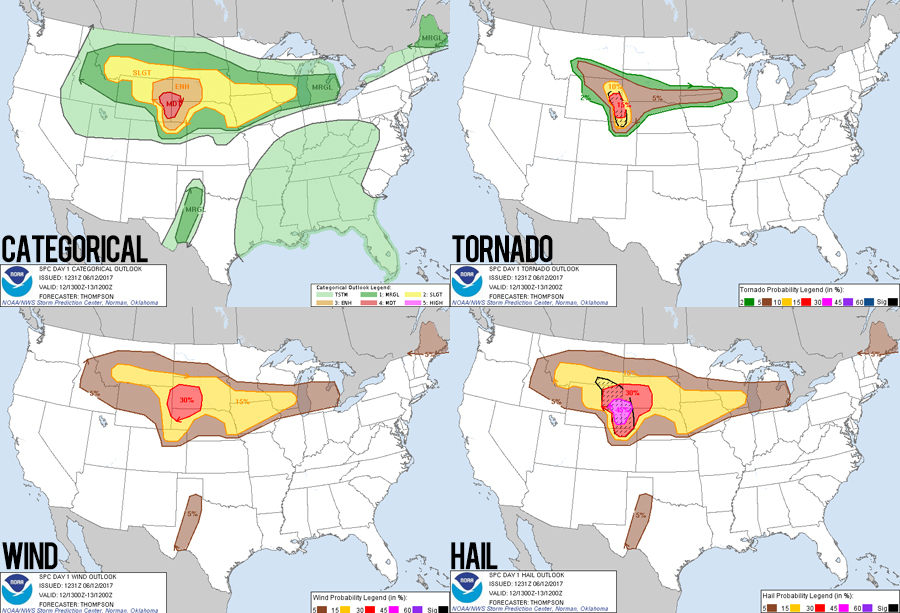
June 12th, 11:00 AM - 2:45 PM MDT I awoke to the pleasant discovery of a Day 1 moderate risk -- complete with 15%-hatched tornado probs. If I cheated and just chased the SPC outlook, then Wheatland, WY was a good target. On the other hand, if I cheated and just chased HRRR updraft helicity tracks, then Cheyenne and even NE Colorado were in play. I fretted over these details until 11AM checkout, at which point I decided Cheyenne was good enough as a staging point (cell coverage and roads get dicey further north).
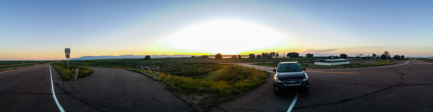
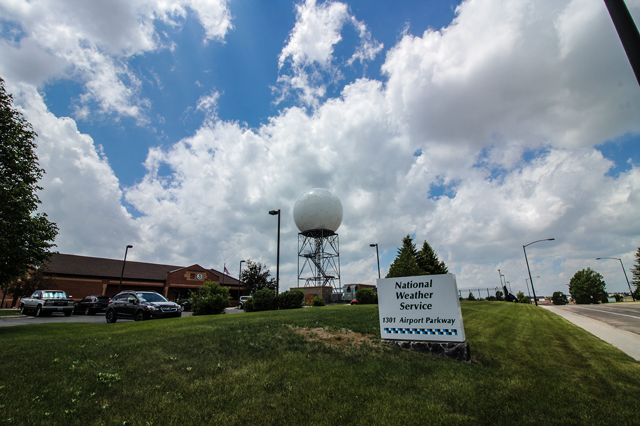
An hour later, I was in Cheyenne with ages to go before initiation -- not a good recipe for pre-storm anxiousness. To kill time, I drove around town looking for neat spots for motion timelapse shots of the pre-storm cumulus. I ended up lapsing at the NWS office and radome, a sweet hillside overlooking most of town, and another hillside overlooking FE Warren Air Force Base -- Cheyenne is definitely a beautiful city.
At 12:30 a nice MCD was issued, and by 1:10 we had a genuine PDS Tor Watch -- incredible for this part of the plains! Agitated cumulus towers were growing along the foothills from Loveland, CO all the way to Casper, WY, and by 2:00 rapid initiation was underway on a cell to my north near Chugwater. I drifted about 15 miles north of Cheyenne just to keep that cell in striking distance, but was more eyeing the cells growing to the south in Colorado. I was sitting near an I-25 overpass reevaluating data when Max Olson pulled up to the same exit. We worked together on last year's StormAssist DVD, but never actually met in-person. I was just about to walk over and say hi when a knock on my driver window made me jump. A state trooper had pulled up behind me and was checking to see if everything was ok. He was a really nice guy and we chatted over the radar for a couple minutes before he left - just as Max was leaving as well. #MissedConnections
The Chase
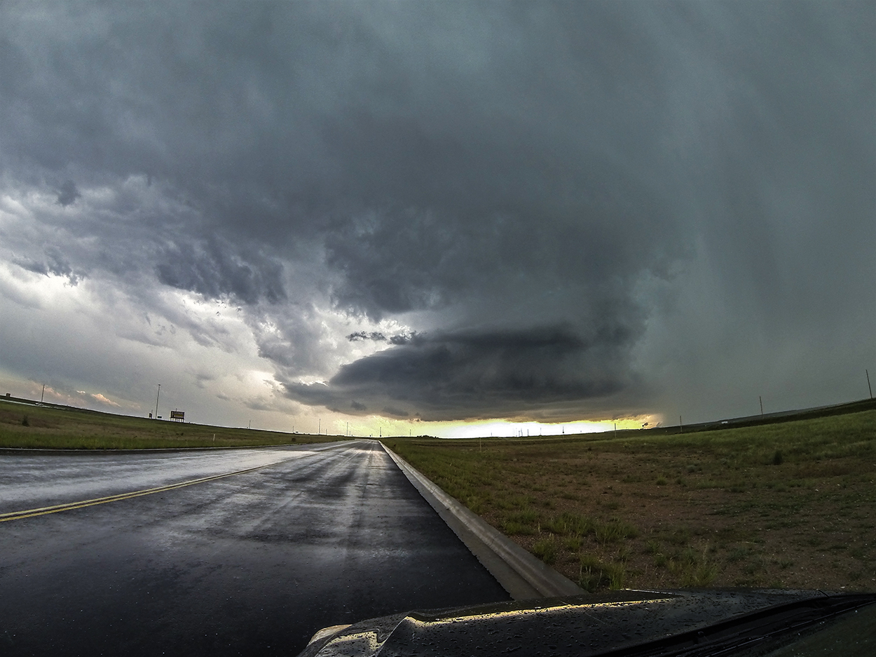
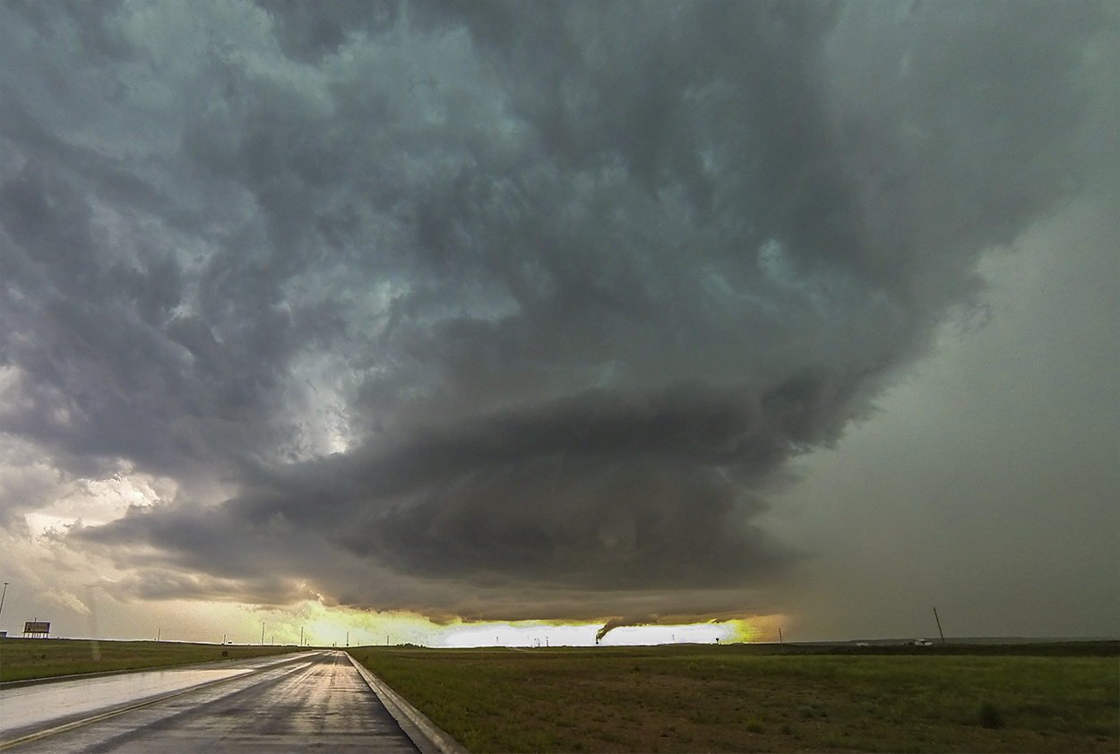
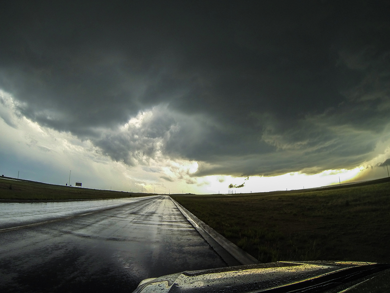
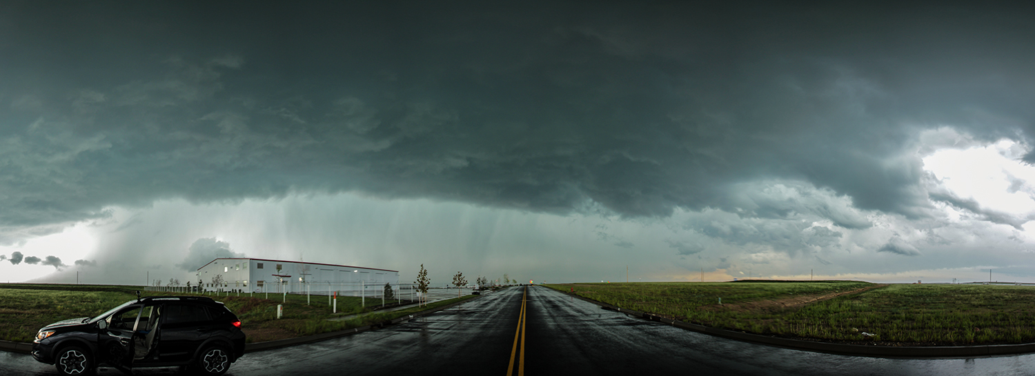
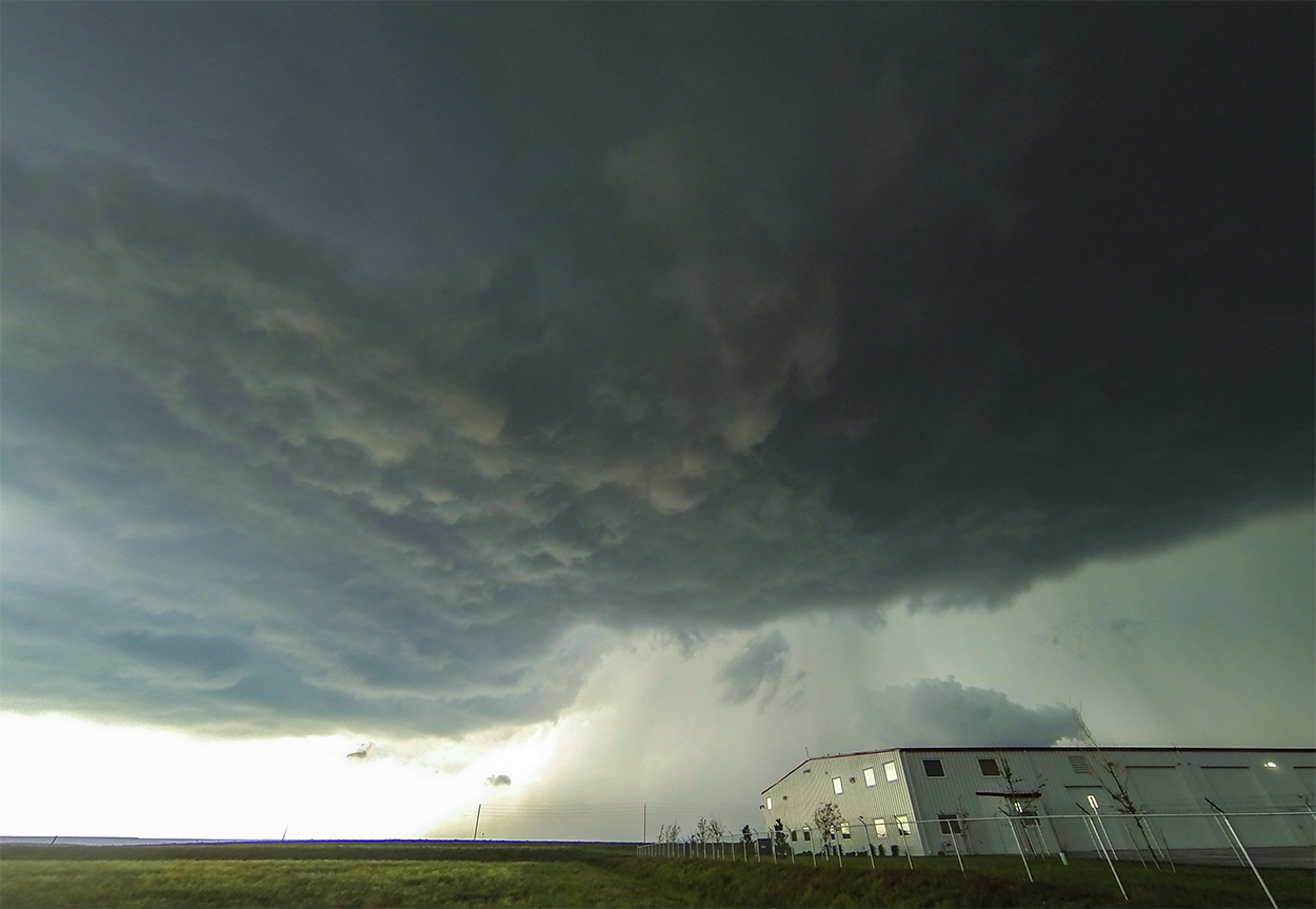
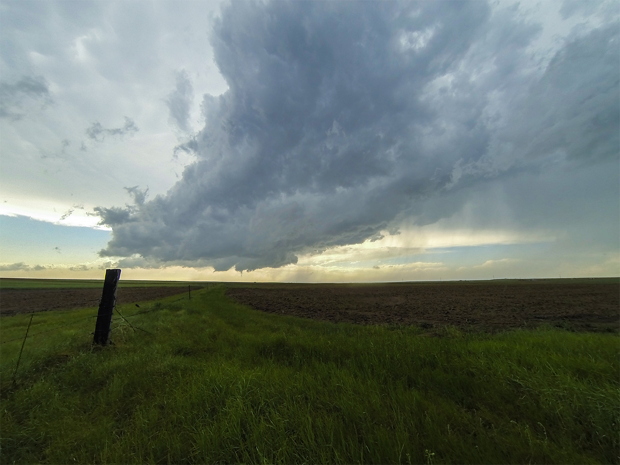
2:45 - 4:00 PM: A smorgasbord of new cells was growing back in Colorado near Ft. Collins -- a more isolated northern cell and two competing middle and southern cells. I dropped back to Cheyenne and 15 minutes later was sitting near the I-25/80 interchange with the newly SVR-warned northern storm's ominous base on the horizon. It was not the most immaculately-sculpted supercell I've ever seen, but the maturing storm already had obvious mid-level rotation and a large, robust base. At 3:15, the middle cell (the most crowded of the 3) went TOR-warned, but I didn't budge -- my northern storm was also ramping up. Intermittent lowerings hung below my storm's base, but these appeared to be outflowy (bulging away from the FFD) rather than inflow features (pointy end towards the rain).
At 3:46, the southern cell also went TOR-warned, and my cell was still just SVR with no obvious wallcloud or low-level rotation. Lightning was picking up, however, and I had to hide in the Crosstrek (for the first time, I felt the lonely vulnerability of chasing solo). Then, just as the base was passing directly overhead, an RFD surge kicked off dramatic rotation in the still-featureless, flat base. I've never seen low-level rotation increase this dramatically from this close angle! As the base started to pull away to the north, rotational and upward motion continued to increase -- I was sure a tornado was imminent! But just as fast as it ramped up, it then became detached from the main updraft and fell apart.
Now I had a critical choice...
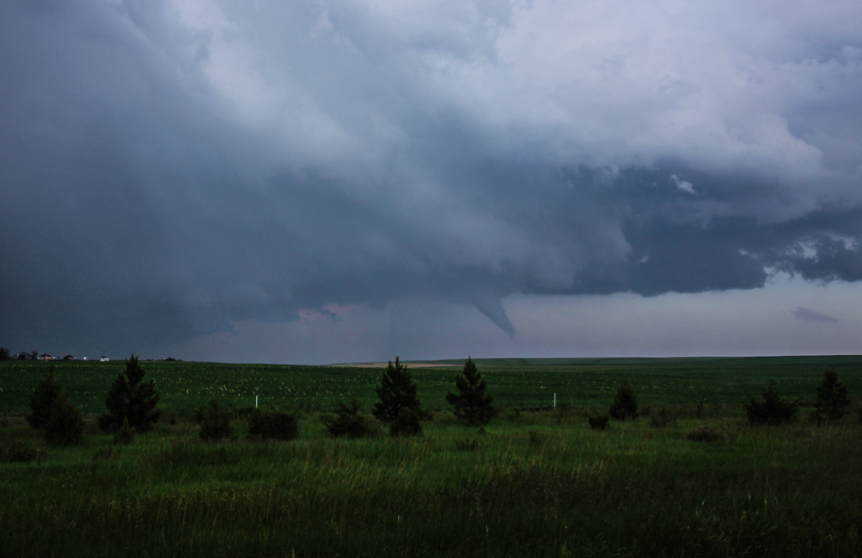
4:00 - 5:50 PM: ...Drop down to the southern TOR-warned cells or stick with my northern Cheyenne storm. Considering 1) cell/road network and 2) storm environment, I decided to blast east on I-80 to intercept the southern cells as they entered Wyoming. In the meantime, I kept watch on the departing Cheyenne cell - noting a couple temporary lowerings but nothing signaling imminent tornado. At 4:19 I was at the Burns, WY exit ready to drop south 8 miles to Carpenter to intercept either of the 2 southern storms. But at that EXACT moment (literally I was taking the off-ramp), the Cheyenne cell went TOR-warned. All of a sudden, the more isolated northern storm seemed the better bet. In that split-second, I decided to go north instead of south. #Regrets
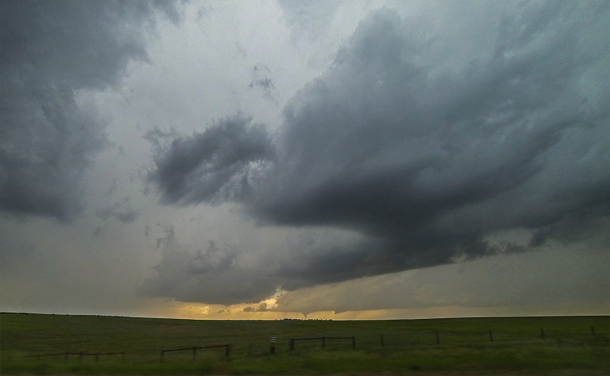
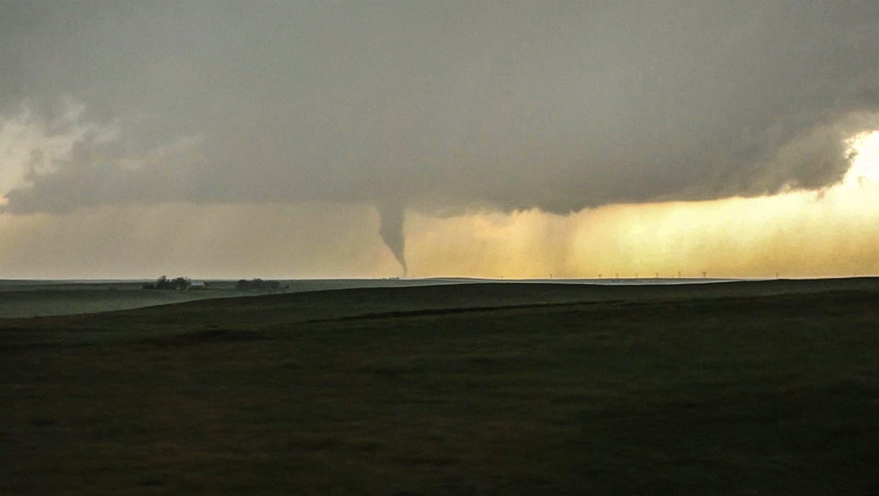
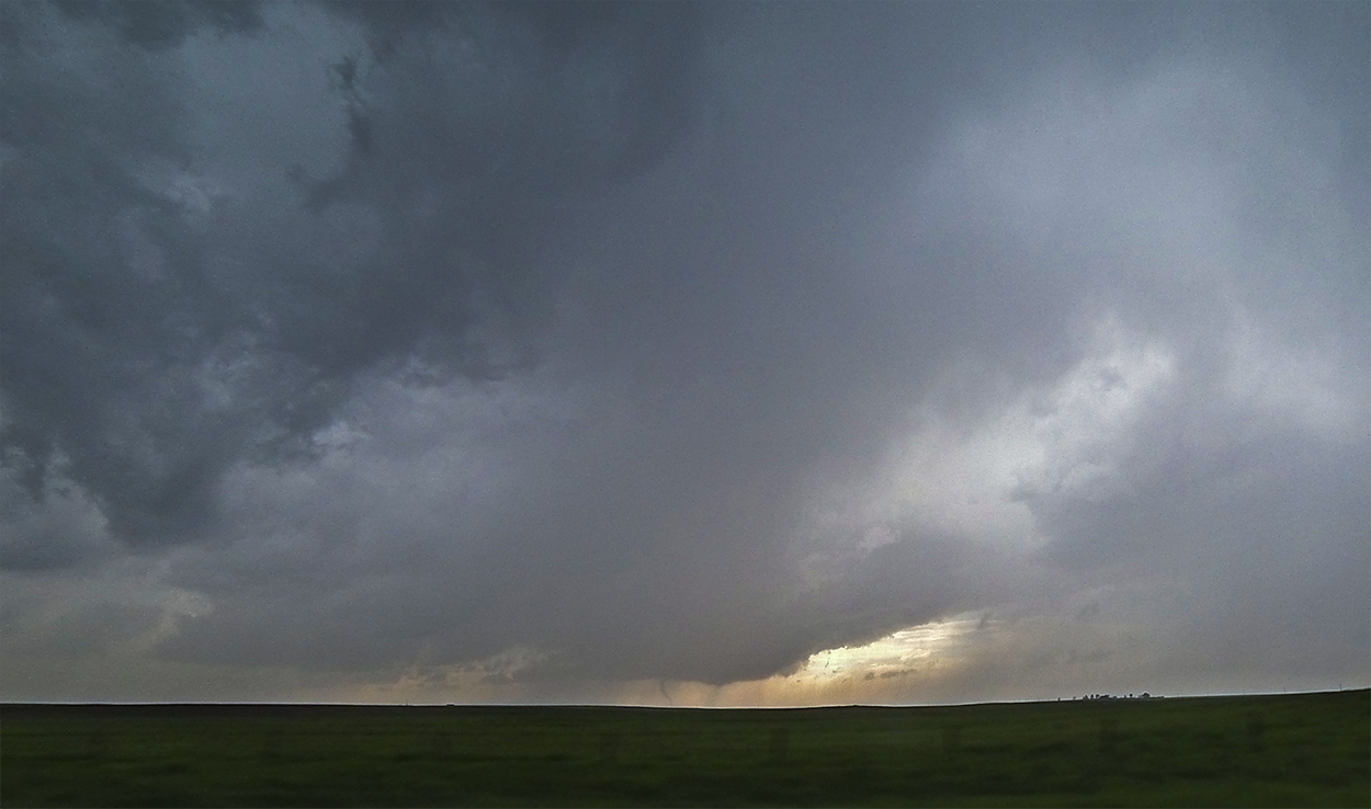
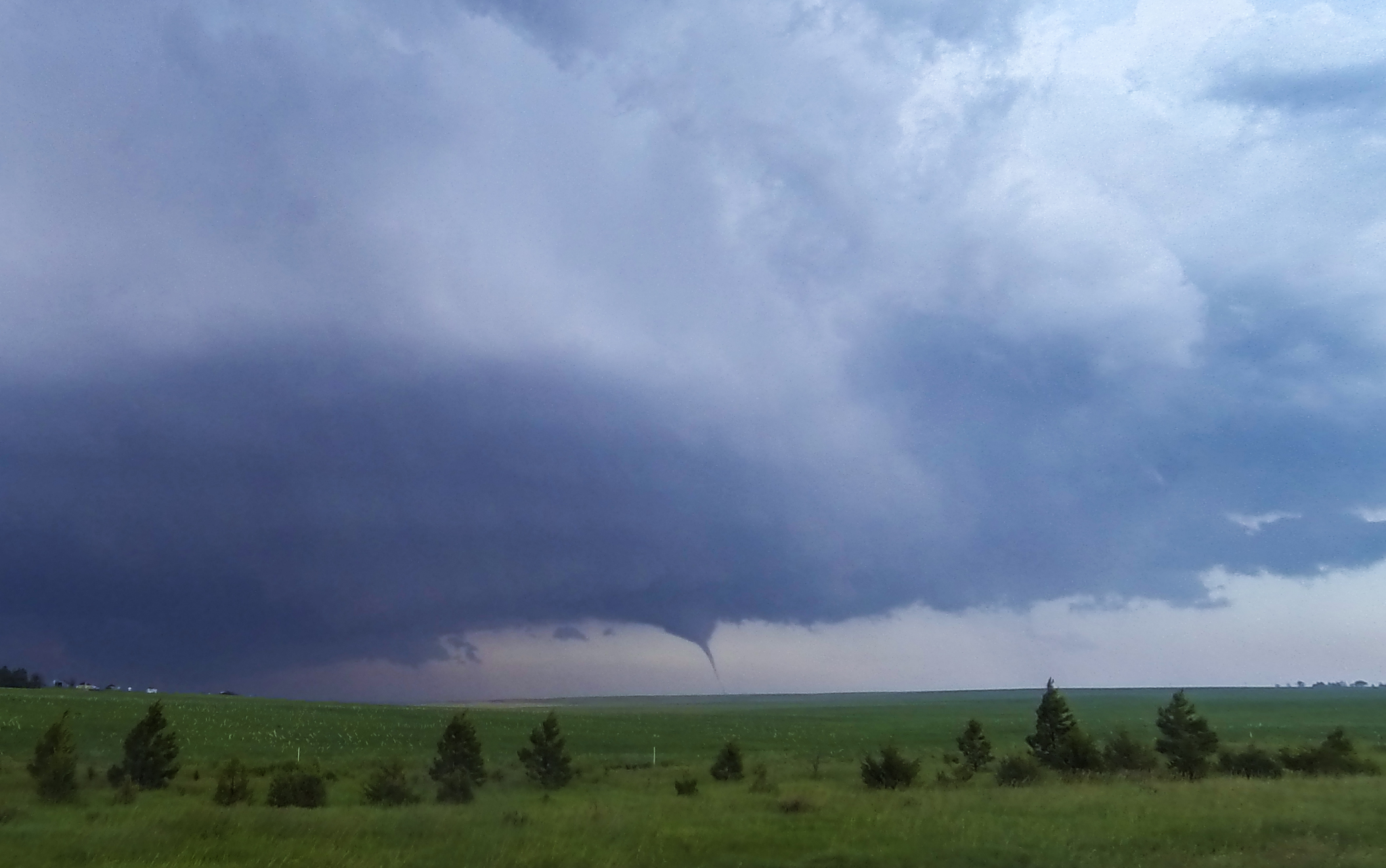
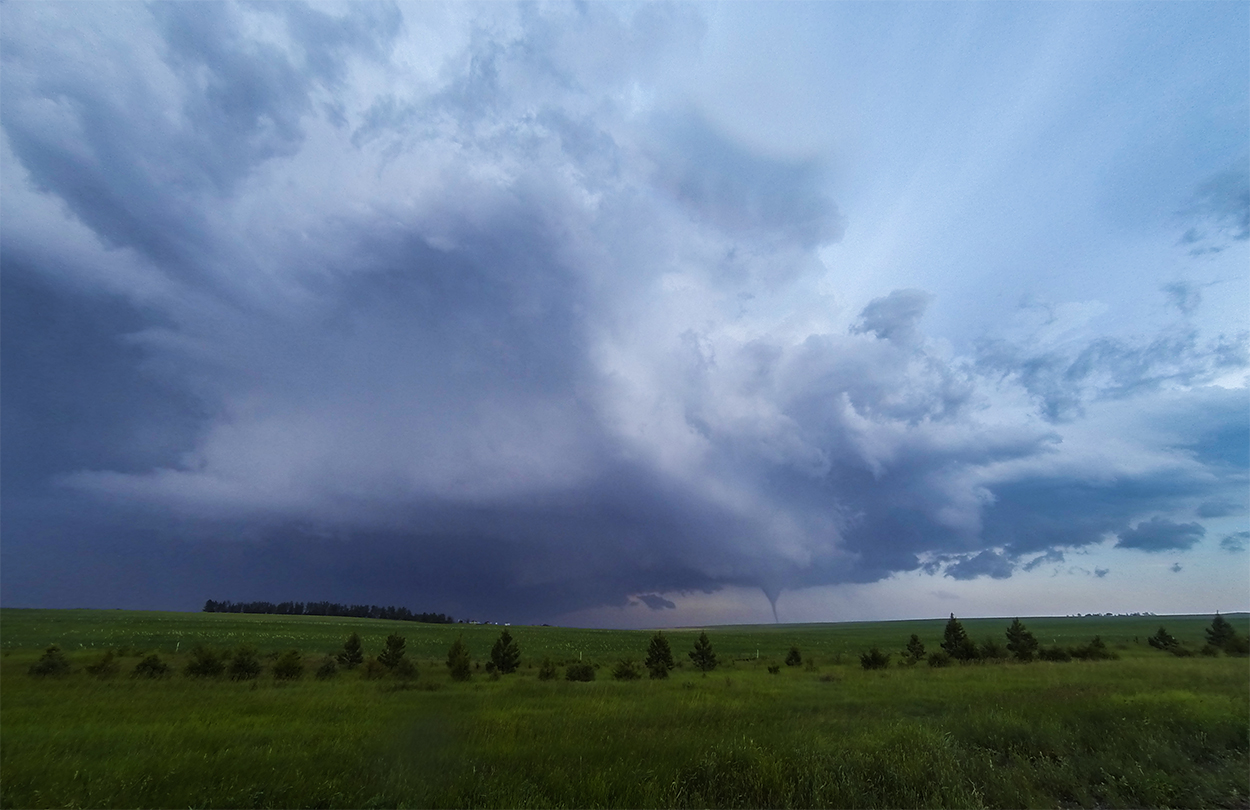
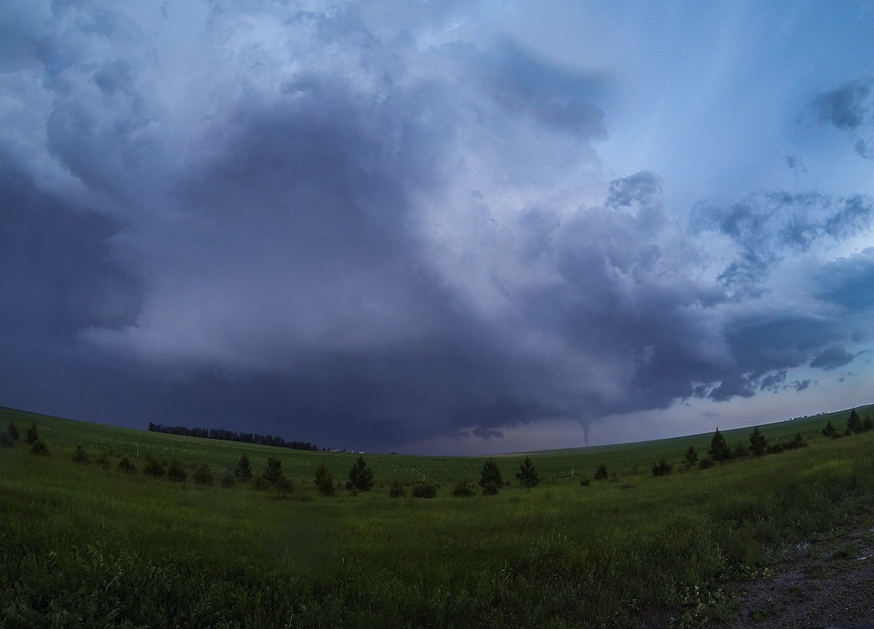
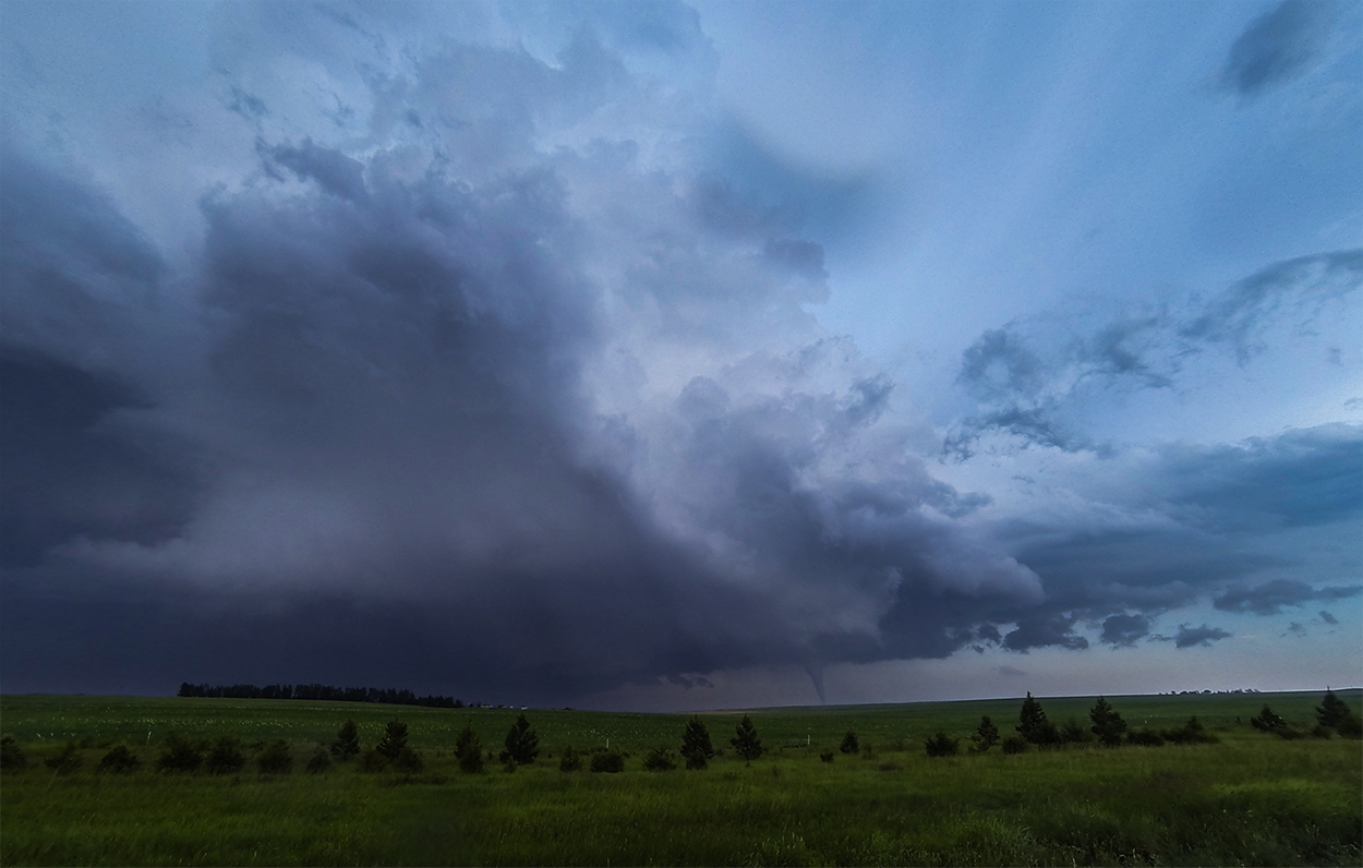
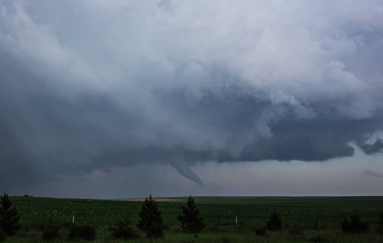
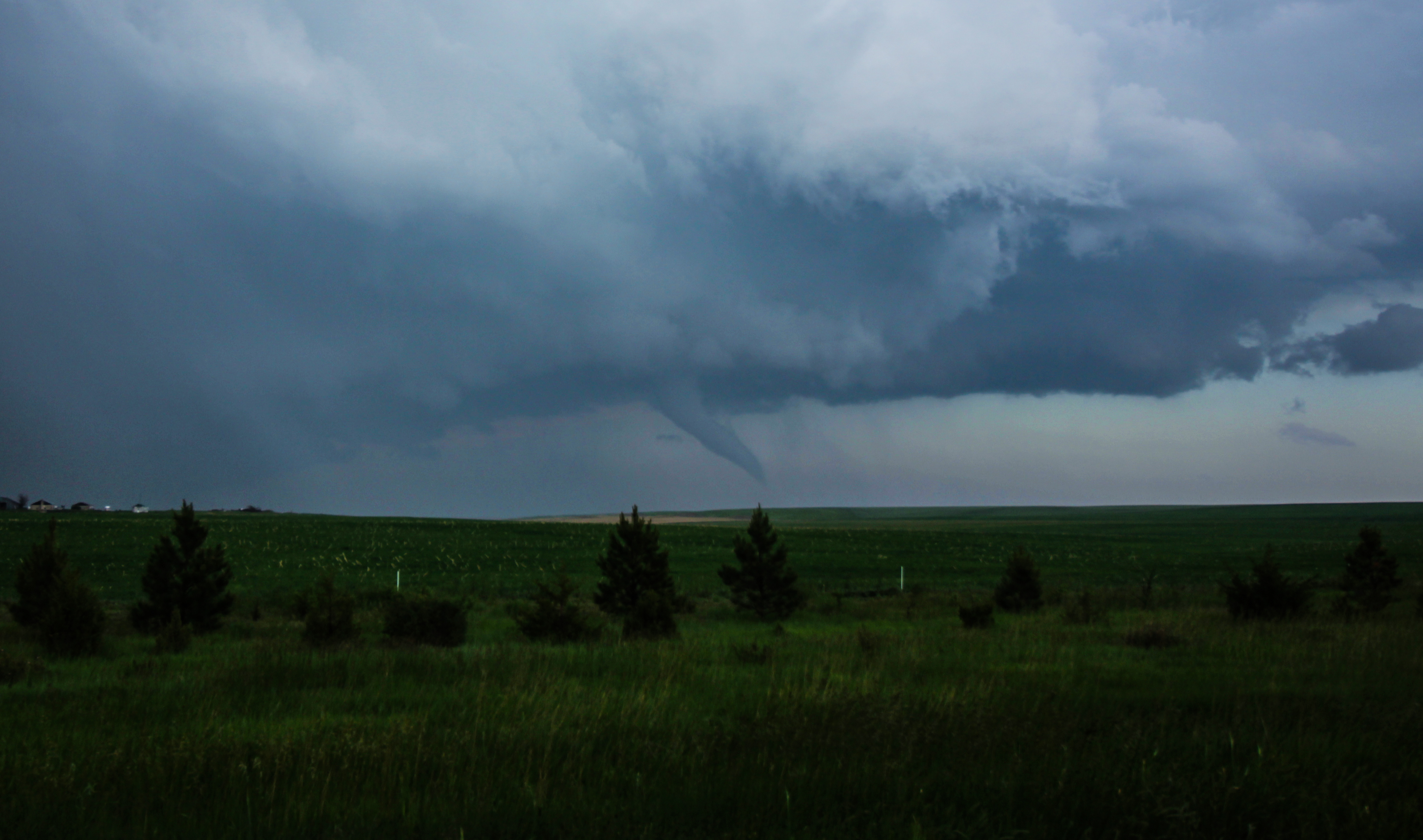
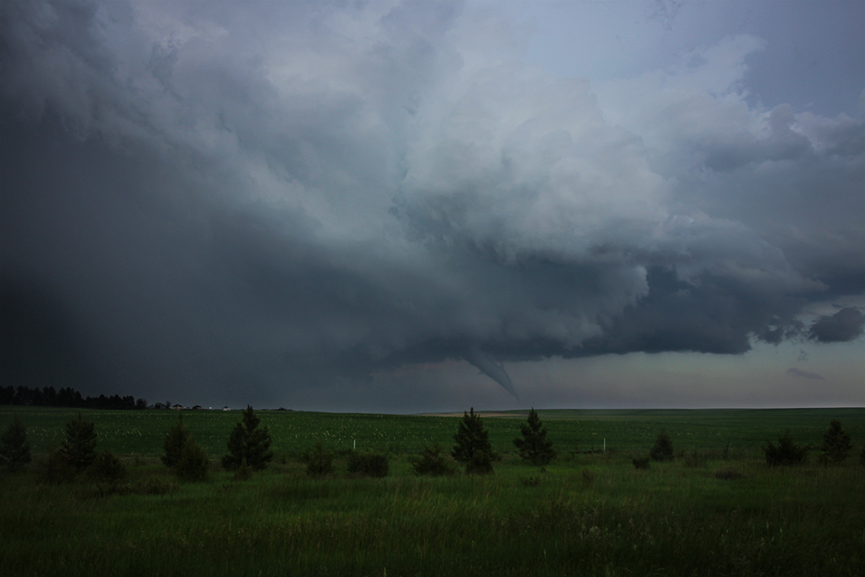
Flying north on Hwy 213, it only took a couple minutes to glimpse a classic conical lowering on the Cheyenne storm -- now about 15 miles to my NW. By 4:29 I could see a cone tornado completely condensed, with another possible wallcloud developing to its northeast. Unfortunately, I was still 20 minutes away; a long-track tornado my only hope for a closer view. But by 4:37 it was clear the tornado was taking on a classic occluded shape -- skinnier at the top than the middle. I cut west at 4:40 onto dirt roads heading directly for the roping tornado, but by the time I pulled to a stop near Hwy 85, the tornado had lifted and the entire storm was fading. The once stout base was a narrow, wispy deck with a few final strands of remaining vorticity needling down.
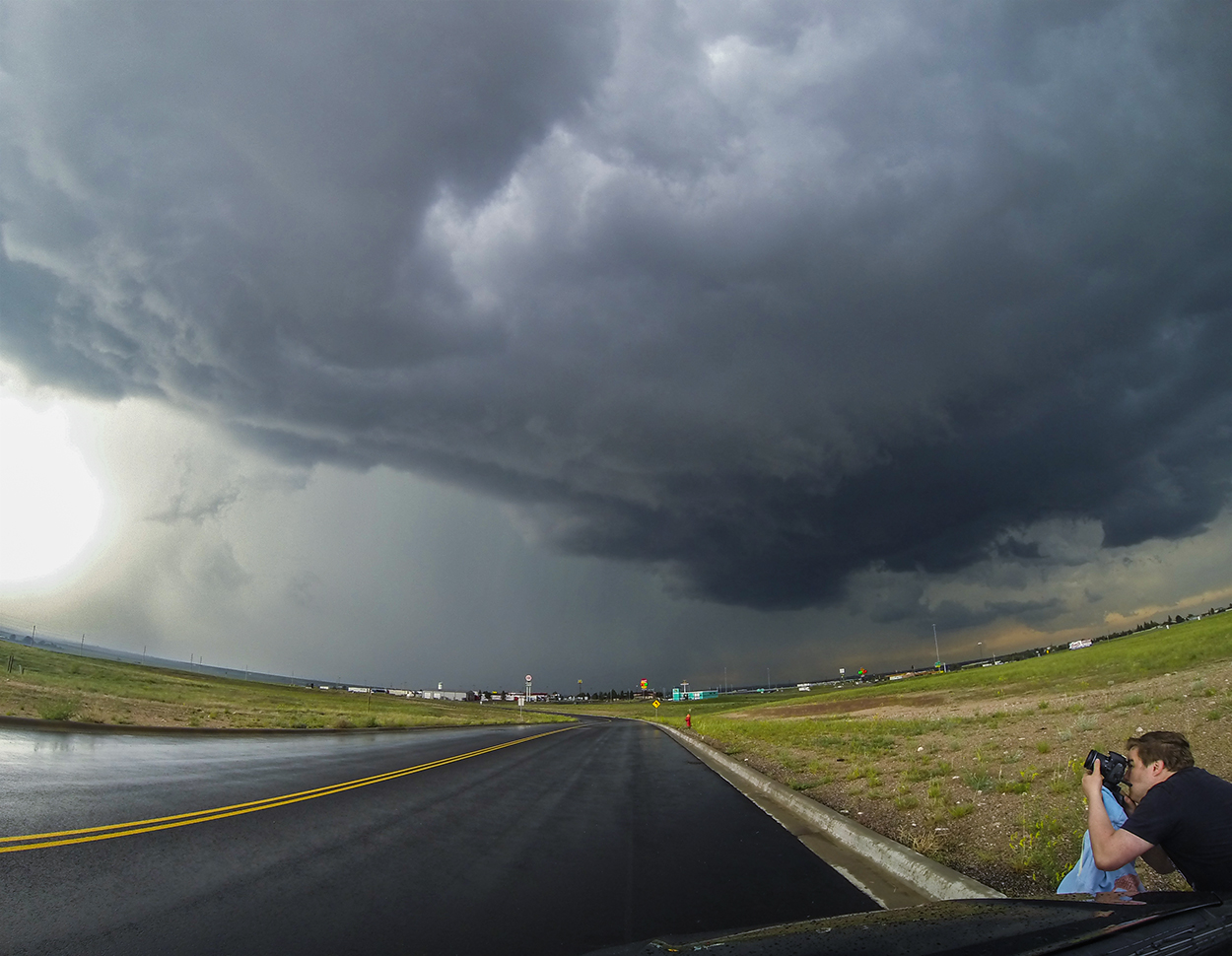
At least I was on the scoreboard for the day, but the distant glances out my driver's window were an insufficient catch. I needed a new target. Radar updates had been non-existent since leaving the interstate, but I could infer that the middle and southern cells were still to my southeast. Drifting east on Hwy 216, I finally got a bar of cell reception and eked out a new radar frame. Sure enough, the middle and southern cells were gaining some separation. The middle cell was an easier catch heading right at me with a clear visual. The southern cell had multiple mesos and required a tricky hook slice from the west -- likely radar blind. So I took the easier/safer bet and held ground while the middle cell closed in. A beefy beaver tail passed overhead as the storm approached, but inflow winds were calm and thunder went silent. Like my previous storm, this cell was fading. It was time to face the beast...the southern cell.
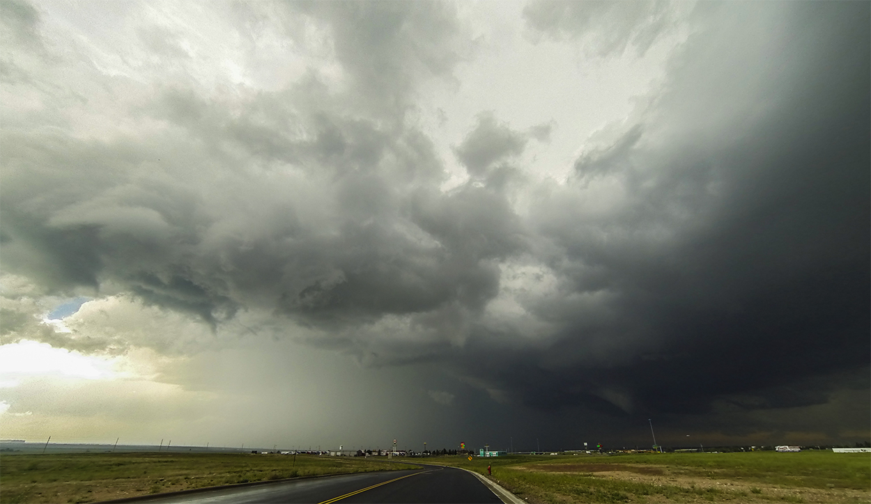
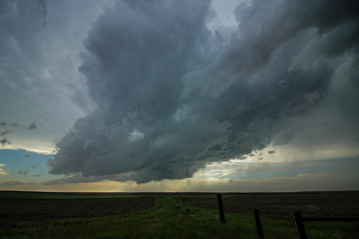
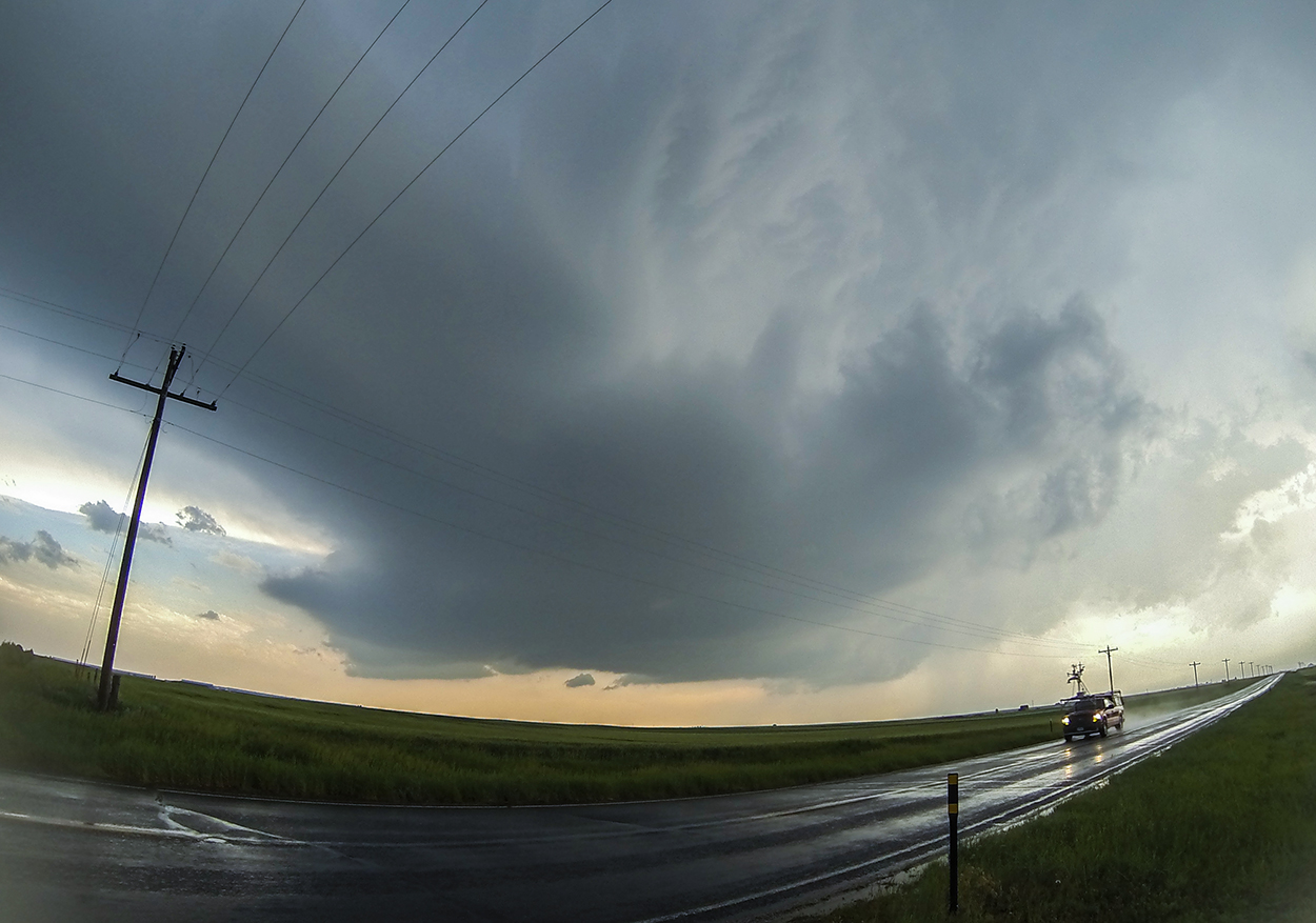
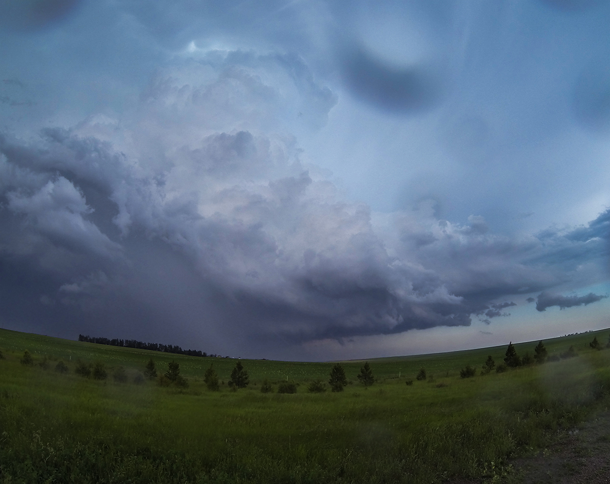
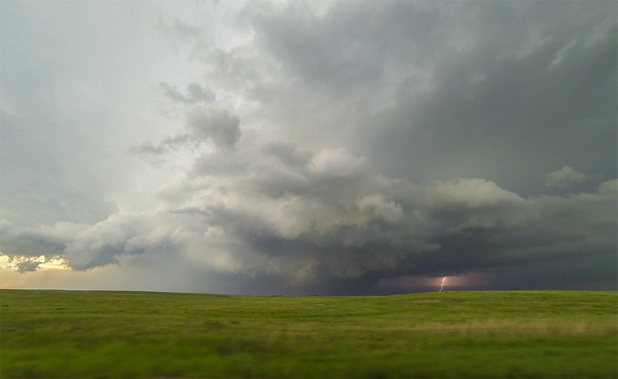
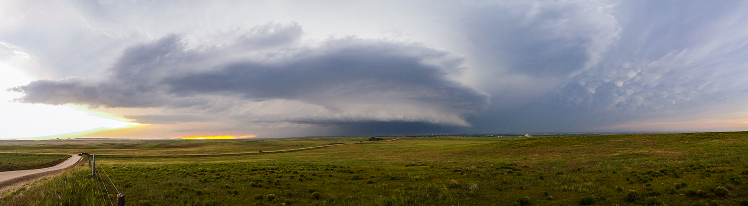
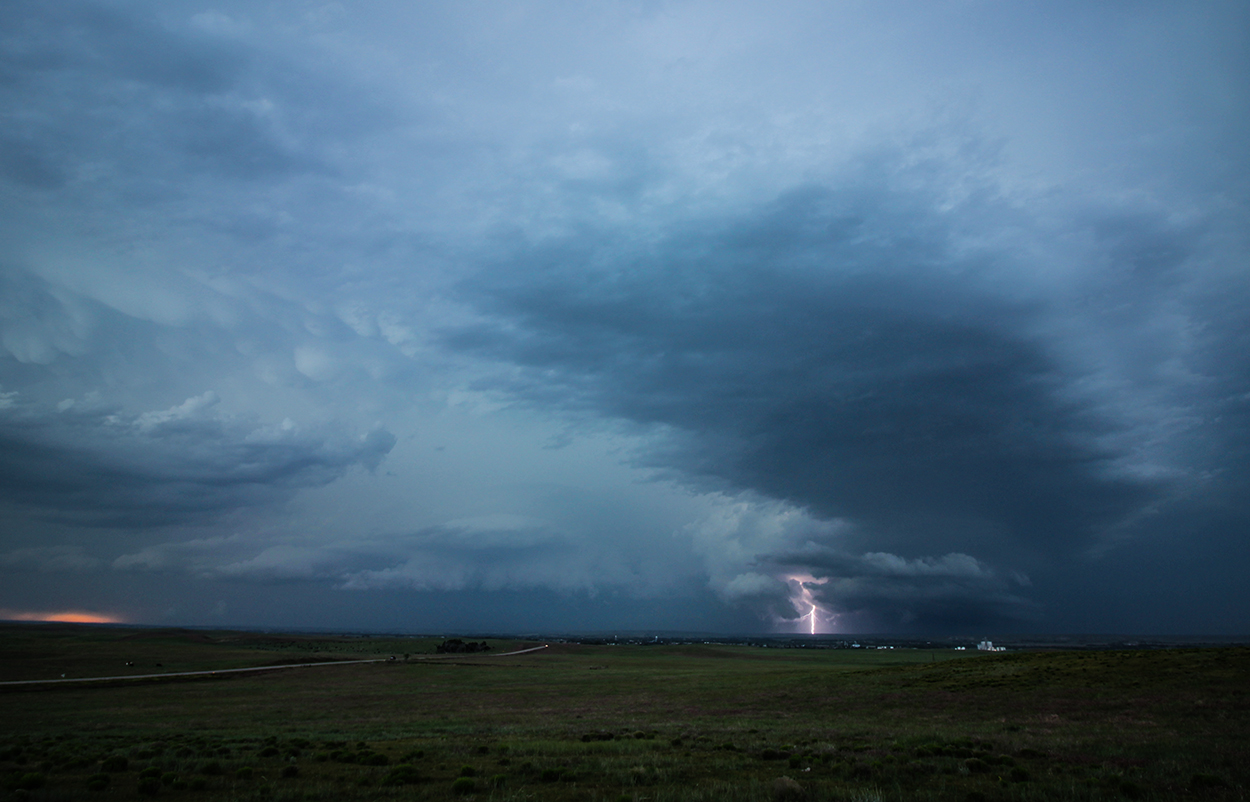
5:50 - 7:40 PM: Some storms are uniquely compelling -- whether it's visual appearance, radar presentation, or something else not quite tangible. The southern cell had this quality in spades. Even from 8 miles west of the core, constant lightning in the updraft column, underneath the base, and stabbing out into clear air advised that this was an especially vigorous storm. I've never before seen velocity data like this -- three individual mesocyclones within 13 miles of each other all near-TVS strength. Needless to say, I was very nervous about falling into the precipitation, losing radar and visual awareness, and stumbling into one of these 3 circulations. Carefully, I ventured east towards Albin, WY and into the rain, hail and lightning barrage. Low visibility caused me to pause in Albin momentarily, but then a bowl lowering started to emerge from the rain to my SE.
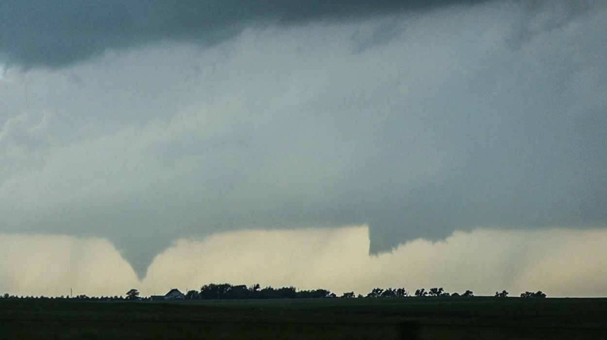
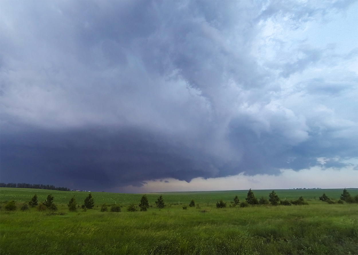
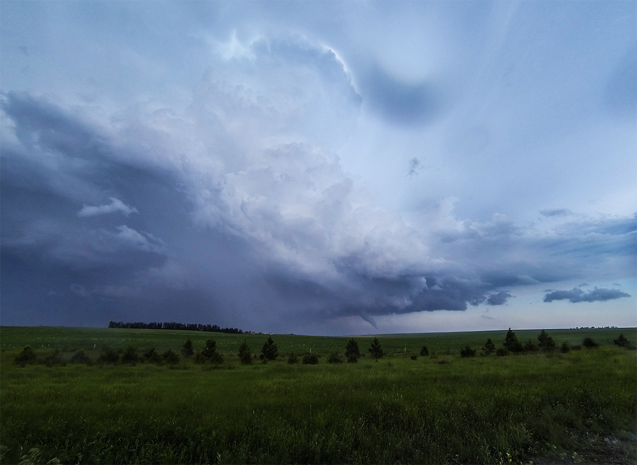
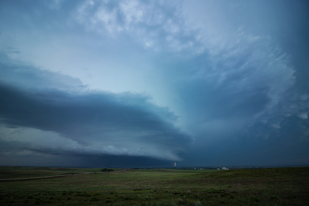
At 6:11, I pulled up to the WY/NE state line 2 miles east of Albin. What followed was one of the most stunning combinations of tornado and supercell structure I've ever witnessed. Underneath, the bowl lowering focused into a tight needle of full condensation that then broadened into an elegant trunk. Above, a powerful surge of cauliflower cumulus crashed into the tropopause with a bright pileus cap. At the center, the western fringe of the updraft column actually started to peel around anticyclonically in dramatic juxtaposition to the cyclonic tornado ongoing below. I watched this whole 5-minute scene with only one other chaser -- immersed in the ambient roar of continual thunder lit by deepening blues and purples. Nothing can fully capture it.
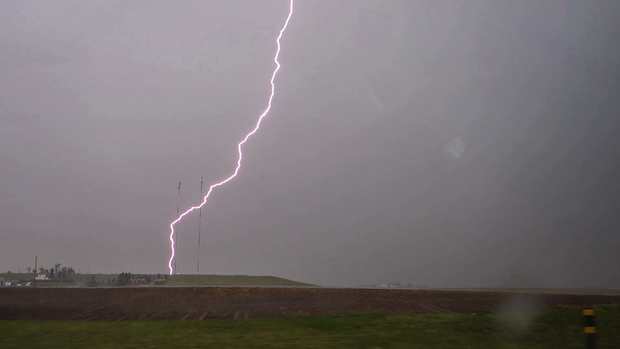
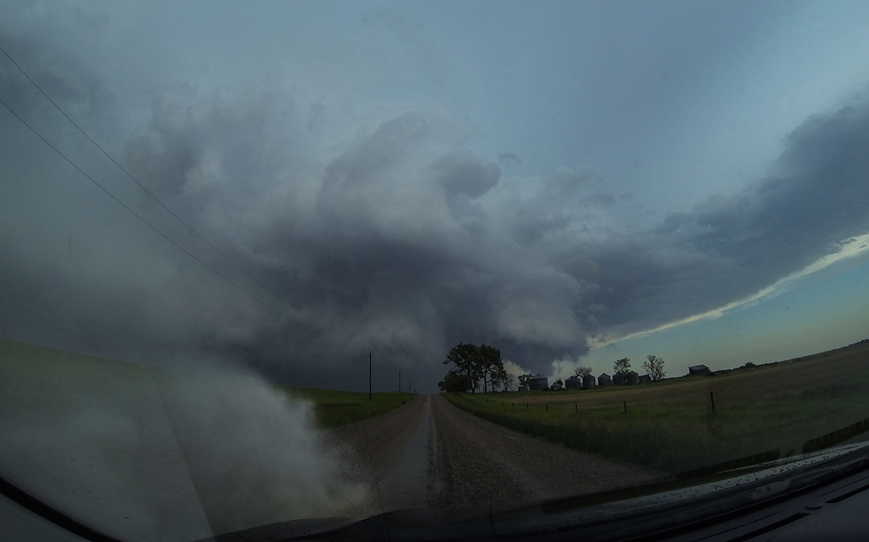
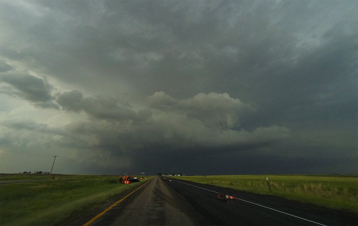
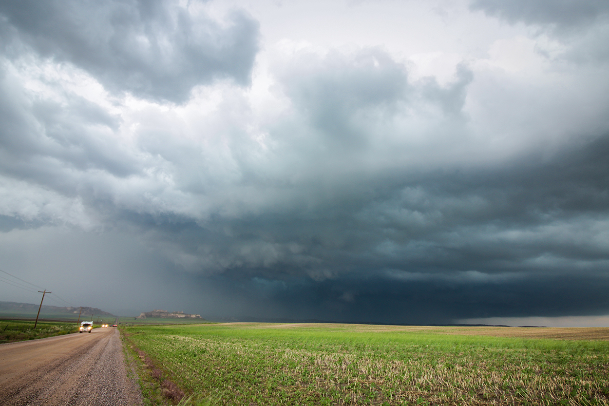
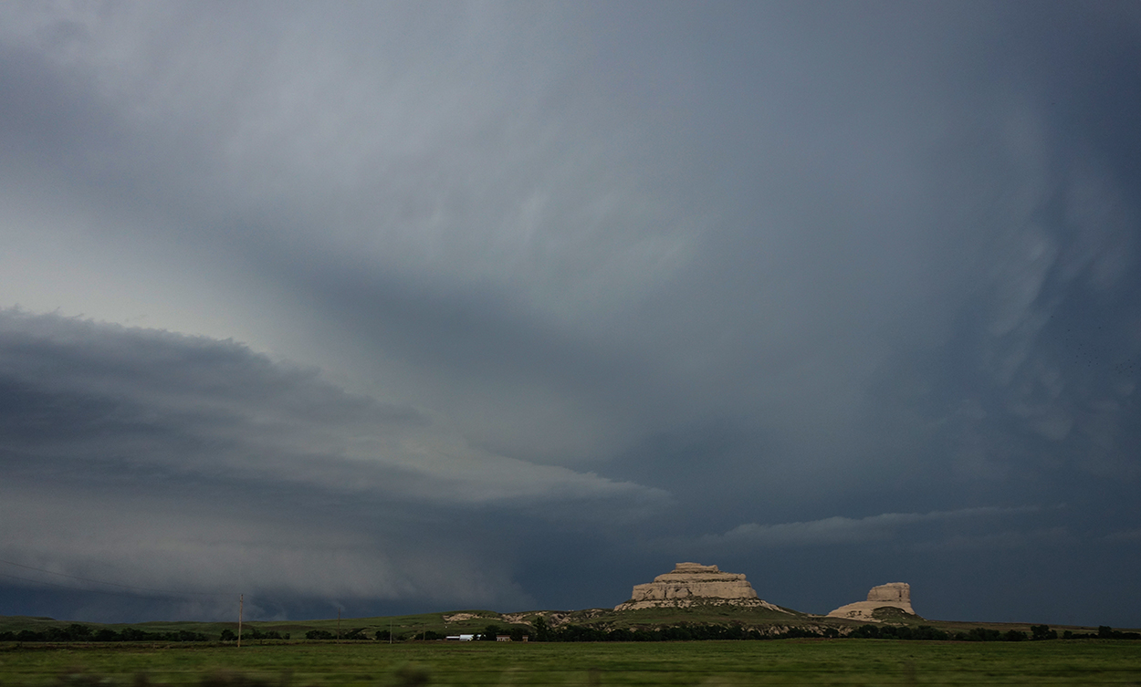
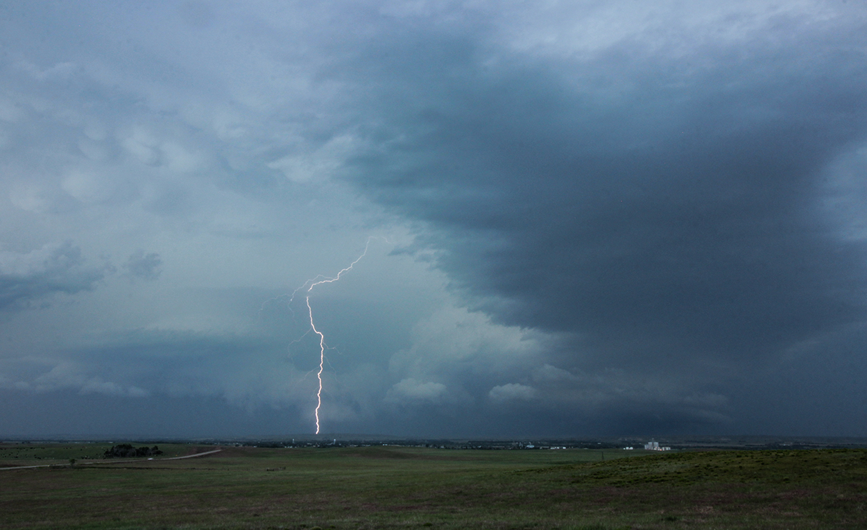
Snapping out of a tornado-induced reverie, by 6:20 it was time to venture into the road/cell signal no-man's-land of the Nebraska panhandle to keep pace with the departing supercell. Jogging north a few miles first, CR14 provided a nice eastward gravel path to trail behind the storm. I continued to observe some striking anticyclonic rotation on the western flank of the updraft. Turning north on Hwy 71, every construction cone and a lighted road sign had been blown down (later I learned this was due to a weak tornado from the eastern-most circulation). By the time I turned east on Hwy 88, I was starting to fall hopelessly behind - thwarted by the lack of roads around the North Platte River. After unsuccessfully attempting to snag a lightning shot with Chimney Rock in the foreground (more pleasantly named "Elk Penis" by Native American tribes), I finally gave up the chase south of Bridgeport.
Post-Chase
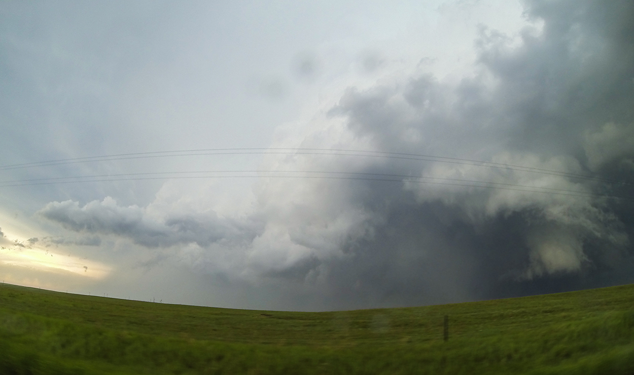
7:40 PM - 11:00 PM: The North Platte river valley provided a wonderful vista overlooking Bridgeport and the escaping supercell -- complete with beautiful laminar layers and sporadic lightning bolts. Rather than head straight for a hotel, I decided to enjoy the last light soaking in the cool outflow breeze and getting a final timelapse. While sitting off the highway leading into Bridgeport, a farmer stopped to check on me and chatted for a while. We went through the standard chaser/local protocol: me explaining my storm chase hobby and him commenting on how far I'd traveled and giving a local weather story (a hailstorm that once polished telephone poles white). As the conversation was winding down, a beatific scene stretched before us in the gathering twilight, the old farmer swept his gaze once more over his hometown and declared, "I hate everyone in this town."
Recap, Filmmaking Notes, and Lessons Learned
- I think it's fair to say that this day lived up to the hype. Despite seeing two beautiful tornadoes, the snap decision at the Burns, WY exit still stings -- costing me perfect position on the gorgeous Carpenter tornado.
- The southern cell's multi-meso structure (or perhaps it was multiple-supercell complex) is absolutely fascinating. Check out Don Burgess's talk from the 2018 Severe Local Storms Conference, complete with mobile doppler animations and discussion about the boundaries that were operating during the triple-meso phase.
- Chasing solo is really a different experience than chasing with Toni -- I totally prefer having Toni there.