Date: May 9, 2015
Time: 5:45 - 9:30 PM CDT
Place: Meade, Minneola, Greensburg, KS
Distance: 836 mi (206 positioning, 123 chasing, 507 to home)
Camera: T3i, GoPro3 Silver
Warnings: SVR, TOR
Rating: S4
The Chase
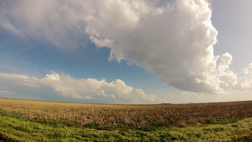
8:02 AM: Hello morning convection, my old friend :( Usually I love the sound of rumbling thunder, but not now - after everything 2015 has done.
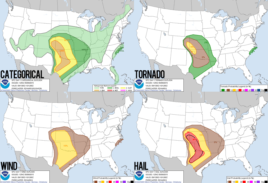
8:15 AM: So we should have been waking up in Woodward, OK right in the middle of at least a moderate risk (SPC issued a relatively rare day 3 moderate), but this morning convection downgraded things to just an enhanced risk. Today was supposed to be "the day" of the 3 day trip. The upper level system is pivoting into Colorado today, which will spawn a lee surface low in Colorado. Good shear across the region (maybe some veer-back-veer), but instability is the big open question now.
11:30 AM: About to try our a little diner in downtown Woodward (Polly Anna Cafe). Moderate rain is finally about to end here, but I think all of Oklahoma is out for storms later - just too much overturning of the atmosphere this morning.
12:20 PM: Left Woodward a few minutes ago, heading to Balko, OK in the panhandle. That marks the edge of where the morning storms passed. I'm thinking there, and to the north and west will be our target today.
12:55 PM: Tornado Watch: east Colorado / west Kansas.
1:41 PM: Just arrived at the Hwy 412/83 intersection smack in the middle of the OK panhandle. Nothing here but a gas station - and quite a few other chasers. Sun is now fully out and surface winds are screaming from the south. I think we are getting air mass recovery!
2:14 PM: Southest Colorado looks like it could be a good target - surface low and under the left exit region of the jet streak. But we are 3 hours from there. I think we'd miss the earlier show there, and then miss the later show here. Ugh I always do this when we sit in one place for a while.
3:27 PM: Just left the Balko gas station, heading north towards Liberal, KS. The dryline is still to our south, but I want to get a little further downstream from it as it arcs northeast - storms will probably be cruising today.
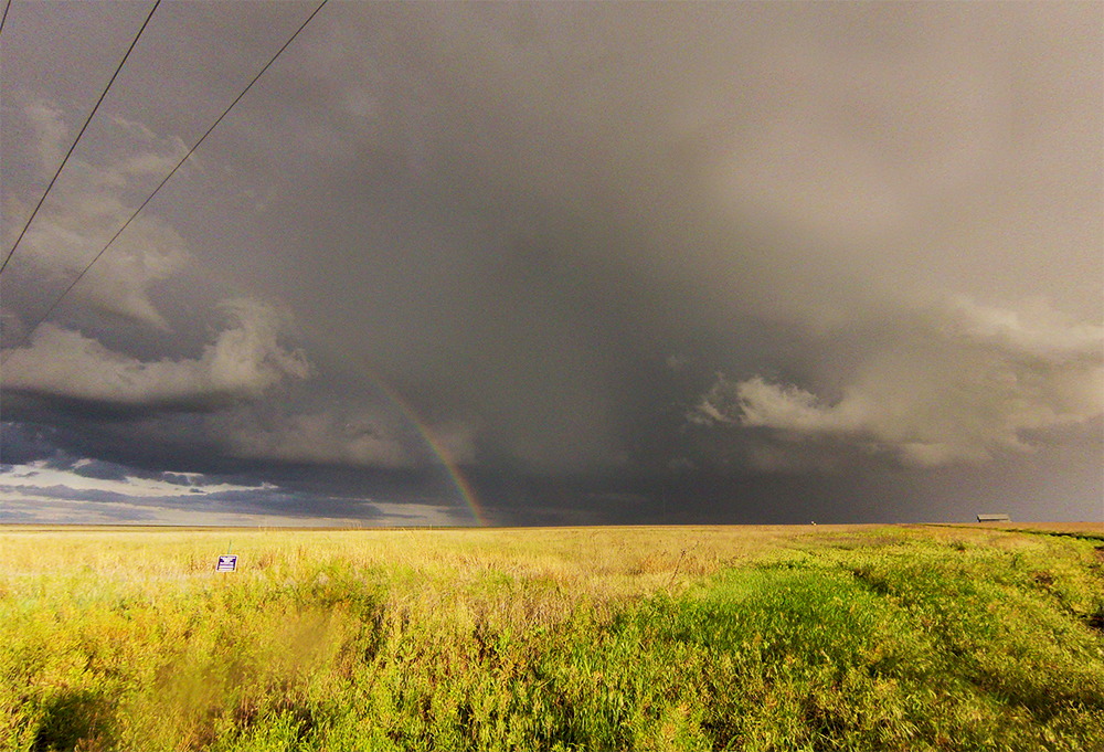
4:01 PM: We're a little north of Liberal now at the 51/83 intersection. Of course, a storm near Eads, CO is starting to take shape. But we would never catch that. It's so hard to stick with my target when nothing is happening here yet.
5:15 PM: We drifted west and north over the past hour - now near Ulysses, KS. I feel so lost. We drifted up here to stay within striking distance of some blips on the KS/CO border, but those are getting sheared apart. The Eads, Colorado supercell has gone crazy with tornado reports. And to make things worse, dryline cells are just starting to fire back near Balko. I might have done what I predicted a few hours ago (missing both shows).
5:37 PM: Storms are continuing to grow in the Oklahoma panhandle. I'm committing to those; I need a definite target after all this uncertainty. Backtracking to Liberal!
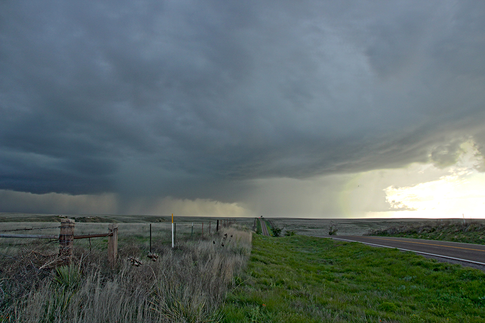
6:11 PM: Cells are looking messy still, so we still have time to get there and they are heading into a good environment. Blasting east on Hwy 160 towards Plains, KS.
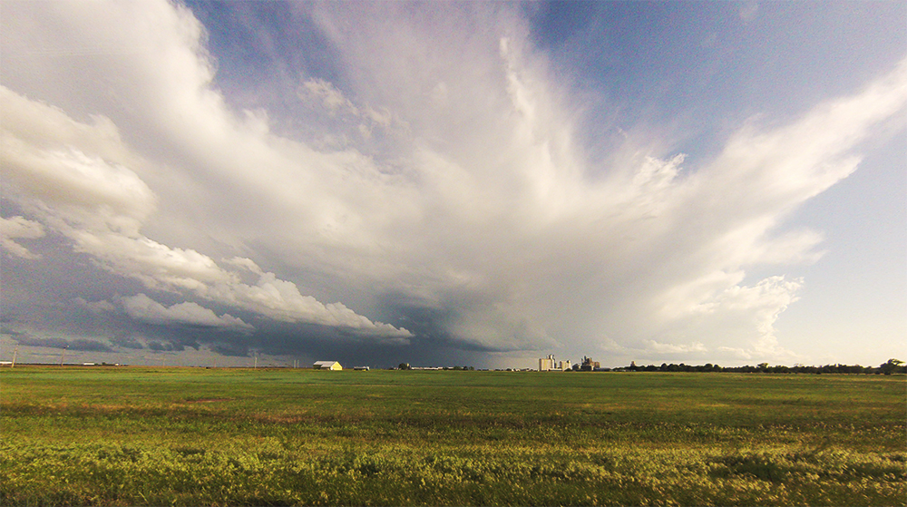
6:33 PM: Gassing up in Meade. Briefly considered dropping south out of town to intercept, but I'm gonna watch them come up to us on the east side of town. Longer opportunity for timelapse, and the storms still need to mature.
7:00 PM: Been timelapsing for the last 15 minutes, but we are looking south into the forward flank of the storms - not the most interesting vantage. Looks like there are a couple updrafts that are fighting for dominance.
7:10 PM: Moving east to get back out of the rain. Looks like two cells are fighting it out now. Both got put under a Severe Warning!
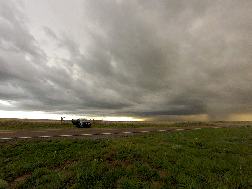
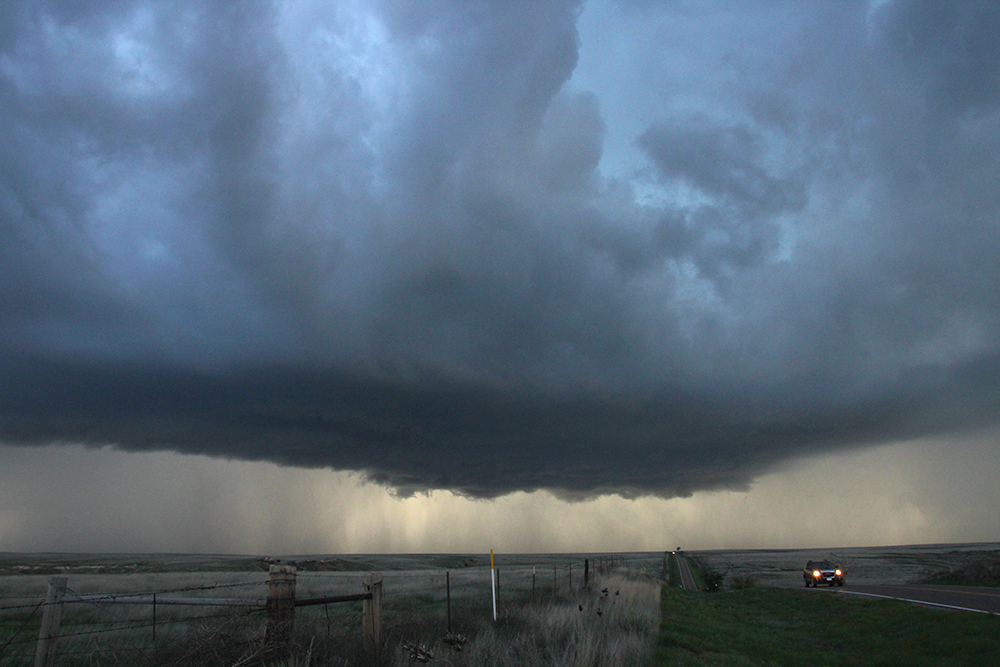
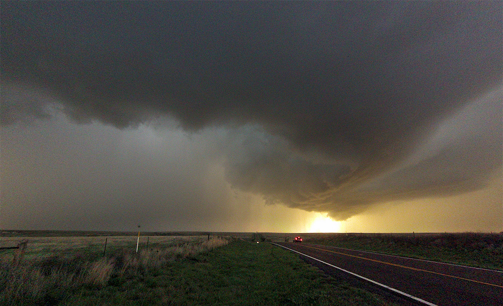
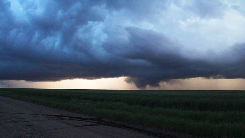
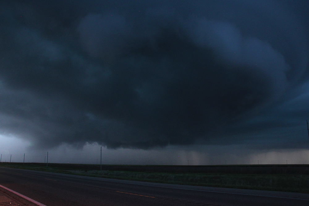
7:25 PM: Awesome vantage point near the 160/283 intersection looking back to the WSW. The northern cell is really starting to take off - even with the southern cell raining into its updraft.
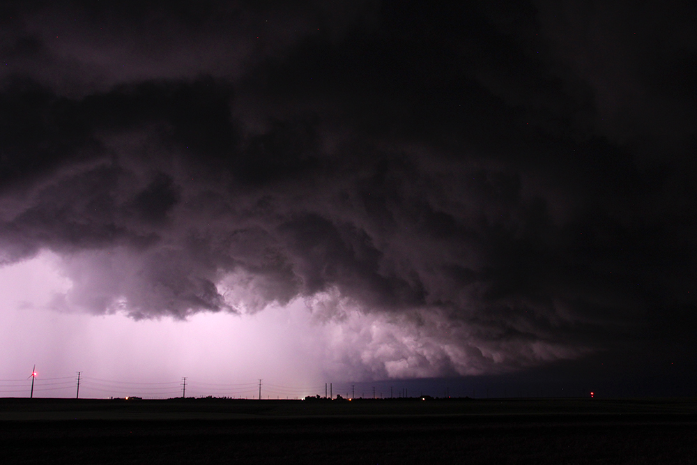
7:33 PM: RFD horseshoe forming up on the northern cell. We are in perfect position.
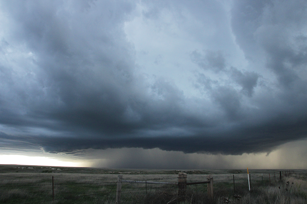
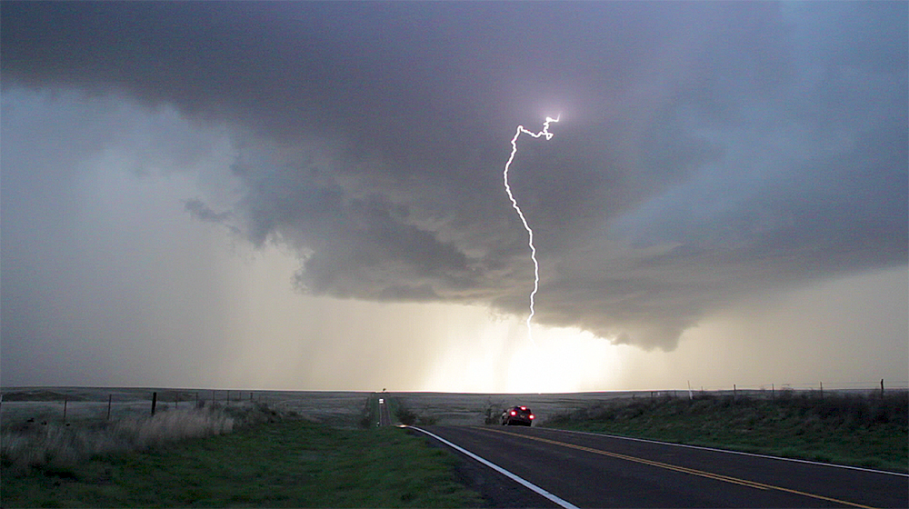
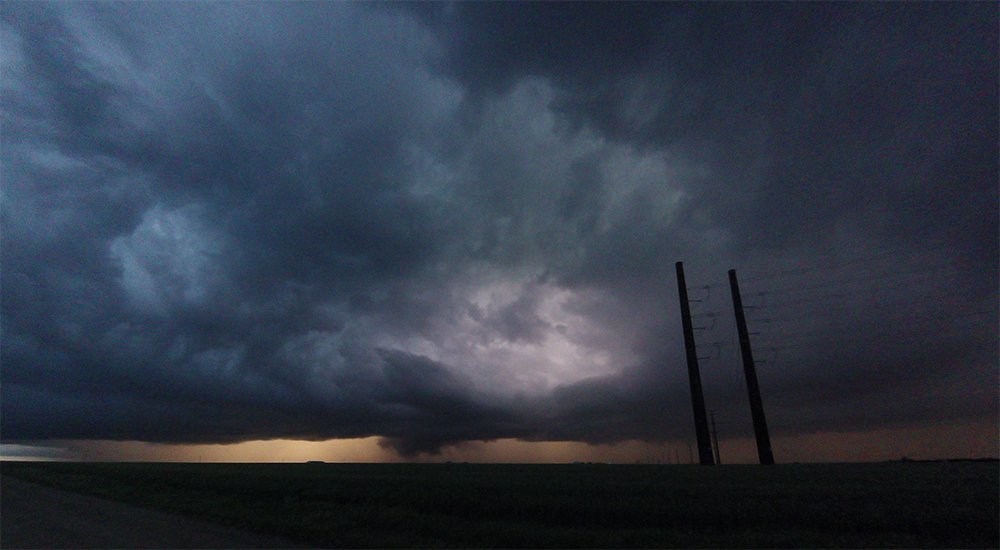
7:40 PM: What an amazing show! RFD has formed a perfect little donut of rotation. Lighting has started going crazy so I am staying in the car and letting the cameras lapse from their tripods.
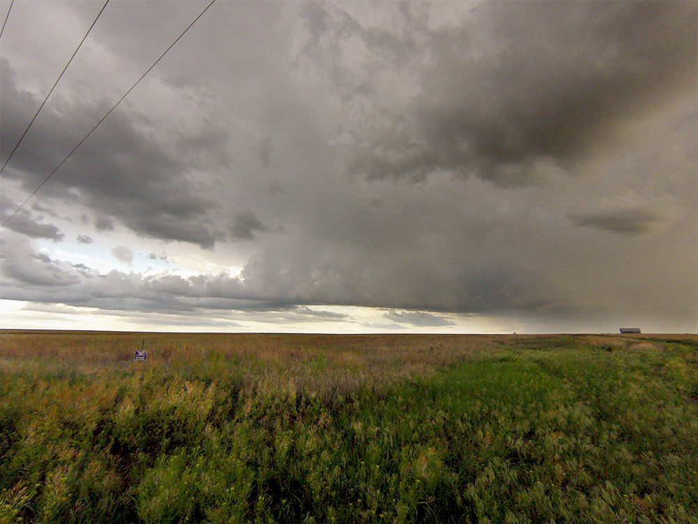
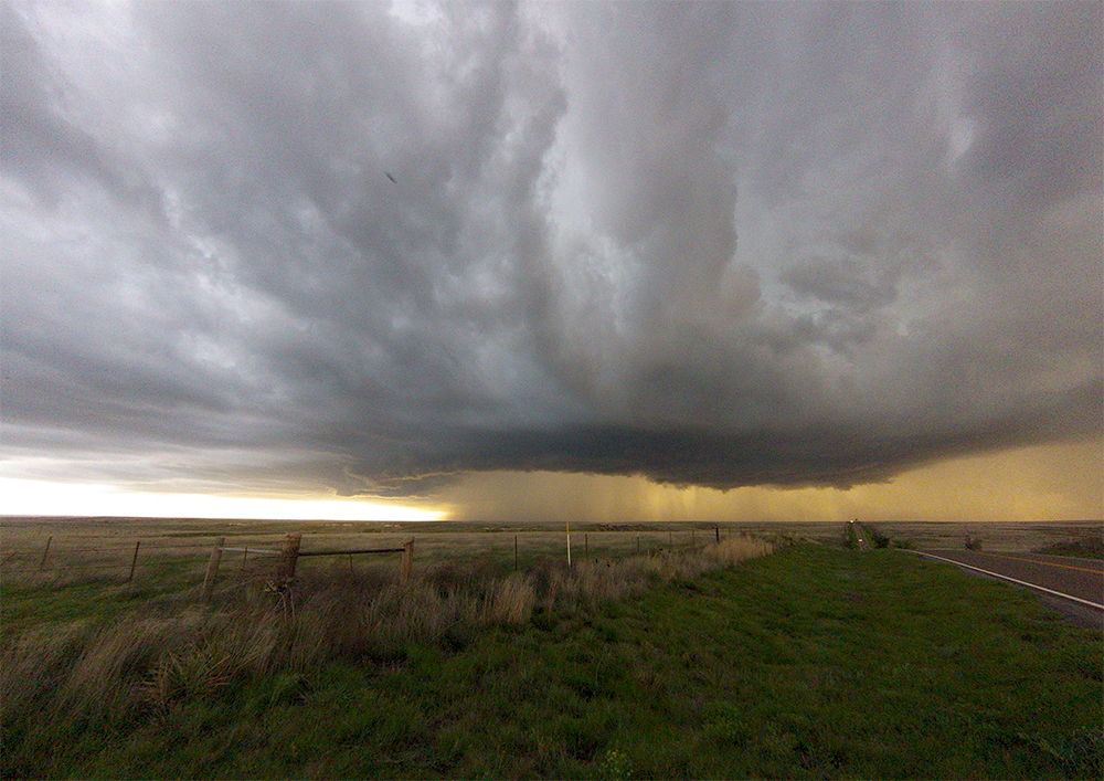
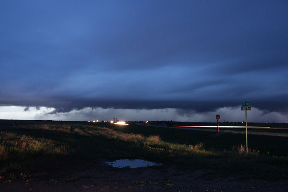
7:45 PM: We gotta bail north through Minneola to stay in front of this thing. TORNADO WARNING JUST HAPPENED! We can do this!!
7:55 PM: Sirens are sounding in Minneola! We've temporarily lost visual in the forward flank core, but Hwy 54 heads NE and should be the perfect highway to parallel the storm. Couldn't ask for better roads (lookin at you Texas).
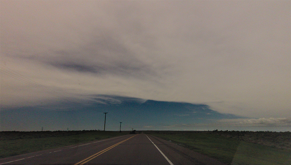
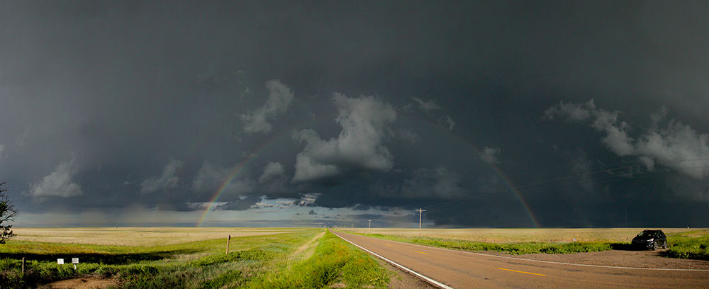
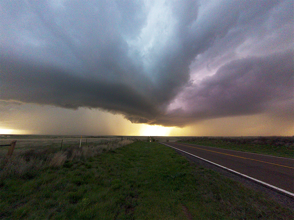
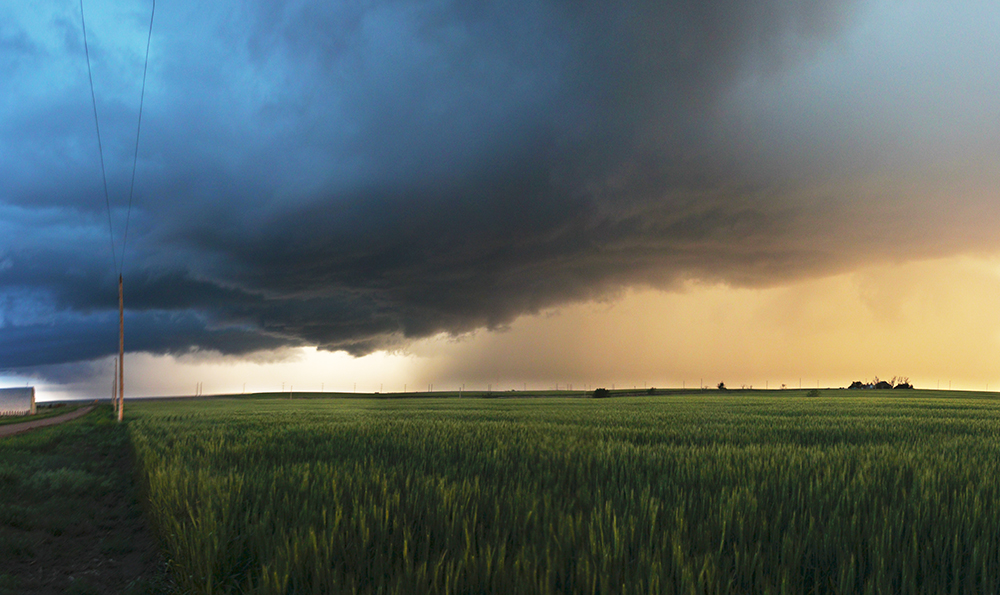
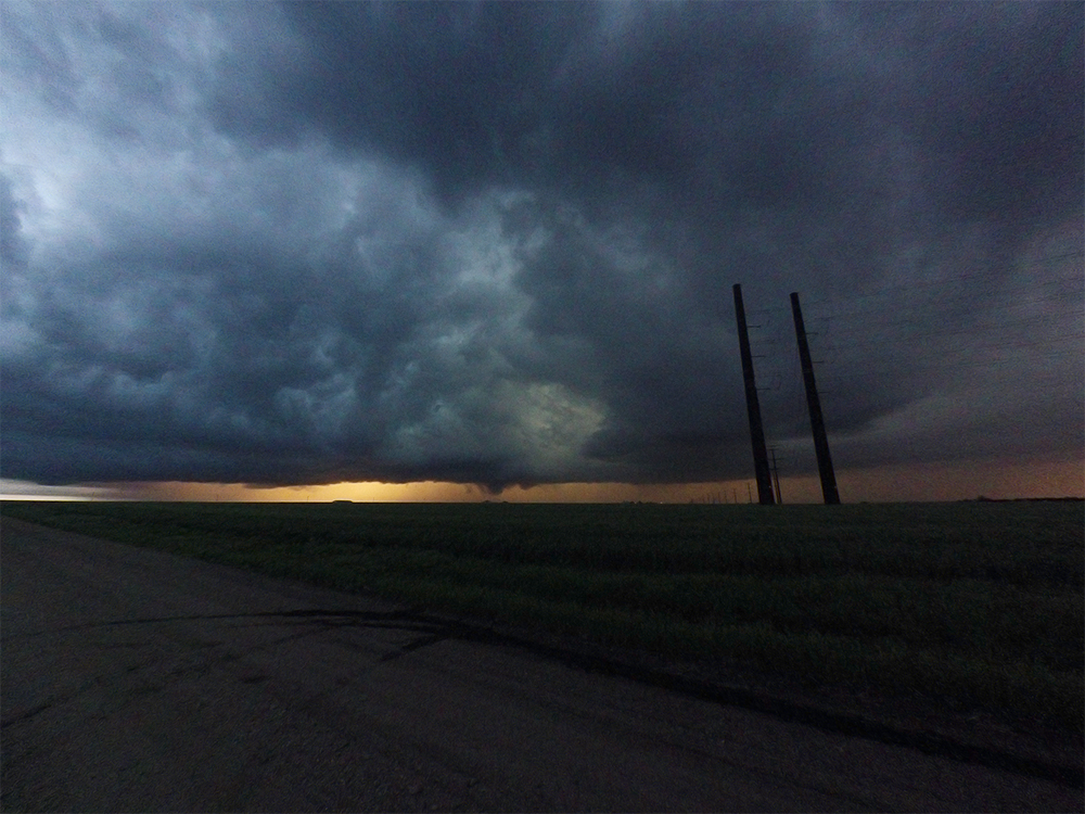
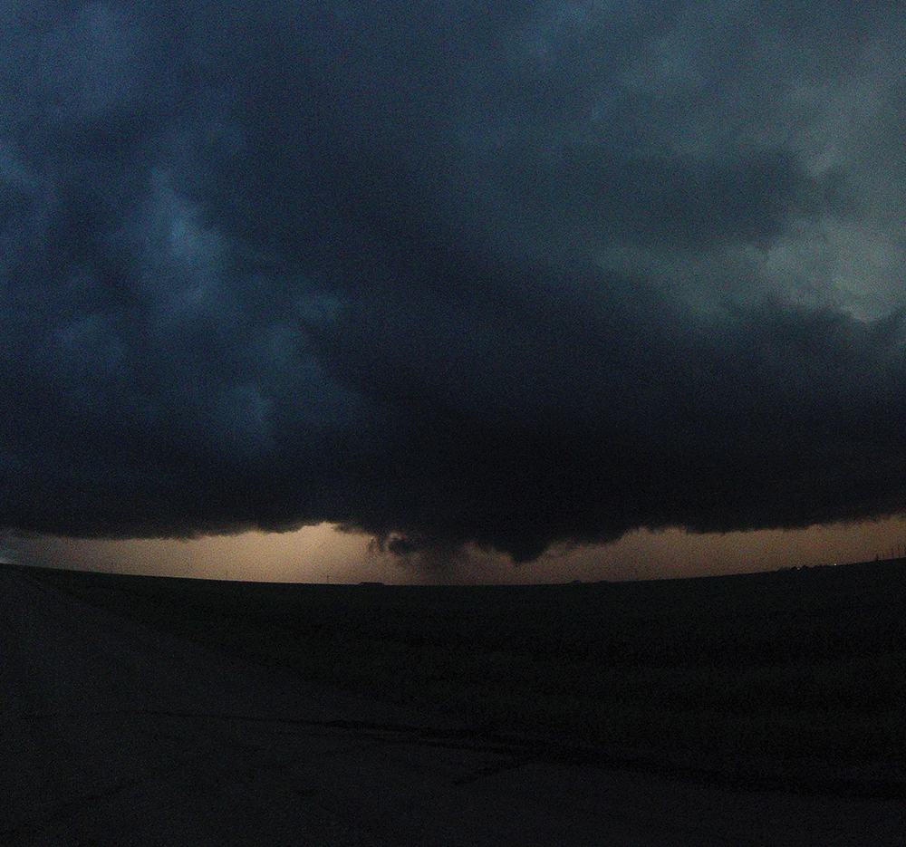
8:08 PM: We just about had a tornado on the ground near Bloom. Great lowering and rotation. This orange and blue contrast from the setting sun is like nothing I've ever seen.
8:17 PM: Chaser hoard is getting thicker. Heading up 54 to get out of the precip again.
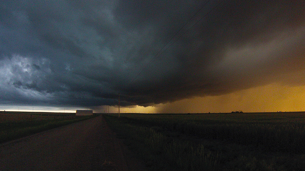
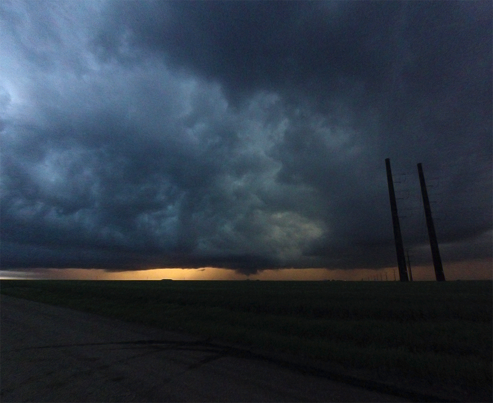
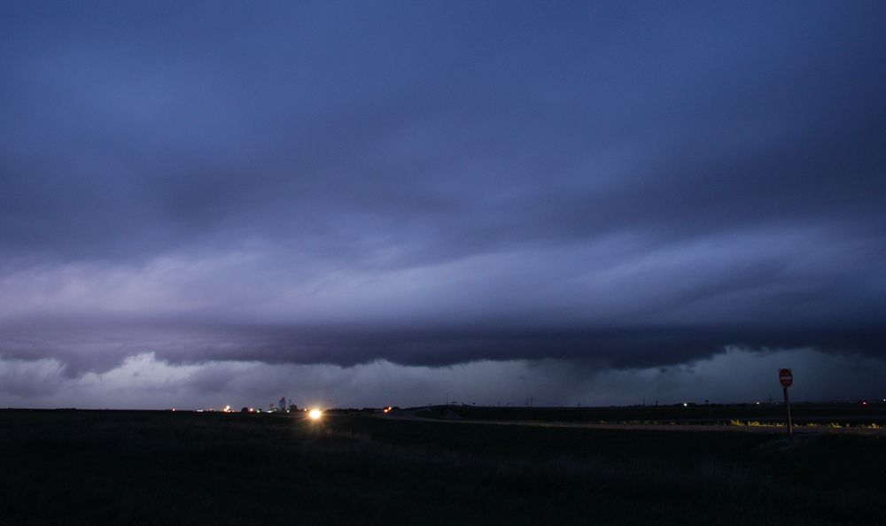
8:25 PM: We're right between Kingsdown and Bucklin now. There's no longer a warning but this thing is really wrapping up again.
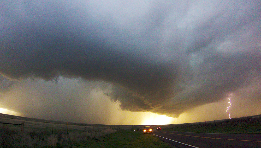
8:34 PM: Meso is on top of us! I let it get too close!
8:38 PM: We escaped further east on 54. Amazing curved meso crossed right behind us. Didnt have the best opportunity to film it given the traffic and darkness. Wow what a rush though!
9:10 PM: Well, the chase is done. Watching some distant lightning from south of Greensburg. Getting in that last relaxing chase moment before we start the long trek to Liberal.
11:22 PM: Late late supper at the Liberal Applebees, here we come. Not quite a steak-worthy day, but definitely my most fun chase of the year so far!
Recap, Filmmaking Notes, and Lessons Learned
- Well, we missed one of the best shows of the year, and one of the most beautiful displays I've ever seen in the Eads, Colorado rainbow-nado. I didn't recognize the potential in that region early enough to make a play on it and that will always take something out of this day.
- Airmass recovery in SW Kansas wasn't as robust as I initially thought it'd be, and it hindsight it's because the recovery air was being drawn up from the overturned TX panhandle environment. Should have realized this sooner.
- In the twilight, I let the unwarned mesocyclone get a little too close for my safety margin. I let my guard down due to the lack of warning.