Date: May 7, 2016
Time: 12:00 - 6:30 PM MDT
Place: Kiowa, Wray, CO
Distance: 688 mi (363 positioning, 237 chasing, 88 to hotel)
Camera: T3i, GoPro3 Black, Sony RX100ii
Warnings: SVR, TOR
Rating: S5
The Chase
6:40 AM: Toni isn't too pleased to be out the door this early on a Saturday morning!
7:04 AM: With the traditional Chick-fil-A breakfast in hand, we are getting on I-25 north targeting northeast Colorado. Upslope events like today always seem to start earlier than I anticipate, so hopefully we're up early enough.
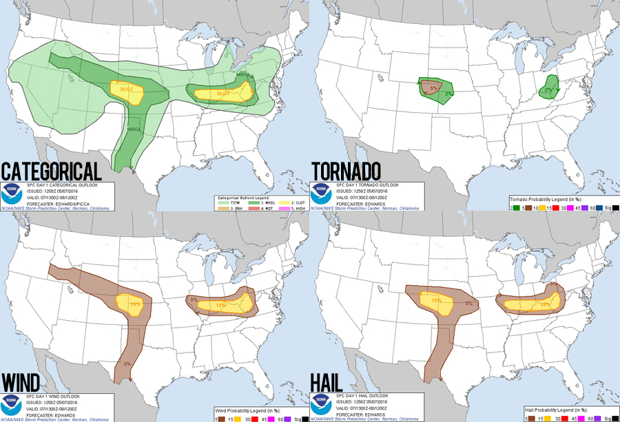
10:07 AM: Gassing up in Trinidad, CO and the forecast looks on track. It looks like two separate arcs of storms might form and move NNE, one starting near Denver and one further east along a little quasi-dryline. Hopefully individual storms in these bands will become supercellular. My main concern is that lower dewpoints (low 50s generally) may result in storm bases too high for tornadoes.
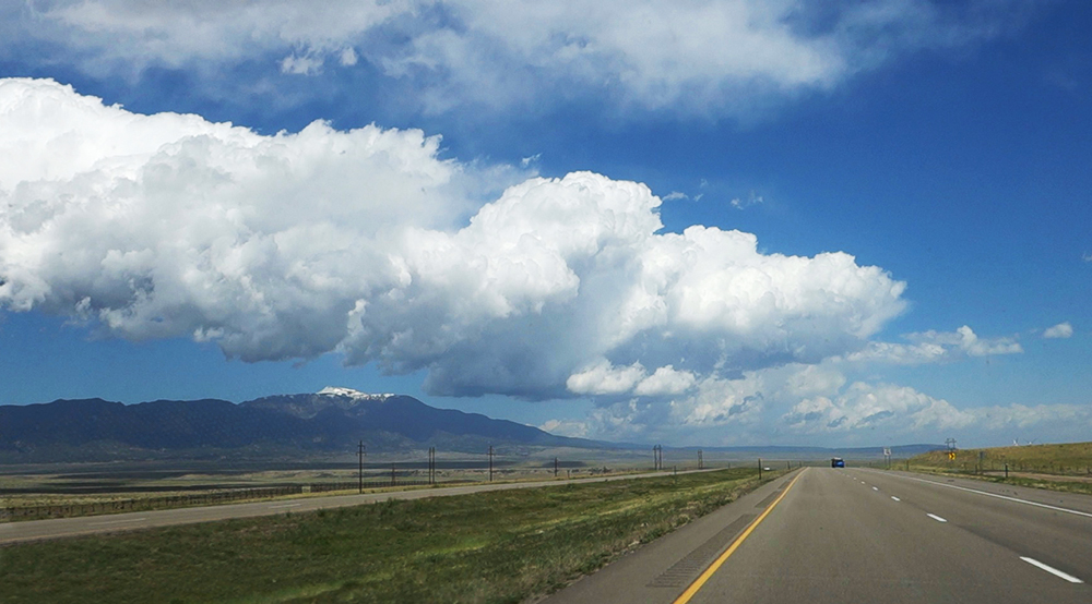
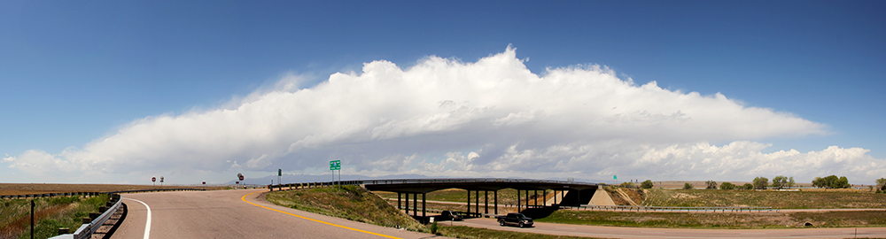
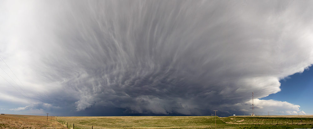
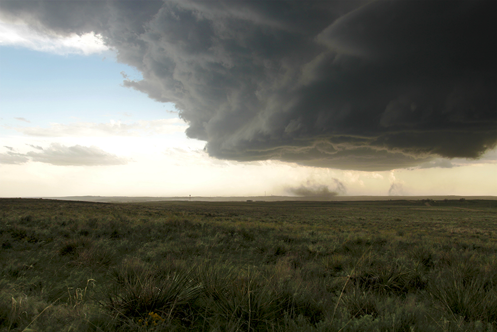
11:22 AM: Made a quick stop south of Pueblo to get a panorama of the beautiful clouds building off the foothills. These could be our storms in a couple hours.
12:00 PM: Fast pit stop in Fountain, CO - I thought there was chaser convergence at this gas station. But it's actually where everyone parks to do some Saturday fishing in Fountain Creek.
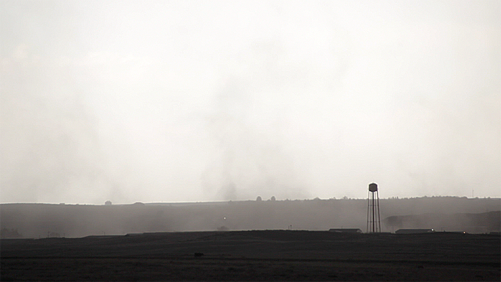
12:04 PM: Weird. They just blew the warning sirens here in Fountain. A cloud base is building to the north, but it's definitely not severe yet - not even a storm.
12:12 PM: We decided to swing around the east side of Colorado Springs to follow this storm base and see what it can do.
12:28 PM: Jeez the stoplights around Peterson AFB were super frustrating. We fell a decent ways behind this little cell, which is looking pretty good despite the cold air. Hopefully we can catch up on Hwy 24.
12:32 PM: Nice, Tornado Watch 143 just went of for all of NE Colorado!
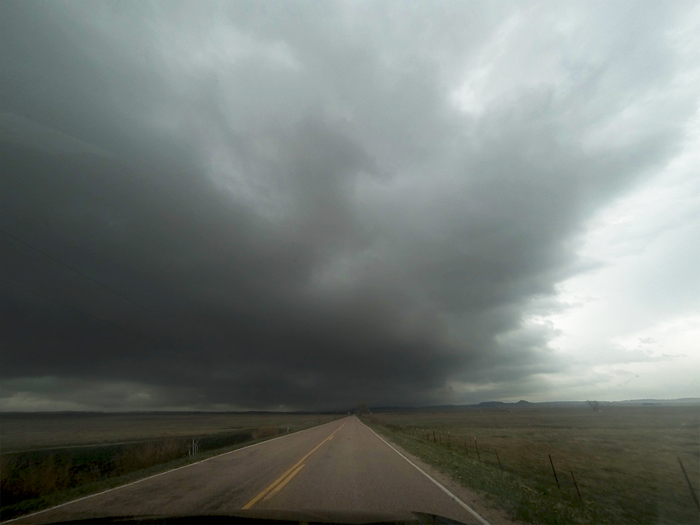
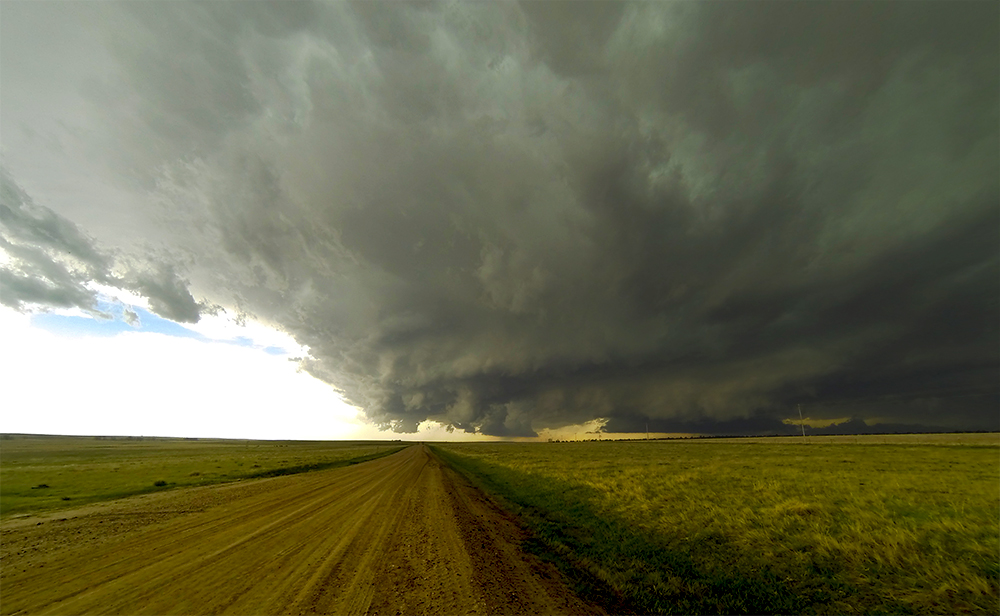
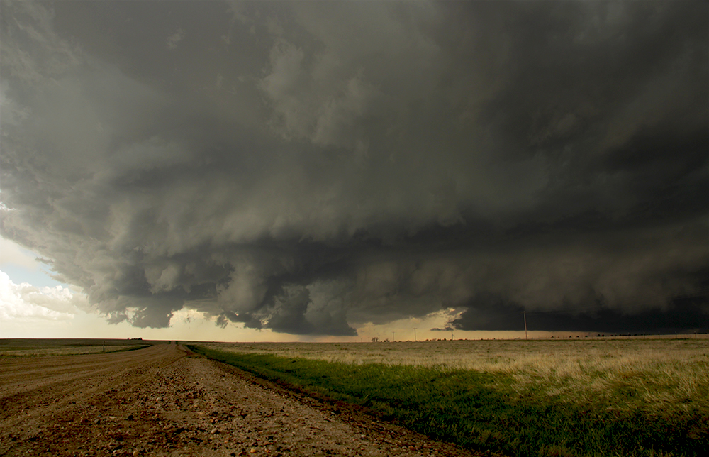
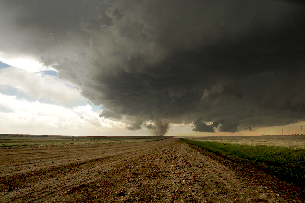
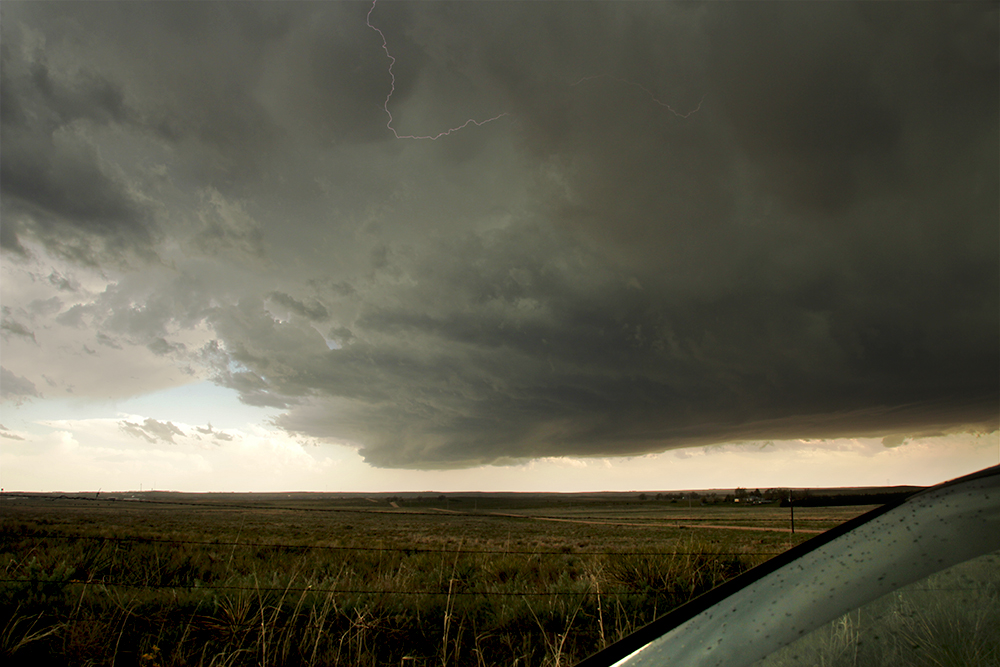
12:44 PM: Passing the spot were we observed the Elbert rope tornado last year. We are heading north along Elbert Rd. and will have to core punch this NNE moving storm to have any chance of getting out in front. Gonna be tough - once we get in the precip we might not have enough speed to pass it.
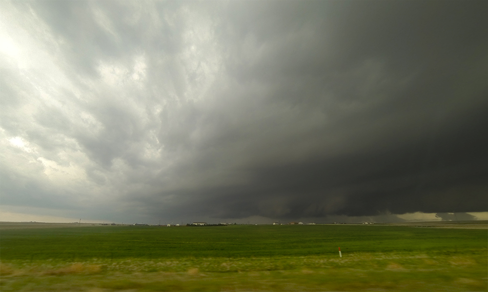
12:56 PM: Are you kidding me?!?! Just about to drive into the rear rain/hail core and the temperature is 46°F. Despite that, a TORNADO WARNING was just issued for our storm!! How in the world? To be fair, we are in the cold RFD just a couple miles SW of the couplet. Maybe the inflow is warmer?
1:05 PM: Toni thinks she sees rotation about a mile to our east, which is where the couplet is. We are just about to enter Kiowa, CO - no time to stop and look if we are ever gonna pull ahead of this.
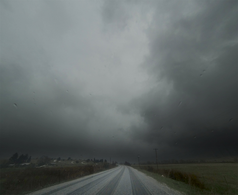
1:18 PM: This is the loudest hail core I've ever driven through; ears are ringing. Hail is quarter sized at worst, but there is a TON of it. Almost out though, I can see the clear air ahead! I'll admit, this is not something we would have done a couple years ago...
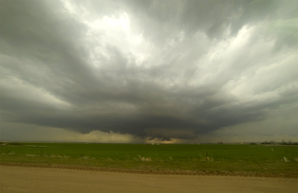
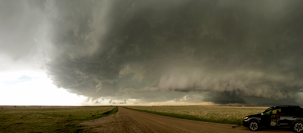
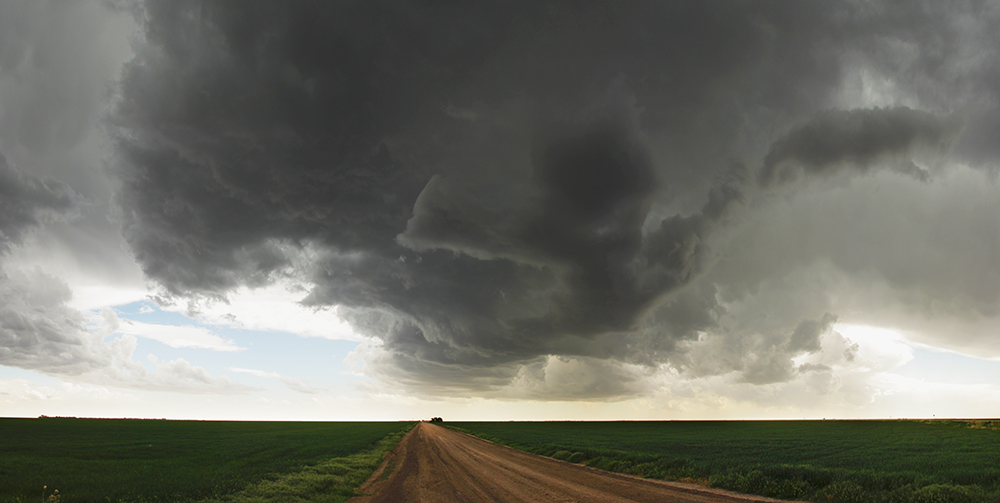
1:25 PM: FINALLY we are free from the precipitation. Stopping for about 1 minute to observe - storm looks pretty cold and outflowy now. I can hear the hail roar in the field from the approaching core.
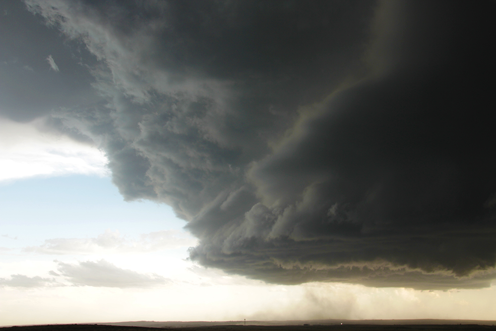
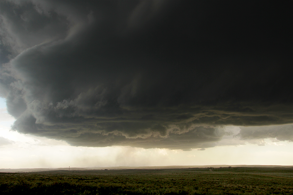
2:06 PM: We've stair-stepped north of Byers now (same spot where we watched the May 21, 2014 HP) for a last look at this very shelfy storm. A local lady stopped and asked for a report. "I came to Colorado to get away from these storms," she said driving off. Major deja vu, I feel like I've had this exact encounter before.
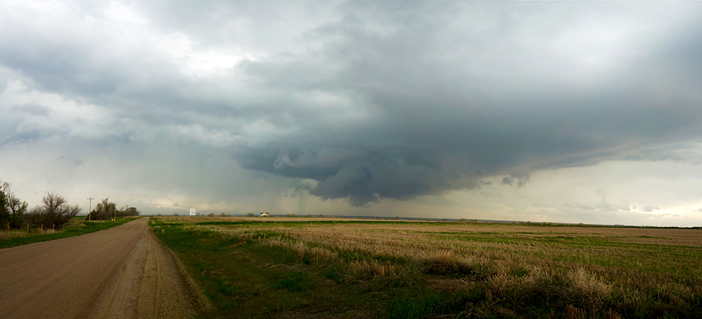
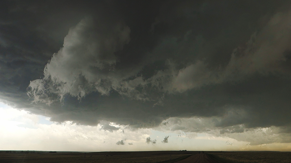
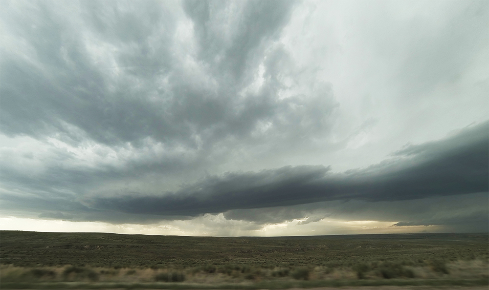
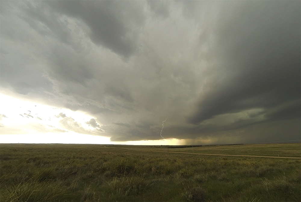
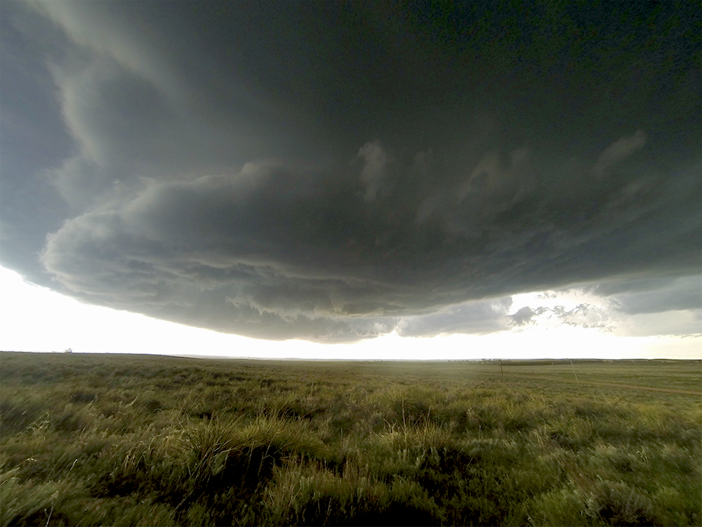
2:28 PM: The next storm coming up from the south has a weird orientation on radar. But it looks interesting in person. Getting some slider-timelapse of the turbulent motion on the leading edge of the cell. Not quite a supercell but very pretty.
2:38 PM: Big ol' gustnado to our south!
2:47 PM: As we were escaping east on Hwy 36, the gust front passed over and we had a direct hit from a gustnado full of tumbleweeds (called a tumbleweednado in the industry).
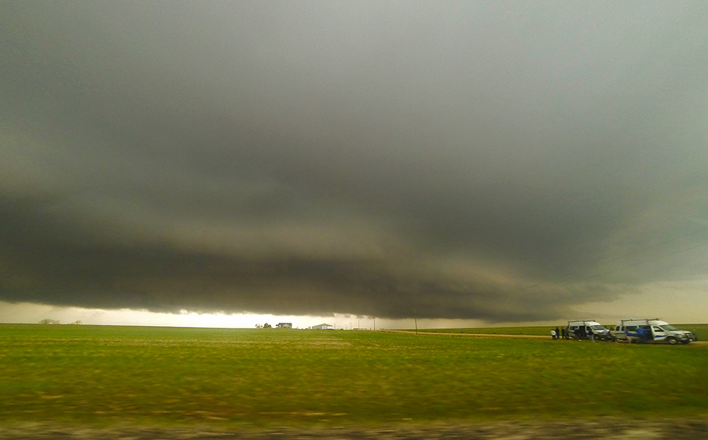
3:16 PM: Well crap. Our original storm went on to produce a tornado close to Ft. Morgan. Reports just coming in now. We, on the other hand, have abandoned that arc and are heading way out east to a new batch a cells closer to the KS border. This will be further from the surface low; I hope the dynamics are still sufficient for tornadoes.
4:10 PM: Just passed in front of our new target cell east of Joes, CO. Base is disappointingly high - looks pretty insignificant right now.
4:22 PM: Learned a new chaser skill. The Coop gas pumps you see in really tiny towns usually have super old pumps without credit card readers. But, at least for this one, there was a separate reader at the end of the pumps - hard to notice. I always assumed I was out of luck for those pumps.
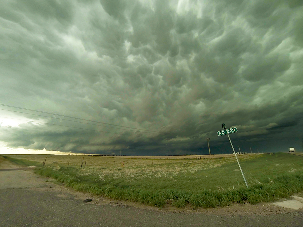
4:40 PM: Headed north towards Wray, CO now. Hopefully these cells to our west can mature more.
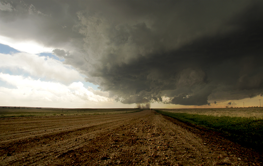
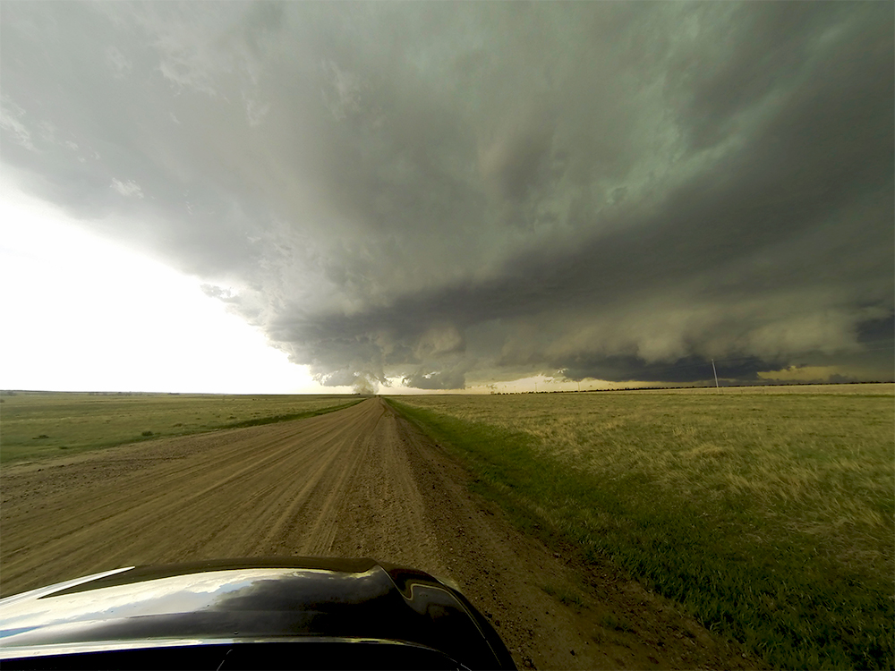
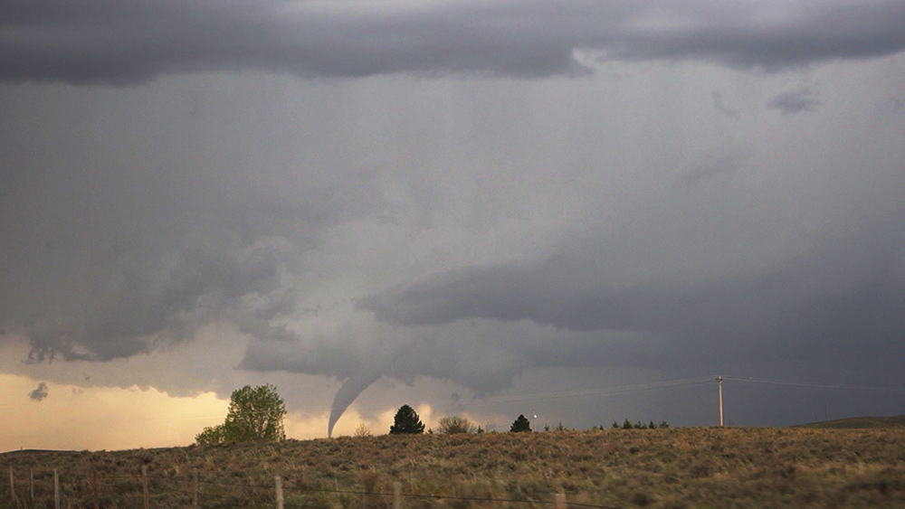
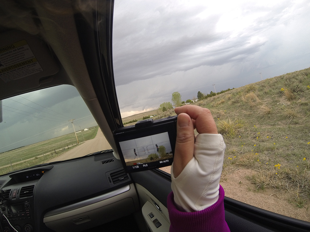
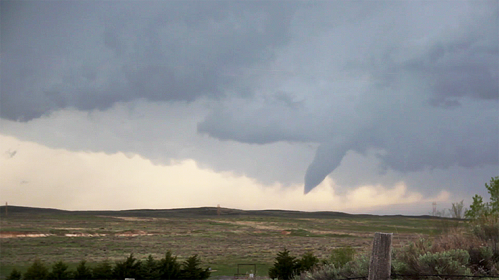
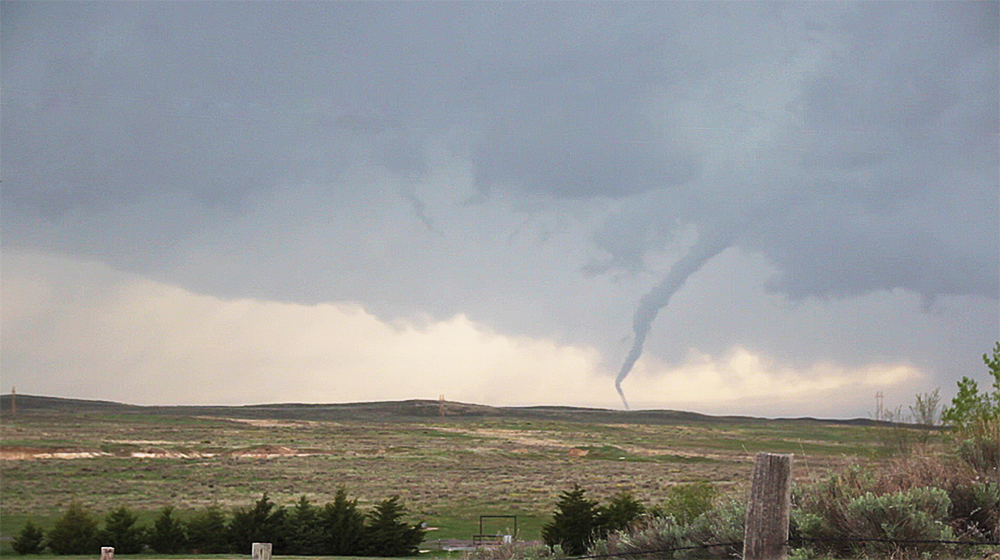
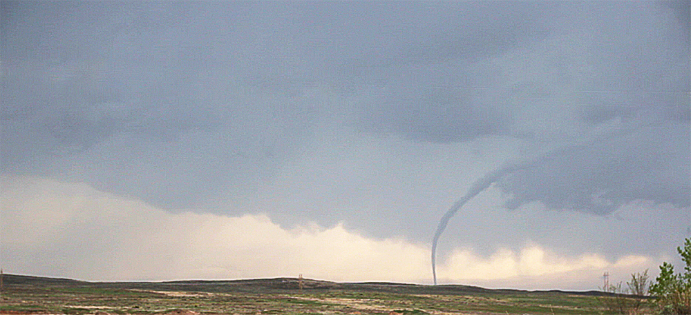
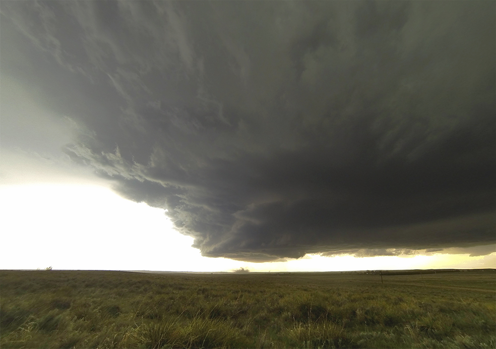
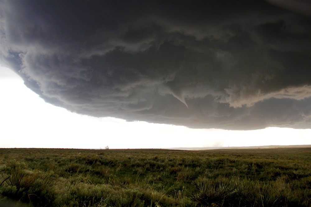
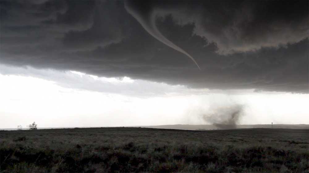
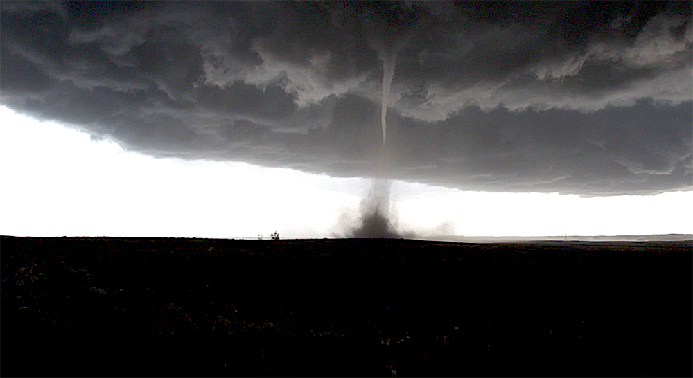
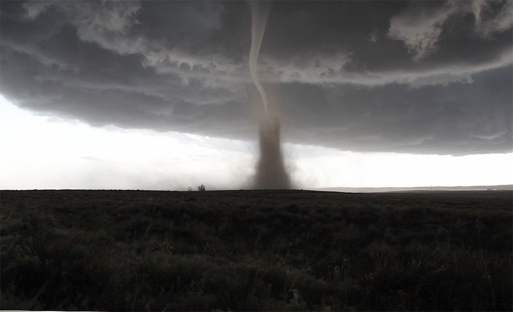
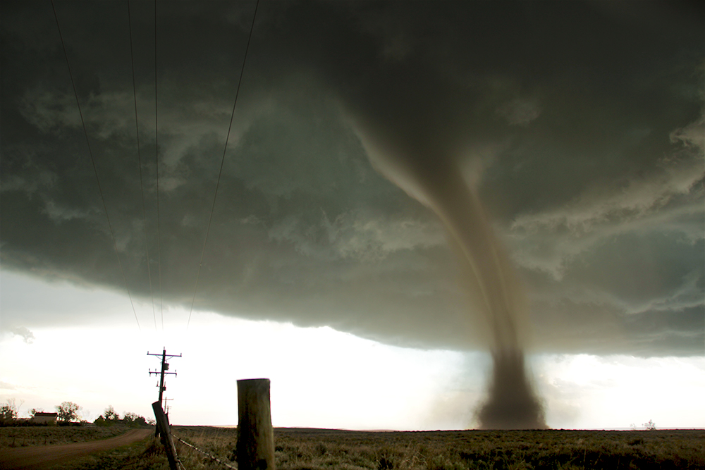
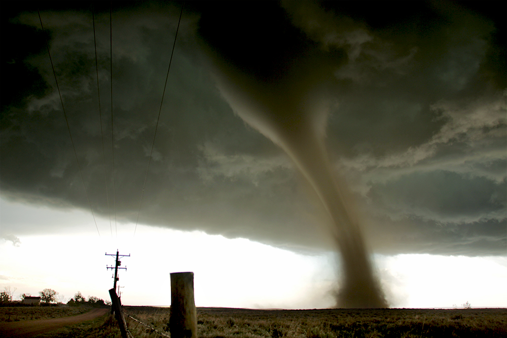
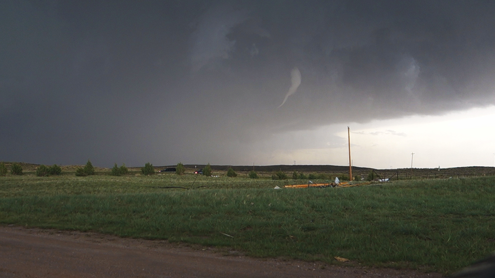
4:58 PM: Surprise funnel dangling out of a storm to our west!! We just left Wray heading north - looking for a good view. The funnel looks like it's about 6-10 miles to our WNW, but it's hard to judge distance from here.
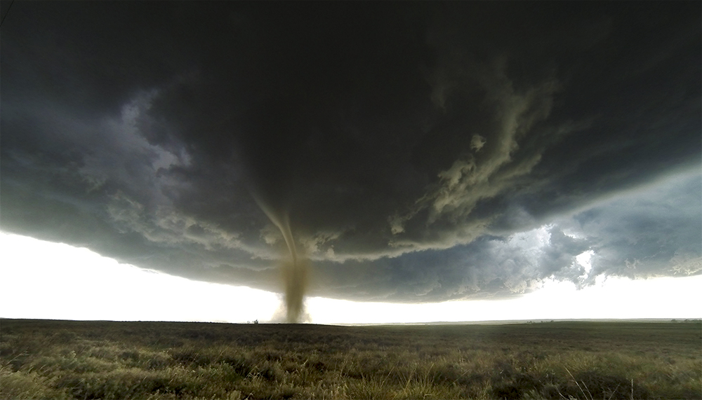
5:06 PM: Woohoo!! The funnel fully condensed into a beautiful elephant trunk for about 2-3 minutes. Got some timelapse and slider shots. What a successful day!
5:15 PM: I'm getting really interested in the strengthening cell to our SSW now. We are still at the location where we watched the elephant trunk. Perfect vantage point looking south. Just gonna stick here and do timelapse.
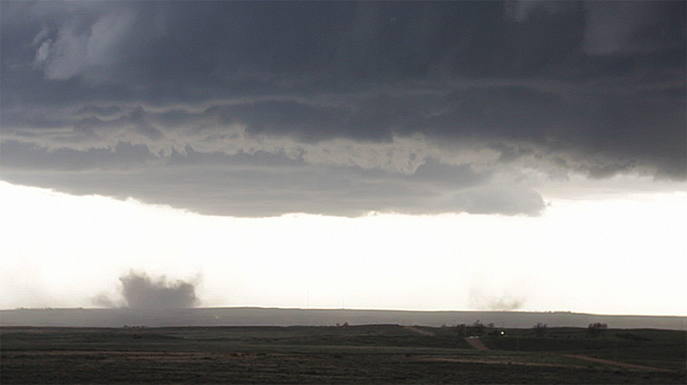
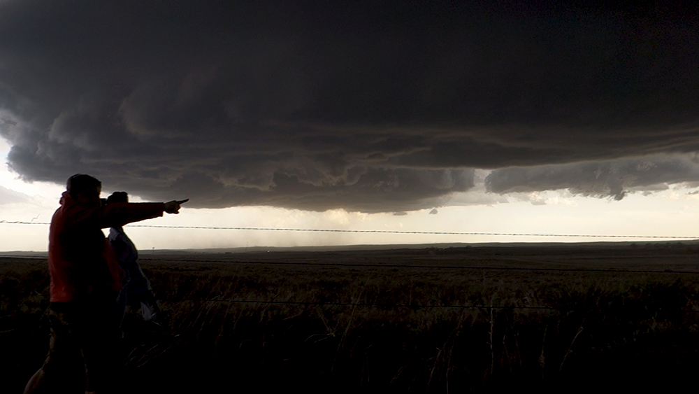
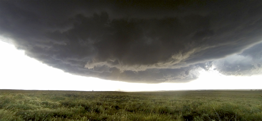
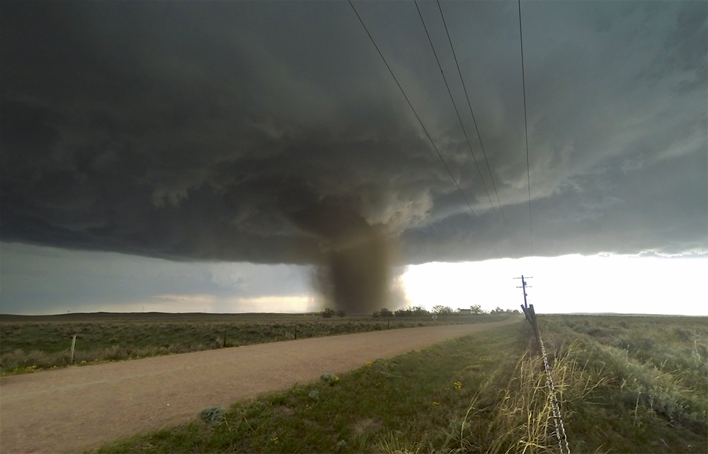
5:36 PM: This storm has organized into a beautiful supercell over the last 15 minutes! We just got a brief, dusty landspout south of Wray - still a good distance away but moving straight at us. Worried for Wray though.
5:41 PM: Another brief spinup very close to Wray. This is getting serious. Major inflow increase. Getting light rain and some hail here but still timelapsing.
5:51 PM: Circulation may be in town.
5:55 PM: ARE YOU KIDDING ME!!!!!!!!!!
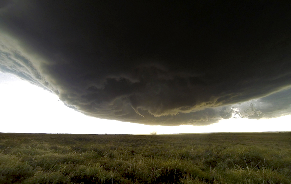
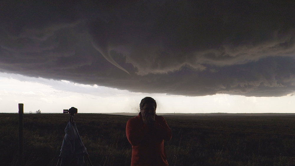
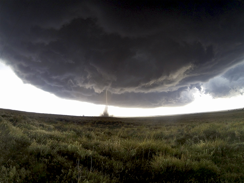
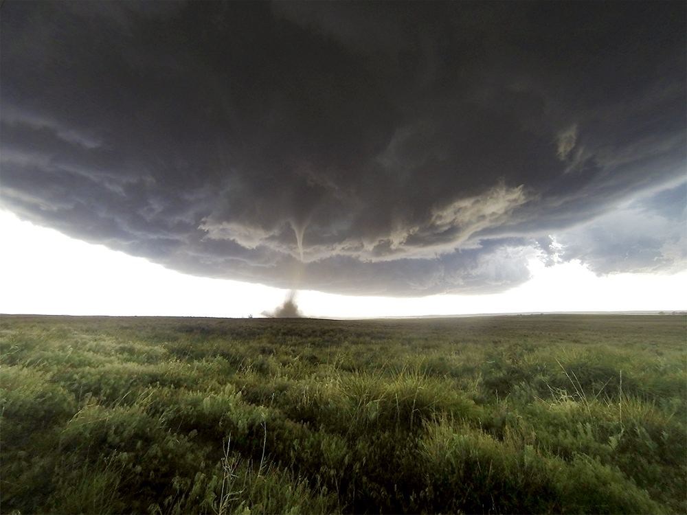
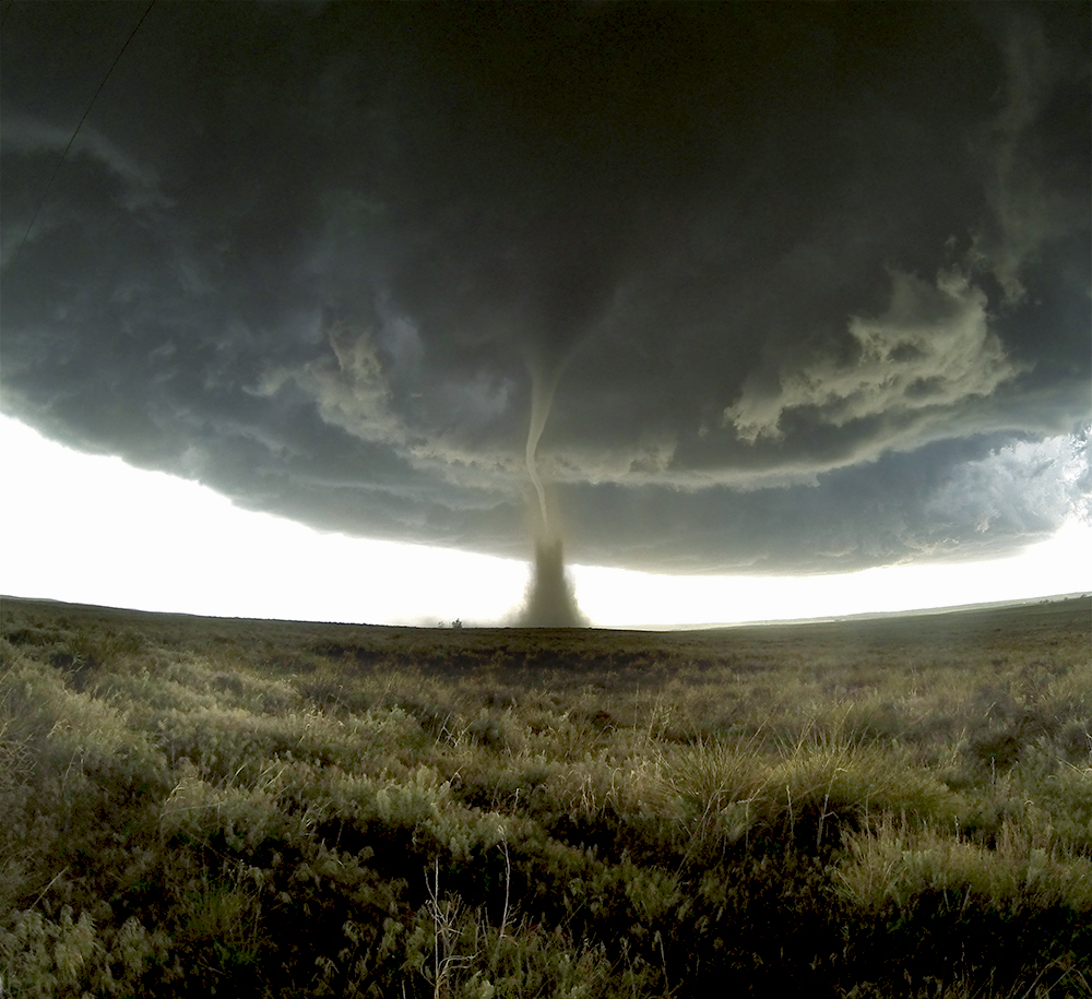
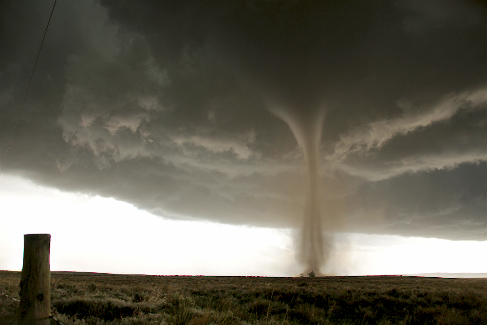
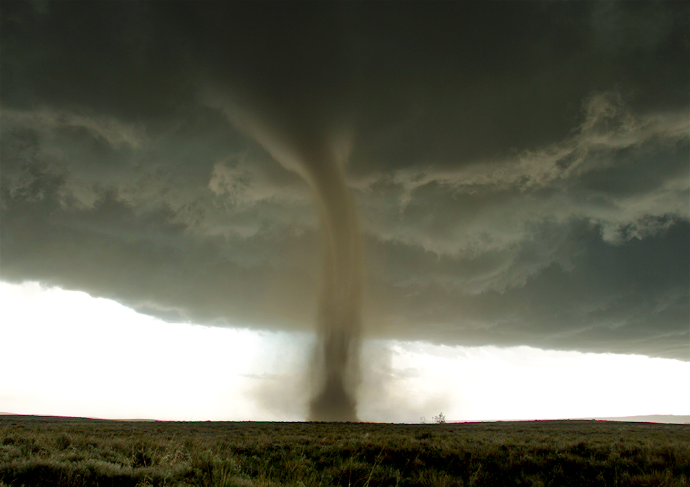
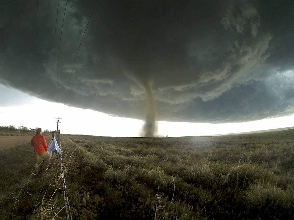
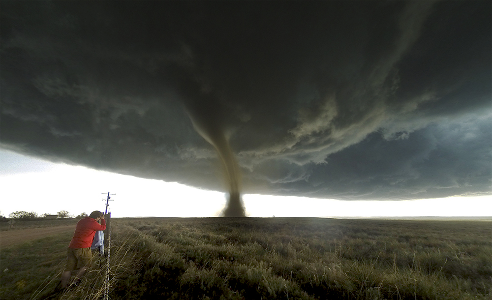
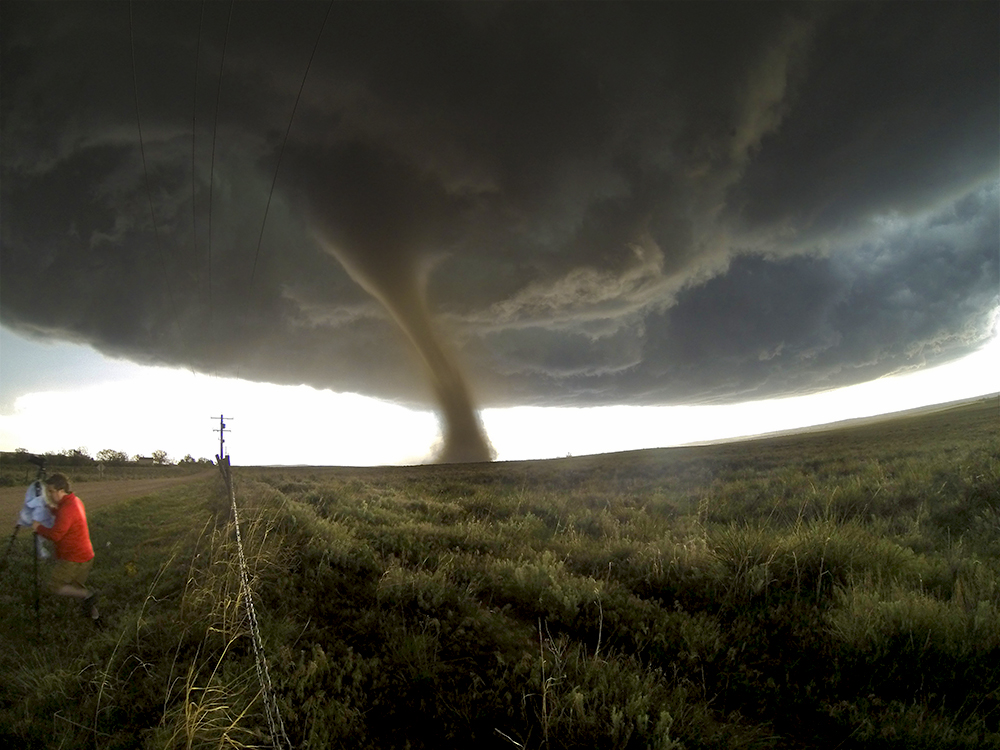
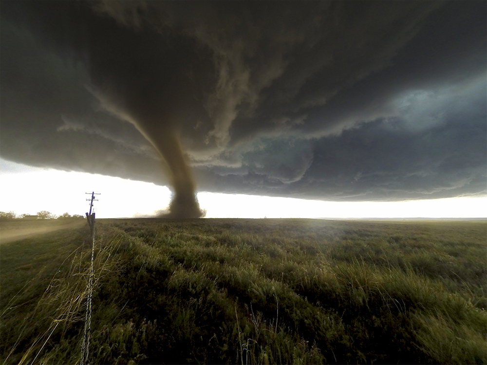
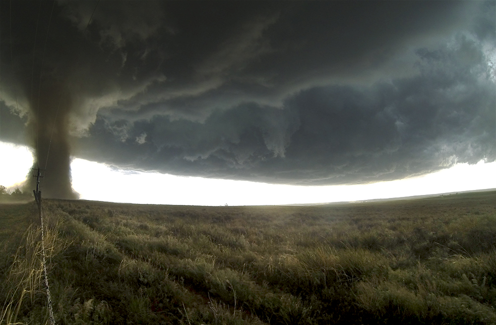
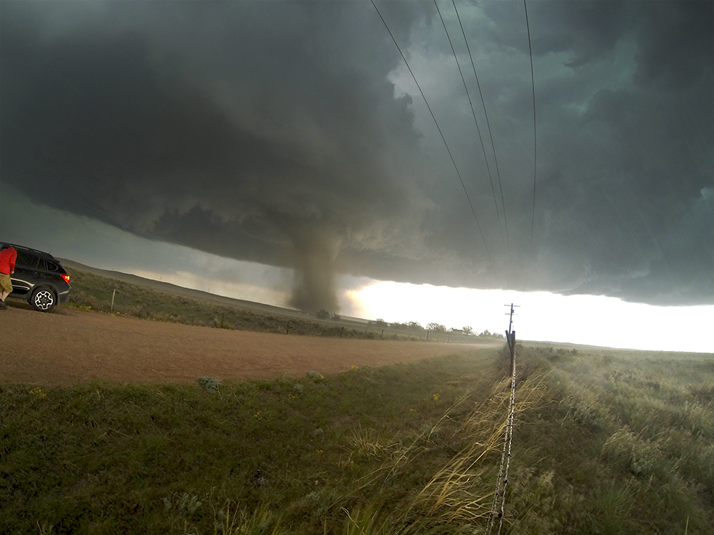
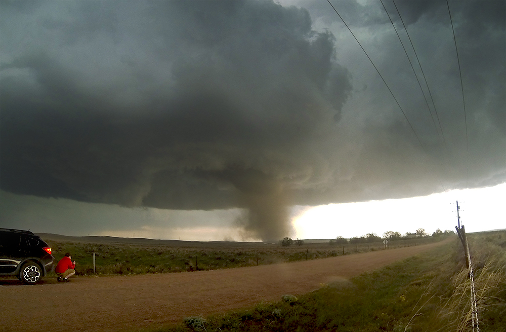
6:20 PM: So I can't even begin to explain what happened over the last 25 minutes. As the supercell was centered directly over Wray, a fresh RFD carved into the updraft and initiated a beautiful laminar funnel with ground circulation. Looked like it was right on top of the gas station we'd stopped at on the north side of town. After about a minute, the circulation increased substantially and started drawing dust up the vortex, with a thin ribbon of condensation in the middle. Very Wizard-of-Oz-esque. Due to some serpentine back-and-forth motion, I flipped the Crosstrek around so it was ready to dash west and south if the tornado got too close.
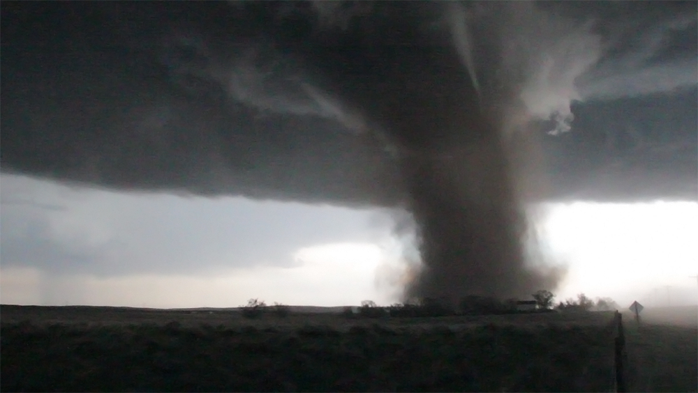
By this time I could actually hear it - a distant jet engine noise. I could hardly believe what I was seeing and hearing, and I started to forget how to adjust the cameras for focus and exposure changes. As the tornado got closer, it leaned northward and I knew it would pass just to our east. RFD slammed us very suddenly; I had been so mesmerized that I wasn't anticipating the onslaught. I took the T3i and sheltered in the lee side of the Crosstrek, staring directly at the beastly, dusty tornado as it passed less than a mile away. My entire field of view was taken up by the tornado, but I couldn't hear it anymore due to the wind whipping at my ears. I couldn't feel anything other than the stinging sand on my legs. It was a bizarre, amazing, one-of-a-kind sensory experience. Unfortunately, I was oblivious to Toni's struggles to load the tripod into the car and get in herself, and she took a body shot from and RFD tumbleweed in the process.
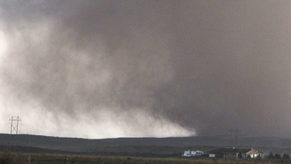
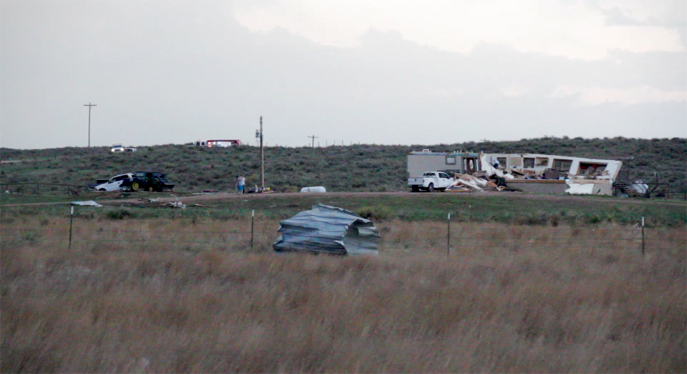
As the tornado passed to the NE, it lost its full condensation, but the motion at the ground was at its most intense. We watched for about two minutes before collecting the GoPro, turning the car around and driving east towards the highway - worried about the houses there. The homes on the west side were ok, but looking towards the east side my heart dropped. What looked like a mobile home had 2 walls missing. I pulled into their driveway, first ones there and panicked about what we might find. As I stepped out of the car I immediately heard and smelled propane - something I had seen dozens of times in tornado aftermath videos but something I never thought I'd experience myself. As I carefully ran up to the house, the family was just emerging from their basement a surreal experience that in a weird way made me feel like I was intruding on some kind of private moment. Thankfully no one had been hurt, but then as I scanned around the yard the heartbreaking realization hit that many of their animals (all of which had names) had been blown out of the shed next to their house. At this point, another chase group in a bigger vehicle pulled up and gave most of the family a ride to town. Another group helped a baby cow in the front year wrapped in barb wire. It was an overwhelming experience. Add to that the fact that the mom of the family hugged us and asked us if WE were ok, it was the most humbling thing I think Ive ever experienced. At this point, Toni and I are too shaken and tired to even think about chasing anymore. We experienced the highest and lowest parts of storm chasing all within 5 minutes. Now all we need is to get to a hotel.
6:35 PM: Another bizarre experience: just used the restroom in the pitch black at a gas station on the north side of Wray. Power is out everywhere.
8:33 PM: Just got to the Goodland, KS Holiday Inn Express. We've stayed here several times before, but somehow this arrival seems different. We didn't talk much on the drive here, turning over the things that happened today. It was by far our most successful, amazing, terrifying, draining chase day we've ever experienced. I wouldn't trade it for anything, though.
Recap, Filmmaking Notes, and Lessons Learned
- Never give up on a chase day!
- In a close pass, tornadic RFD makes most types of cinematic filming impossible (tripods tip and sliders get clogged with grit). I wish I had gotten the monopod out for a steadier T3i shot.
- Be ready for the rollercoaster of excitement and heartbreak in a close tornado intercept followed by damage. As best as possible we plan to stay out of damage zones, but planning and reality can sometimes be very different.
- Have a plan for rearranging equipment in the car so that you can carry passengers out of a damage zone.
- When you pull up to a fresh damage zone, make sure there is still a path for emergency vehicles to pass, as they will be arriving shortly