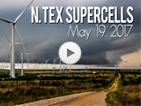
Date: May 19, 2017
Time: 3:00 - 7:45 PM CDT
Place: Joy, Ringgold, TX
Distance: 880 mi (142 to target, 226 chasing, 512 to home)
Camera: T3i, GoPro3, GoPro5
Warnings: SVR, TOR
Rating: S4
Pre-Chase
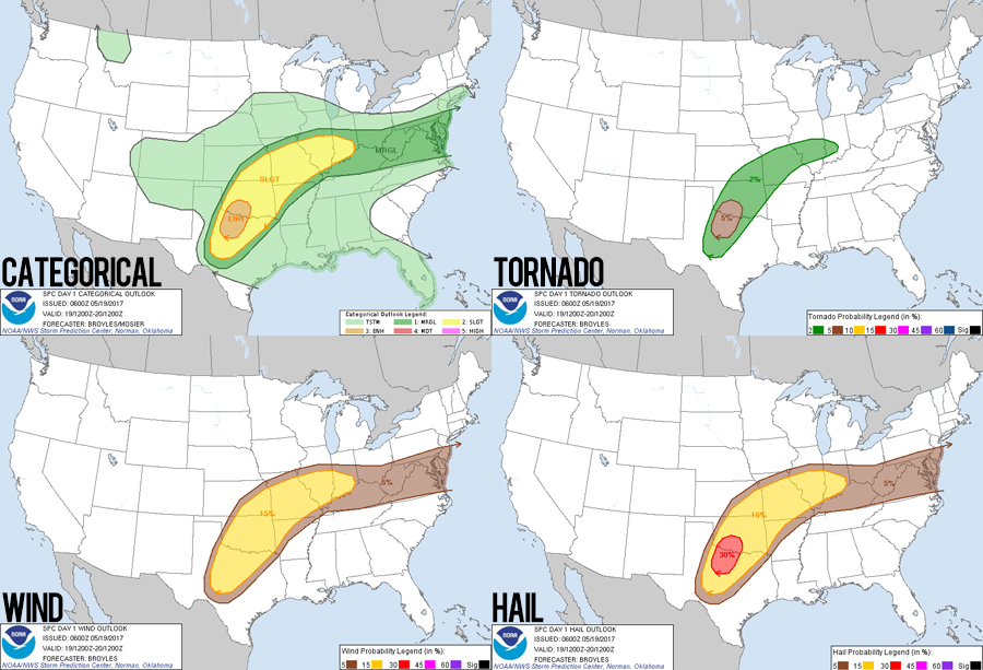
9:00 - 11:45 AM CDT: A complex (i.e. messy) forecast was on tap today as the culmination of a multi-day severe episode was coming to a close. The upper-level western trough that sparked storms over the previous 3 days (including yesterday's high risk), was finally ejecting east. The "last day of" a multi-day event is often the trickiest to chase. Environmental overturning, morning MCS scouring, early initiation, and congealing cold-front storms are typical flies in the ointment, and today was no exception.
After scrubbing morning models and picking north Texas as a target (lazily leaning on the SPC enhanced outlook), I met Julie and Peter in the lobby for a glamourous Hampton Inn continental breakfast. They would be continuing back to Nashville today, so we'd be back to the usual Stephen-Toni chase team. Fortunately, as a final chase hurrah with Julie and Peter, around 10AM as we were getting ready to pack the cars, an elevated morning storm surged NNE over Enid and gave some cool straight-line winds.
11:45 AM - 3:00 PM CDT: Saying goodbye to Julie and Peter, we embarked south on Hwy 81 towards my initial target of Jacksboro, TX. My hopeful forecast was that this area would remain south of morning storms and provide a nice balance of unstable air and good shear. The only notable occurrence on this otherwise gray, boring trek south was when we passed the infamous stretch of Hwy 81 where the 2013 El Reno tornado crossed -- tossing Mike Bettis and the Weather Channel crew. By 3PM, we were gassing up in Duncan, OK within striking distance of our first storm of the day.
The Chase
3:00 - 3:50 PM CDT: The tail-end-Charlie of a decaying morning MCS was becoming a little more discrete and organized near the town of Bellevue, TX - even exhibiting a nice hook (no TOR-warning though). So jogging east at Comanche, through the crazy little village of Loco, and finally setting up near the twin towns of Ringling/Cornish, OK, we were in perfect position. Perfect position to see a watery, mushy mess of a dying storm. We watched for about 5 minutes before leaving. It was so uninteresting that I didn't even take a single picture!
3:50 - 5:15 PM CDT: Jacksboro still looked like a good target, so we headed west on 70, cut SW on 79, and then south on 148 as originally planned. Near Petrolia, TX, we skimmed the forward edge of a congealing complex of cells forming on the cold gust front of a morning storm. This linear complex wouldn't have much if any tornado potential and so didn't tempt us while we continued south. As the linear shelf cloud fell away in the rearview mirror, a new, discrete cell began organizing near Newcastle, TX. It would track through a nicely unstable and sheared environment, and, more importantly, it would track right towards us! New target acquired.
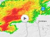
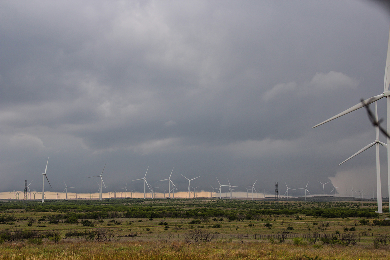
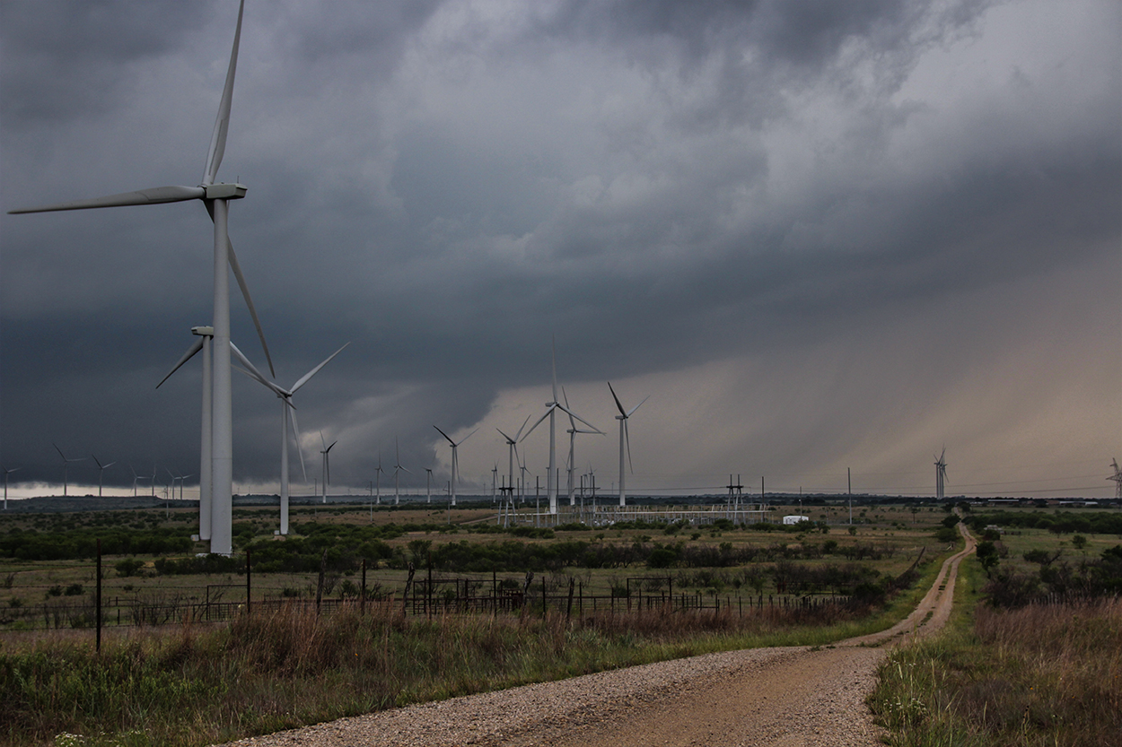
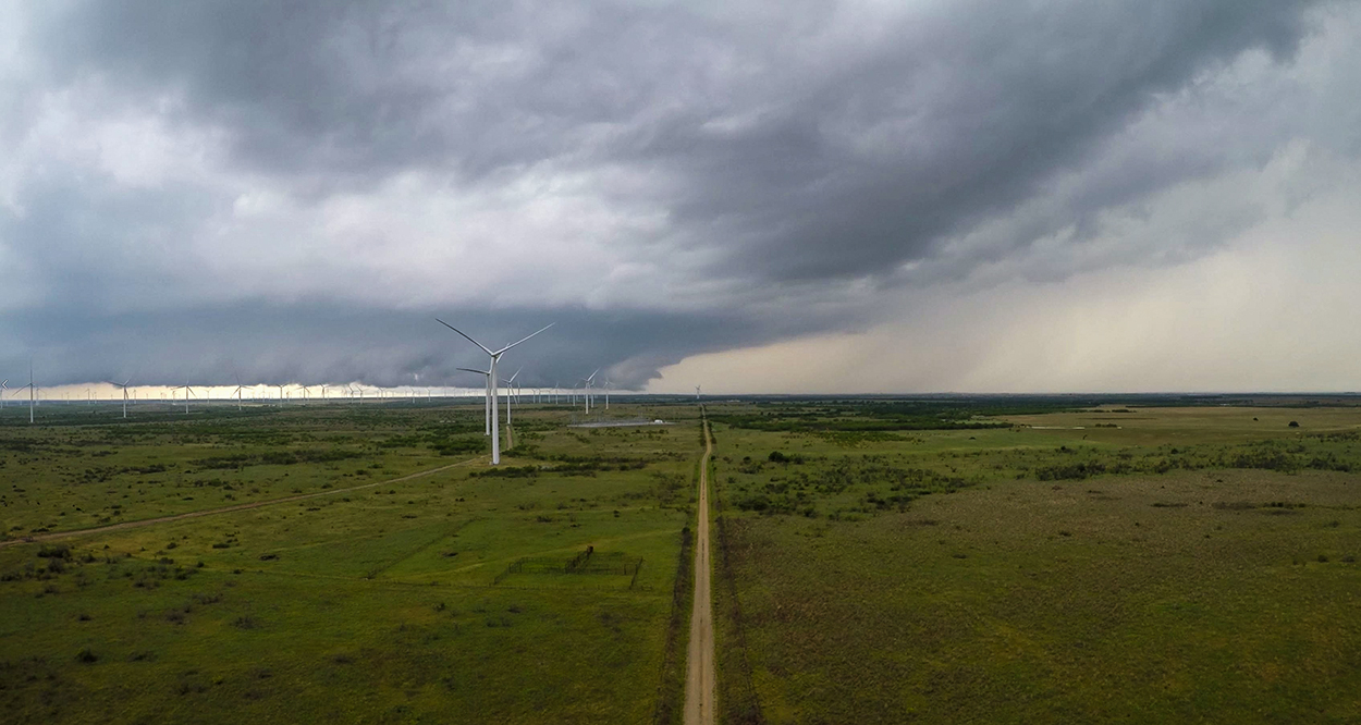
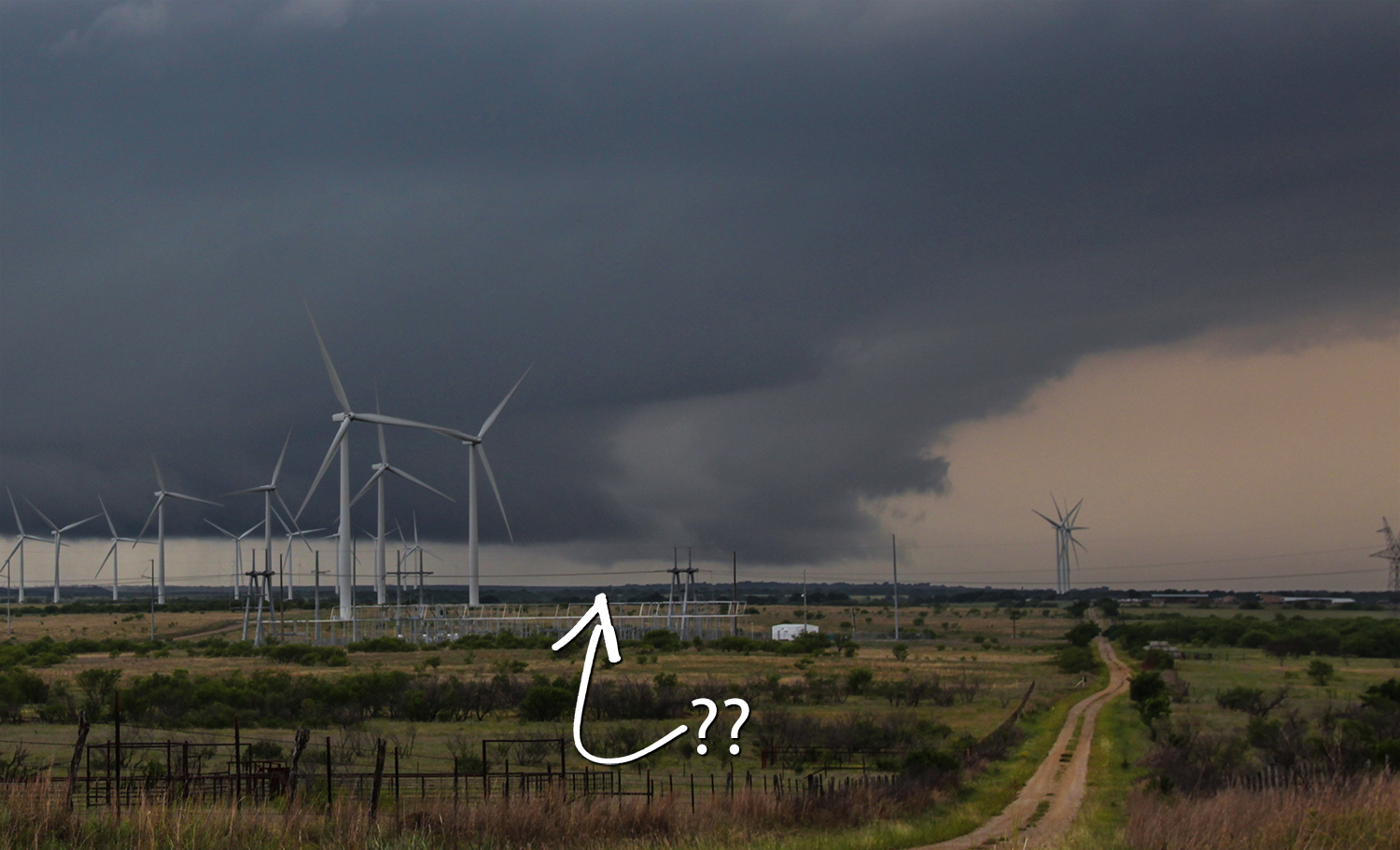
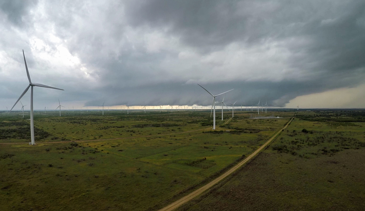
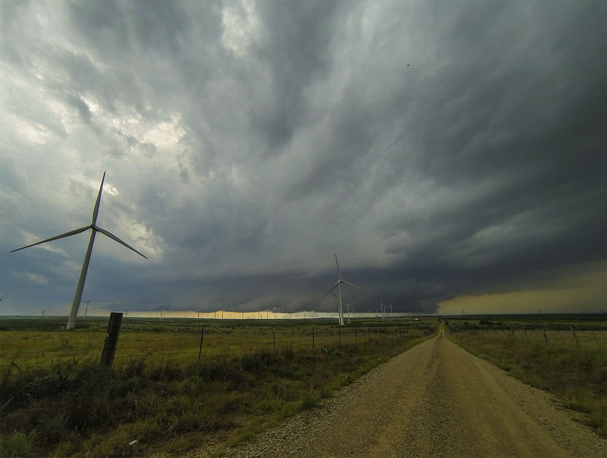
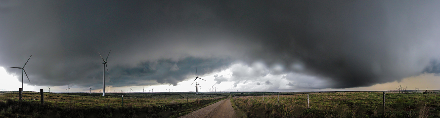
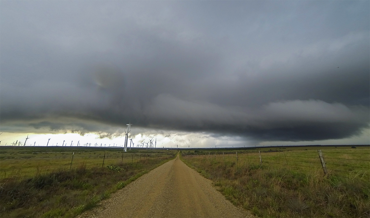
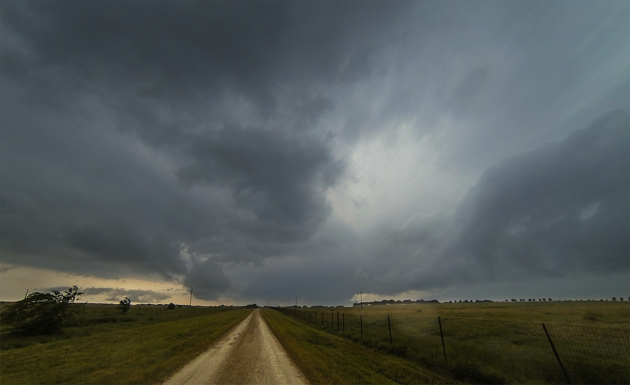
5:15 - 6:30 PM CDT: The low scrub trees and rolling hills of north Texas make chasing deceptively thorny. There are plenty of great viewing spots as you're driving along, but they always seem to disappear when you need them most. True to form, it took us nearly 15 minutes to find a good vantage point between Joy and Windthorst, TX - finally stumbling on a good overlook beside a windfarm at 5:35 PM. Thankfully the maturing supercell was still about 15 miles to our southwest, so we had ample time to set up timelapse and drone shots. A SVR warning was issued at 5:48 as the storm neared. Though it wasn't obvious on radar, visually we could see that there were actually twin updrafts and inflow regions within a couple miles of each other. It was fascinating to watch the nearby turbines attempt to orient themselves optimally in the shifting winds as the supercell made a final approach.
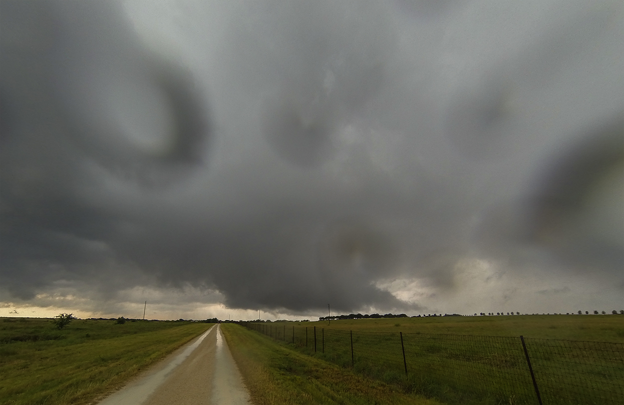
A Tornado warning was issued at 5:59, just as the gust front was a couple miles west of us. I was not watching radar very closely by this point, relying mostly on visuals, and I didn't see any areas that appeared imminent for tornadogenesis. What I didn't realize at the time was that the tightest circulation was actually located with the further of the twin updrafts, and that the close, more visually apparent base was starting to gust out as the western meso blasted it with RFD. So while I expected to be directly in the circulation's path, we were actually about 4 miles too far east with an intervening base blocking our view.
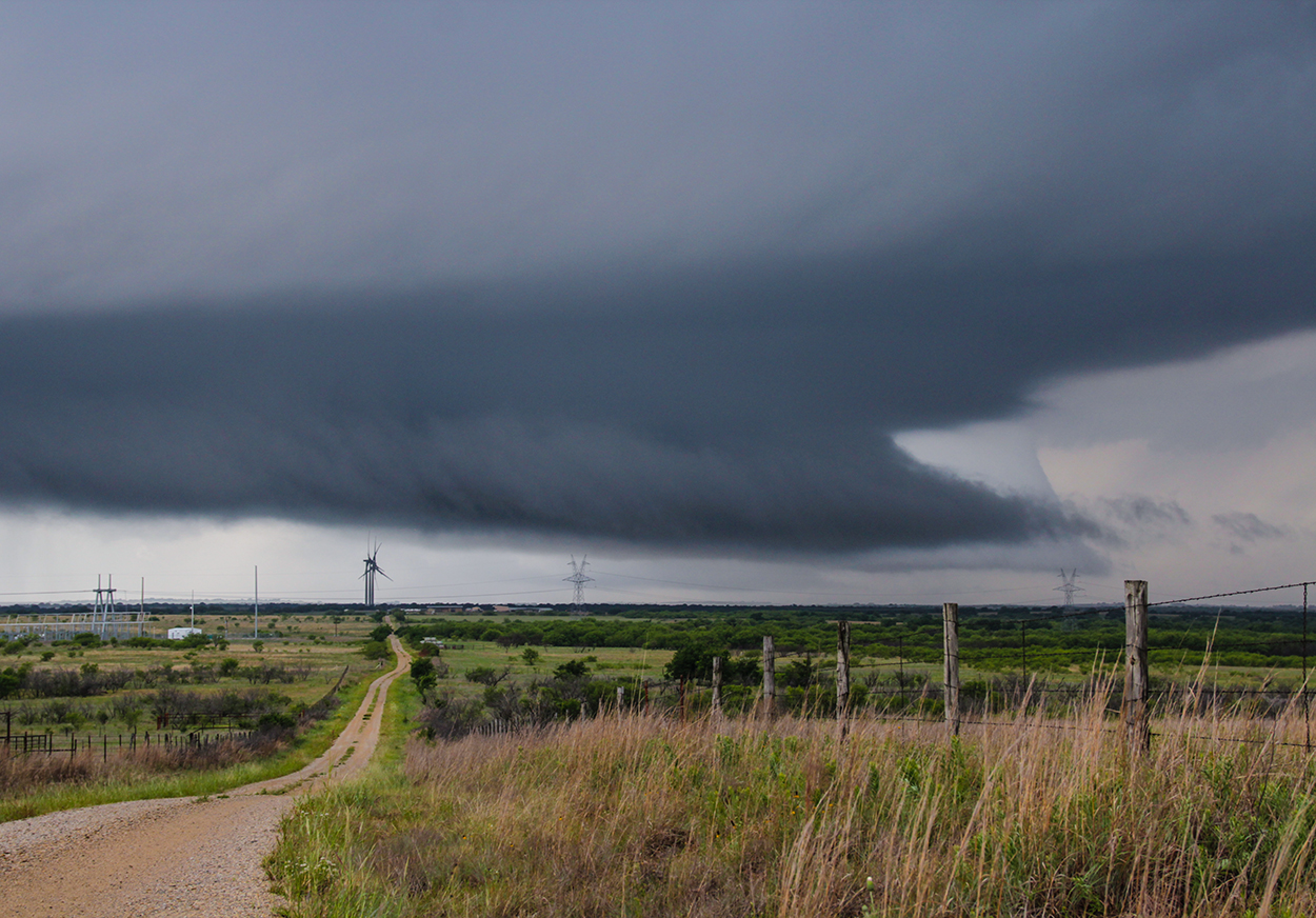
Finally realizing what was happening, we let the closer gust front pass over and then ventured north on a janky gravel road in an attempt to spy the warned mesocyclone. The driving was white-knuckled in the pouring rain, slippery roads, and lown visibility, but the circulation to our northeast look very tight on radar. I caught a couple tantalizing glimpses through the rain and trees of what appeared to be a wallcloud, but by 6:30 it was apparent the storm was utterly rain-wrapped and getting out of reach.
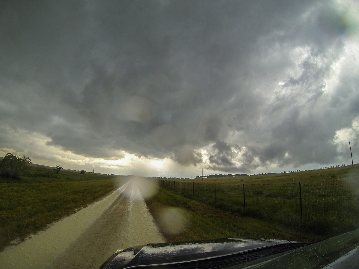
6:30 - 7:50 PM CDT: A new cell on the SW flank of our TOR-warned storm was starting to mature and look interesting. With a quick maneuver north to Henrietta then east through Ringgold on Hwy 82, we were soon sitting downstream from this new storm. I pulled off the highway onto a long, farmhouse driveway and awaited the arrival of our new target - still about 9 miles to the SW. Unfortunately, with the northeasterly storm motions, waiting downstream also meant waiting in the forward flank precip. So after setting up the waterproof Gopro for timelapse, I had to sit in the car rather than fully experience the stormy environment outside.
After a few minutes, the family in whose driveway we were parked drove out to check on us (maybe to hint that we should leave, but I was oblivious to any passive-aggressive suggestions). I told them to watch this storm coming up from the SW since it had some broad but decent rotation. They thanked us and went back to the house. Sure enough, as the storm closed in it exhibited a scraggly wallcloud -- the most decent structure we'd seen all day. Inflow and rising motion was only meager at best however, and after a few more minutes all organization completely collapsed.
Post-Chase
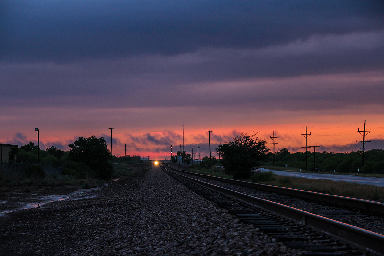
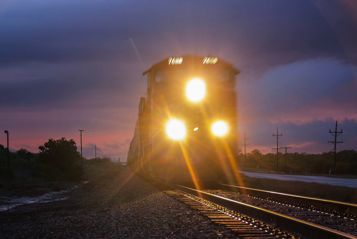
7:50 - 10:00 PM CDT: Seeing no other storms worth chasing, we called it a day and Toni booked us in the Wichita Falls Courtyard. On the drive towards town, I stopped to shoot some sunset train footage. One of the passing trains slammed its brakes and came to a halt at the crossing where we were filming. I had an "oh crap what if we get in trouble filming here??" moment and we quickly left. Some new little storms were popping up over Wichita Falls as we unloaded the car -- putting out some nice staccato thunder. I had to park around the rear of the hotel, and their back door wouldn't open with my keycard. I got absolutely soaked running all the way around to the front entrance as the new little storm dumped its rain and pea-sized hail on me -- a final little "better luck next time, kid" from mother nature. We walked to the Texas Roadhouse for supper and then called it a night.
Recap, Filmmaking Notes, and Lessons Learned
- There were many tornado reports today (scattered across Missouri, Kansas, Oklahoma, and Texas). But none of these provided any memorable footage. Given the setup, I think we picked the best possible target and maneuvered well on multiple storms. Today was just a day where the weather didn't cooperate.
- I tried my first ever aerial timelapse as the Joy/Windthorst supercell moved in. The Karma does a great job hovering in place, however there is some flutter in the GPS position and altitude lock. This becomes especially noticeable in timelapse, and no amount of post-processing stabilization will fix it. Perhaps a higher hover altitude will minimize this wobbling effect, since it's mostly apparent on the ground along the bottom of the frame.
- You can never stop eating Cheetos during a long chase drive (at least not until the bag is totally empty). Avoid this snack if at all possible!