Date: May 18, 2017
Time: 2:30 - 7:30 PM CDT
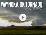
Place: Chester, Waynoka, Alva, OK
Distance: 431 mi (168 to target, 189 chasing, 74 to hotel)
Camera: T3i, GoPro3, Sony RX100ii
Warnings: SVR, TOR
Rating: S5
Pre-Chase
After our excellent McLean chase on May 16th, which forced us all the way to OKC before we found a hotel with power, the 17th was spent in and around the OKC area. We hit up Waffle Champion for brunch and OnCue for snacks. (As a 34-year-old, I was actually impressed with a gas station. What have I become?) We also made a brief stop at the El Reno memorial -- thankfully no spooky car trouble like our last visit (the Sentra's last chase day back in 2014).
It was more than just laziness that kept us in central Oklahoma on the 17th. After the upper level energy on the 16th ejected into the Midwest, a new, potent shortwave started digging into Utah -- embedded in the larger western trough that was still in roughly the same position as on the 16th. Surface moisture that was scoured to the OK/AR border started streaming northwest in response to lee cyclogenesis and a stout overnight low level jet. Woodward, where we spent the night, surged from a 50-degree dewpoint to 67 in less than 3 hours. In other words, mother nature was quickly recharging for another round of severe weather on the 18th. And if you believed the whispers on social media, a high risk was a distinct possibility.
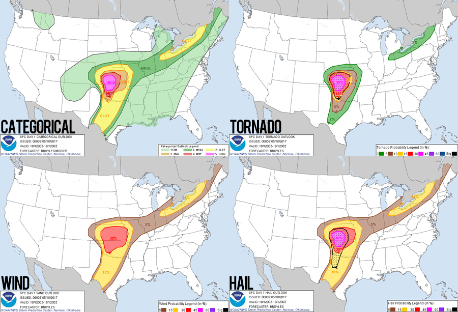
Sure enough, morning dawned on the 18th with an SPC day 1 high risk outlook, and were already in the "30-hatched" tornado forecast zone (30 meaning a 30% probability of a tornado passing within 25 miles of a point, and hatched meaning that tornado being EF2-EF5). We've chased plenty of moderate risk events over the years, but only one other high risk -- our 2nd chase ever on April 14, 2012. All the same creepy-nervous excitement from that old chase came flooding back as I pondered over two possible targets: the dryline/warm-front triple-point in SC Kansas, or the dryline in western Oklahoma. As with most high risk events, the forecast was tricky and presented multiple possible gotchas, primarily the timing and spacing of initiation (i.e. early, closely-spaced storms would interfere and never exploit the otherwise dangerous ambient environment).
Oh yea, and there was one other complexity: this would be our inaugural day as chase tour guides. My sister Julie and her partner Peter were originally planning to visit us in ABQ on the tail end of their western US vacation. But instead, they decided* to meet us out in the plains. (*I'm not sure of the details, but I infer that complex negotiations were required before Julie convinced Peter to make this otherwise insane vacation detour). So between the high-end forecast and the responsibility of a second vehicle in the caravan, I had pre-chase butterflies like crazy.
The Chase
12:00 - 2:30 PM CDT: Checkout from Woodward Hampton Inn. Grab two-way radios from Walmart. Nervous Arby's lunch reading PDS tornado watch. Keep tabs on Julie and Peter's position coming from ABQ. Those final pre-initiation hours were a nervous blur with nothing much to do. I decided the play the dryline near Woodward, so we were already in prime position. My only nightmare was that Julie and Peter would not arrive before initiation and we'd either need to meet up mid chase (dangerous) or fall desperately behind storms (frustrating).
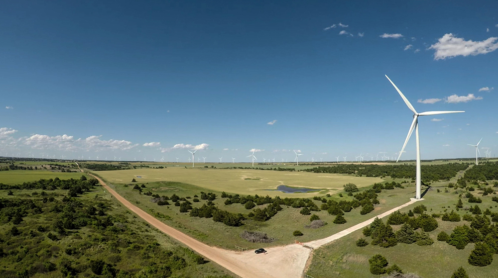
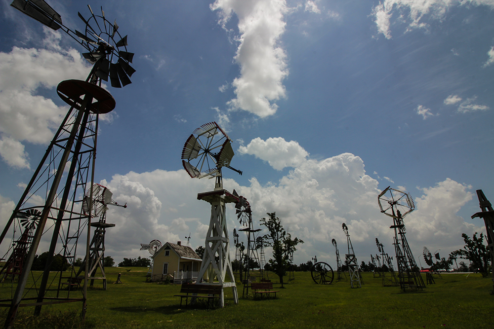
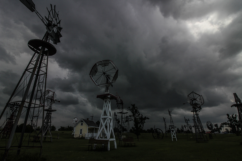
To ensure our convoy would form up as early as possible, Toni and I drove 30 miles SW to the tiny town of Shattuck -- immediately downstream from the bubbling cumulus dryline circulations. I finally got the chance to timelapse their neat little antique windmill museum -- though I was too antsy to relax. Peter and Julie were still 30 minutes away. Initiating towers were building as the old windmills cranked in the backed, SE surface winds. Finally, just as early-storm precip was encroaching on Shattuck, a blue-green Sentra pulled up. They arrived! (And I noted, for the first time in 3 years a Sentra was back on the chase.) We barely said hellos, hit the bathrooms at the giant teepee gas station across the street, and then took off northeast to get ahead of storms. It was a hectic, Twister-esque "If you have to pee, you should do it now" meetup scene.
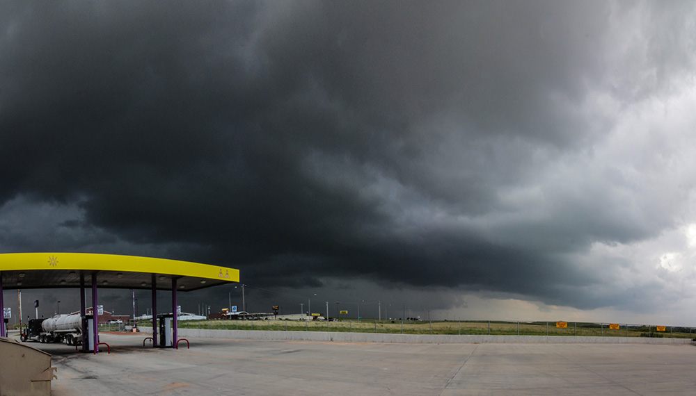
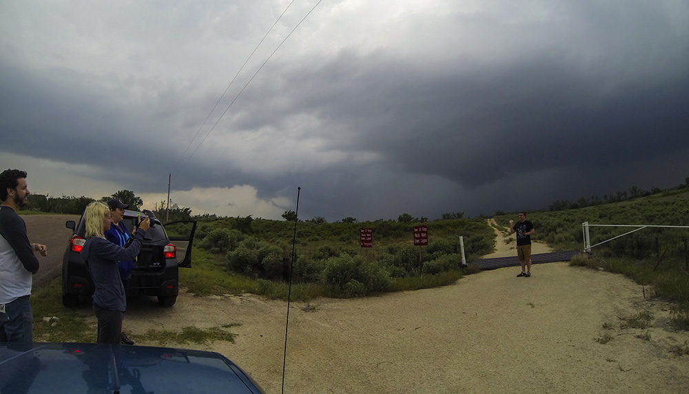
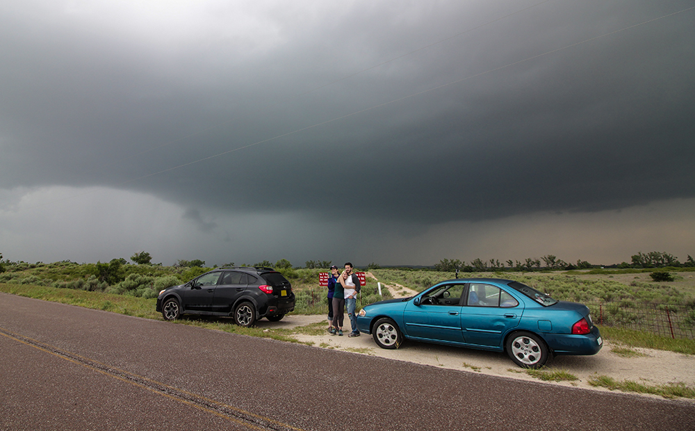
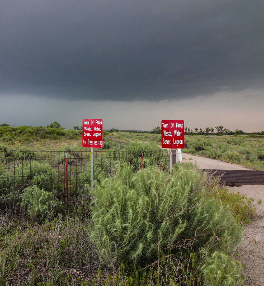
2:30 - 4:00 PM CDT: First task was to get downstream of the early storms and reassess chase strategy. We core-punched (if you can call it that) a strengthening storm near Gage and then stopped to watch its southwest side in Fargo, OK. Amusingly, we pulled off at the Fargo "Waste Water Sewage Lagoon" -- a great first stop as storm chase tour guide!
Frustratingly, quite a few cells went up simultaneously in our area, and all were fighting for dominance. Despite a severe warning, our cell looked pretty tame with a featureless base. It needed more time and space to cook. We pursued through Woodward and then north into a rainy morass of cells. Between frustration with storm mode, two-way radio problems, and muddy roads, I was worried the day was going to turn into an all out bust before it barely got started. But then we noticed a freshly Tor-warned storm to our south in Dewey county.
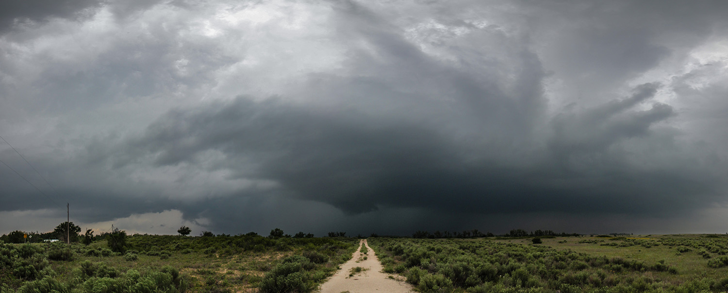
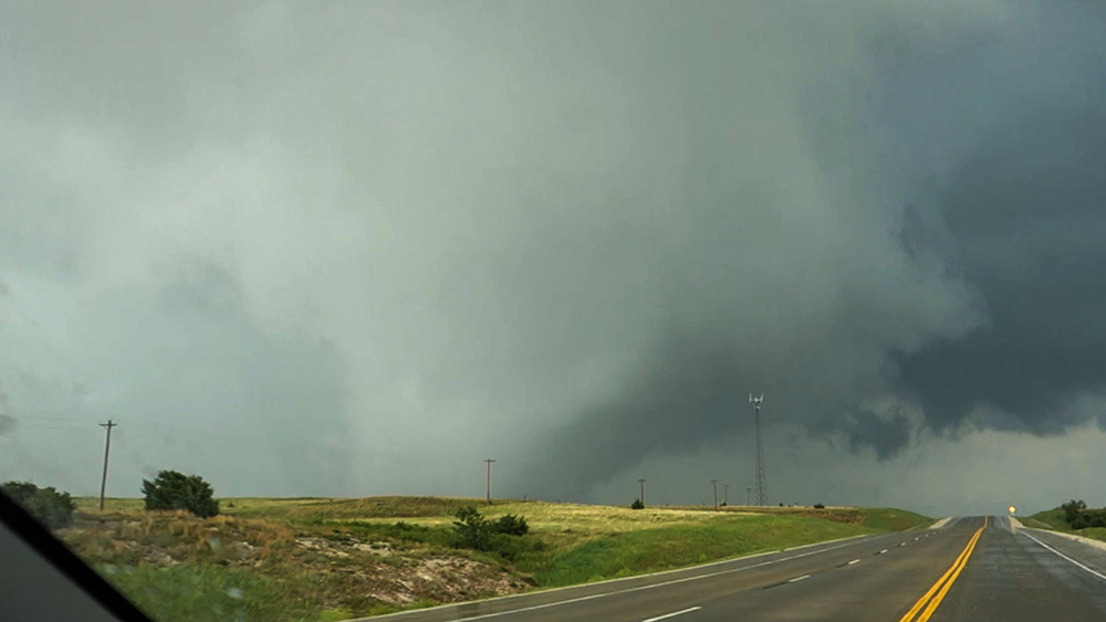
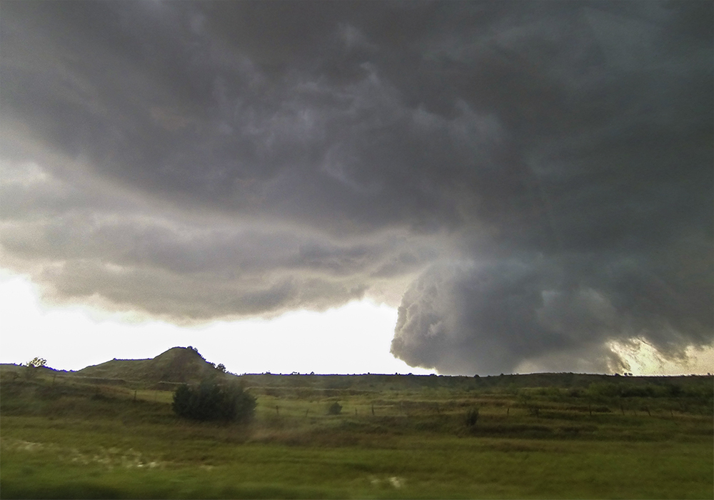
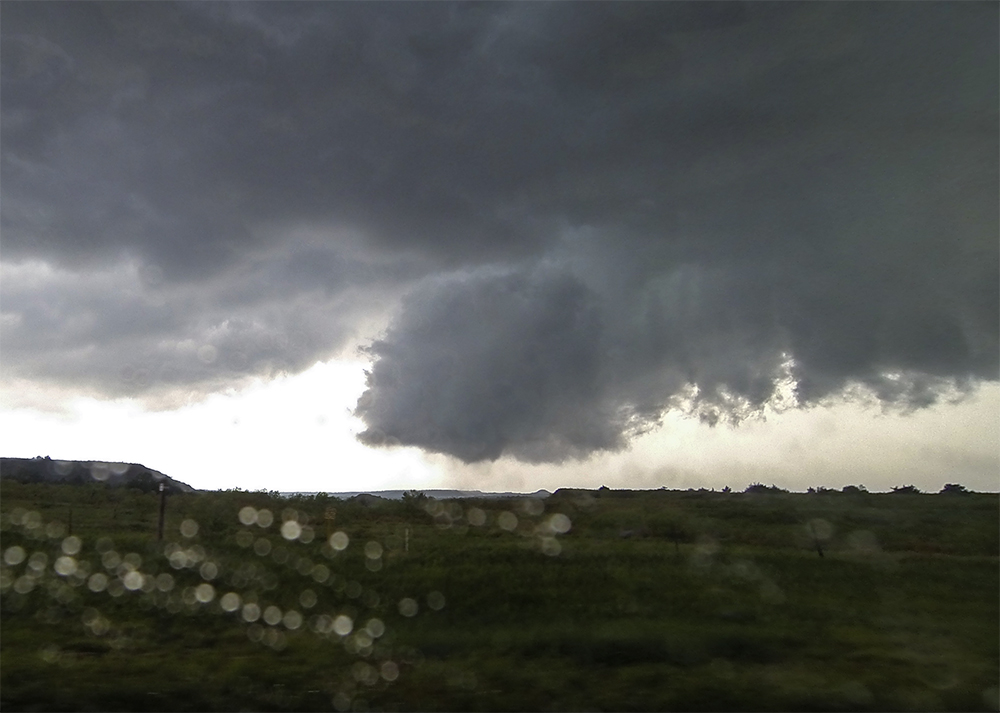
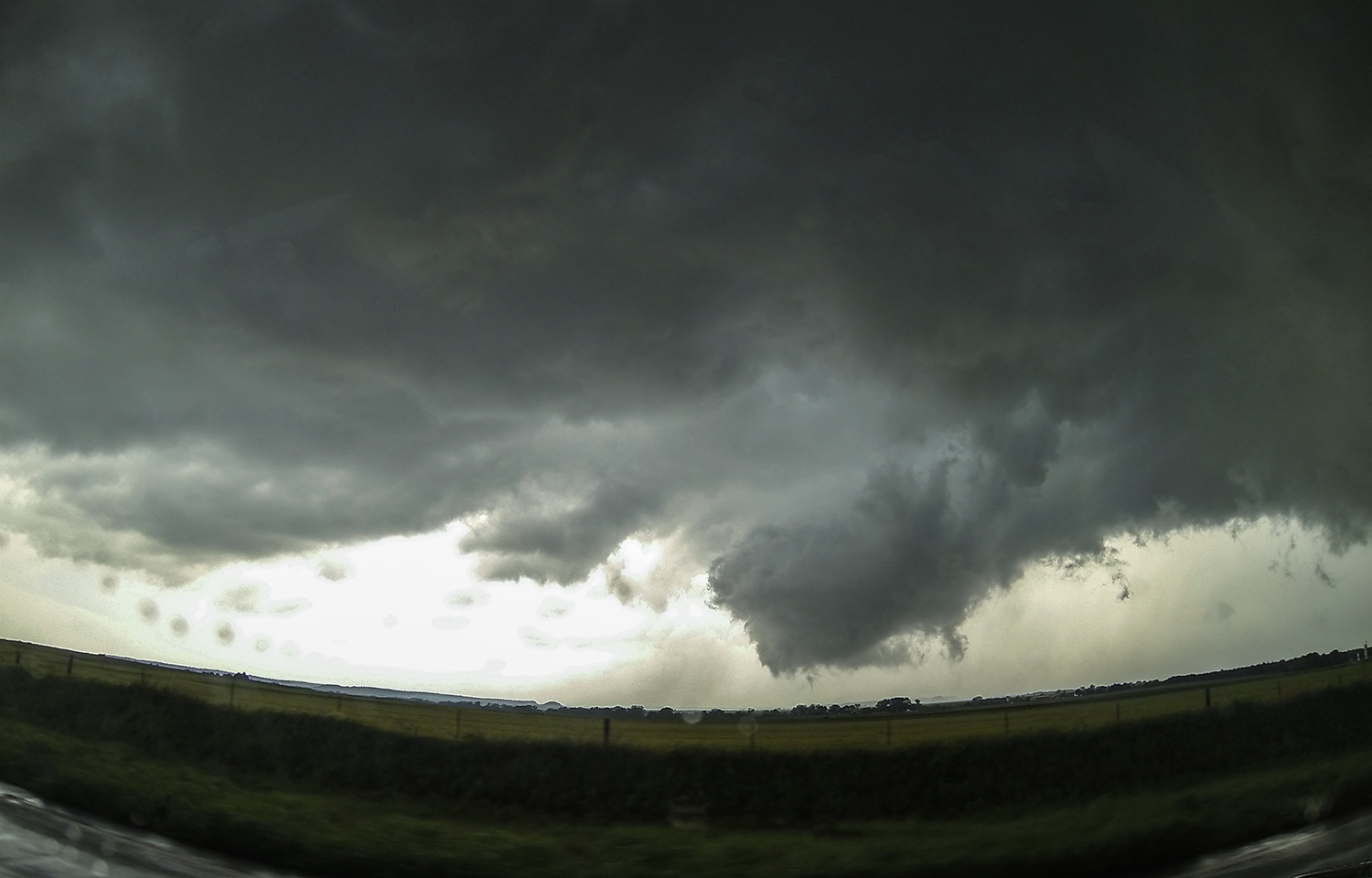
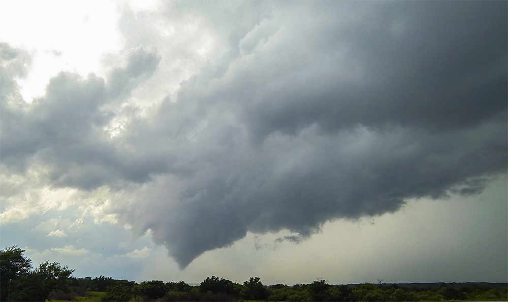
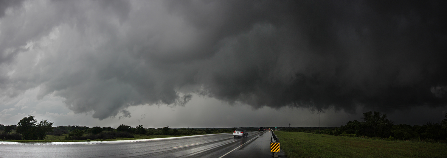
4:00 - 6:00 PM CDT: Setting a good pace east out of Woodward, we would intercept the north-moving storm near the Hwy 412/281 intersection south of Waynoka. I apologized a couple times to Peter for the speeds we were pulling (just a hair over the limit), but by 4:44 a hazy, blocky wallcloud loomed above the highway roughly 2 miles in front of us. Quarter hail was centrifuging out of the meso, and we hung back a moment to ensure the circulation had fully crossed the road, then it was full blast east on 412 and north on 281.
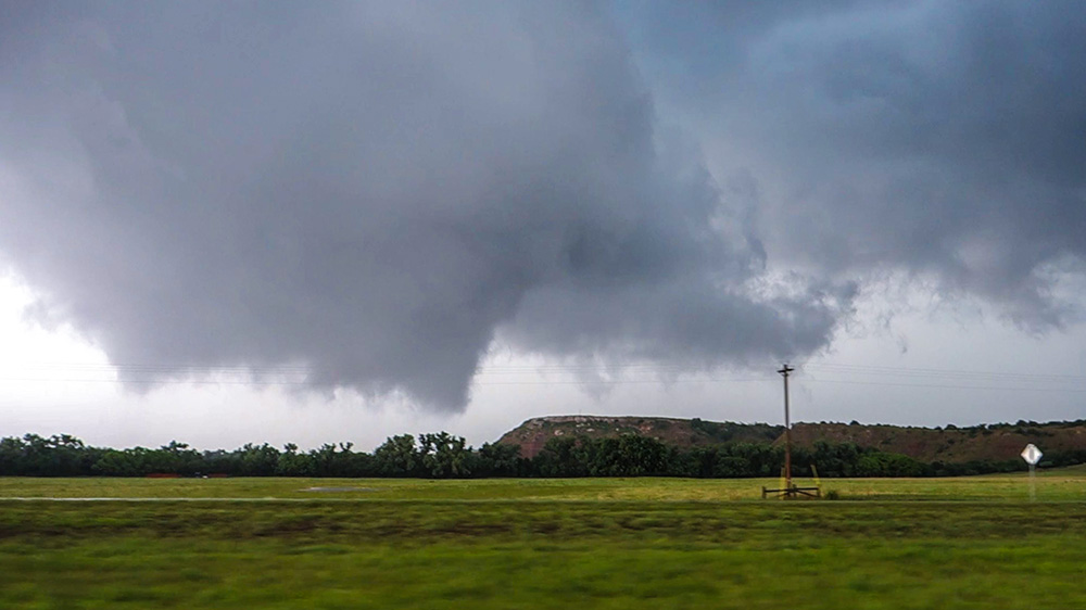
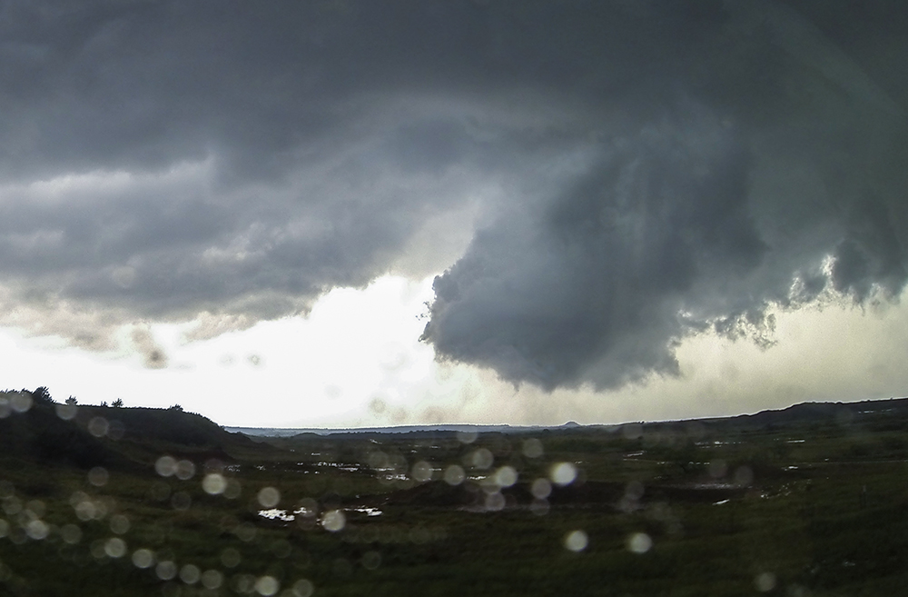
Passing directly south of the wallcloud prior to our turn north, intense rotation was observed -- a tornado was imminent. North of 412, highway 281 rolls through a series of shallow canyons and buttes (an area known as the Glass Mountains) near the Cimarron river. As we climbed a final rise, I remarked over the radio "it's gonna show its ugly face right over that hill." Sure enough, as we cleared the rise and got a clear view, streaky rain bands and intermittent vortices were visible under the violently churning wallcloud. We had our tornado!
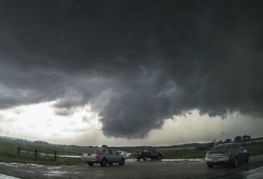
Hwy 281 was the perfect road option - paralleling the tornado amazingly. "We're right along side her. She's beautiful!" I'll always prefer a static location to watch a tornado pass, but this was the next best thing. We caravanned with the tornado for 10 minutes before pulling off at the Cimarron river bridge. Julie and I got out to high-five and get some photos and video as the whirling funnel continued to our northwest. We could no longer see ground contact, but other chaser videos confirmed the tornado was still on the ground as it crossed the Cimarron.
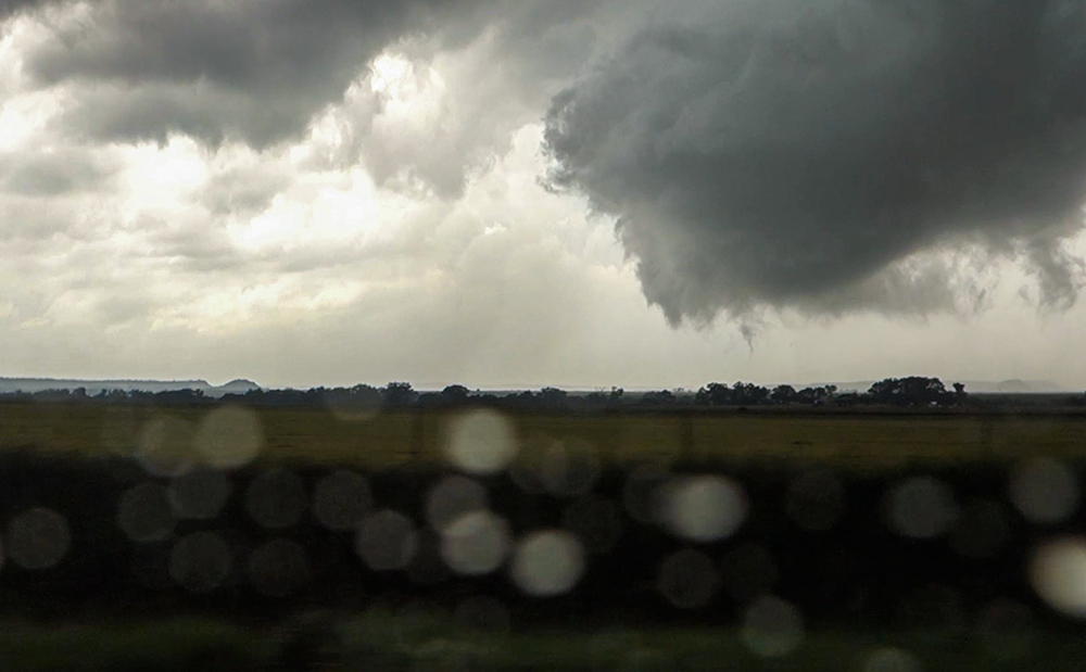
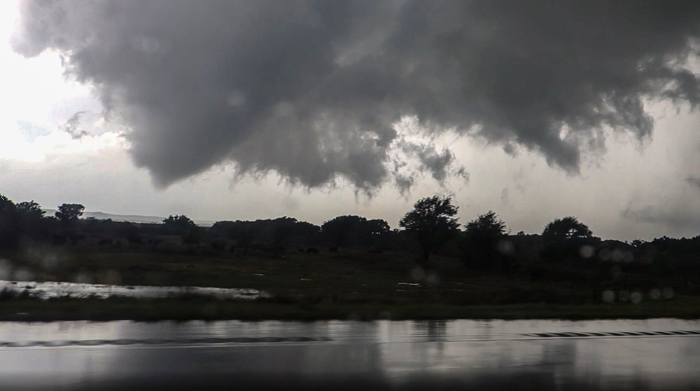
By 5:08, we were falling behind and into a growing hoard of chaser traffic. Getting through Waynoka was a nearly 10-minute ordeal, and then 281 cut east for 10 miles, so it took us quite a while to make up lost ground and regain sight on the storm's base. I was really surprised that there was absolutely no eastward component to the parent storm's motion -- it moved straight north. One last distant view of a wispy, dissolving wallcloud was the reward for our pursuit, and by the time we passed through Alva, it was obvious our parent storm was dying. We needed a new target.
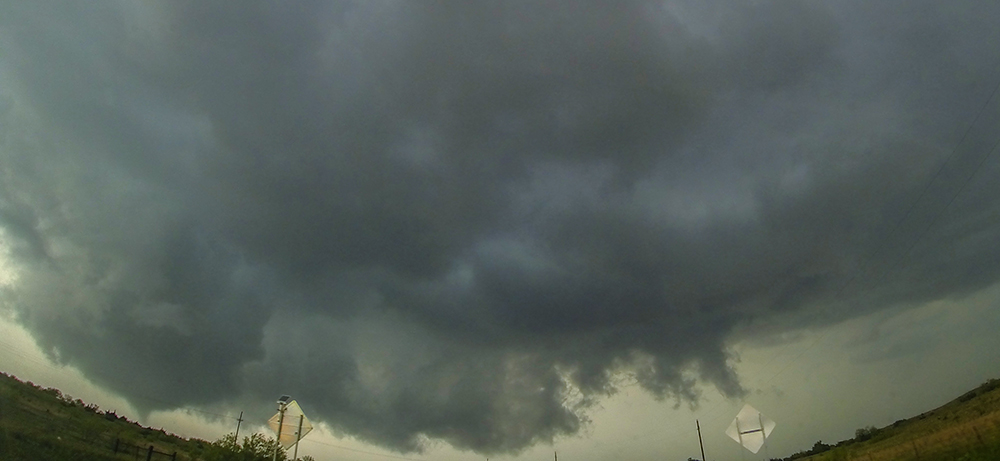
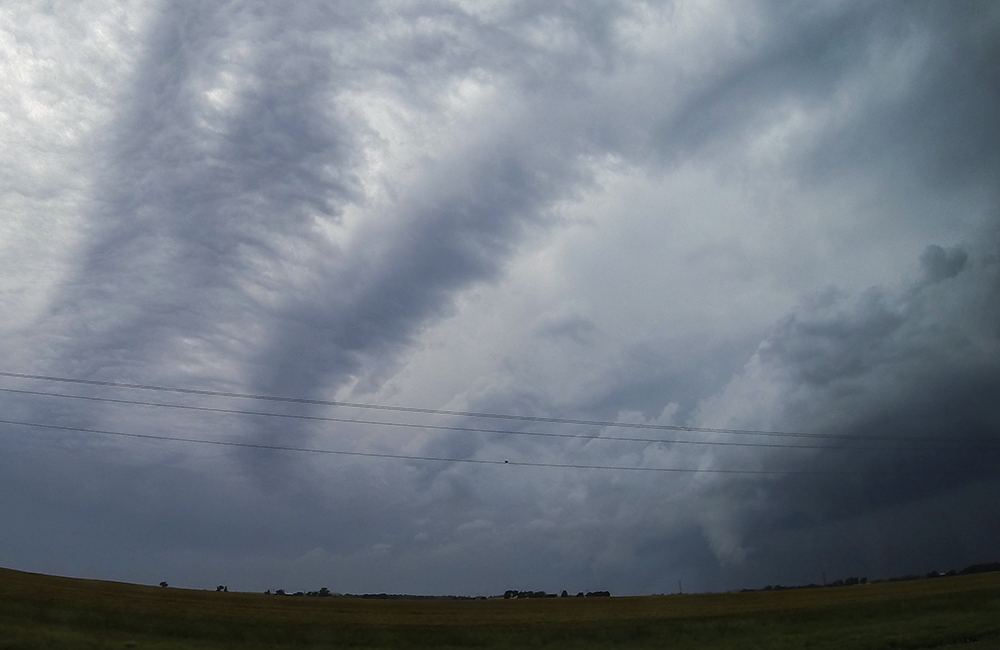
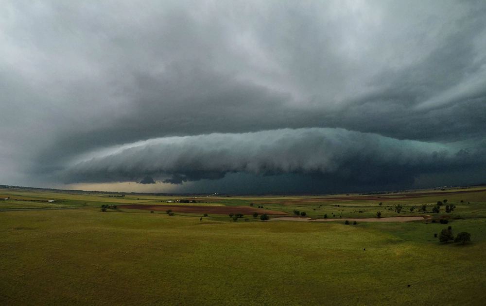
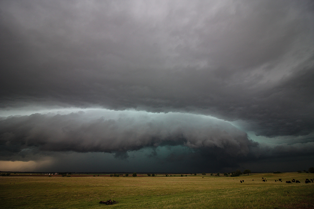
6:00 - 7:45 PM CDT: A couple new cells had fired off the dryline and were now maturing to our southwest: a messy complex of updrafts near Woodward and a more discrete supercell near Camargo. Since evening was not that far off, I decided to get in front of the closer but messier northern complex while we still had daylight, and so we started the trek south to intercept. By 6:44, we were in position between Hopeton and Waynoka. This time, the storm would come to us.
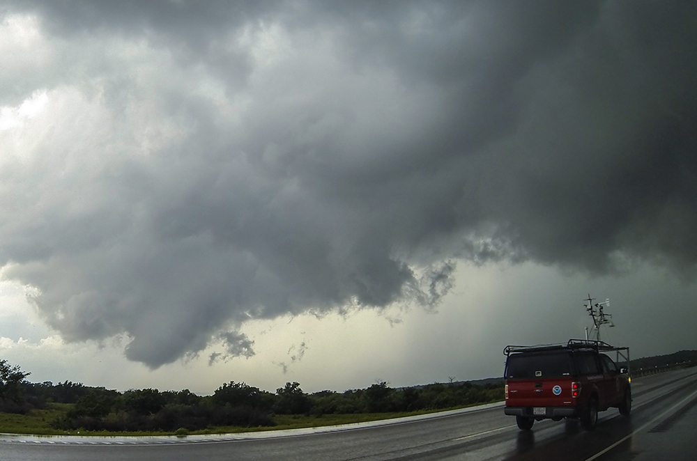
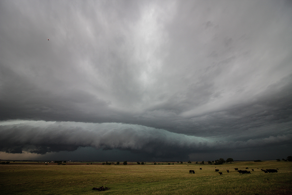
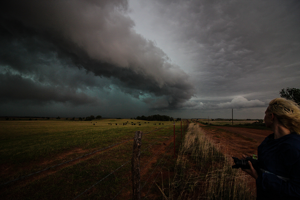
Over the next 20 minutes, we watched as the complex of storms consolidated into a dominant supercell with an absolutely gorgeous RFD/outflow gust front. A striking, bright stripe above a surging shelf cloud over a turquoise core created beautiful picture, drone, and timelapse opportunities. It was also great to be out of the cars and hanging out together with everyone as cows grazed in the adjacent field -- oblivious to the incredible structure behind them.
As the storm made a final approach, an inflow kink with attendant couplet organized just to our north. We let the cold RFD blast us for a couple minutes, then with Julie and Peter's concurrence, we plunged north towards this feature as a final adventure for the day. Visibility dropped to near zero as 60 - 70 MPH RFD gusts slammed us from the west (though there was surprisingly little if any hail). Toni tracked the couplet on radar as it passed safely just to our north and east. At 7:13, at tornado warning was issued for our cell. I hadn't noticed a single other chaser over the last hour, so it was a neat feeling that we'd had this storm to ourselves -- a nice contrast to the earlier Waynoka tornado. Given the heavily rain-wrapped nature of this storm, it was clear we'd never actually see any possible tornado, so we called the chase in Alva (after trying a couple gas stations before finding one with power).
Post Chase
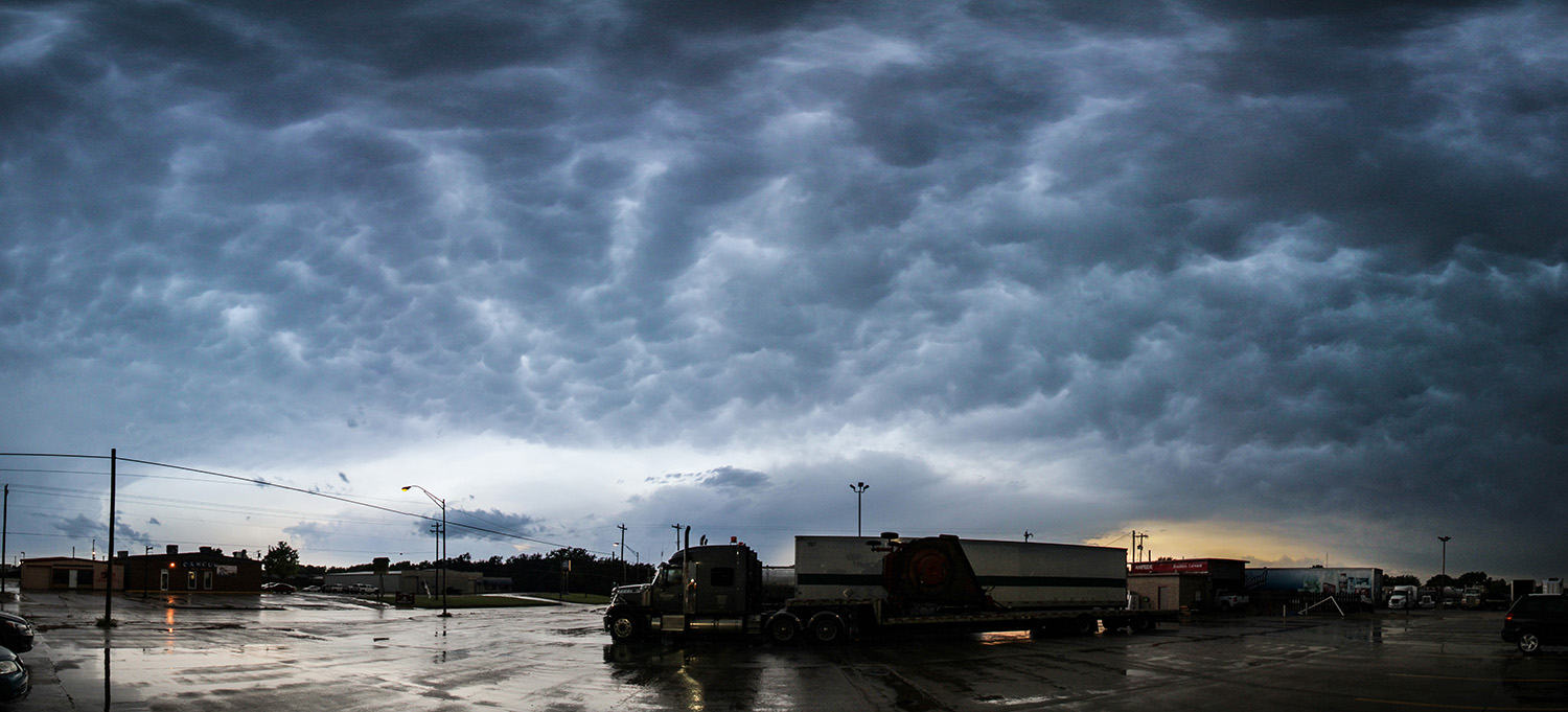
7:45 - 10:30 PM CDT: Enid was the closest/best spot to get food and a hotel for the night, so we followed behind the now decaying storms in the deepening twilight. Passing though Jet, Oklahoma, we learned they actually have a literal jet on the east side of town (a Cessna T-37 "Tweet"). Upon arrival in Enid, we hit up Tokyo Sushi for some, well, sushi, before retiring to the Hampton Inn for the night. We hung out in our room for a couple hours afterward, remembering the events of the day. This was a special new experience sharing the chase day with Julie and Peter.
Recap, Filmmaking Notes, and Lessons Learned
- High risk chases are nerve-wracking, since there's always the chance for a catastrophic event. Thankfully, the tornadoes today were mostly weak and short-lived. We luckily hit the needle-in-a-haystack dryline storm that produced that main tornadoes of the day. I wish were had seen the earlier Seiling/Chester tornado from the same storm, but can't complain about our catch at all.
- The Waynoka supercell had the strangest left-deviant motion I've ever seen in a cyclic supercell; usually it's the right-turners that are prolific. Some chaser videos suggest that the new wallcloud/tornado (the one we caught) actually formed west of the initial Seiling/Chester tornado. I can't recall analagous storm evolution.
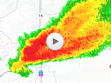
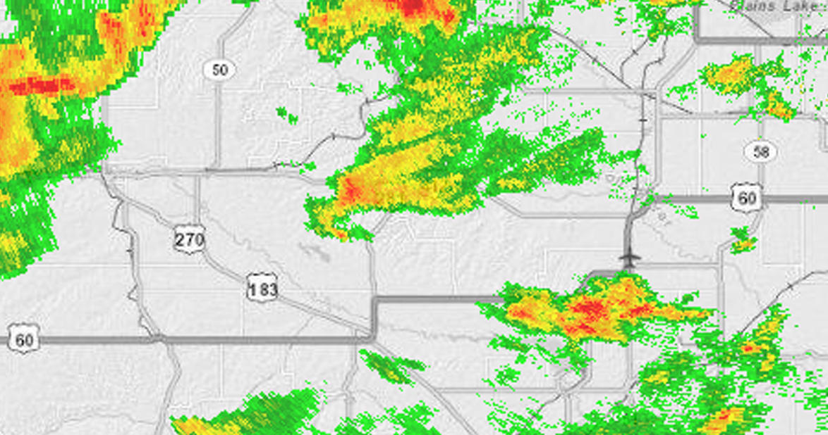
- KVNX sometimes makes storms look weaker than they actually are. Here's the Waynoka supercell while it was producing a strong tornado. I recall once hearing this called the "Vance Wedge," and did a little more digging. This paper indicates that "outgrowing trees or changed landscape" on the southwest side of the Vance radar dome cause reflectivity to be lower in that direction.