Date: June 6, 2014
Time: 5:00-9:00 PM CDT
Place: Syracuse, Lakin, Deerfield, Garden City, Kansas
Distance: 411 mi (197 positioning, 169 chasing, 45 to hotel)
Camera: T3i, GoPro3 Silver, Lumix
Warnings: SVR, TOR
Rating: S5
Forecast and Set Up
Today was our 4th chase day in a row. I cant believe Im typing that. Today also featured our closest ever encounter with a tornado. I REALLY cant believe Im typing that...
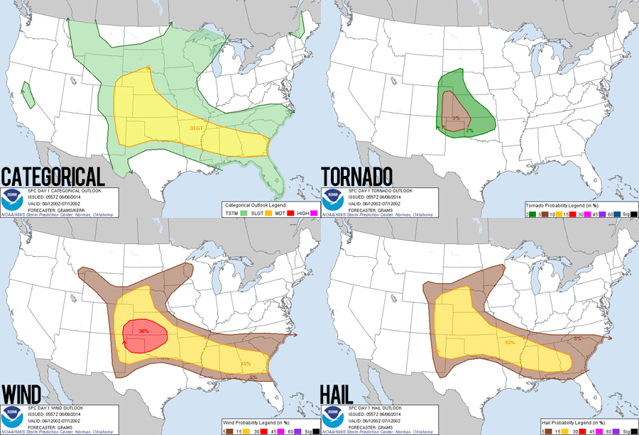
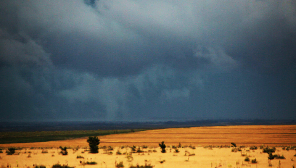
After a couple days of upslope storm chasing in the Colorado plains, today we were heading out into the prime chase territory of southwest Kansas. I was actually surprised that the SPC didnt increase the tornado potential in their initial outlooks as it appeared a great mixture of parameters was coming together. Mid 60s dewpoints were boosting CAPE values towards 3000 J/kg underneath a decent belt of mid-level westerly winds creating nice looping hodographs. Combined with lots of outflow boundaries from last nights storms, I was really excited about the days prospects.
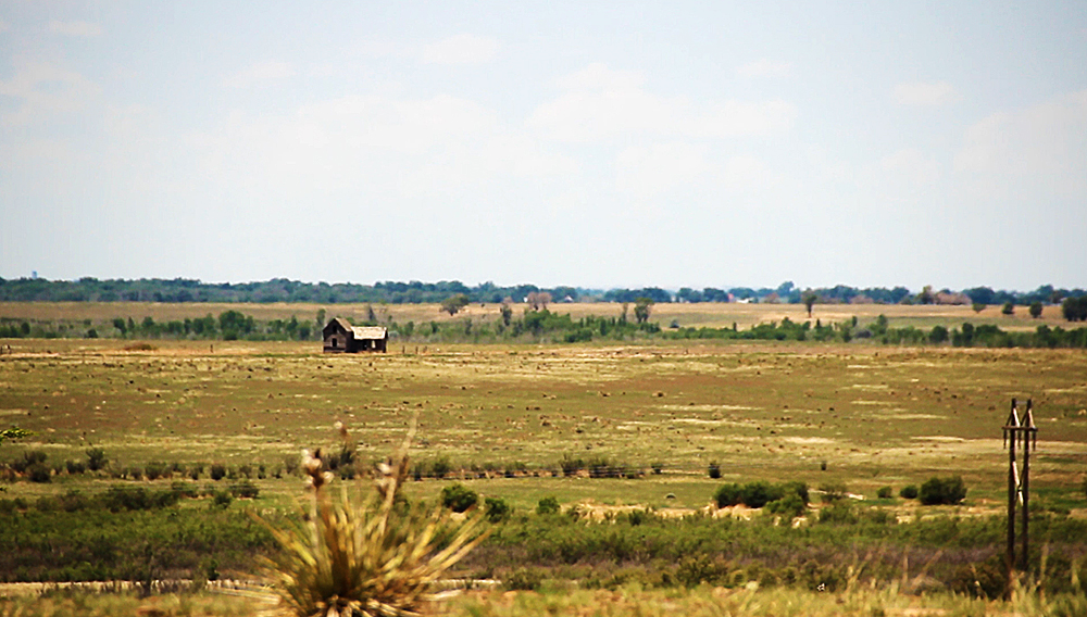
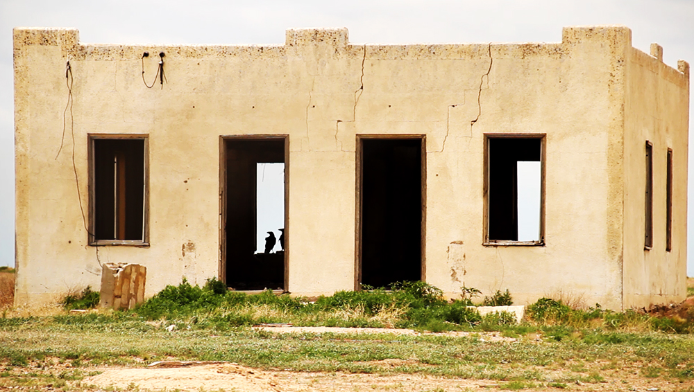
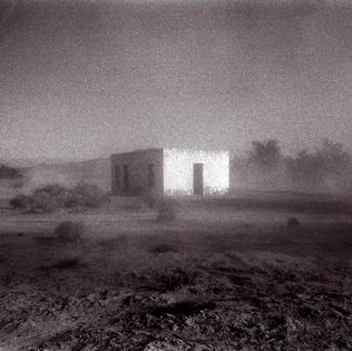
Starting relatively close to the target, we left La Junta late morning and headed east on Hwy 50 to Lamar, and then south on 287. Along the way, we had ample opportunity to explore some amazing abandoned locations including a grey desert farmhouse and an old mortar building that looked kinda like the cover of the latest Godspeed album. Toni wanted to stop at a neat looking cafe in Springfield, CO, but unfortunately they were closed. Leaving Springfield, we caravanned behind a DOW truck for a while, which is always a nice sign.
Early in the afternoon, two primary areas of convergence started to become apparent. One outflow boundary had pushed all the way through the TX panhandle and into northeast New Mexico. Another was oriented NW-to-SE in southwest Kansas. Trying to hedge our possibilities, we headed south on 287 to Boise City, OK about halfway between the boundaries. During this part of the trip, we were almost entirely without cell connectivity, even in Boise City. Getting a little frustrated and worried I was missing some important forecasting details, I made the call to head up to Elkhart, KS and the reliable Kansas 4G network. I hate making positioning calls based on cell service, but at this point it was almost a necessity as we had hardly been able to get a peep from the network thus far.
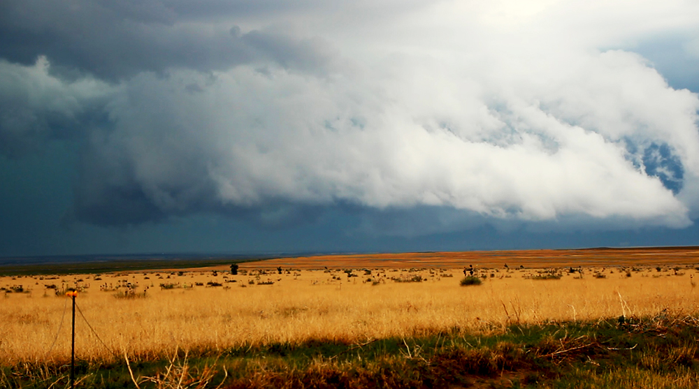
We sat north of Elkhart for about 20 minutes, having finally gotten good weather updates. A tornado watch had just gone up right on top of us, and the outflow boundary to our north was just starting to light up. We decided to stick with our Kansas target as a storm began explosively building south of Syracuse. We were off to the races
The Chase
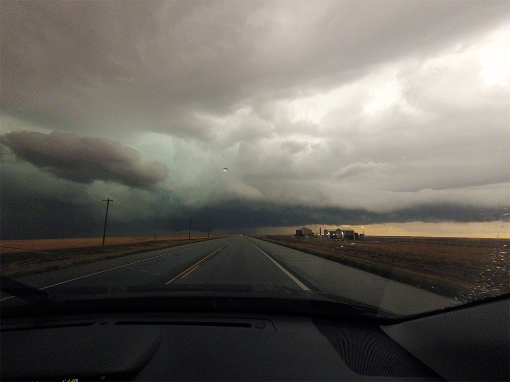
Our storm continued to mature as we rushed north on Hwy 27 for an intercept. On radar, the cell had a NW-to-SE orientation paralleling the outflow boundary that birthed it and giving the appearance of being slightly elevated. But I was hopeful that the updraft region would eventually root down to the surface, so I was on the lookout for any little radar appendages emerging from the storms southern side.
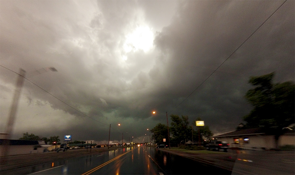
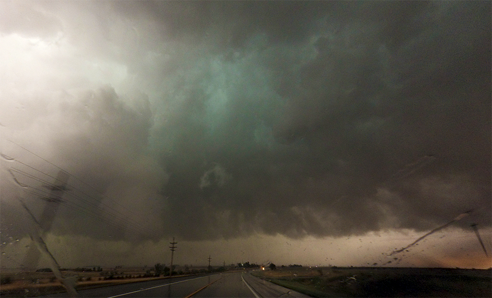
We pulled up south of Syracuse just as the storm was slowly making its way a few miles east of town. At this point, neither radar nor visual appearance gave good clues what the cell was thinking. On radar, the storm had slowed and taken a right turn (good sign) but still lacked other clear supercellular characteristics (bad sign). Visually, there was a very pronounced lowering on the southern end of the storm, but I would hesitate to call it a wallcloud. Instead, it appeared to be an intermediate formation having elements of a wallcloud, shelf cloud, and roll cloud simultaneously. Most interestingly, white columns of scud were in direct contact with the ground and were rising rapidly into this lowering! I was almost convinced a weak tornado was in progress, but something just didnt look quite right - there wasnt enough tight motion. In hindsight, my best guess is that hail fog was getting ingested off the ground and into the thunderstorm. Needless to say, all this was very exciting yet confusing.
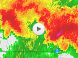
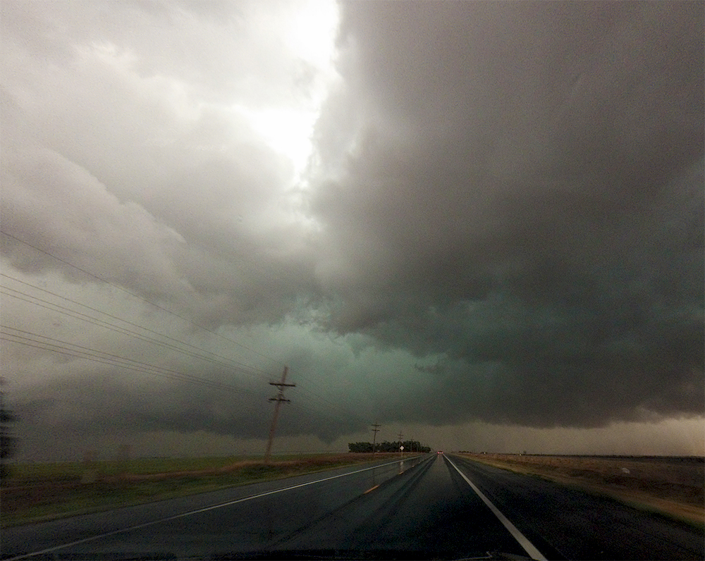
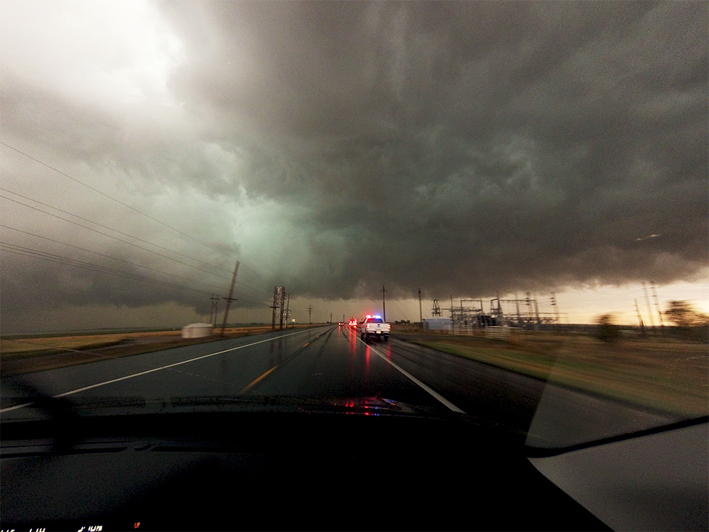
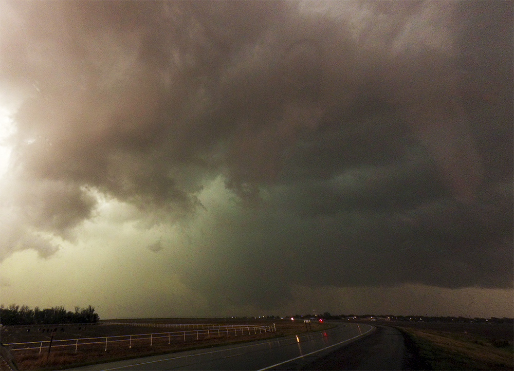
We cautiously crept east on Hwy 50/400, staying just behind the precipitation core to our east and north. Copious amounts of quarter-sized hail were on the ground and already creating a layer of fog. Initially, winds were directly out of the north blowing out of the precipitation. But at some point just west of Lakin, the winds switched 180 degrees and became inflow from the south. We stopped for a moment to reanalyze the confusing situation, and thats when we noticed a very promising bowl-shaped lowering just ahead of us over Lakin. Not only that, but a couplet was developing on radar!!
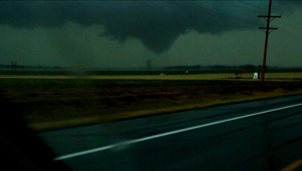
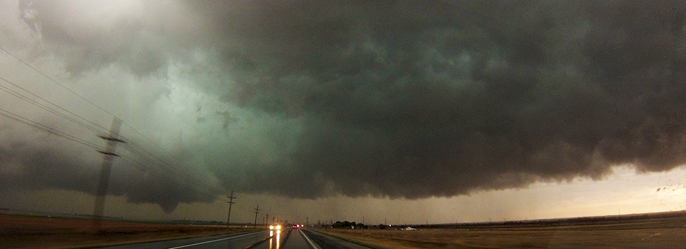
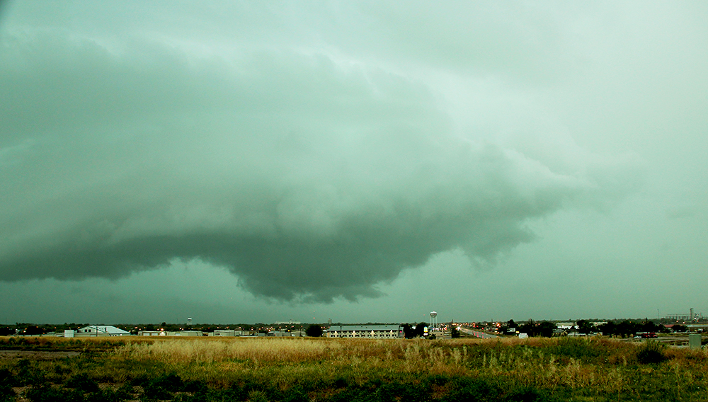
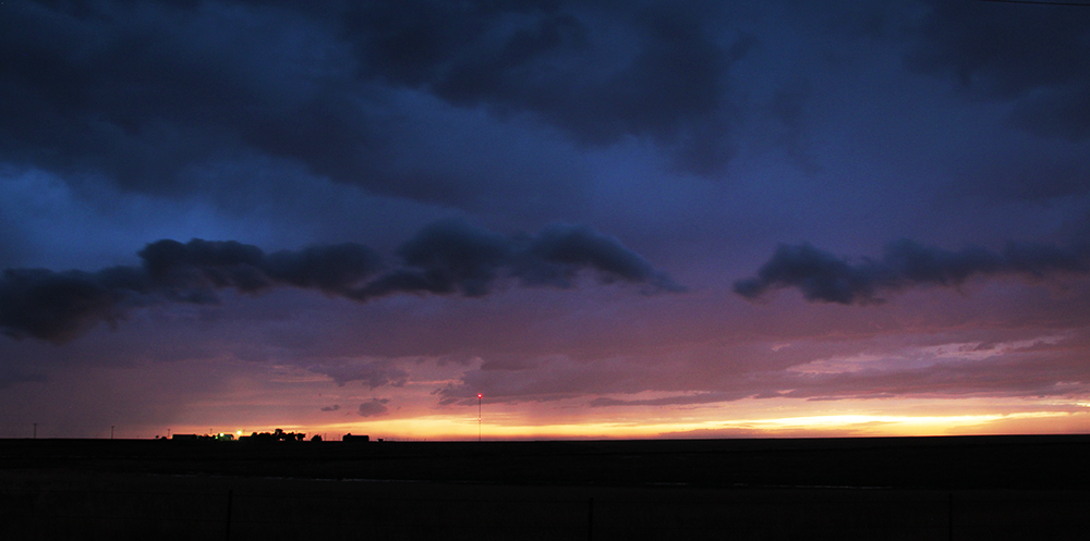
We blasted east through Lakin at 6:45PM CDT, catching up to the lowering and getting tantalizing glimpses of a funnel extending almost all the way to the ground. Above the funnel, a green RFD was beginning to carve into the back side of the storm. This was it, the storm was really wrapping up!! By 6:47 we cleared Lakin and had a beautiful view of a cone tornado on the ground just a few hundred yards to our northeast! This was easily the closest and clearest view weve ever gotten of a tornado. The field underneath the cone had a whitish color where the tornado was in contact, and a grey rear-inflow jet extended along the ground behind the tornado. It was amazing, and we were basically the only people there! The storm was only severe warned at the time, but by 6:48 the tornado warning went out. This was our first tornado from an unwarned storm.
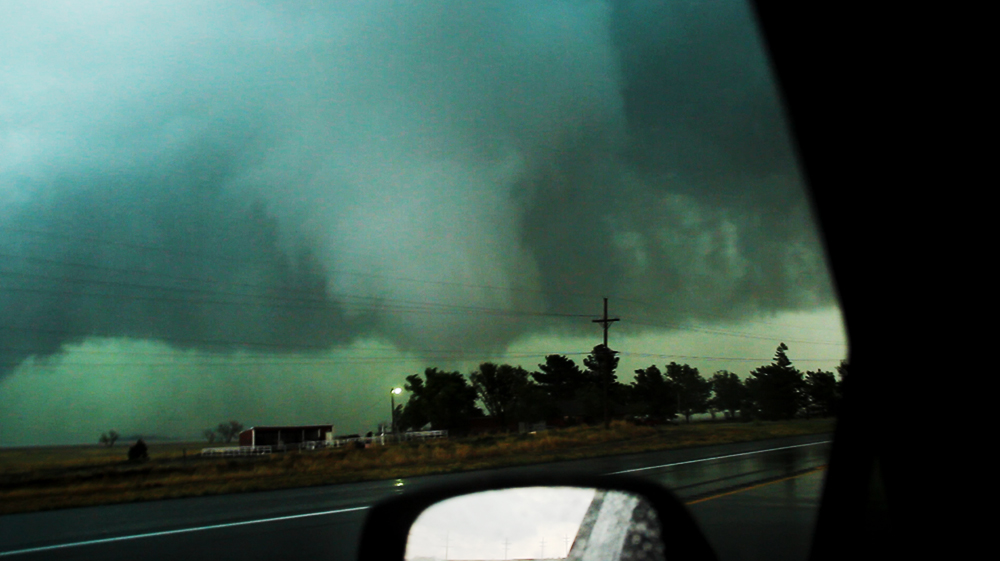
Over the next 2 minutes, the cone tornado carouselled north around the front side of the mesocyclone and fizzled out. It then reemerged a few minutes later on the back side of the meso moving on a more southerly course. This second appearance was more diffuse and not condensed all the way to the ground, but it was our closest approach as we were only a couple hundred yards behind it! We could not have asked for a better road situation, as the highway exactly paralleled the mesocyclone path, allowing us to creep safely along with it.
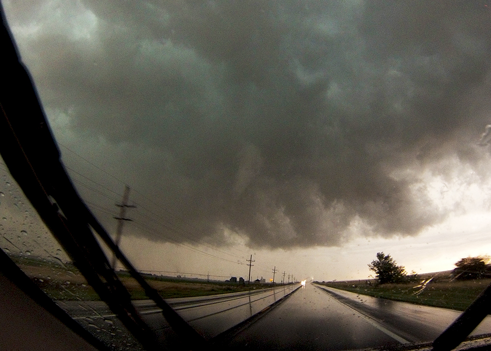
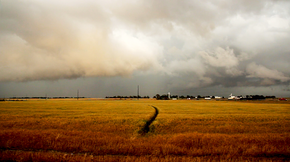
After a minute or so, the second tornado lifted and the wall cloud seemed to fall apart. A very brief, orphaned funnel appeared above us as the wall cloud died, and then the storm structure once again became somewhat confusing. We tracked along the highway until we were just west of Deerfield, and then sat outside town as the sirens blared while we reevaluated the storm. Several areas of potential development were surrounding us, with a new most prominent wall cloud becoming shrouded in rain to the northeast. We opted to take a cautious approach (there are very few south escapes on Hwy 50/400 due to the Arkansas River and we didnt want to get trapped between tornadic circulations), so we hung back a little further before proceeding.
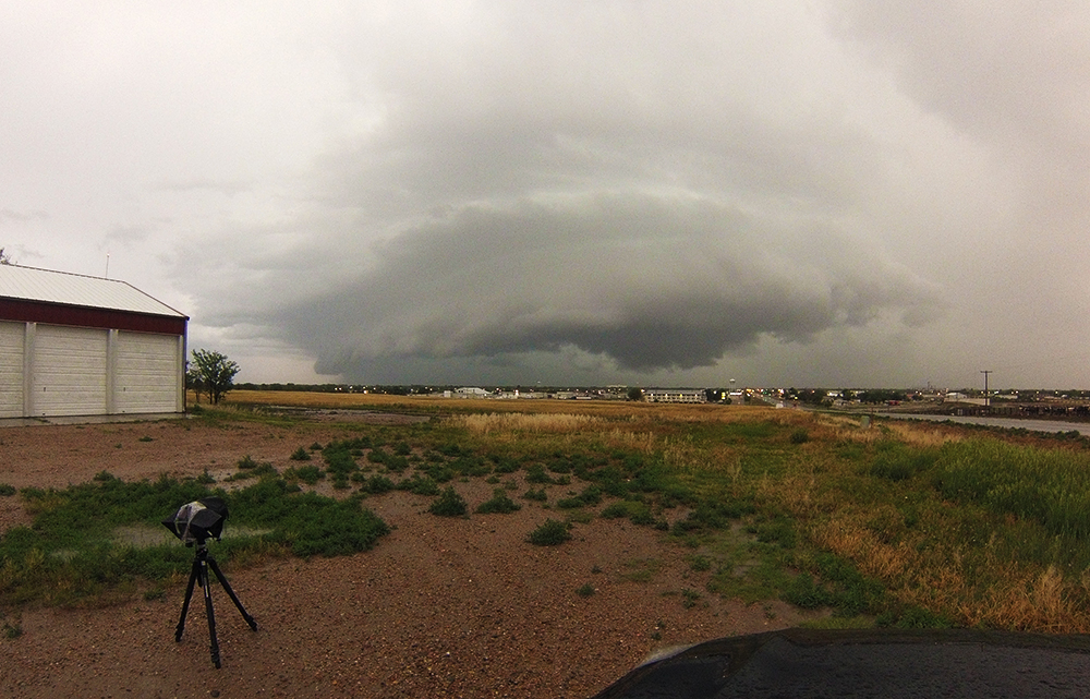
Eventually, we were able to safely get out ahead of the storm, but by this time all tornadic signs had been lost. Sadly, a compact mesoscale convective system (MCS) had swooped in from the west and cut off any inflow for our storm. Sitting on an overlook just north of Garden City, we had an amazing view of the northern bookend vortex on this MCS, complete with a well formed rotating wallcloud. This was the first time Ive even observed a bookend vortex with such clear structure.
Just for fun, we pursued the bookend vortex east of Garden City for several miles, but we never saw anything else as it got shrouded in rain. We did end up getting directly beneath the broad bookend couplet, but it had lost its structure by that point. Heading back to Garden City for the night, we had our standard late-night Applebees dinner before going to bed at the Hampton Inn. A successful day all around!
Recap, Filmmaking Notes, and Lessons Learned
- Our storm was definitely challenging to analyze, both at the time and in hindsight. What I didn't recognize at the time was that our cell performed a somewhat unusual west-east split, where we ended up pursuing the east(i.e. right?) split. The west split also took on some supercell characteristics, and this probably explains what caused the sudded switch from outflow to inflow as we travelled east of Syracuse.
- I contacted the Dodge City NWS, and they let me know that our tornadoes were rated EF0 - ground circulation but no damage.
- Being north of an MCS can give a great view of the bookend vortex.
- As it turns out, the storm of the day occurred near Trinidad, Colorado - associate with the southern outflow boundary that we chose to ignore. We were heading south along 287 when this storm produced two tornadoes. Not having cell service at that point, we weren't able to make a play on that storm (I'm not sure we would have, anyway).
- I need a better in-car mount for the T3i. My shaky tornado footage is not the cinematic quality I desire. This will definitely be a project for next season.
