Date: June 5, 2014
Time: 3:15 - 9:15 PM MDT
Place: Middle of nowhere, west and south of Limon, Colorado
Distance: 248 mi (18 positioning, 193 chasing, 37 to hotel)
Camera: GoPro3 Black and Silver, Lumix, T3i
Warnings: SVR
Rating: S3
Forecast and Set Up
After a couple long, stressful chase days, today was a welcome change of pace. We slept until nearly noon to recover from the very late drive into Castle Rock the night before. Then we started the day off right by visiting Crave Burgers where I got possibly the best burger Ive ever tasted (tempura fried cheddar, candied bacon, and avocado)! Following that, Toni did a little outlet mall shopping while I checked the days weather models.
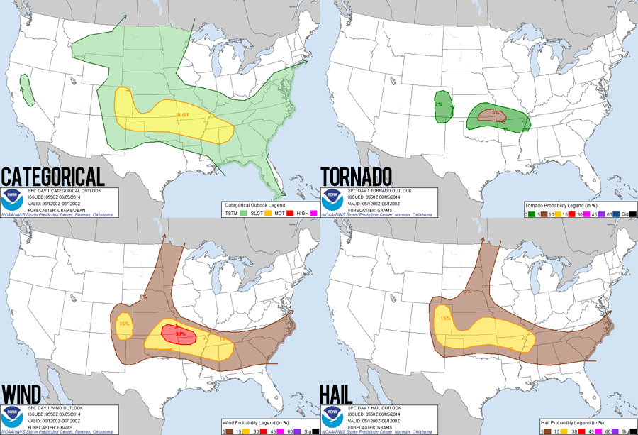
Another upslope day was on tap, with surface winds from the east running up against the Rockies to provide lift while a midlevel belt of 40 kt westerlies provided shear. Widely scattered supercells were forecast, but moisture and instability were a bit lower than yesterday (upper 40s or low 50s dewpoints and 1000 J/Kg CAPE). Even with meager tornado chances, I was confident wed see some beautiful structure.
By mid-afternoon, we were on the road - reversing our path from last night and planning to hunt for any signs of the previous evenings potential tornado in Limon. Thundershowers had already been rolling off the mountains for at least an hour, but we didnt pay much attention to these cells initially. While gassing up in Elizabeth, however, a cell just a few miles to our northeast got a severe warning. Change of plans the chase was on!
The Chase
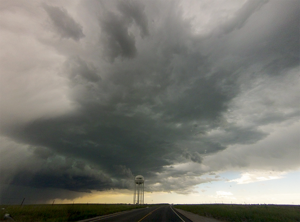
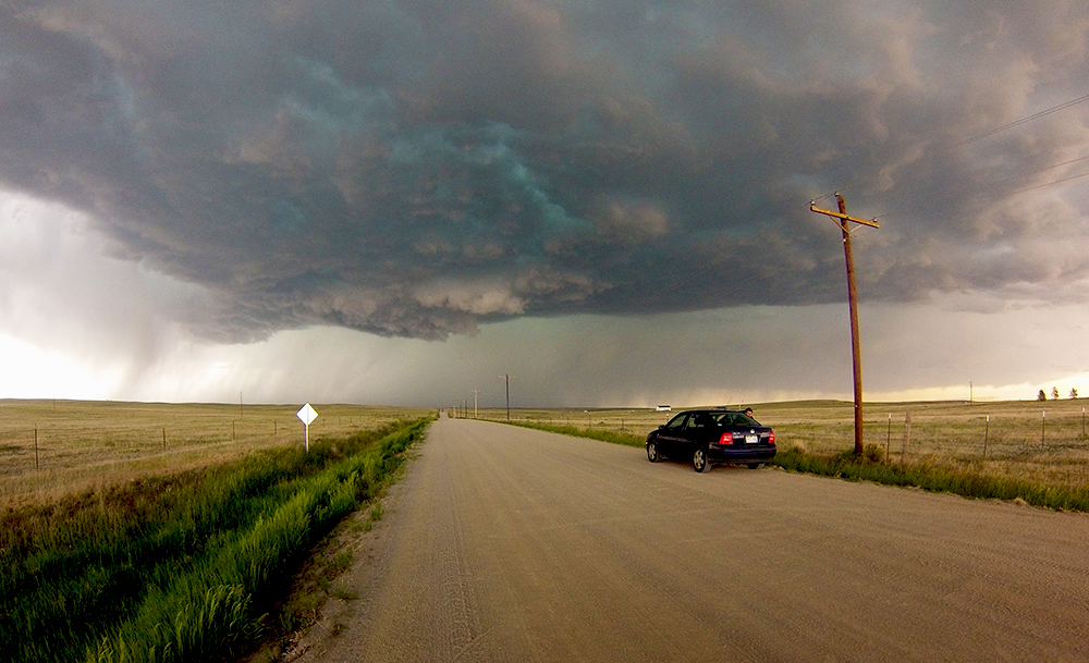
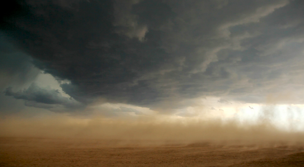
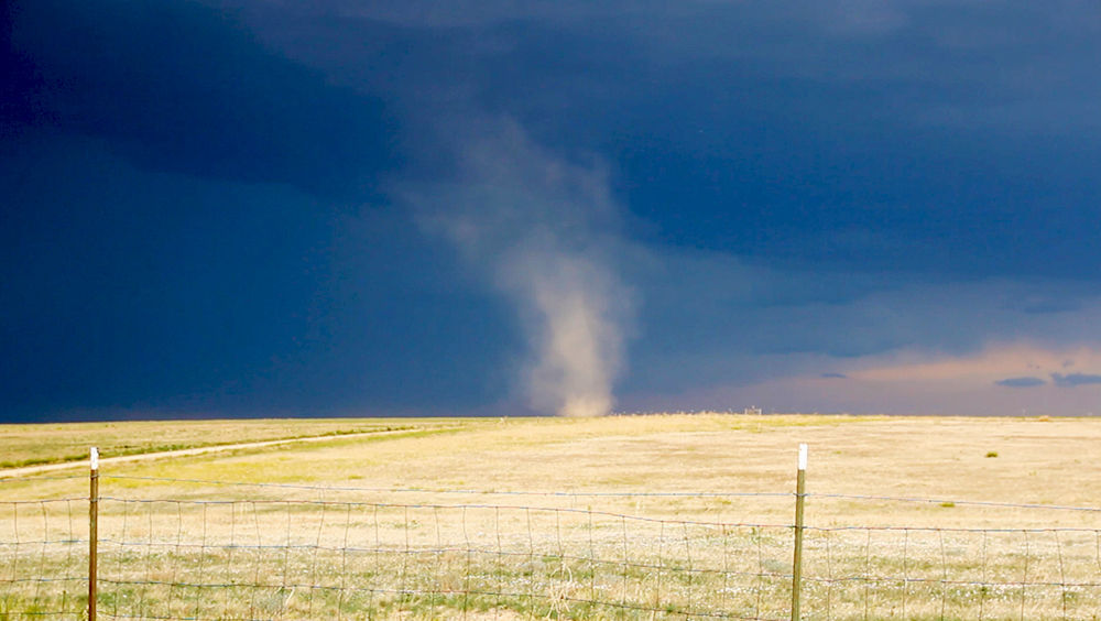
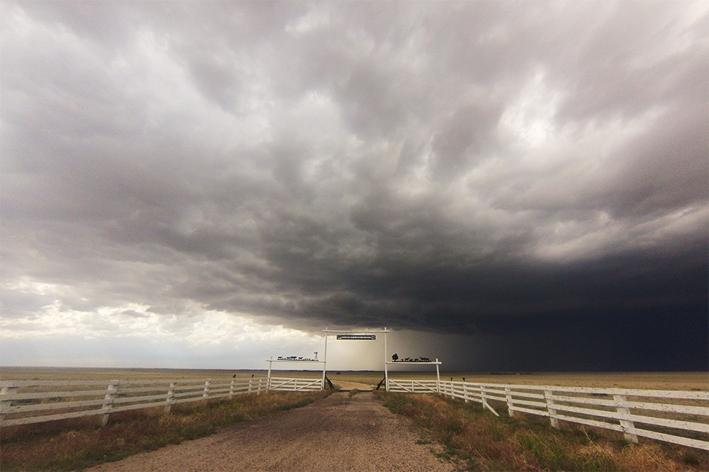
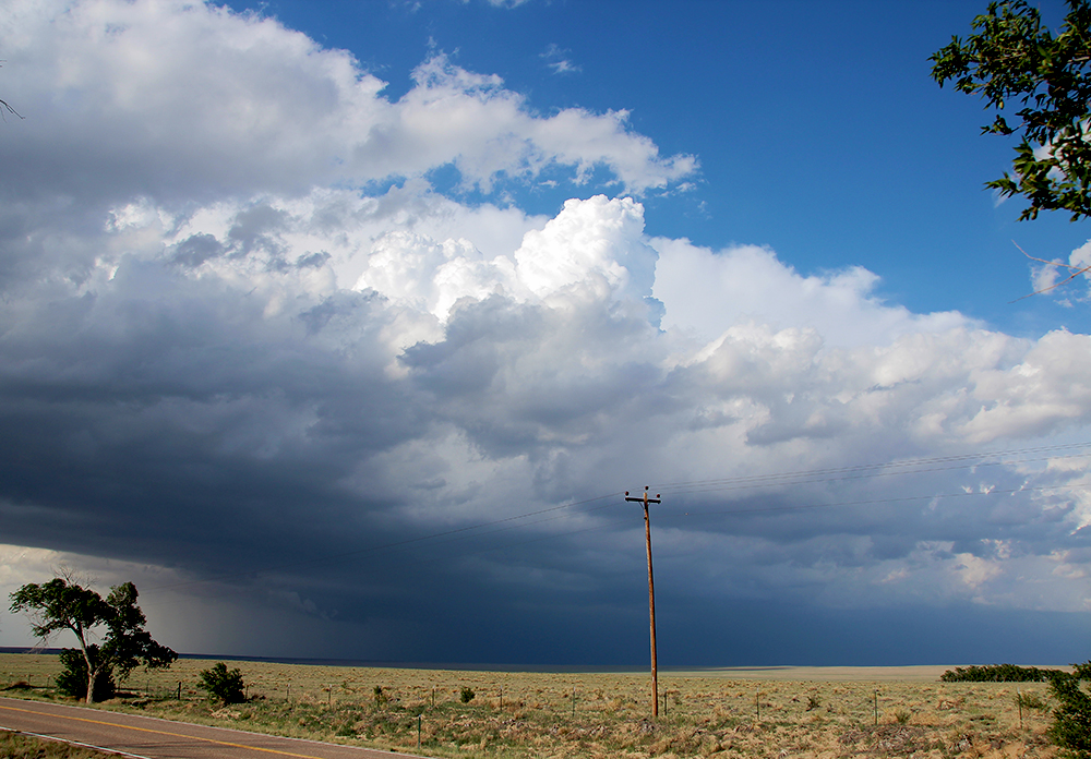
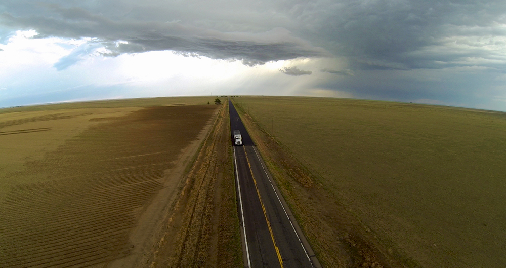
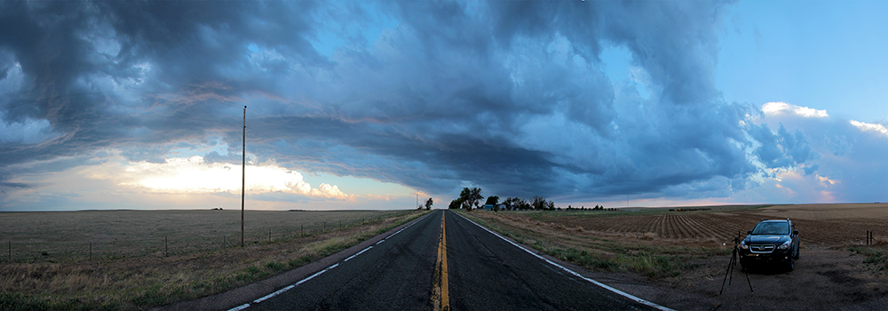
Hwy 86 provided an absolutely perfect chase route as it curved lazily ESE exactly paralleling the consolidating supercells path - allowing us to quickly catch up to the storms southern side. Radar presentation was taking on a better appearance and we were in perfect position within a developing inflow notch. The chiseled storm base was developing small, tiered lowerings that indicated broad rotation beneath the main updraft. Our first stop placed us just 2 miles south of the updraft with an amazing view of a broad RFD push interacting with opposite-moving inflow. A stubby inflow tail developed near the RFD/inflow convergence, and I was very hopeful for a brief landspout, but nothing was able to drop.
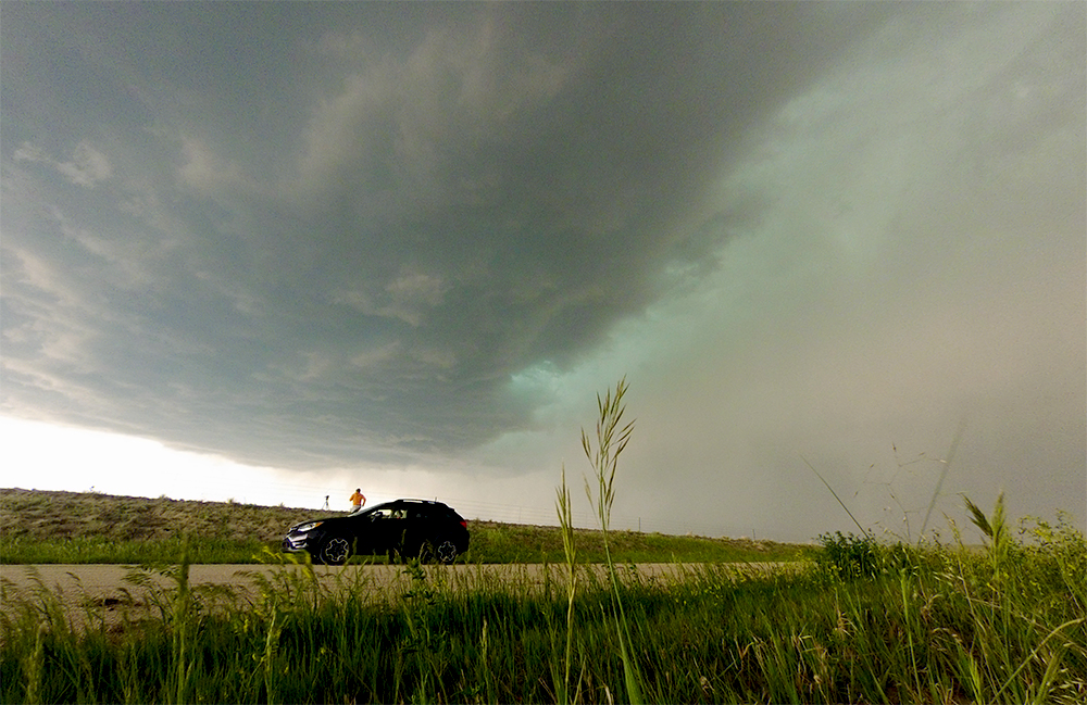
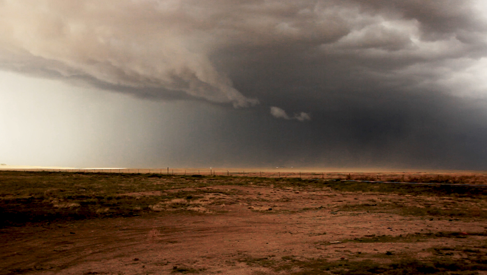
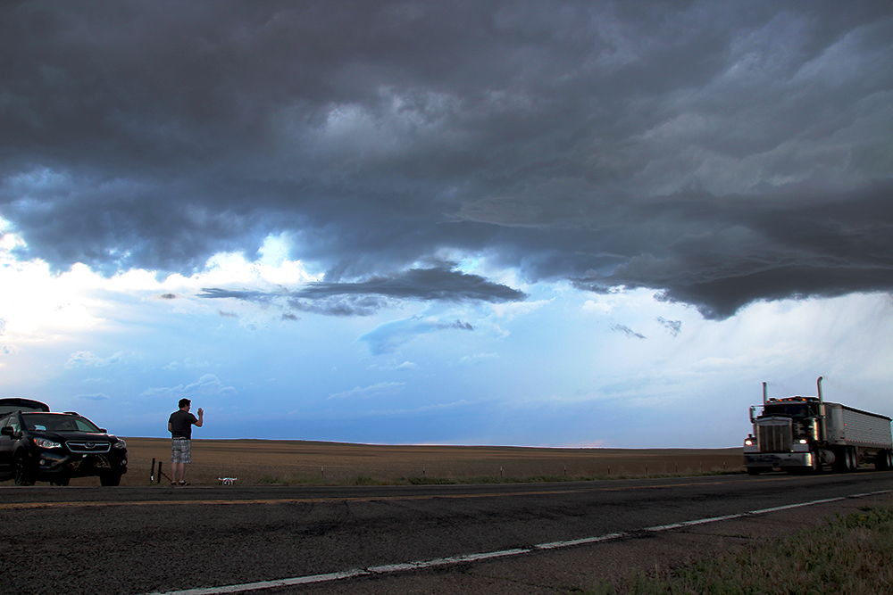
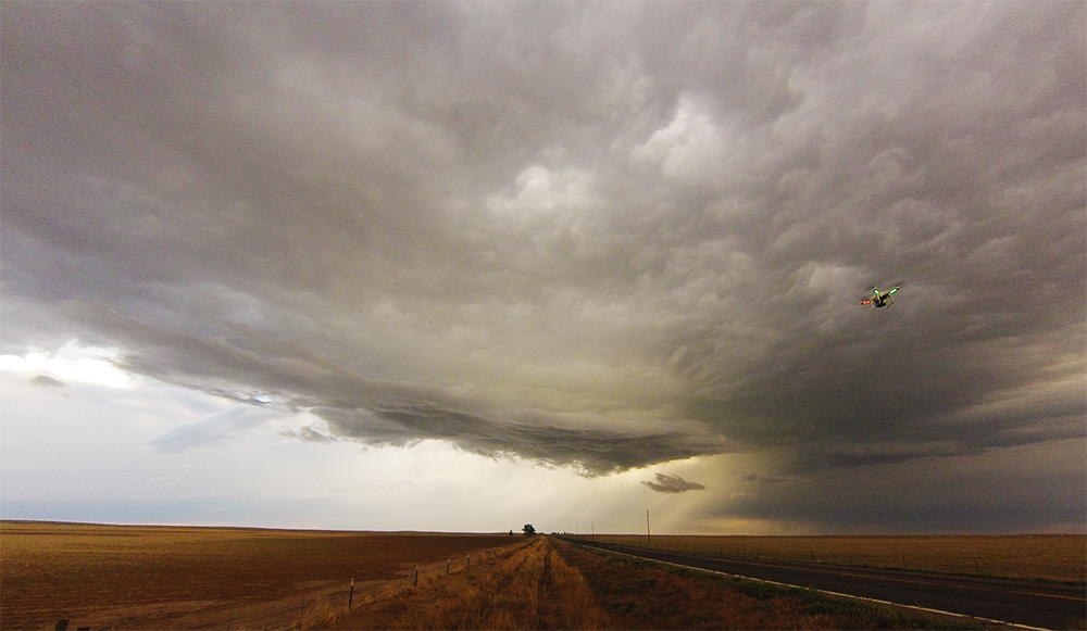
Over the next few minutes as the storm continued to mature, it took a dramatic right turn and began moving SSE. At the same time, the forward flank began to take on a more linear, outflow-dominate appearance. This turn forced us off Hwy 86 and onto southward dirt roads to stay in front of the precipitation. Despite this, we had several opportunities to stop for timelapse and copter footage as we played along the edge of the rain.
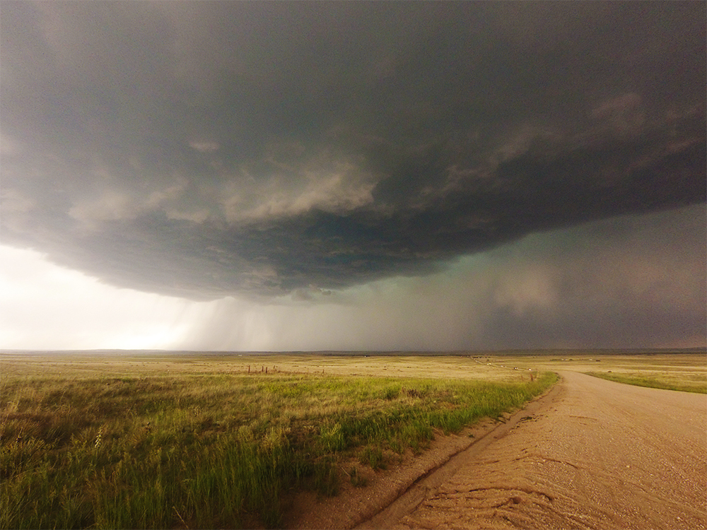
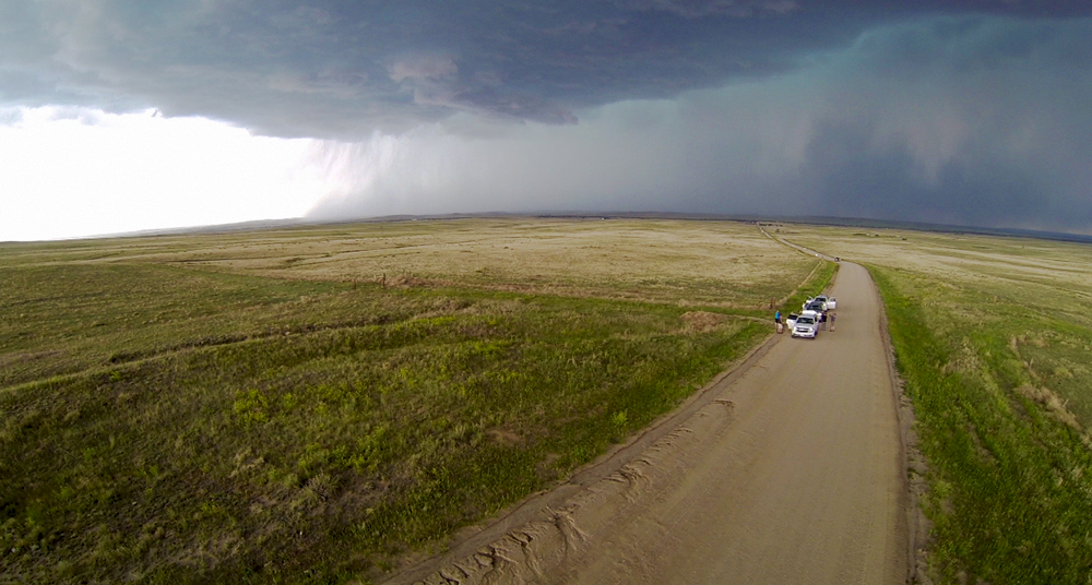
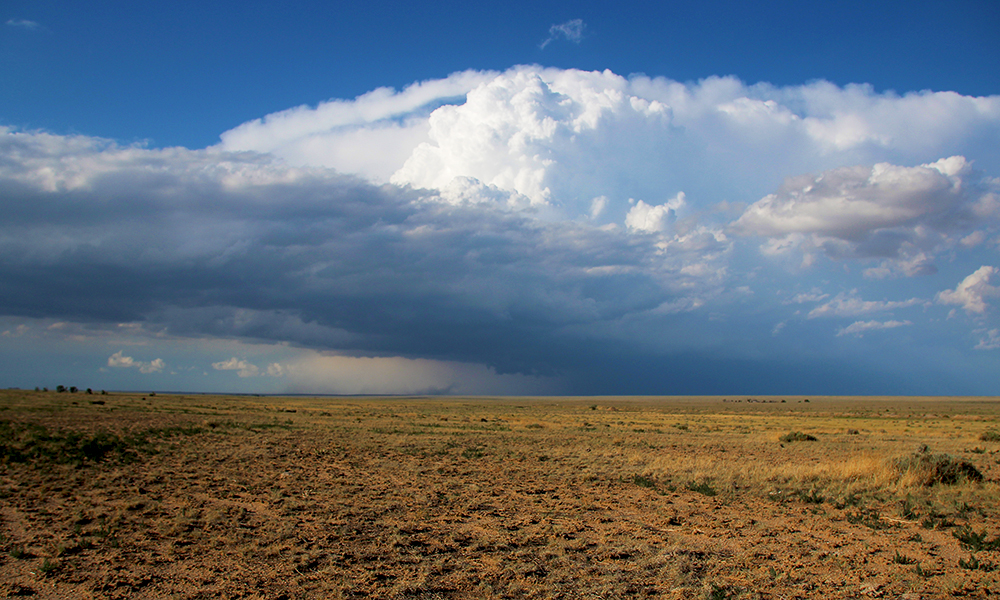
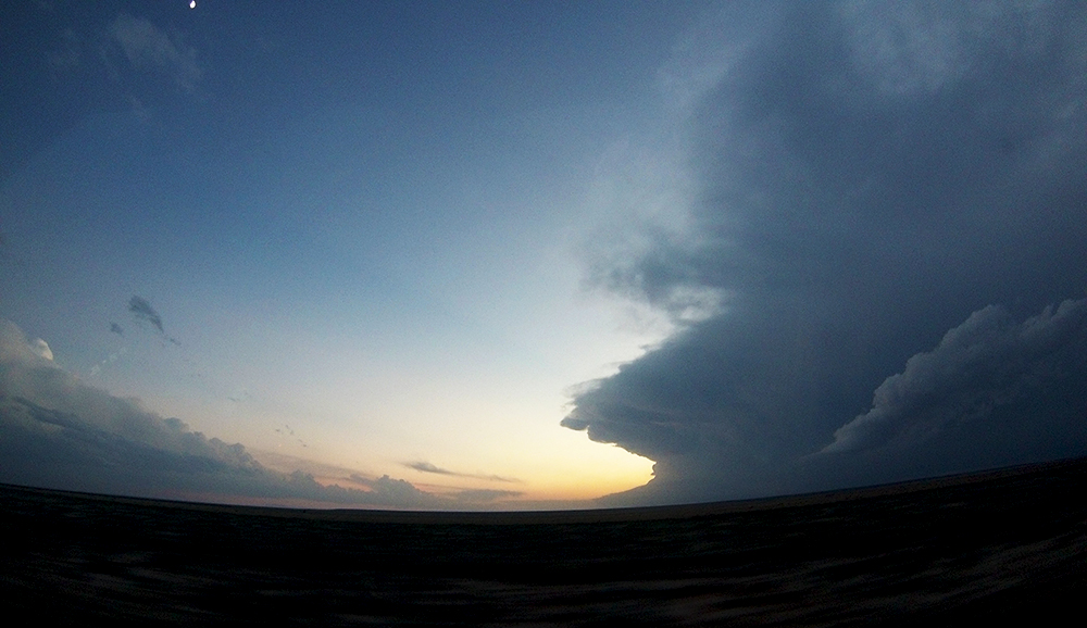
We continued these short moves and stops for the next hour and a half, eventually ending near the intersection of hwys 94 and 71. During most of that time, we werent able to get radar updates and were chasing by eye, which was a fun challenge and not at all stressful due to the storm's lazy motion. By the time we were just south of the 94/71 intersection, vigorous outflow sent a parade of tumbleweeds down the highway. I was feeling more and more confident that the storm was on its last legs, so we headed several miles south on 71 to get a better view of the entire structure. From our more distant vantage point, we were able to observe a new updraft develop and mature on the storm's southern flank, saving the cell and giving it a new lease on life.
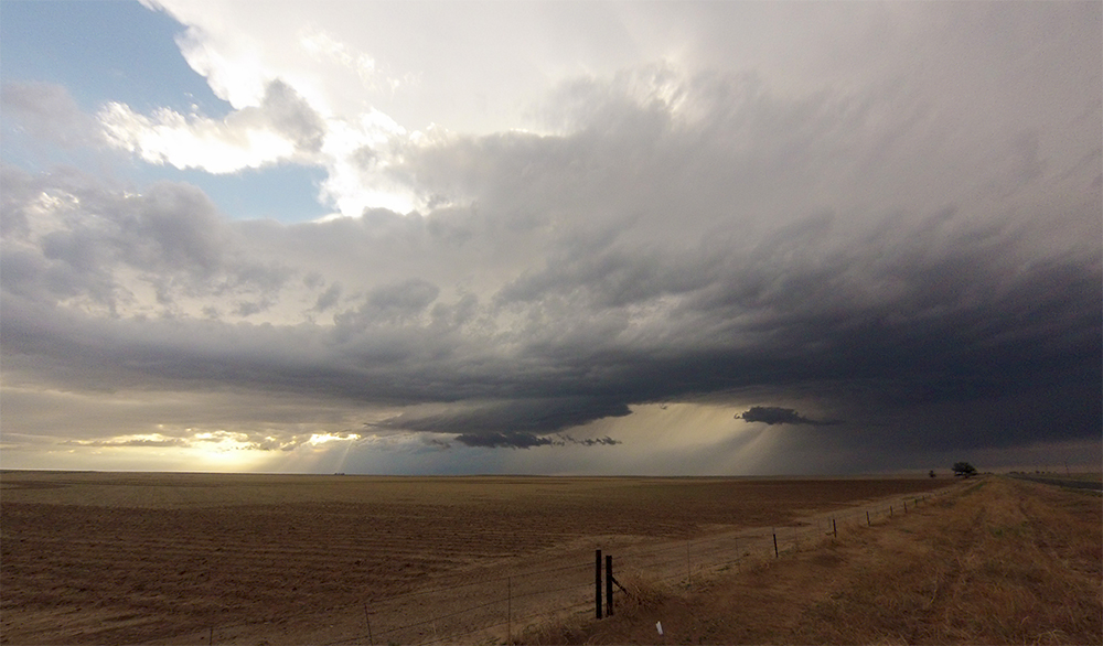
Despite this resurgent development, I still wasnt too sure that the storm would last. Itd been at least an hour since wed seen any interesting lowerings under the updraft, and I was ready for a new storm. And as luck would have it, a new storm was just getting organized east of Colorado Springs about 40 miles to our northeast, and was already exhibiting a clear inflow notch. So we turned around and raced north on 71 back to the intersection with Hwy 94. Along the way, we re-crossed the still-very-distinct outflow boundary sent out by our original storm.
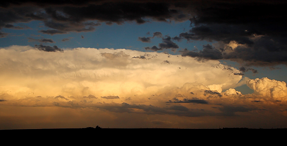
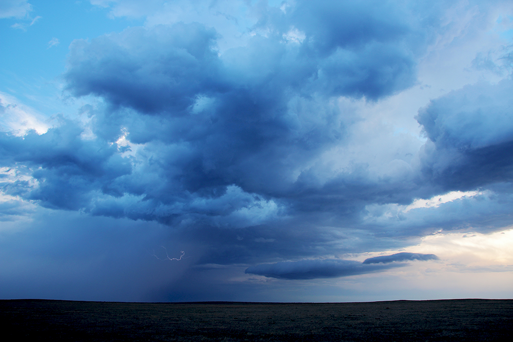
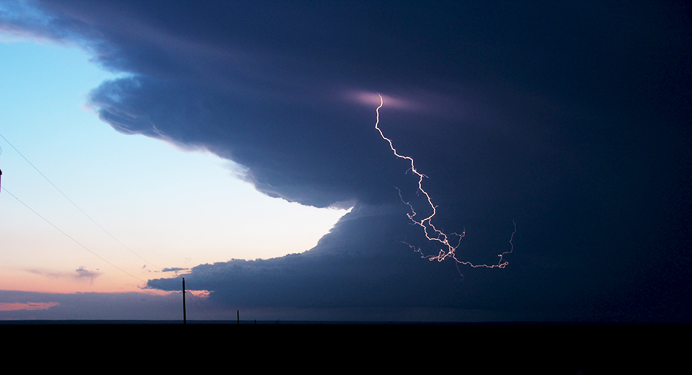
Sadly, by the time we intercepted this new cell, it was already on its way out. Moving through the same area as our original storm, it was obviously having trouble sustaining itself in the already stabilized airmass. Even though the storm wasnt very impressive, we still had fun getting magic-hour timelapse and flying the quadcopter. After that, we called it a chase and headed south to La Junta for the night. Along the way, I had one last chance to shoot lightning photos of a weak storm developing southeast of Colorado Springs. I captured a couple nice bolts before we continued on to the La Junta Hampton Inn.
Recap, Filmmaking Notes, and Lessons Learned
- As it turns out, the original supercell we chased did produce a reported tornado early in the evening after we gave up on it. Never saw any confirmation on this, however.
- If you don't have a cell signal amplifier, pretty much the only place between Limon and La Junta to get Verizon service is at the 71/94 intersection.
- Never set focus for a shot using the LCD screen. No matter how inconvenient the angle, look through the viewfinder. I should totally know better by now.