Date: June 15, 2010
Time: 6:00 P.M.
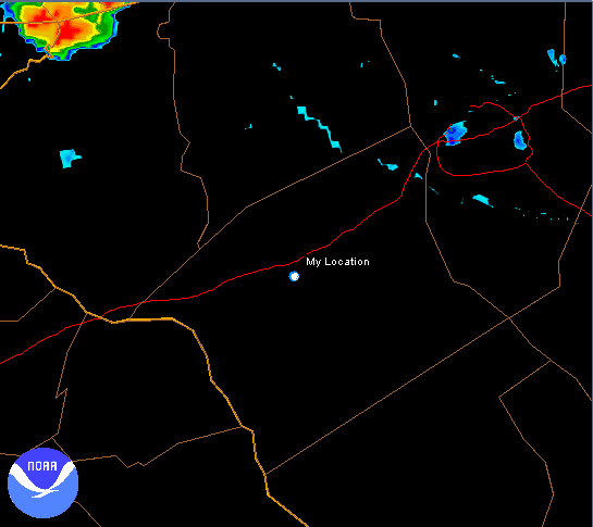
Place: Anderson, SC
Camera: Panasonic DVCam
Warnings: Severe Thunderstorm Warning
Rating: S3
This was one of the more unusual storms I have ever witnessed. It began as just about any summer thunderstorm does. The initial cumulonimbus towers formed just a few miles to my northeast and within about 15 or 20 minutes it had grown into a fairly intense storm with a particularly high amount of lightning. During its formation, the cell was nearly stationary rather than tracking to the northeast with the other storms. Then, most interesting and unusual of all, the storm actually began propagating south-southeastward, nearly 180 degrees opposite the other storm motions! As it neared, outflow winds from east to west dramatically picked up as the core of the storm slid just a couple miles to my east. I would estimate sustained winds at one point were 50MPH with the 65-70MPH gusts along with lots of quarter-sized hail. Even 20 minutes after the storm had passed, winds continued at a sustained 20-30MPH. I still have no idea how so much wind was stirred up over such a large area by such a relatively modest sized storm cell with no mesocyclone.
After the storm passed, the city of Anderson was alive with sirens. Power was out all over the place, particularly just to our east where the main core and downbursts passed. We drove around a little to film the damage and saw mostly trees and power lines down, but there were reports of roof damage as well. The video and radar below shows the full life-cycle of the very unique storm.