Date: April 28-29, 2017
Time: N/A
Place: Childress to Gainesville, TX
Distance: 1230 mi (602 positioning, 0 chasing, 628 to home)
Camera: T3i, GoPro5, Sony RX100ii
Warnings: None
Rating: S0
Pre-Chase
The 2017 storm season certainly got off to a unique start. We've already had 3 high risk days (January 22, April 2, and April 5) plus another handful of moderate and enhanced risks that actually ended up being more prolific tornado producers (January 21, February 28, March 6, March 28, and April 3). Throw in a whopper of a surprise day on April 14 (the Dimmitt wedge and tornado family), and we've had an active year. But alas, no chases for us yet. As is to be expected in the early season, the big events have all taken place well east of my feasible target zone (with the exception of the Dimmitt surprise). There have been a few days further west that got some hype on Facebook, but they all ended up having typical early season bust modes. And thus far, I've felt pretty proud of myself for holding off on these events despite my growing antsy-ness to get out and chase. Cue April 28-29 for one of the worst series of forecast busts of my chasing career (to date at least).
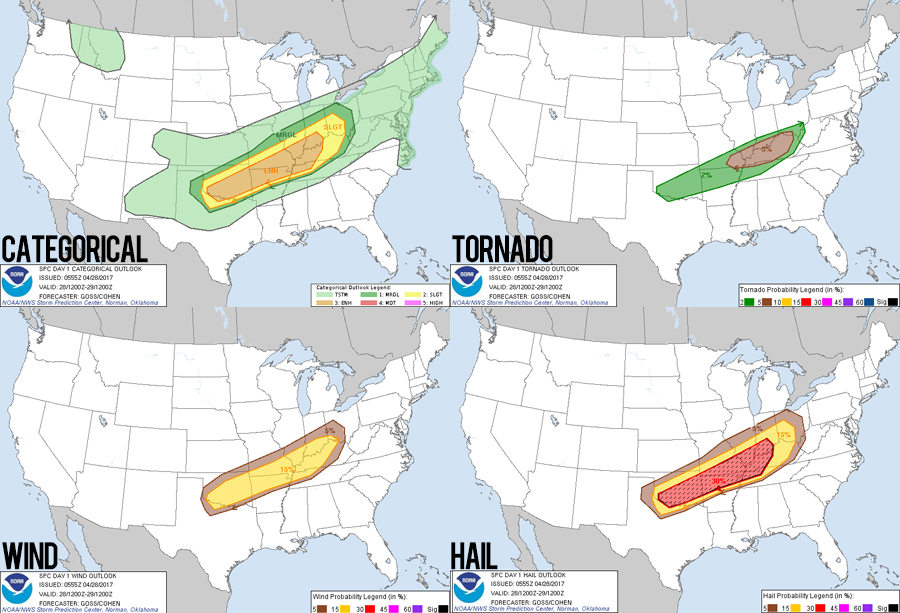
The general setup features a broad but amplyfying upper level trough over the four corners -- with some nice SW 500mB flow spilling out over the warm sector in north Texas and southwest Oklahoma. Instability looks great with mid-to-upper 60 degree dewpoints and CAPES easily clearing 3000 J/kg. So the shear and juice are in place; the fly in this ointment is the trigger. Often, dryline circulations are a nice source of initial lift to get those juicy surface parcels past a cap. This system, however, has a weak/diffuse dryline. But if I have a wish-casting weakness, it's for those lone supercells in a weakly-forced setup -- supercells that get the entire environment to themselves and have amazing, clear views and wonderful tornadoes. "Surely some little dryline bulge will get the job done and pop off a storm," was my thinking. And when an SPC outlook mentioned "a conditional risk for intense supercellular development capable of a large hail/tornado risk" -- that was enough to hook me despite the very real chance that not a single daytime storm would form.
I did have a smidgen of model justification to back me up. On the afternoon of the 27th, the NAM3K (a new convection-allowing model this year, upgraded from the NAM4K but with smaller 3-kilometer grid) was showing a few runs with late afternoon development in the warm sector. Despite this being the very definition of wish-casting (tunnel vision on the one model telling you what you want to hear), I decided to pull the trigger. After work, we made the late evening trek to Childress, TX -- pre-positioning for the next day's chase. (At this point, you might be asking "If storms were gonna form late in the afternoon, why not just drive out the next morning when you had more model runs in range of the event?" That would be a question to which I have no good response.)
The first sign I'd made a classic forecasting blunder came about midnight in Childress as I perused the latest model runs. Not a single one showed a hint of warm sector initiation...
The "Chase"
9:00 AM - 1:00 PM CDT: One thing I absolutely love about pre-positioning the day before is the lazy excitement that builds through the morning in the hotel room as you check model runs and pack up camera gear. It's harder to savor that excitement when you're making a 400 mile scramble from ABQ the morning of the event. That excitement was definitely tempered a bit this morning by the increasing likelihood for a daytime bust - but it was still there. After checking out of the Holiday Inn Express, Toni picked out a new lunch restaurant -- K. Bryant's Barbecue in downtown Childress. The atmospheric building is a former old-timey hardware store with all the original shelving still present along one of the high walls. Oh and the BBQ Frito Pie is amazing.
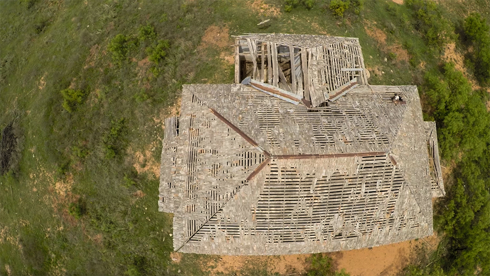
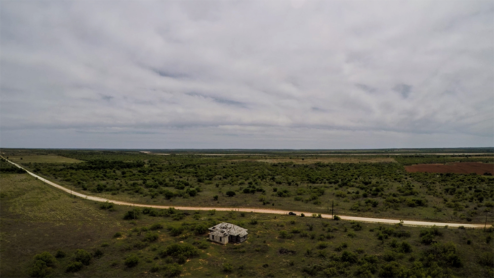
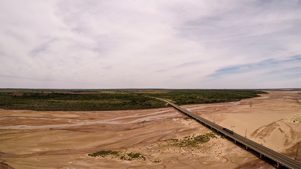
1:00 - 3:00 PM CDT: After lunch, we still had hours before any chance of initiation, so I decided to film some random b-roll around downtown Childress and then head north out of town and see what exploring we could do around the Red River. This year I upgraded my aerial capabilities with the new GoPro Karma quadcopter -- complete with a 4k GoPro5 and a desperately-needed 3-axis gimbal. I couldn't have been more pleased with the buttery smooth footage from some test flights over an old abandoned church and the Hwy 62 Red River bridge. Goofing off and playing with camera equipment in the middle of nowhere is one of the best parts of chasing. But after a couple hours, it was time to start getting into chase mode.
3:00 - 7:30 PM CDT: Surface observations indicated that the dryline was a littler further east than previously expected, so we headed SE on Hwy 287 with an updated target of Gainesville, TX. Along the way, I monitored the new GOES16 visible satellite imagery for any cumulus fields that might be precursors to initiation. The higher resolution, 5-minute-refresh satellite data is going to be a game-changer for honing in on the optimal pre-initiation target. But sadly on this day, the visible satellite was telling a dispiriting story -- a thin, milky cirrus deck was the only feature anywhere close to my target area. The cirrus affirmed that great shear was already overhead, but without any bubbling convection underneath to take advantage of it.
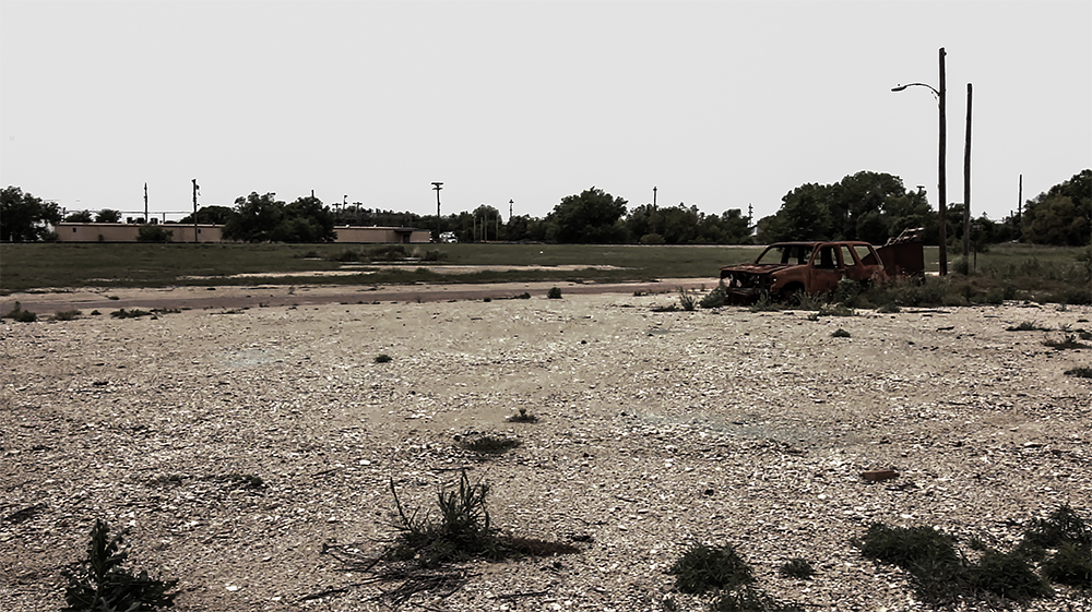
Upon arrival in Gainesville, I thoroughly scrubbed observations and models for any subtle convection clues, but the afternoon was growing long and time was running out with no initiation in sight. We gassed up at a combination convenience store and drive-through liquor store (!!!) before heading a bit farther east (more out of just needing something to do rather than actually targeting). East of Gainesville, the trees suddenly get remarkably thicker, so we paused near Callisburg to wait and see what might happen. Interestingly, this spot marked the furthest east we have ever gone on a chase.
7:30 PM - 12:30 AM CDT: As sunset neared, the atmosphere remained stubbornly stable - not a single Cu in sight. So we slunk back to the Gainesville Rib Crib in defeat -- though trying out our 2nd new BBQ spot of the day lessened that sting a little. While eating some BBQ sliders, I noticed that the HRRR repeatedly initiated an intense cell just a little to our west near Wichita Falls by around 9PM. Energized by an excellent dinner, I decided that perhaps we could see some storms after all. So back to Wichita Falls we drove.
But wish-casting had once again set in and I got tunnel-vision on the HRRR. As 9PM passed with no storms, the next HRRR run said "just wait till 10PM, it's still happening." Rinse and repeat as 10PM passed and the next run said "just wait till 11PM." I came to my senses around 11:45, after sitting by a nice little lake on the west side of Wichita falls for nearly an hour. This was the latest we'd ever stayed out hoping for development, and I finally admitted we just weren't meant to see storms today. As we headed to our Vernon, TX hotel for the night, storms eventually did pop back near Childress where we started the day, but these were elevated cells not in the warm sector -- development which had been well-forecast for that last couple days. I still can't believe how many SpotterNetwork dots were out following those storms at 2 in the morning.
Post-Chase
Apr 29 11:00 AM - 1:00 PM CDT: The next morning, I took a quick look at models and easily made the call that the day wouldn't be worth chasing. A sharp, crashing cold front looked to set off a nice squall line east of Dallas, but I just wasn't interested in chasing those kinds of storms that far east. So after checking out, we headed back to Childress for some lunch. I was up for another visit to K. Bryant's, but Toni decided that 3 BBQ meals in a row was too many. Instead, we stopped at Dawson's Family Restaurant and had a nice little Saturday lunch buffet. By this point, Childress was behind the cold from with temperatures in the low 40's, and I'd made the classic early-season chase mistake of forgetting some warmer clothes for post-chase drives.
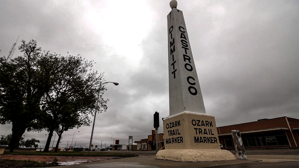
1:00 - 5:00 PM CDT: After lunch, we took a slight detour to pass through the town of Dimmitt, TX on the way back home. As mentioned earlier, Dimmitt was the site of a surprise tornado outbreak just 15 days earlier, but thankfully the town itself was spared. Last fall, I started volunteering with the StormAssist charity in editing their year-end review of tornado events, which is sold on DVD, Bluray, and Vimeo to raise funds to help storm-impacted communities. I thought getting some b-roll footage in Dimmitt would probably be helpful to help tell the story of that day's events.
While I was getting some slider footage of the Dimmitt town signs in the howling 40 degree north wind, I got a FB message with a simple pic of a massive grey wedge with the message "Texas got neat today." Apparently my quick forecast of a crashing cold front and linear storm modes hadn't quite verified. It turns out that a few discrete storms were able to initiate in a very narrow pre-frontal corridor SW of Dallas near the town of Canton. It was the final slap in the face for this trip - Canton was only a couple hours from where we were the day before. I had not only botched the day-of forecast, but I also blew off what turned out to be true event and one of the bigger tornadoes of the year. It was a humbling but essential lesson: I still have a lot of room for improvement.
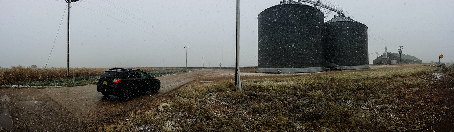
5:00 - 6:30 PM CDT: As we continued west towards home, we eventually hit a band of significant snowfall near Clovis, NM. It was kind of surreal to be back in the high plains desert with quarter-mile visibility due to heavy snow. I got my only weather picture of the whole trip stopped near an old grain silo and train crossing west of Clovis -- heavy snow falling all around. One of the stranger ends to any of our chases.
Recap, Filmmaking Notes, and Lessons Learned
- Never, never, never get cocky about forecasting skill. If things are starting to seem easy, then you aren't paying attention to enough data.
- Don't latch on to the HRRR, the NAM3K, or any other CAM as a substitute for forecasting from surface obs.
- The 3-axis gimbal along with the ability to start and stop recording remotely are going to revolutionize the amount of work needed to incorporate quadcopter footage this year.
- I'm gonna try a new log format this year that merges my old paragraph-style writeups with the later twitter-style real-time updates. I liked the immediacy of the short, real-time updates but missed the deeper analysis and descriptions of the old logs.