Date: April 26, 2016
Time: 3:00 - 7:30 PM CDT
Place: Thomas, Canton, Fairview, OK
Distance: 1168 mi (459 positioning, 155 chasing, 554 to home)
Camera: T3i, GoPro3 Black, Sony RX100ii
Warnings: SVR
Rating: S3
The Chase
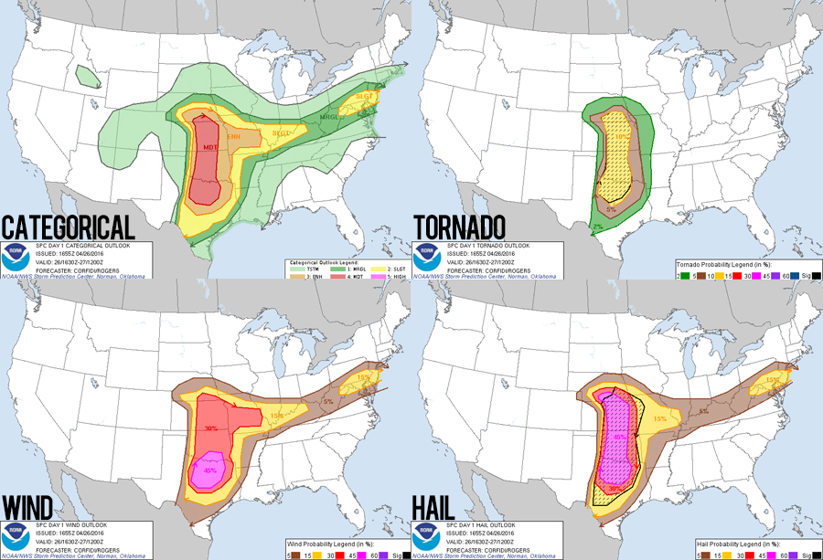
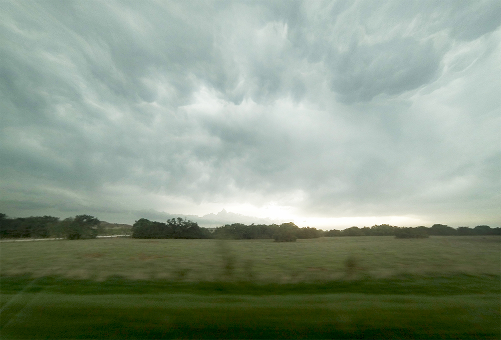
7:15 AM MDT: Leaving ABQ for what will either be a big day or a big bust. Models from a few days ago were showing a classic outbreak scenario across Kansas and Oklahoma, but as the day has approached problems have emerged. Particularly, a bad case of veer-back-veer in the wind profiles. Still, with CAPE values getting close to 5000 J/KG is spots, there's no way I could sit this one out.
9:52 AM MDT: I've held off the decision of whether to chase Oklahoma or Kansas until the last second. We are in Tucumcari where we either continue on I40 to Oklahoma or cut northeast on Hwy 54 to Kansas. Given current obs and the last few HRRR runs, I'm going with Oklahoma. Current target: Altus.
2:04 PM CDT: Just west of the dryline now gassing up in Sayre, OK. Looking at the special 18z Norman sounding, there isn't quite as bad VBV as the models were showing. Might be a sign this day will be better than expected? A new mesoscale discussion just went out as well, tornado watch is imminent.
2:35 PM: Dryline Cu towers are starting to show radar blips from Kansas down to I40. We are still about 20 miles west of the mixing zone. A PDS Tornado Watch was just issued. I'm actually very surprised the SPC is going all in. BUT MAN AM I EXCITED!!!
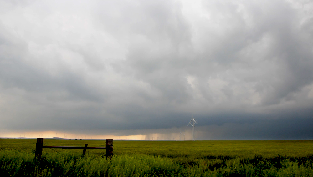
2:57 PM: Dryline towers initiating just to our north now near Custer City moving away to the NNE. Getting up close to them now in case they explode, but really keeping an eye to the SW as well.
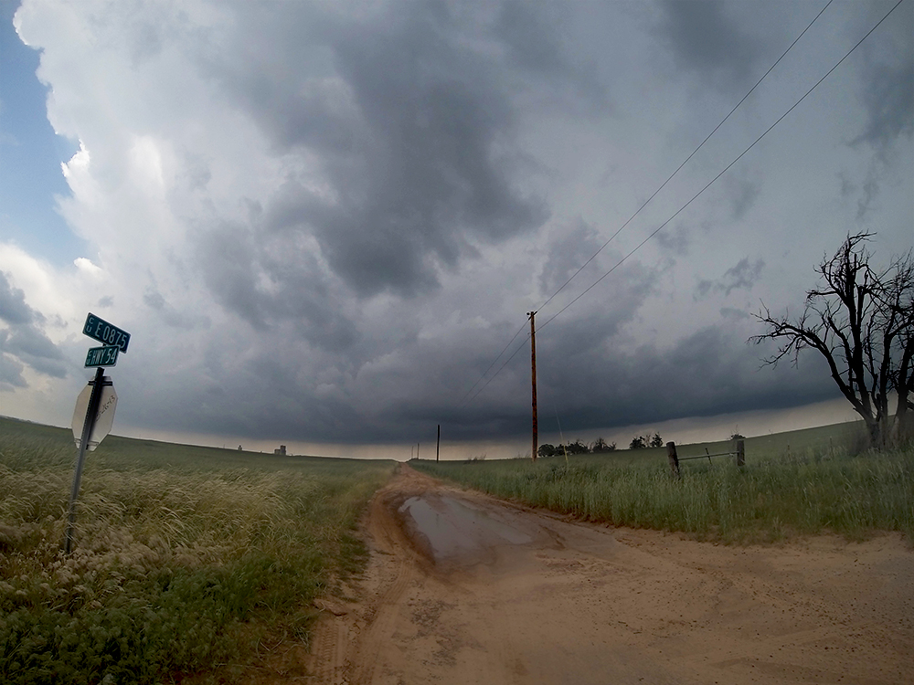
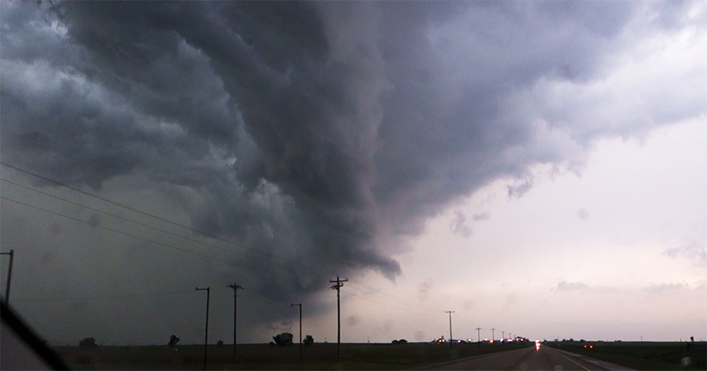
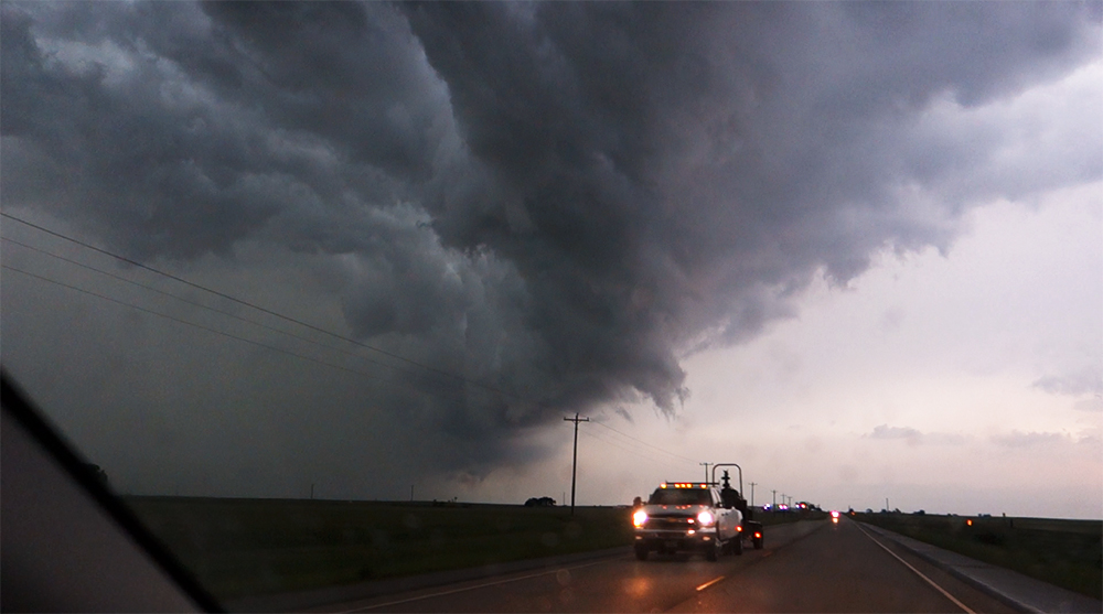
3:40 PM: Sitting near Thomas now - just a couple miles east of the dryline mixing zone. A new base is looking real nice to our SW near Clinton. Way SW a cell is also exploding over Crowell, TX. It will probably be tornadic as it moves into SW Oklahoma. If we want to get there we need to start moving now. Very torn.
4:00 PM: Our close cell continues to strengthen, but it is looking very linear now as well. Just met a nice chaser from Amarillo who chased the Red Rock tornado 25 years ago today.
4:10 PM: Gonna stick with this storm instead of dropping south. Inflow has sculpted it into a subtle bean shape and the SW flank has stopped firing and seeding into it. All points look good as of now.
4:29 PM: Tail end RFD still hasn't hooked in like I was hoping. We are proceeding north into Canton to stay with it but this think is looking more linear than a few minutes ago. Very sharp tail end on radar. Stopped for a second on the side of the road and some people started yelling at me from their porch. Not sure if they were mad or wanted info.
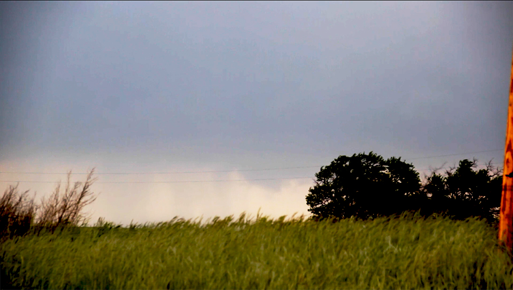
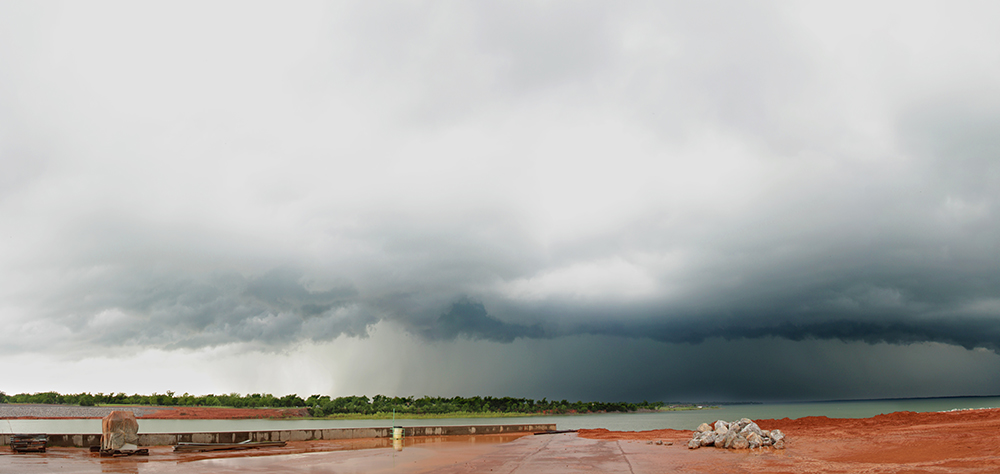
4:53 PM: Gorgeous view here at the Canton Lake dam, but sadly I think this storm is finally shriveling. Gonna stick with it just a little longer because we are now well out of position for storms on SW Oklahoma. (This better not be a May 16, 2016 heartbreaker all over again).
5:37 PM: Well this was a sign. Just got free from a comically slow one-lane river crossing south of Cleo Springs. Delayed us for 10 minutes and we were already falling behind. Looking for a new target.
5:49 PM: A new little cell has initiated in the open warm sector near Geary. We are dropping south at Ringwood to get closer.
6:05 PM: Well that new cell must've heard we were coming. It continued to develop rapidly for a few more radar scans but then immediately fell apart. Wow what is going on today?? I thought storms would explode in this monster CAPE, maybe the VBV is really bad now.
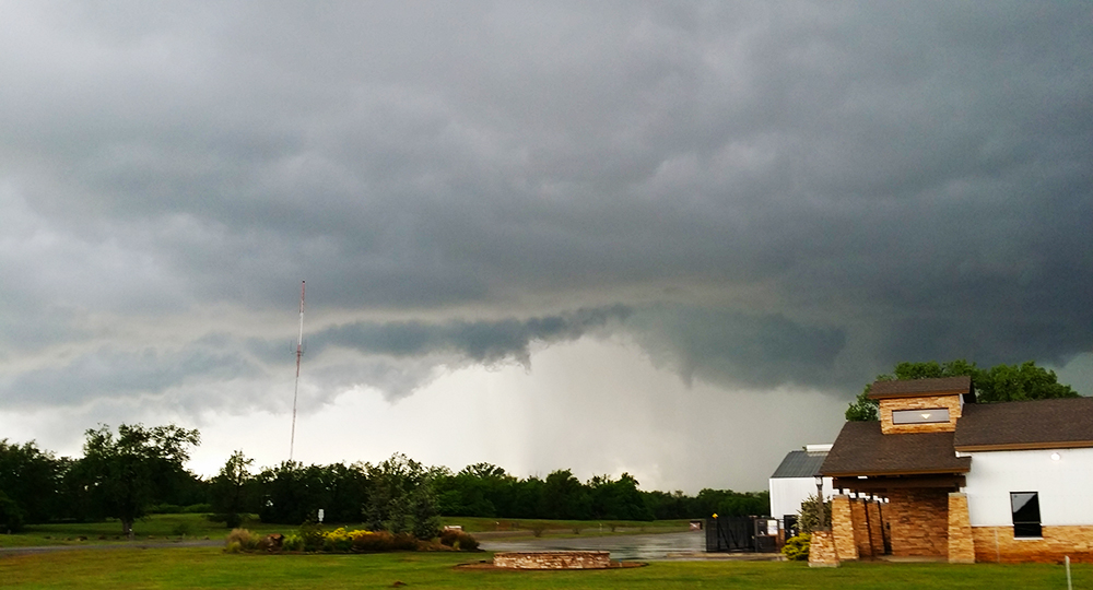
6:23 PM: A very strong but compact LEWP is moving towards Fairview - where we were an hour ago. Gonna check that out, but honestly after that I don't see much else that is chaseable.
6:48 PM: Pretty good shelf cloud north of Fairview as the LEWP passes over. There's actually a very impressive associated bookend vortex on doppler radar several miles to our north. It's got a very neat spiral rain band structure. We will try to sneak a peek through the rain.
7:15 PM: Some strong winds and lightning as we got closer to the bookend vortex, but there's not much else to see structure-wise. Calling it a day.
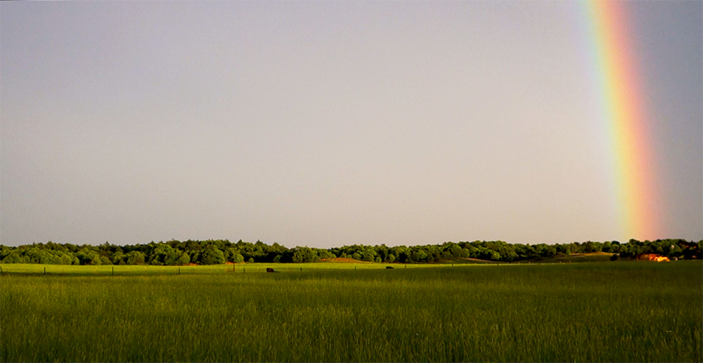
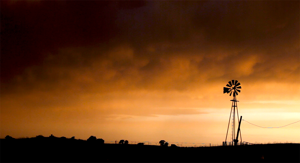
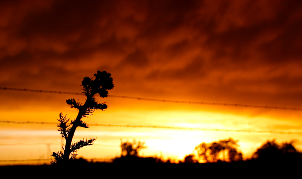
8:07 PM: Another stunning sunset as the MCS continues off to the east. Stopping to get some shots.
8:30 PM: Power is out in Chester, where the LEWP passed over at its strongest.
9:57 PM: Classic end to the chase day. Dinner in the Elk City Huddle House (they have low melt!!) while the local news talks about today's storms.
Recap, Filmmaking Notes, and Lessons Learned
- Given the PDS tornado watch, I think most people will count this as a pretty major bust day. There were several widely scattered tornado reports in Texas, Oklahoma, Kansas, Missouri, and even 1 in Indiana. But none were intense or long-tracked as the PDS watch signaled.
- When a forecast looks apocalyptic several days out, there tends to be significant forecast inertia scaling back the predictions when models start to show problems. A particularly bad case of veer-back-veer (which showed up in the 0z soundings) is likely what limited today's potential, and that started showing up in the few days leading up to today.
- I've traditionally thought of negatively-tilted troughs as the best-case synoptic setups for outbreaks, but after chasing a couple over the last few years, these can really have their own issues as well. Today it was the meridional upper level winds that contributed to the VBV.
- Carelessness created a video editing nightmare. My timelapse and RX100ii footage is all 24p, but I somehow accidentally filmed all the T3i footage at 29.97 fps. UGH!!!