Date: April 26, 2013
Time: 5:00 - 8:30 PM CDT
Place: Leedey, Arapaho, and New Cordell, OK
Distance: 1094 mi (521 positioning, 98 chasing, 475 to home)
Camera: T3i, GoPro, Lumix
Warnings: SVR
Rating: S5
Forecast and Set Up
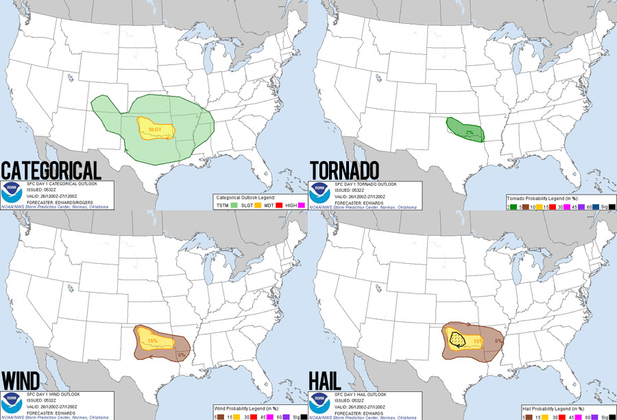
Though an ominous date in storm chasing lore, today's setup didn't portend nearly the same storm potential as 22 years ago. But I did think it was worth a relatively short drive on a free Friday. A positively tilted trough was kicking into the plains, giving a brief window for moisture to be drawn up into Texas and southern Oklahoma. At the same time, the southern jet stream was streaking across the same region, providing nice turning-with-height wind profiles. My hope was that a diffuse dryline on the Texas Panhandle/Oklahoma border would provide enough lift to generate some discrete storms that would move out into the moist, sheared environment. Behind that dryline, a cold front was crashing in from the NW across the Texas panhandle and would provide much better lift for storm development, but would also likely result in more linear storms, precluding tornado development.
Yesterday after work, Toni and I made the late evening drive from Albuquerque to Childress, Texas (thank goodness for Hyperion on audiobook, keeping me awake). My original thinking was that storms would develop today along the Red River. But as usual, morning models changed my mind; storms looked more likely north of us in western Oklahoma. Still, we were in excellent position and thus got a lazy start to the day, leaving Childress around noon. In Altus, OK, Toni found a nice local coffee shop where we sat around for a while watching the visible satellite images for any developing cumulus. We wasted a little more time near Altus Air Force Base watching C5 Galaxy's do touch-and-go landing practice. As the afternoon wore on, it looked like storms were having trouble initiating further south along the weak dryline. So while the initial play for discrete storms was off, we could still catch the cold front action moving in from the northwest.
The Chase
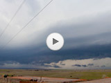
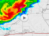
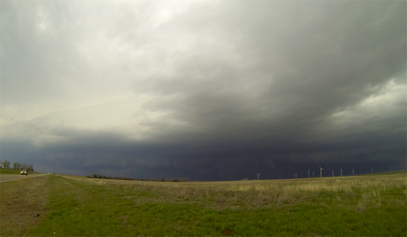
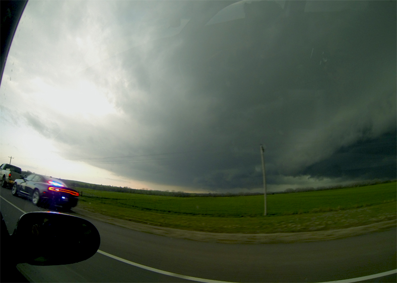
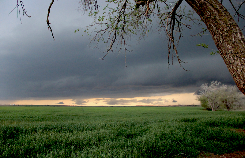
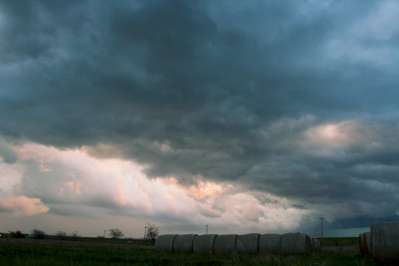
At 5PM we grabbed a quick bite in Elk City and headed north towards what initially looked like a rather anemic line of storms. From a distance they look very low-topped, and I was nervous we weren't going to see anything interesting. Continuing north, we quickly intercepted the SE-moving storm complex, and near Leedey I got some neat slider footage of a developing gust-front and shelf cloud. Not wanting to be overrun, we raced east on Hwy 47 as the storms suddenly began to take on a much more impressive appearance. Though still outflow-dominant, there were beefy lowerings embedded in the gust front, and (what I didn't realize at the time) inflow bands feeding into these lowerings.
Just south of Putnam, I thought we had enough lead time to pull over and set up a motion-timelapse of the approaching squall line. We pulled off the road on a nice hill overlooking a wind farm and I began setting up the slider and stepper motor. To power the stepper motor, we run a cable from the car battery to where the slider is set up, and this can take several minutes to assemble. Unfortunately, this caused two problems. First, I underestimated how fast the storm was surging out towards us, and I finally got everything assembled just as the first rain drops and cold outflow winds hit us. Second, I was so busy fiddling with camera equipment that I completely missed a brief tornado that was reported just 2 miles to our north underneath one of the beefy lowerings. (I have scoured our GoPro footage during this time and never saw the tornado, so it might not have been visible from our location.)
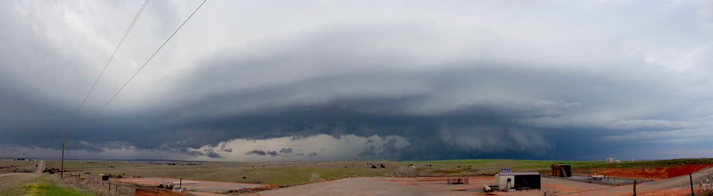
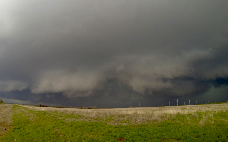
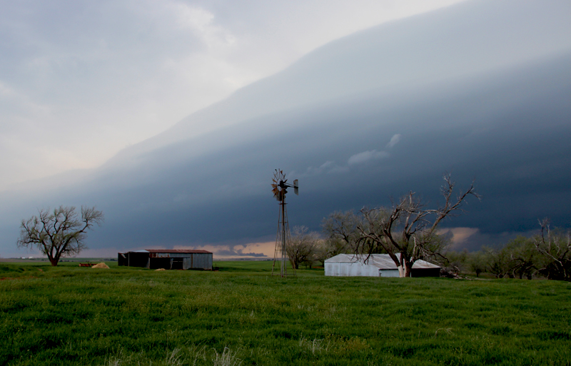
Escaping to the south along Hwy 183, we soon emerged back out from underneath a massive surging outflow boundary. Since the storm complex was moving more east than south, we were quickly able put a little more distance between us and the precipitation. Near Arapahoe, we pulled off at an old windmill and barn, and I finally got the slider set up to capture some motion timelapse of the approaching shelf cloud. We had about 20 minutes to relax and film as the precipitation core caught back up to us. These are the moments that I will always remember.
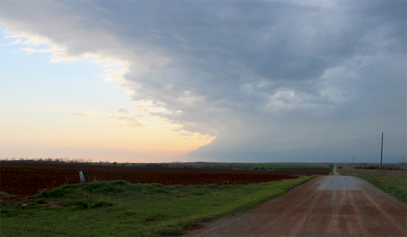
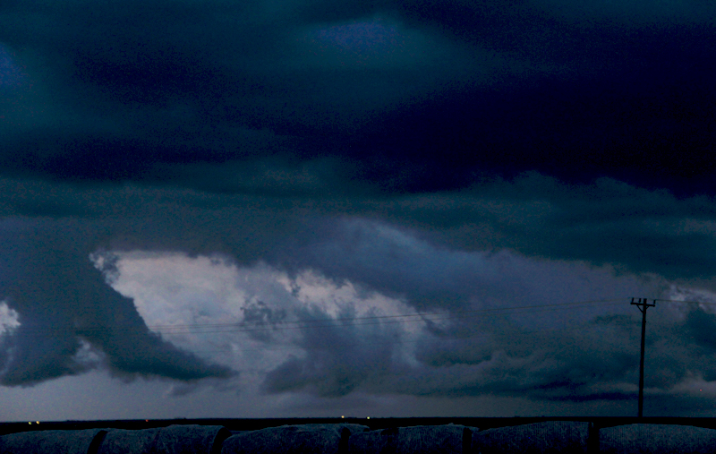
With the northern portion of the squall line bowing out well off to our east, we next set our sights on the tail end of the line hanging back to the southwest near Elk City. Gassing up in Clinton, we continued south to get into tail-end Charlie's path Sitting north of New Cordell, we noted some very interesting yet confusing structure to our east as this tail-end cell took on a hybrid supercell/shelf cloud appearance combining elements of an updraft core and surging outflow all at once. We even observed what appeared to be an RFD cut on the rear of the storm, before an outflow boundary from the north passed over and hampered our view.
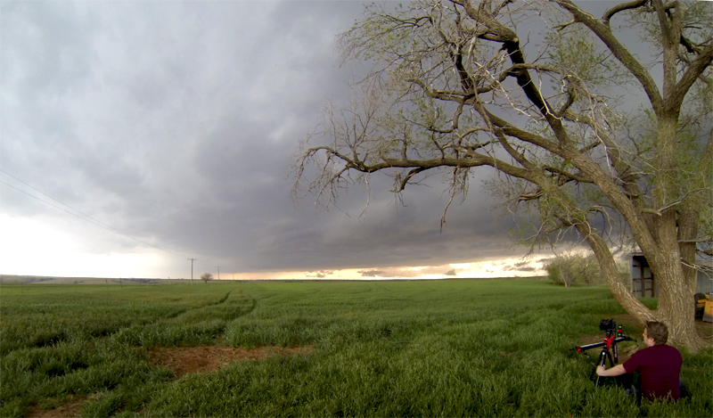
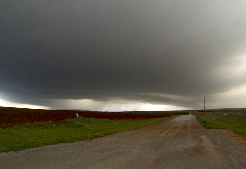
As darkness neared, and despite some of the supercell-esque features we observed, I thought it was finally time to punch through the storm and wash the car off a little (no tornado warning was in progress, nor was any meso evident on radar, so I felt pretty safe with this maneuver). Just south of New Cordell, we punch through a very sharp wall of precipitation that included a few nickel-sized hail stones. Toni was a little nervous, but after 3 or 4 minutes we broke out of the rain to the sight of a gorgeous setting sun. I had never before appreciated the unique turbulence that occurs immediately behind a squall line, and the setting sun lit some beautiful, tumbling cloud fragments that made for a great timelapse finale. We finished the day in back in Elk City, satisfied with a fun, productive chase.
Recap, Filmmaking Notes, and Lessons Learned
- Despite the lack of discrete storms along the dryline, I can't be too sad about the way this day turned out. We ended up within a couple miles of the only tornado reported for the day, even if we missed seeing it. Being chased across the wilderness by a huge surging shelf cloud has its own element of fun.
- Don't assume that tornadoes are out of the question, even on linear looking storms. I wish I had been more attentive and noticed the inflow bands associated with some of the shelf cloud lowerings.
- I really need to rethink the slider stepper motor power supply. The car battery/cable approach is just too cumbersome and takes too long to set up (and more importantly, tear down). I will look into a battery pack.
- Setting up the slider against the car at a 45-degree angle makes for a very interesting, rising camera move that is very easy to set up. Just don't lean against or sit in the car while you're lapsing.