Date: April 23, 2014
Time: 3:30 - 8:30 PM CDT
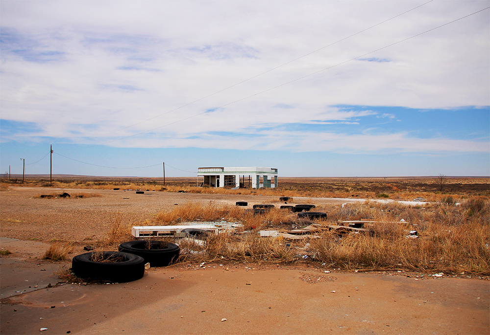
Place: Sayre, Willow, & Blair, OK
Distance: 929 mi (342 positioning, 136 chasing, 451 to home)
Camera: T3i, GoPro3 Silver & Black, Lumix
Warnings: SVR
Rating: S5
Forecast and Set Up
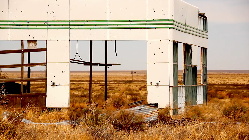
Ten days ago, on April 13, I had a completely deflating experience. After spending the night in Elk City, we were targeting Ardmore, OK for possible tornadic storms. On the way, we made a stop in El Reno to pay our respects to Tim and Paul Samaras and Carl Young. Seeing the year old tornado damage was eerie and humbling. After sitting quietly for a while in the fields south of town where the crumpled Twistex Chevy Cobalt came to rest, we were ready to continue on. Unfortunately, the Sentra wasnt; the engine ran rough, stumbled, and then died. I learned that theres lots of time for deep existential contemplation when youre stranded on the corner of two dirt roads in the middle of nowhere at one of the darkest locations in storm chase lore realizing your chase is done before it even begins.
We were eventually able to limp into Amarillo (after some terrifying cold-reboots at 70MPH), where we decided the Sentra was no longer a trustworthy chase vehicle. This was far from the first time it had randomly died, and the thought of getting stranded in the path of an onrushing supercell was too unsettling. With heavy hearts, we said goodbye to the Sentra and traded it in for a Subaru Crosstrek. And now, 10 days later, the Crosstrek is making its debut chase!
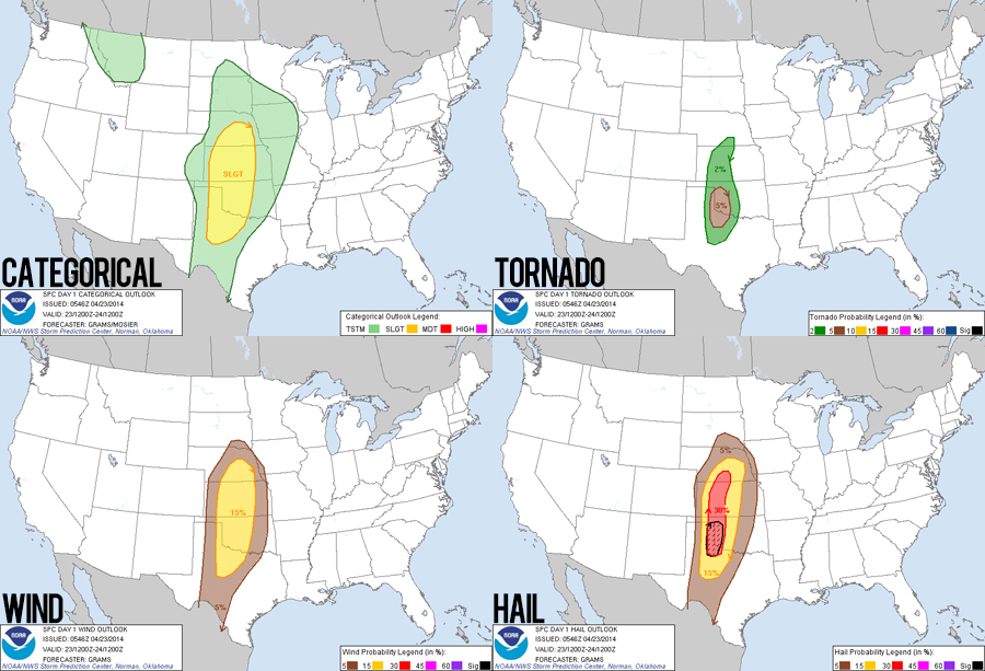
Very much like the 2013 chase season, 2014 has started extremely slowly. An annoyingly persistent trough in the eastern US has kept moisture at bay all spring as crashing cold fronts repeatedly scoured the Gulf of Mexico. The past few days have finally started to resemble a more normal spring pattern, but moisture is still a primary concern. Today we chased along the dryline in the Texas panhandle and eastern Oklahoma. Shear was just large enough for supercells (getting better the further north you go), and adequate moisture was progged to arrive just in time. A sunset tornado was not out of the question.
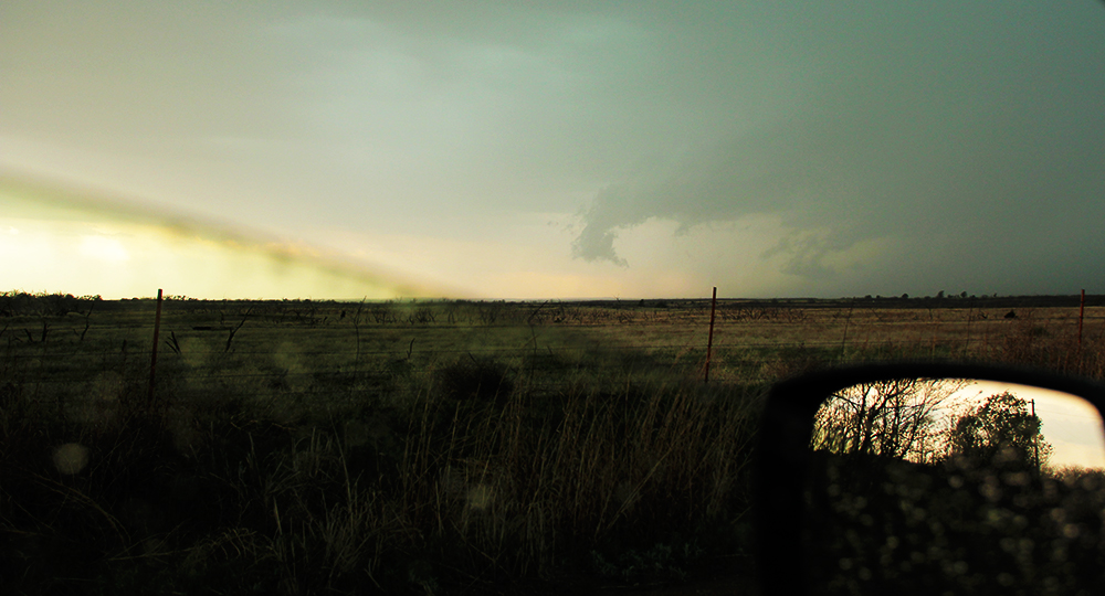
With this hope, we left ABQ midmorning and made good time across the Texas panhandle. Always a dilemma in Amarillo (go northeast, east, or southeast) we opted to take Hwy 287 southeast out of town. In Clarendon, we stopped at Subway for lunch (storm chase food trickier this year, as Toni is avoiding dairy). At this point, storm intiation was underway and we needed to make critical navigation decisions.
The Chase
Sadly, my first navigation decision of the year was a blunder. I got suckered north out of Clarendon by a decent looking storm that ended up being a dying, elevated piece of junk by the time we got to it (I didnt notice the more deviant northward motion, like a n00b). Now we were on I-40 as a developing storm way to our south near Memphis, TX (my original target) was just getting interesting. Feeling some dismay setting in (remembering April 13, 2012 where we got trapped north of the storms in this same area), we decided to blast way east on I-40 and then cut south across the storms path.
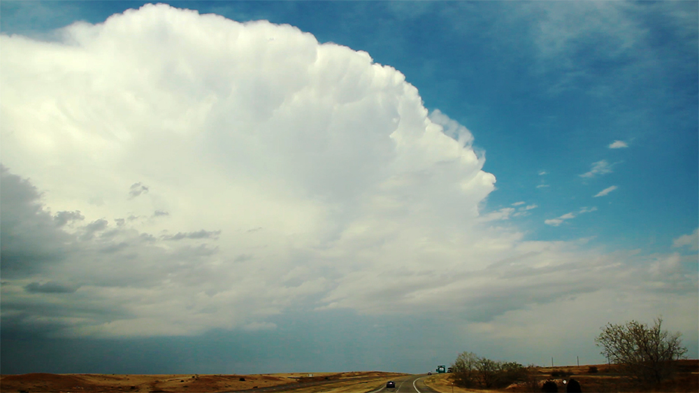
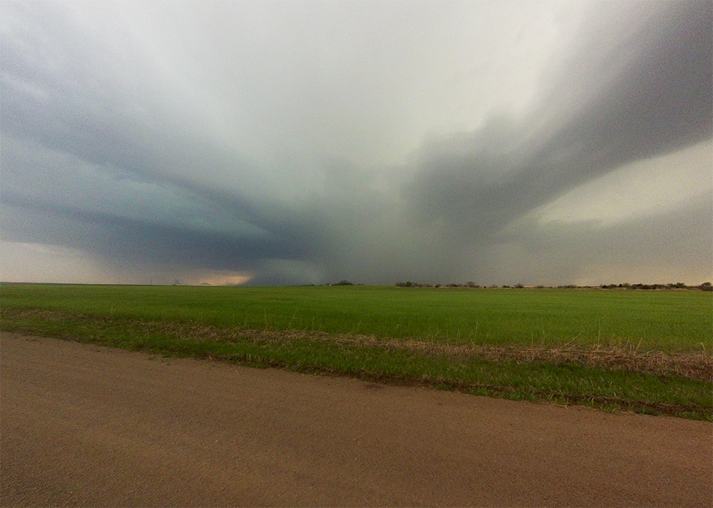
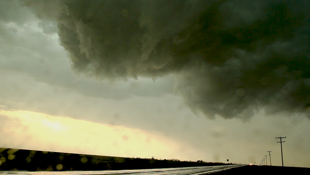
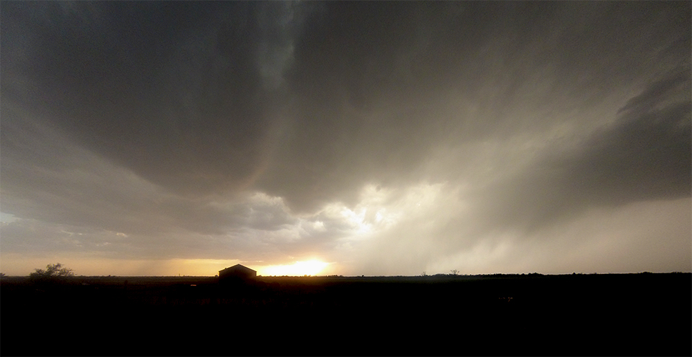
As it turned out, this plan worked. We arrived south of Sayre, OK nearly 30 minutes ahead of the now beastly looking HP supercell. Now my favorite part of the chase could commence: peacefully filming timelapse and slider shots of the oncoming supercell. As it neared, the storm developed several very impressive inflow bands that all pointed directly into the heart of the rain-shrouded circulation. There was also some dramatic outflow scud that raced away from the forward flanking precipitation. However, no tornado looked imminent and the updraft base was still quite elevated.
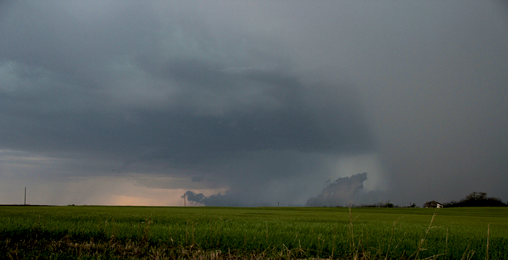
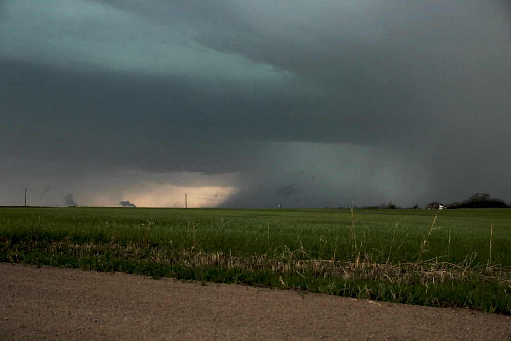
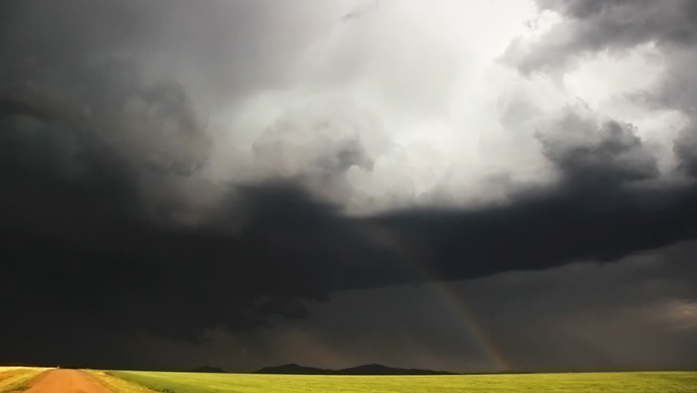
On final approach, the storm structure got quite messy as the inflow region filled in with rain. We dropped south several miles to the tiny town of Willow, OK passing the TIV along the way. It was at this point that things got a lot more exciting. To our south, we observed some scuddy upflow associated with a small, newly developing cell that was beginning to interact with the primary storm. Driving a mile further south, we were underneath this feature when suddenly inflow winds picked up dramatically. Sticking my handheld anemometer out the window, I measured a 64 MPH gust as the car began rocking. In the sky directly above us, the new cell tightened into some dramatic rotation as it was ingested into the main supercell. It's quite possible that if dew points had been a tad higher, we would have had a tornado just a couple hundred yards away in the field in front of us!
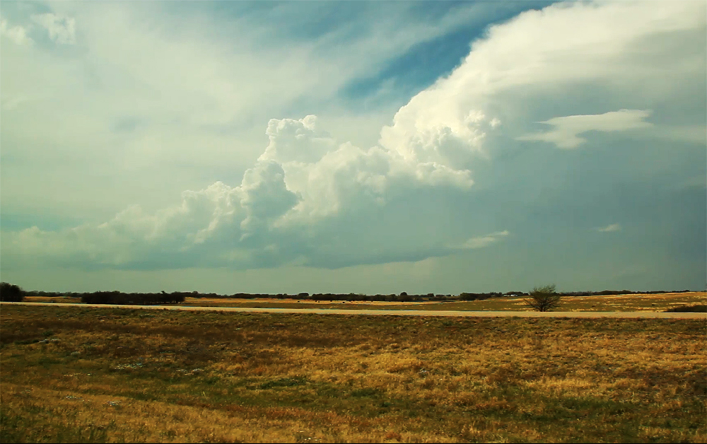
Heavy rain followed this dramatic encounter, and for a few minutes we lost good visuals opting to remain in place instead of pursuing blindly. But as the rain cleared and the storm continued northeast, we were treated to an amazing view of a large, low, slowly rotating wallcloud. As far as I could tell, there was no touchdown under this feature, but the storm did go on to produce a weak tornado just a few minutes later.
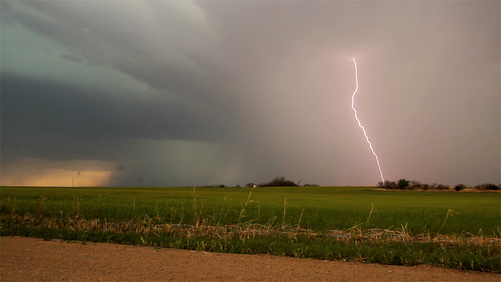
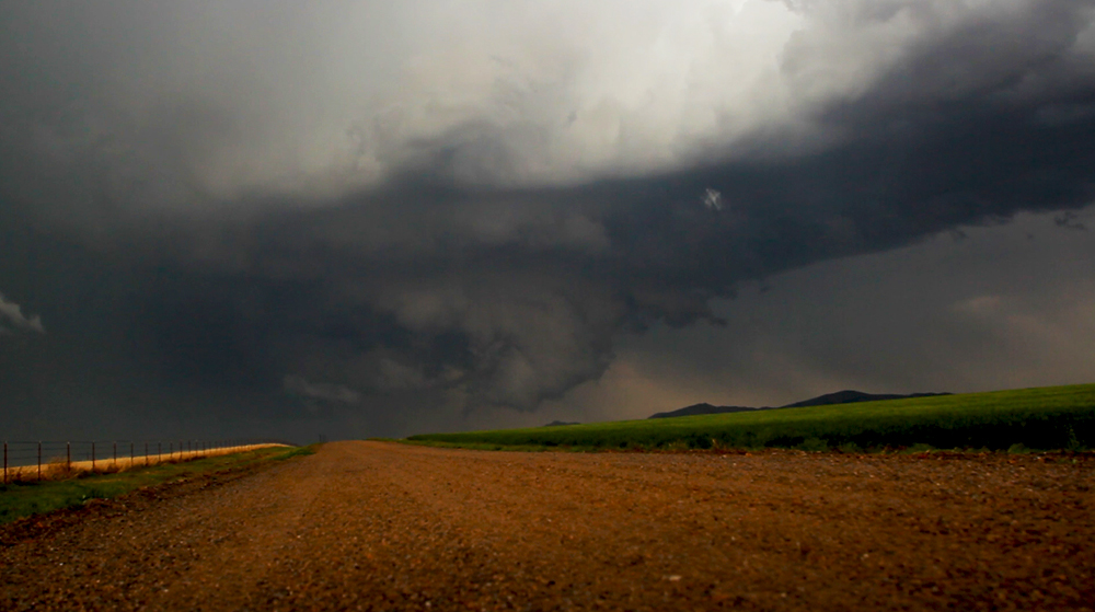
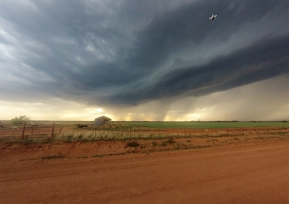
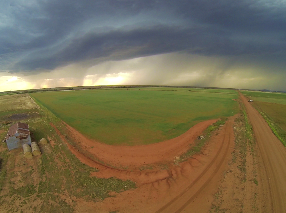
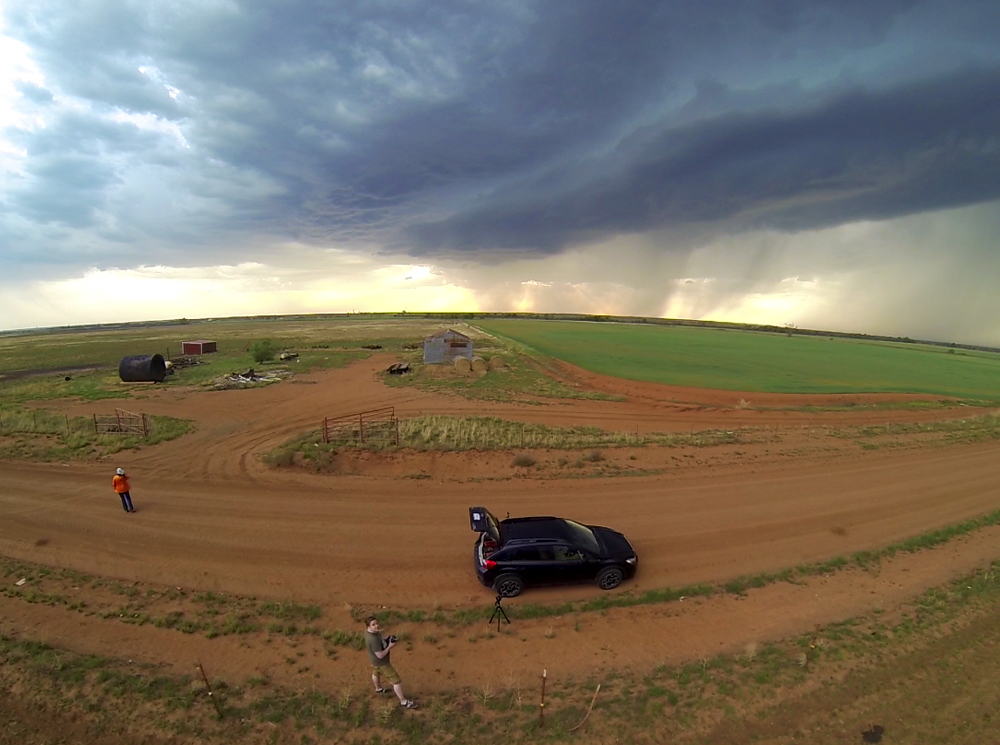
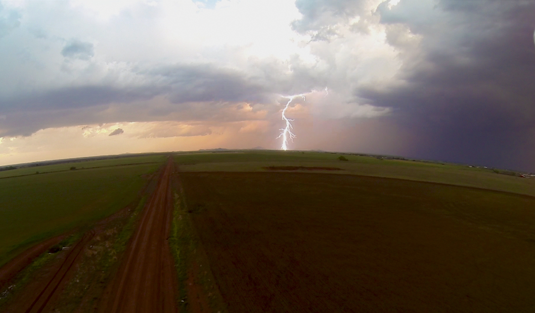
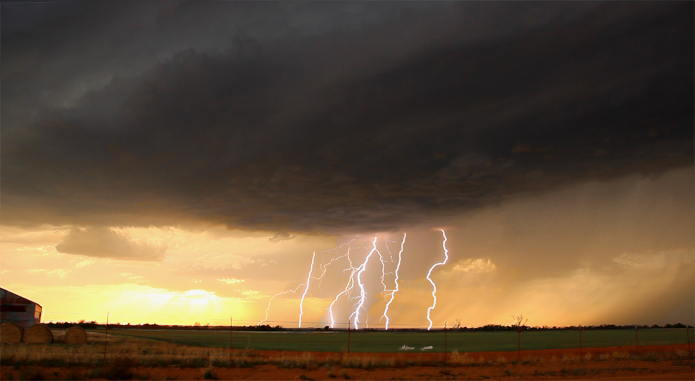
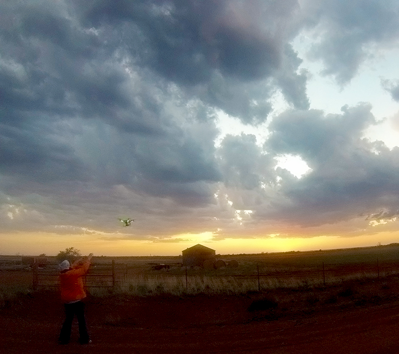
At this point, we opted to abandon the storm, since we really dont like chasing under lots of rain and the storm was getting a little too far east for our return home. Instead, we dropped south to Blair, OK and caught a newly developing, high-based storm at sunset. For the first time, I was able to deploy my new quadcopter in the lighter wind field. While the storm never developed into much, it was an amazing experience to capture aerial footage for the first time - including my first aerial lightning strikes! After the storm passed, we grabbed supper in Altus, before making the long drive to Tucumcari, NM where we spent the night.
Recap, Filmmaking Notes, and Lessons Learned
- Always check carefully for deviant northern motion on a storm. Definitely a good indication that it's elevated and non-tornadic.
- The Crosstrek is a great chasing vehicle and has much better clearance that the Sentra. I am so much more confident on wet dirt roads with the all-wheel-drive. I need to avoid getting overconfident.
- Don't let a messy inflow region fool you, new rotation can spin up in 3 minutes.
- Aerial footage from the quadcopter is amazing, but it can still need some post-processing stabilization, which is very time consuming.